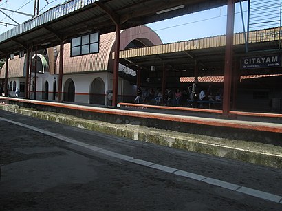
Stasiun Citayam stop - Wednesday schedule
| Line | Direction | Time |
|---|---|---|
| D26 | Sawangan | 05.00 |
| D26 | Sawangan | 05.10 |
| D26 | Sawangan | 05.20 |
| D26 | Sawangan | 05.30 |
| D05 | Terminal Depok | 05.30 |
| D26 | Sawangan | 05.40 |
| D05 | Terminal Depok | 05.40 |
| D26 | Sawangan | 05.50 |
| D05 | Terminal Depok | 05.50 |
| D26 | Sawangan | 06.00 |
| D05 | Terminal Depok | 06.00 |
| D26 | Sawangan | 06.10 |
| D05 | Terminal Depok | 06.10 |
| 111 | Citayam | 06.19 |
| D26 | Sawangan | 06.20 |
| D05 | Terminal Depok | 06.20 |
| 111 | Citayam | 06.29 |
| D26 | Sawangan | 06.30 |
| D05 | Terminal Depok | 06.30 |
| 111 | Citayam | 06.39 |
| D26 | Sawangan | 06.40 |
| D05 | Terminal Depok | 06.40 |
| 111 | Citayam | 06.49 |
| D26 | Sawangan | 06.50 |
| D05 | Terminal Depok | 06.50 |
Directions to Stasiun Citayam stop (Jakarta) with public transit
The following transit lines have routes that pass near Stasiun Citayam
How to get to Stasiun Citayam stop by bus?
Click on the bus route to see step by step directions with maps, line arrival times and updated time schedules.
How to get to Stasiun Citayam stop by train?
Click on the train route to see step by step directions with maps, line arrival times and updated time schedules.
Bus stops near Stasiun Citayam stop in Jakarta
- Jalan Raya Citayam, 11, 4 min walk,
- Nuansa Depok, 7 min walk,
- Pasar Citayam Dalam, 7 min walk,
- Pasar Citayam 2, 8 min walk,
Train stations near Stasiun Citayam station in Jakarta
- Citayam, 24 min walk,
Bus lines to Stasiun Citayam stop in Jakarta
- D26, Sawangan,
- D05, Terminal Depok,
- D07, Citayam,
- 111, Parung,
What are the closest stations to Stasiun Citayam?
The closest stations to Stasiun Citayam are:
- Jalan Raya Citayam, 11 is 259 meters away, 4 min walk.
- Nuansa Depok is 467 meters away, 7 min walk.
- Pasar Citayam Dalam is 514 meters away, 7 min walk.
- Pasar Citayam 2 is 579 meters away, 8 min walk.
- Citayam is 1809 meters away, 24 min walk.
Which bus lines stop near Stasiun Citayam?
These bus lines stop near Stasiun Citayam: D05, D26.
Which train line stops near Stasiun Citayam?
BOGOR LINE (Jakarta Kota)
What’s the nearest train station to Stasiun Citayam in Jakarta?
The nearest train station to Stasiun Citayam in Jakarta is Citayam. It’s a 24 min walk away.
What’s the nearest bus stop to Stasiun Citayam in Jakarta?
The nearest bus stop to Stasiun Citayam in Jakarta is Jalan Raya Citayam, 11. It’s a 4 min walk away.
What time is the first train to Stasiun Citayam in Jakarta?
The BOGOR LINE is the first train that goes to Stasiun Citayam in Jakarta. It stops nearby at 3:45 AM.
What time is the last train to Stasiun Citayam in Jakarta?
The BOGOR LINE is the last train that goes to Stasiun Citayam in Jakarta. It stops nearby at 12:53 AM.
What time is the first bus to Stasiun Citayam in Jakarta?
The D07 is the first bus that goes to Stasiun Citayam in Jakarta. It stops nearby at 5:00 AM.
What time is the last bus to Stasiun Citayam in Jakarta?
The 111 is the last bus that goes to Stasiun Citayam in Jakarta. It stops nearby at 11:11 PM.
See Stasiun Citayam stop, Jakarta, on the map
Public transit to Stasiun Citayam stop in Jakarta
Looking for directions to Stasiun Citayam in Jakarta, Indonesia?
Download the Moovit App to find the current schedule and step-by-step directions for Bus or Train routes that pass through Stasiun Citayam.
Looking for the nearest stops closest to Stasiun Citayam ? Check out this list of closest stops to your destination: Jalan Raya Citayam; Nuansa Depok; Pasar Citayam Dalam; Pasar Citayam 2; Citayam.
Bus: D05, D26, D07, 111.Train: BOGOR LINE.
We make riding on public transit to Stasiun Citayam easy, which is why over 1.5 million users, including users in Jakarta trust Moovit as the best app for public transit.
Use the app to navigate to popular places including to the airport, hospital, stadium, grocery store, mall, coffee shop, school, college, and university.
The first line to this stop is D26, at 05.00, and the last line is 111 at 23.13.
53 Jl. Mushalla Al-Mukhtar, Bojong Gede, Citayam Dua, Indonesia
This stop serves Angkutan Kota Depok and Angkutan Kabupaten Bogor’s lines
Popular routes from Stasiun Citayam stop, Jakarta
Bus stops near Stasiun Citayam stop
Train station near Stasiun Citayam station
Popular public transit stations in Jakarta
Get around Jakarta by public transit!
Traveling around Jakarta has never been so easy. See step by step directions as you travel to any attraction, street or major public transit station. View bus and train schedules, arrival times, service alerts and detailed routes on a map, so you know exactly how to get to anywhere in Jakarta.
When traveling to any destination around Jakarta use Moovit's Live Directions with Get Off Notifications to know exactly where and how far to walk, how long to wait for your line, and how many stops are left. Moovit will alert you when it's time to get off — no need to constantly re-check whether yours is the next stop.
Wondering how to use public transit in Jakarta or how to pay for public transit in Jakarta? Moovit public transit app can help you navigate your way with public transit easily, and at minimum cost. It includes public transit fees, ticket prices, and costs. Looking for a map of Jakarta public transit lines? Moovit public transit app shows all public transit maps in Jakarta with all Bus, Train, Metro and LRT routes and stops on an interactive map.
Jakarta has 4 transit type(s), including: Bus, Train, Metro and LRT, operated by several transit agencies, including PPD (Pengangkutan Penumpang Djakarta), Mayasari Bakti, Sinar Jaya Megah Langgeng, Miniarta, AJA P (Arimbi Jaya Agung), KWK (Koperasi Wahana Kalpika), APB (Angkutan Pengganti Bemo), Mikrolet, DAMRI, TransJakarta, Angkutan Kota Depok, KOASI (Koperasi Angkutan Bekasi), Angkutan Kabupaten Bogor, Angkutan Tangerang and Angkutan Kota Bogor