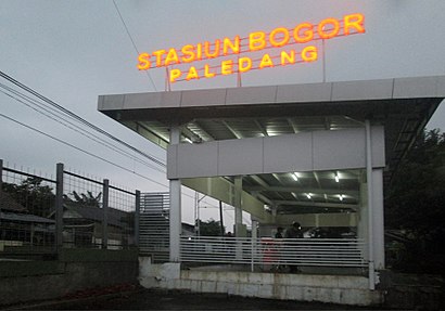
Directions to Stasiun Paledang station (Kota Bogor) with public transit
The following transit lines have routes that pass near Stasiun Paledang
How to get to Stasiun Paledang station by bus?
Click on the bus route to see step by step directions with maps, line arrival times and updated time schedules.
How to get to Stasiun Paledang station by train?
Click on the train route to see step by step directions with maps, line arrival times and updated time schedules.
Bus stops near Stasiun Paledang in Kota Bogor
- Bimba Aiueo Paledang, 4 min walk,
- TAMAN Topi, 4 min walk,
- Jalan Kapten Muslihat 16, 5 min walk,
- Grand Central Bogor, 5 min walk,
- Budi Mulia, 5 min walk,
- SMPN 1 Bogor, 5 min walk,
- Bappeda, 6 min walk,
- Halte Stasiun Bogor, 7 min walk,
- Djuanda, 8 min walk,
- Jalan Perintis Kemerdekaan 5, 9 min walk,
Train station near Stasiun Paledang in Kota Bogor
- Bogor, 21 min walk,
Bus lines to Stasiun Paledang station in Kota Bogor
- 01, Cipinang Gading,
- K2F, Ciawi,
- 3, Bubulak,
- 10, Bantar Kemang,
- 12, Cimanggu,
- 22, PONDOK Rumput,
- JRC GRAND CENTRAL BOGOR, Grand Central Bogor - Stasiun Juanda,
- JRC GRAND CENTRAL BOGOR, Grand Central Bogor - Stasiun Tebet,
- JRC GRAND CENTRAL BOGOR, Grand Central Bogor - Stasiun Manggarai,
- 2, Bubulak,
- K3, Cidangiang - Sukasari Via Suryakencana,
- 05, Cimahpar,
- 06, Ciheuleut,
- 08, Warung Jambu,
- 08A, Warung Jambu,
- 25, Warung Jambu,
- K5F, Stasiun Bogor,
- 16, Mayor Oking,
- K1F, Terminal Bubulak,
- 03, Cimahpar,
What are the closest stations to Stasiun Paledang?
The closest stations to Stasiun Paledang are:
- Bimba Aiueo Paledang is 165 meters away, 4 min walk.
- TAMAN Topi is 212 meters away, 4 min walk.
- Jalan Kapten Muslihat 16 is 296 meters away, 5 min walk.
- Grand Central Bogor is 324 meters away, 5 min walk.
- Budi Mulia is 325 meters away, 5 min walk.
- SMPN 1 Bogor is 330 meters away, 5 min walk.
- Bappeda is 397 meters away, 6 min walk.
- Halte Stasiun Bogor is 458 meters away, 7 min walk.
- Djuanda is 536 meters away, 8 min walk.
- Jalan Perintis Kemerdekaan 5 is 588 meters away, 9 min walk.
- Bogor is 1564 meters away, 21 min walk.
Which bus lines stop near Stasiun Paledang?
These bus lines stop near Stasiun Paledang: 12, 16, K2F, K5F.
Which train line stops near Stasiun Paledang?
BOGOR LINE (Bogor)
What’s the nearest train station to Stasiun Paledang in Kota Bogor?
The nearest train station to Stasiun Paledang in Kota Bogor is Bogor. It’s a 21 min walk away.
What’s the nearest bus stop to Stasiun Paledang in Kota Bogor?
The nearest bus stops to Stasiun Paledang in Kota Bogor are Bimba Aiueo Paledang and TAMAN Topi. The closest one is a 4 min walk away.
What time is the first train to Stasiun Paledang in Kota Bogor?
The BOGOR LINE is the first train that goes to Stasiun Paledang in Kota Bogor. It stops nearby at 3:58 AM.
What time is the last train to Stasiun Paledang in Kota Bogor?
The BOGOR LINE is the last train that goes to Stasiun Paledang in Kota Bogor. It stops nearby at 1:06 AM.
What time is the first bus to Stasiun Paledang in Kota Bogor?
The 12 is the first bus that goes to Stasiun Paledang in Kota Bogor. It stops nearby at 5:00 AM.
What time is the last bus to Stasiun Paledang in Kota Bogor?
The K2F is the last bus that goes to Stasiun Paledang in Kota Bogor. It stops nearby at 10:34 PM.
See Stasiun Paledang, Kota Bogor, on the map
Public Transit to Stasiun Paledang in Kota Bogor
How to get to Stasiun Paledang in Kota Bogor, Indonesia?
It’s easy with Moovit. Type in your street address and Moovit’s route finder will locate the fastest way to get you there! Not sure where to get off on the street? Download the Moovit App to find live directions (including where to get off on Stasiun Paledang), see timetables and get the estimated arrival times for your favorite bus or train lines.
Looking for the nearest stop or station to Stasiun Paledang? Check out this list of closest stops available to your destination: Bimba Aiueo Paledang; TAMAN Topi; Jalan Kapten Muslihat 16; Grand Central Bogor; Budi Mulia; SMPN 1 Bogor; Bappeda; Halte Stasiun Bogor; Djuanda; Jalan Perintis Kemerdekaan 5; Bogor.
Bus: 12, 16, K2F, K5F, 01, 3, 10, 22, 2, JRC GRAND CENTRAL BOGOR, JRC GRAND CENTRAL BOGOR, JRC GRAND CENTRAL BOGOR.Train: BOGOR LINE.
Download the Moovit App to see the current schedule and routes available for Kota Bogor. No need to install a special bus app to check the bus time or a train app to get train time. Moovit is the only all-in-one transit app that helps you get where you need to go.
We make riding on public transit to Stasiun Paledang easy, which is why over 1.5 million users, including users in Kota Bogor trust Moovit as the best app for public transit.
Use the app to navigate to popular places including to the airport, hospital, stadium, grocery store, mall, coffee shop, school, college, and university.
Location: Kota Bogor, Jakarta
Streets near Stasiun Paledang, Kota Bogor
Get around Kota Bogor by public transit!
Traveling around Kota Bogor has never been so easy. See step by step directions as you travel to any attraction, street or major public transit station. View bus and train schedules, arrival times, service alerts and detailed routes on a map, so you know exactly how to get to anywhere in Kota Bogor.
When traveling to any destination around Kota Bogor use Moovit's Live Directions with Get Off Notifications to know exactly where and how far to walk, how long to wait for your line, and how many stops are left. Moovit will alert you when it's time to get off — no need to constantly re-check whether yours is the next stop.
Wondering how to use public transit in Kota Bogor or how to pay for public transit in Kota Bogor? Moovit public transit app can help you navigate your way with public transit easily, and at minimum cost. It includes public transit fees, ticket prices, and costs. Looking for a map of Kota Bogor public transit lines? Moovit public transit app shows all public transit maps in Kota Bogor with all Bus, Train, Metro and LRT routes and stops on an interactive map.
Jakarta has 4 transit type(s), including: Bus, Train, Metro and LRT, operated by several transit agencies, including PPD (Pengangkutan Penumpang Djakarta), Mayasari Bakti, Sinar Jaya Megah Langgeng, Miniarta, AJA P (Arimbi Jaya Agung), KWK (Koperasi Wahana Kalpika), APB (Angkutan Pengganti Bemo), Mikrolet, DAMRI, TransJakarta, Angkutan Kota Depok, KOASI (Koperasi Angkutan Bekasi), Angkutan Kabupaten Bogor, Angkutan Tangerang and Angkutan Kota Bogor