How to get to State Farm Insurance by bus?
Click on the bus route to see step by step directions with maps, line arrival times and updated time schedules.
Bus stops near State Farm Insurance in Kansas City
Light Rail stations near State Farm Insurance in Kansas City
- Armour (35th & Main St), 39 min walk,VIEW
Bus lines to State Farm Insurance in Kansas City
What are the closest stations to State Farm Insurance?
The closest stations to State Farm Insurance are:
- On Main at 27th Street Northbound Nearside is 340 yards away, 4 min walk.
- On Armour at Main Eastbound Farside is 545 yards away, 7 min walk.
- On 31st at Grand Westbound is 582 yards away, 8 min walk.
- Armour (35th & Main St) is 3275 yards away, 39 min walk.
Which bus lines stop near State Farm Insurance?
These bus lines stop near State Farm Insurance: 201, 31.
Which light rail line stops near State Farm Insurance?
STCR (Umkc)
What’s the nearest bus station to State Farm Insurance in Kansas City?
The nearest bus station to State Farm Insurance in Kansas City is On Main at 27th Street Northbound Nearside. It’s a 4 min walk away.
What time is the first light rail to State Farm Insurance in Kansas City?
The STCR is the first light rail that goes to State Farm Insurance in Kansas City. It stops nearby at 5:15 AM.
What time is the last light rail to State Farm Insurance in Kansas City?
The STCR is the last light rail that goes to State Farm Insurance in Kansas City. It stops nearby at 12:16 AM.
What time is the first bus to State Farm Insurance in Kansas City?
The 201 is the first bus that goes to State Farm Insurance in Kansas City. It stops nearby at 4:24 AM.
What time is the last bus to State Farm Insurance in Kansas City?
The 31 is the last bus that goes to State Farm Insurance in Kansas City. It stops nearby at 1:53 AM.
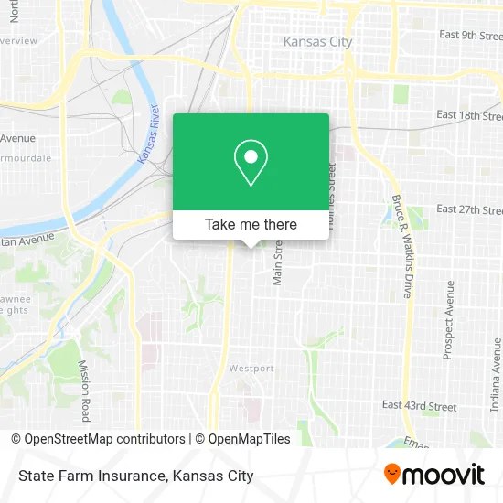
See State Farm Insurance, Kansas City, on the map
Public Transit to State Farm Insurance in Kansas City
Wondering how to get to State Farm Insurance in Kansas City? Moovit helps you find the best way to get to State Farm Insurance with step-by-step directions from the nearest public transit station.
Moovit provides free maps and live directions to help you navigate through your city. View schedules, routes, timetables, and find out how long does it take to get to State Farm Insurance in real time.
Looking for the nearest stop or station to State Farm Insurance? Check out this list of stops closest to your destination: On Main at 27th Street Northbound Nearside; On Armour at Main Eastbound Farside; On 31st at Grand Westbound; Armour (35th & Main St).
Bus: 201, 31, 35.Light Rail: STCR.
Want to see if there’s another route that gets you there at an earlier time? Moovit helps you find alternative routes or times. Get directions from and directions to State Farm Insurance easily from the Moovit App or Website.
We make riding to State Farm Insurance easy, which is why over 1.5 million users, including users in Kansas City, trust Moovit as the best app for public transit. You don’t need to download an individual bus app or train app, Moovit is your all-in-one transit app that helps you find the best bus time or train time available.
For information on prices of bus and light rail, costs and ride fares to State Farm Insurance, please check the Moovit app.
Use the app to navigate to popular places including to the airport, hospital, stadium, grocery store, mall, coffee shop, school, college, and university.
State Farm Insurance Address: 4435 Main St street in Kansas City
- Malcolm T. Wilson Student Enrollment Center,
- Children's Mercy Ophthalmology Clinic on Broadway,
- Shawnee Mission Medical Center,
- Metropolitan Community College (MCC) - Penn Valley Main Campus,
- Metropolitan Community College (MCC) - Administrative Center,
- Days Inn & Suites-Kansas City (Days Inn & Suites by Wyndham Kansas City Downtown),
- Our Lady of Perpetual Help Redemptorist Catholic Church,
- Wdaf Fox 4 Kansas City TV-News Tips-Nexstar Broadcasting,
- The Russell,
- Gates Bar-B-Q (Gates & Sons Barbecue of Kansas),
- Main & Linwood,
- Kansas City Scout Statue,
- Mcckc Penn Valley Health Science,
- Main St,
- Ambassador Apartments,
- Federal Reserve Bank of Kansas City,
- Crown Center/Union Station,
- Main St / E Armour Blvd,
- Costco,
- The National Wwi Museum and Memorial 2 Memorial Drive
Places Near State Farm Insurance (Kansas City)
- Kansas City Zoo,
- Country Club Plaza,
- Worlds of Fun,
- Legends Outlets Kansas City, Kansas City,
- Liberty, MO, Liberty,
- The Glory Hole,
- Walmart, Kansas City,
- Grandview, MO, Grandview,
- Stans Glory Hole,
- Ku Medical Center, Kansas City,
- GEHA Field at Arrowhead Stadium,
- Arrowhead Stadium,
- Harrah's Casino, North Kansas City,
- Truman Medical Center,
- T-Mobile Center,
- Walmart Supercenter,
- Kauffman Stadium,
- Kansas City International Airport (MCI) (Kansas City International Airport),
- Amazon Fulfilment Center-MKC6, Kansas City,
- St. Luke's Hospital - Medical Plaza I
How to get to popular places in Kansas City with public transit
Get around Kansas City by public transit!
Traveling around Kansas City has never been so easy. See step by step directions as you travel to any attraction, street or major public transit station. View bus and train schedules, arrival times, service alerts and detailed routes on a map, so you know exactly how to get to anywhere in Kansas City.
When traveling to any destination around Kansas City use Moovit's Live Directions with Get Off Notifications to know exactly where and how far to walk, how long to wait for your line, and how many stops are left. Moovit will alert you when it's time to get off — no need to constantly re-check whether yours is the next stop.
Wondering how to use public transit in Kansas City or how to pay for public transit in Kansas City? Moovit public transit app can help you navigate your way with public transit easily, and at minimum cost. It includes public transit fees, ticket prices, and costs. Looking for a map of Kansas City public transit lines? Moovit public transit app shows all public transit maps in Kansas City with all Bus, Train and Light Rail routes and stops on an interactive map.
Kansas City has 3 transit type(s), including: Bus, Train and Light Rail, operated by several transit agencies, including Kansas City Area Transportation Authority, Lawrence Transit, Topeka Metro, RideKC Johnson County, Amtrak, Greyhound-us and FlixBus-us