
State & Harrison/Ida B Wells Drive (South) stop - Sunday schedule
| Line | Direction | Time |
|---|---|---|
| 6 | 79th Street & Lake Shore Drive (West) | 5:09 AM |
| 62 | Archer & Neva Terminal (South) | 5:11 AM |
| 29 | 95th Red Line Station (East) | 5:19 AM |
| 6 | 79th Street & Lake Shore Drive (West) | 5:33 AM |
| 62 | Archer & Neva Terminal (South) | 5:41 AM |
| 29 | 95th Red Line Station (East) | 5:44 AM |
| 62 | Archer & Neva Terminal (South) | 6:03 AM |
| 6 | 79th Street & Lake Shore Drive (West) | 6:03 AM |
| 29 | 95th Red Line Station (East) | 6:08 AM |
| 62 | Archer & Neva Terminal (South) | 6:23 AM |
| 29 | 95th Red Line Station (East) | 6:30 AM |
| 6 | 79th Street & Lake Shore Drive (West) | 6:30 AM |
| 146 | Solidarity Dr & Planetarium (East) | 6:37 AM |
| 62 | Archer & Neva Terminal (South) | 6:42 AM |
| 29 | 95th Red Line Station (East) | 6:52 AM |
| 6 | 79th Street & Lake Shore Drive (West) | 6:54 AM |
| 146 | Solidarity Dr & Planetarium (East) | 6:57 AM |
| 62 | Archer & Neva Terminal (South) | 7:01 AM |
| 29 | 95th Red Line Station (East) | 7:13 AM |
| 6 | 79th Street & Lake Shore Drive (West) | 7:14 AM |
| 146 | Solidarity Dr & Planetarium (East) | 7:17 AM |
| 62 | Archer & Neva Terminal (South) | 7:21 AM |
| 29 | 95th Red Line Station (East) | 7:34 AM |
| 6 | 79th Street & Lake Shore Drive (West) | 7:35 AM |
| 146 | Solidarity Dr & Planetarium (East) | 7:38 AM |
Directions to State & Harrison / Ida B Wells Drive (South) stop (Chicago) with public transit
The following transit lines have routes that pass near State & Harrison / Ida B Wells Drive (South)
 Bus: 126, 146, 2, 29, 6.
- Train: MD-N, ME, UP-N.
- Chicago 'L': BLUE LINE, BROWN LINE, RED LINE, ORANGE LINE, PINK LINE.
How to get to State & Harrison / Ida B Wells Drive (South) stop by public transit?
Click on the bus route to see step-by-step directions with maps, line arrival times and updated time schedules.
How to get to State & Harrison / Ida B Wells Drive (South) stop by public transit?
Click on the train route to see step-by-step directions with maps, line arrival times and updated time schedules.
How to get to State & Harrison / Ida B Wells Drive (South) stop by public transit?
Click on the Chicago 'L' route to see step-by-step directions with maps, line arrival times and updated time schedules.
Bus stops near State & Harrison / Ida B Wells Drive (South) stop in Chicago
- State & Harrison/Ida B Wells Drive (North), 2 min walk,
- State & Van Buren (North), 3 min walk,
- State & Van Buren (South), 3 min walk,
- Clark & Harrison (South), 4 min walk,
- Michigan & Harrison (South), 5 min walk,
- Dearborn St & Harrison St (Drop Off Only), 5 min walk,
Chicago 'L' stations near State & Harrison / Ida B Wells Drive (South) station in Chicago
- Lasalle, 2 min walk,
- Lasalle/Van Buren, 4 min walk,
- Jackson (Red), 4 min walk,
Bus lines to State & Harrison / Ida B Wells Drive (South) stop in Chicago
- 2, Midway Plaisance & Cottage Grove (East),
- 10, Stony Island & 62nd Street (South),
- 29, Navy Pier Terminal (North),
- 146, Foster & Broadway (West),
- 148, Marine Drive & Winona (North),
- 147, Paulina & Howard Terminal (North),
- 6, 79th Street & Lake Shore Drive (West),
- 62, Cicero & Archer (South),
- 24, Dearborn & Randolph (North),
- 36, Devon & Clark (West),
- 22, Paulina & Howard Terminal,
- 1, Bronzeville/Union Station,
- 3, King Drive,
- 4, Cottage Grove,
- X4, Cottage Grove Express,
- J14, Jeffery Jump,
- 26, South Shore Express,
- 28, Stony Island,
- 850, North Bolingbrook – East Loop Express,
- 851, South Bolingbrook – East Loop Express,
What are the closest stations to State & Harrison / Ida B Wells Drive (South)?
The closest stations to State & Harrison / Ida B Wells Drive (South) are:
- State & Harrison/Ida B Wells Drive (North) stop is 87 yards away, 2 min walk.
- Lasalle station is 104 yards away, 2 min walk.
- State & Van Buren (North) stop is 230 yards away, 3 min walk.
- State & Van Buren (South) stop is 245 yards away, 3 min walk.
- Clark & Harrison (South) stop is 264 yards away, 4 min walk.
- Lasalle/Van Buren station is 265 yards away, 4 min walk.
- Jackson (Red) station is 284 yards away, 4 min walk.
- Michigan & Harrison (South) stop is 385 yards away, 5 min walk.
- Dearborn St & Harrison St (Drop Off Only) stop is 425 yards away, 5 min walk.
Which bus lines stop near State & Harrison / Ida B Wells Drive (South)?
These bus lines stop near State & Harrison / Ida B Wells Drive (South): 126, 146, 2, 29, 6.
Which train lines stop near State & Harrison / Ida B Wells Drive (South)?
These train lines stop near State & Harrison / Ida B Wells Drive (South): MD-N, ME, UP-N.
Which Chicago 'L' lines stop near State & Harrison / Ida B Wells Drive (South)?
These Chicago 'L' lines stop near State & Harrison / Ida B Wells Drive (South): BLUE LINE, BROWN LINE, RED LINE.
What’s the nearest Chicago 'L' station to State & Harrison / Ida B Wells Drive (South) in Chicago?
The nearest Chicago 'L' station to State & Harrison / Ida B Wells Drive (South) in Chicago is Lasalle. It’s a 2 min walk away.
What’s the nearest bus station to State & Harrison / Ida B Wells Drive (South) in Chicago?
The nearest bus station to State & Harrison / Ida B Wells Drive (South) in Chicago is State & Harrison/Ida B Wells Drive (North). It’s a 2 min walk away.
State & Harrison / Ida B Wells Drive (South) station
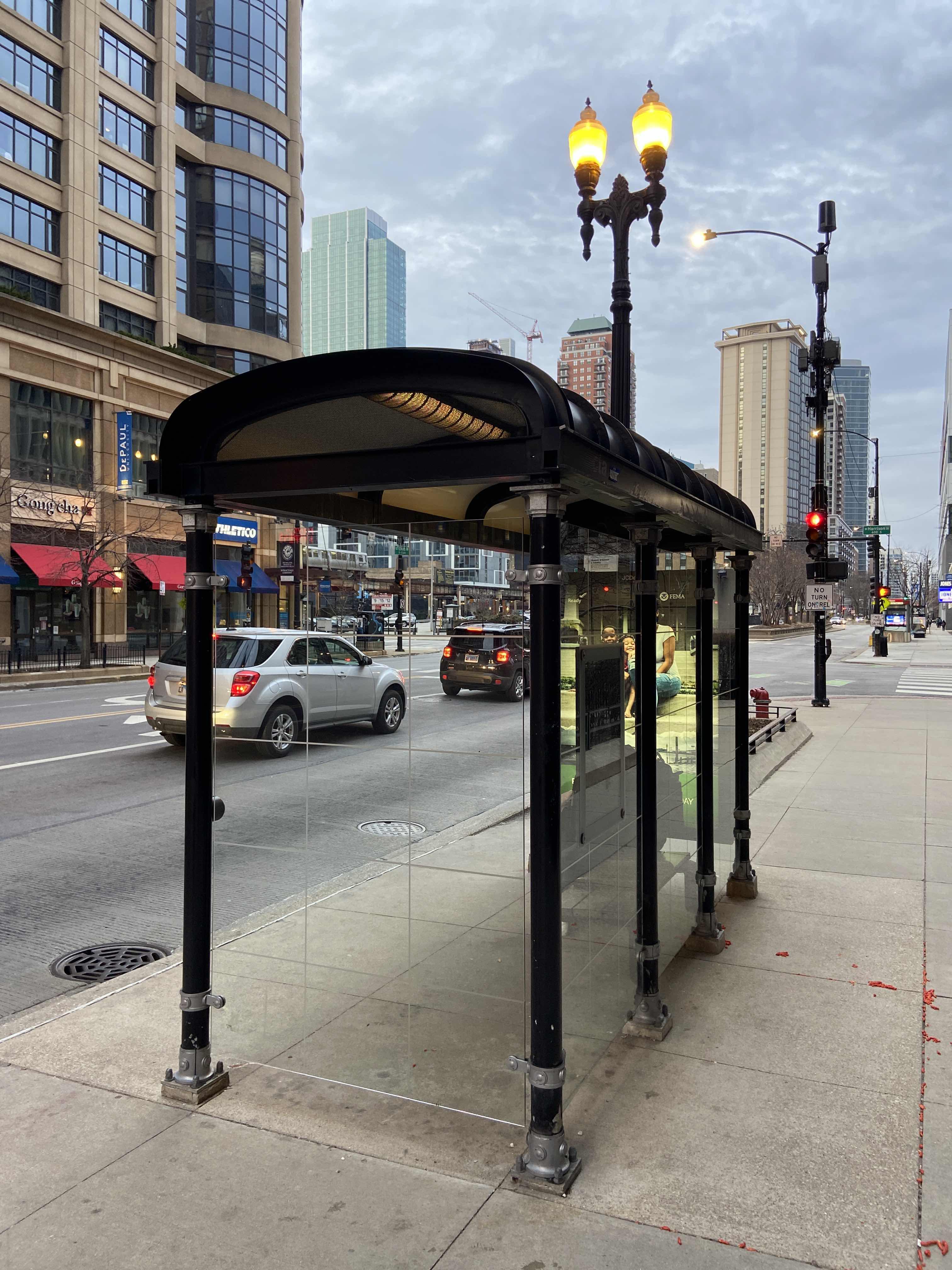 Taken by Anonymous
See State & Harrison / Ida B Wells Drive (South) stop, Chicago, on the map
Public transit to State & Harrison/Ida B Wells Drive (South) stop (ID: 1431) in Chicago
Looking for directions to State & Harrison / Ida B Wells Drive (South) in Chicago, United States?
Download the Moovit App to find the current schedule and step-by-step directions for Bus, Chicago 'L' or Train routes that pass through State & Harrison / Ida B Wells Drive (South).
Looking for the stops closest to State & Harrison / Ida B Wells Drive (South)? Check out this list of closest stops to your destination: State & Harrison/Ida B Wells Drive (North); Lasalle; State & Van Buren (North); State & Van Buren (South); Clark & Harrison (South); Lasalle/Van Buren; Jackson (Red); Michigan & Harrison (South); Dearborn St & Harrison St (Drop Off Only).
Bus: 126, 146, 2, 29, 6, 10, 148, 147, 62.Train: MD-N, ME, UP-N.Chicago 'L': BLUE LINE, BROWN LINE, RED LINE, ORANGE LINE, PINK LINE, PURPLE LINE.
We make riding on public transit to State & Harrison / Ida B Wells Drive (South) easy, which is why over 1.7 billion users, including users in Chicago, trust Moovit as the best app for public transit.
Use the app to navigate to popular places including to the airport, hospital, stadium, grocery store, mall, coffee shop, school, college, and university.
State & Harrison/Ida B Wells Drive (South) stop’s code is 1431
The first line to this stop is 6, at 5:09 AM, and the last line is 62 at 4:41 AM.
South State Street, Central, Chicago, IL, USA
This stop serves CTA’s lines
- State & Harrison/Ida B Wells Drive (North),
- State & Van Buren (North),
- State & Van Buren (South),
- Clark & Harrison (South),
- Michigan & Harrison (South),
- Dearborn St & Harrison St (Drop Off Only)
Bus stops near State & Harrison/Ida B Wells Drive (South) stop
- Lasalle,
- Lasalle/Van Buren,
- Jackson (Red)
Chicago 'L' stations near State & Harrison/Ida B Wells Drive (South) station
- Kedzie & Foster (North),
- Western Ave,
- Belmont & Broadway (East),
- 79th Street & Hoyne (West),
- Route 134/Belvidere (Route 120),
- 63rd Street & Blackstone (East),
- River Rd & Irving Park Rd,
- Palos Park,
- Armitage & Kedzie (East),
- Millennium Station,
- Harlem Ave & Lake St,
- Grand Ave & Harlem Ave,
- 115th Street & Pulaski (East),
- 111th Street & Perry (East),
- 183rd St & Oak Park Ave,
- 95th & Stony Island Plaza (East),
- 103rd Street & Vincennes Ave (East),
- Racine & Taylor (South),
- Grand & Narragansett (West),
- Michigan & Lake/Randolph (South)