Directions to State Police Association (Boston) with public transportation
The following transit lines have routes that pass near State Police Association
 Bus: 354, 43, 501, 504, EZRIDE.
- Train: FAIRMOUNT, FRAMINGHAM/WORCESTER, HAVERHILL, NEEDHAM.
- Subway: GREEN LINE B, GREEN LINE C, GREEN LINE D, ORANGE LINE, RED LINE.
How to get to State Police Association by bus?
Click on the bus route to see step by step directions with maps, line arrival times and updated time schedules.
From Boston College, Boston
72 minFrom Dorchester, Boston
63 minFrom FOUR POINTS BY SHERATON Boston Newton, Newton
40 minFrom Qea, Quincy
117 minFrom Melrose, MA, Melrose
68 minFrom Arlington, MA, Arlington
69 minFrom The Mall At Chestnut Hill, Newton
86 minFrom Forest Hills Station MBTA, Boston
55 minFrom Boda Borg, Malden
49 minFrom Courtyard by Marriott Brookline, Brookline
54 min
How to get to State Police Association by train?
Click on the train route to see step by step directions with maps, line arrival times and updated time schedules.
How to get to State Police Association by subway?
Click on the subway route to see step by step directions with maps, line arrival times and updated time schedules.
Bus stops near State Police Association in Boston
- Downtown Crossing - Franklin St @ Washington St, 3 min walk,VIEW
- Tremont St @ Beacon St, 3 min walk,VIEW
- Cambridge St @ Government Ctr Sta, 4 min walk,VIEW
- State St @ Washington Mall - State St Sta, 4 min walk,VIEW
- Beacon St @ Park St, 5 min walk,VIEW
- Congress St Opp North St, 5 min walk,VIEW
- Park Street - Tremont St Opp Hamilton Pl, 5 min walk,VIEW
- Park Street - Tremont St @ Winter St, 7 min walk,VIEW
- Tremont St Opp Temple Pl, 9 min walk,VIEW
- Temple Pl @ Washington St, 9 min walk,VIEW
Subway stations near State Police Association in Boston
Bus lines to State Police Association in Boston
- RED LINE SHUTTLE, Ashmont - Park Street via Post Office,VIEW
- RED LINE SHUTTLE, JFK/UMass - Park Street via Post Office,VIEW
- RED LINE SHUTTLE, JFK/UMass - Park Street,VIEW
- 15, Mattapan Via Nubian & Fields Corner,VIEW
- 39, Forest Hills,VIEW
- 57, Watertown Via Kenmore,VIEW
- 116, Wonderland Via Maverick,VIEW
- 354, Burlington (Express) Via Woburn,VIEW
- BLUE LINE SHUTTLE, Orient Heights (Local Shuttle),VIEW
- BLUE LINE SHUTTLE, Government Center (Express Shuttle),VIEW
- BLUE LINE SHUTTLE, Orient Heights (Express Shuttle),VIEW
- BLUE LINE SHUTTLE, Wonderland (Shuttle),VIEW
- GREEN LINE E SHUTTLE, Medford/Tufts (Shuttle),VIEW
- GREEN LINE SHUTTLE, Medford/Tufts Via Union Square (Shuttle),VIEW
- GREEN LINE SHUTTLE, North Station (Shuttle),VIEW
- GREEN LINE SHUTTLE, Union Square (Shuttle),VIEW
- RED LINE SHUTTLE, Kendall/MIT (Shuttle),VIEW
- RED LINE SHUTTLE, Harvard (Shuttle),VIEW
- RED LINE SHUTTLE, Broadway (Shuttle),VIEW
- RED LINE SHUTTLE, Jfk/Umass (Shuttle),VIEW
What are the closest stations to State Police Association?
The closest stations to State Police Association are:
- Downtown Crossing - Franklin St @ Washington St is 172 yards away, 3 min walk.
- Downtown Crossing is 208 yards away, 3 min walk.
- Tremont St @ Beacon St is 229 yards away, 3 min walk.
- State Street is 255 yards away, 4 min walk.
- Cambridge St @ Government Ctr Sta is 265 yards away, 4 min walk.
- State St @ Washington Mall - State St Sta is 294 yards away, 4 min walk.
- Beacon St @ Park St is 323 yards away, 5 min walk.
- Congress St Opp North St is 340 yards away, 5 min walk.
- Government Center is 366 yards away, 5 min walk.
- Park Street - Tremont St Opp Hamilton Pl is 387 yards away, 5 min walk.
- Park Street - Tremont St @ Winter St is 528 yards away, 7 min walk.
- Tremont St Opp Temple Pl is 678 yards away, 9 min walk.
- Temple Pl @ Washington St is 745 yards away, 9 min walk.
Which bus lines stop near State Police Association?
These bus lines stop near State Police Association: 354, 43, 501, 504, EZRIDE, SL5.
Which train lines stop near State Police Association?
These train lines stop near State Police Association: FAIRMOUNT, FRAMINGHAM/WORCESTER, HAVERHILL, NEEDHAM.
Which subway lines stop near State Police Association?
These subway lines stop near State Police Association: GREEN LINE B, GREEN LINE C, GREEN LINE D, ORANGE LINE, RED LINE.
What’s the nearest subway station to State Police Association in Boston?
The nearest subway station to State Police Association in Boston is Downtown Crossing. It’s a 3 min walk away.
What’s the nearest bus station to State Police Association in Boston?
The nearest bus stations to State Police Association in Boston are Downtown Crossing - Franklin St @ Washington St and Tremont St @ Beacon St. The closest one is a 3 min walk away.
What time is the first subway to State Police Association in Boston?
The GREEN LINE E is the first subway that goes to State Police Association in Boston. It stops nearby at 5:05 AM.
What time is the last subway to State Police Association in Boston?
The GREEN LINE E is the last subway that goes to State Police Association in Boston. It stops nearby at 2:20 AM.
What time is the first bus to State Police Association in Boston?
The 57 is the first bus that goes to State Police Association in Boston. It stops nearby at 5:07 AM.
What time is the last bus to State Police Association in Boston?
The 116 is the last bus that goes to State Police Association in Boston. It stops nearby at 1:58 AM.
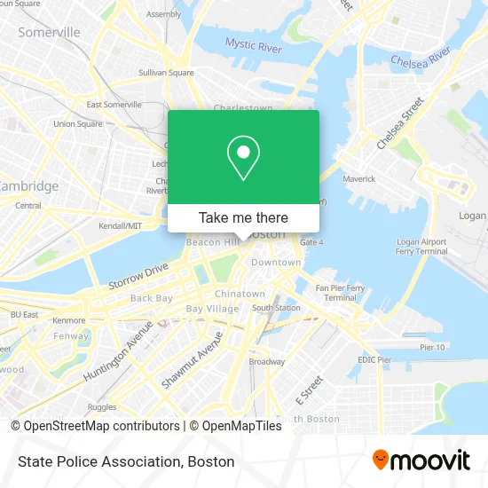
See State Police Association, Boston, on the map
Public Transit to State Police Association in Boston
Wondering how to get to State Police Association in Boston? Moovit helps you find the best way to get to State Police Association with step-by-step directions from the nearest public transit station.
Moovit provides free maps and live directions to help you navigate through your city. View schedules, routes, timetables, and find out how long does it take to get to State Police Association in real time.
Looking for the nearest stop or station to State Police Association? Check out this list of stops closest to your destination: Downtown Crossing - Franklin St @ Washington St; Downtown Crossing; Tremont St @ Beacon St; State Street; Cambridge St @ Government Ctr Sta; State St @ Washington Mall - State St Sta; Beacon St @ Park St; Congress St Opp North St; Government Center; Park Street - Tremont St Opp Hamilton Pl; Park Street - Tremont St @ Winter St; Tremont St Opp Temple Pl; Temple Pl @ Washington St.
Bus: 354, 43, 501, 504, EZRIDE, SL5, RED LINE SHUTTLE, RED LINE SHUTTLE, RED LINE SHUTTLE, 15, 39, 57, 116, BLUE LINE SHUTTLE, BLUE LINE SHUTTLE, BLUE LINE SHUTTLE.Train: FAIRMOUNT, FRAMINGHAM/WORCESTER, HAVERHILL, NEEDHAM.Subway: GREEN LINE B, GREEN LINE C, GREEN LINE D, ORANGE LINE, RED LINE, BLUE LINE, GREEN LINE E.
Want to see if there’s another route that gets you there at an earlier time? Moovit helps you find alternative routes or times. Get directions from and directions to State Police Association easily from the Moovit App or Website.
We make riding to State Police Association easy, which is why over 1.7 million users, including users in Boston, trust Moovit as the best app for public transit. You don’t need to download an individual bus app or train app, Moovit is your all-in-one transit app that helps you find the best bus time or train time available.
For information on prices of bus, subway and train, costs and ride fares to State Police Association, please check the Moovit app.
Use the app to navigate to popular places including to the airport, hospital, stadium, grocery store, mall, coffee shop, school, college, and university.
State Police Association Address: 11 Beacon St Ste 700 street in Boston
- Pierce & Mandell PC (Eddie & Alyce Mandell Memorial Scholarship Fund, Inc.),
- Mooo,
- Xv Beacon Hotel Boston,
- XV Beacon Hotel,
- Boston Athenaeum,
- Emmets Irish Pub & Restaurant (Emmet&Apos S Pub &Amp),
- RP Realty Advisors (Boston Property Advisors James R Johnston Mai),
- Black Saml L,
- 21st Amendment,
- Boston Athenaeum Library,
- 73 Tremont Café,
- Suffolk University Sawyer Building,
- One Beacon Street,
- Suffolk University,
- Meghan Grace Hannigan Lawyer,
- Saloniki Greek,
- Wework One Beacon Street,
- Cabot Properties (Cabot Industrial Value Fund Manager),
- Umass Amherst,
- Suffolk University's 73 Tremont
Places Near State Police Association (Boston)
- Wilbur Theatre, Boston,
- Seaport District, Boston,
- Faneuil Hall, Boston,
- Massachusetts General Hospital, Boston,
- Prudential Center, Boston,
- House Of Blues, Boston,
- Castle Island, Boston,
- Museum Of Science, Boston,
- Boston Medical Center, Boston,
- Isabella Stewart Gardner Museum, Boston,
- Boston Common, Boston,
- Boston Children's Hospital, Boston,
- North End, Boston,
- Td Garden, Boston,
- Boston Convention & Exhibition Center, Boston,
- Leader Bank Pavilion (Leader Bank Pavillion), Boston,
- Cheers, Boston,
- Mgm Music Hall, Boston,
- Wang Theater, Boston,
- Quincy Market, Boston
How to get to popular places in Boston with public transit
Get around Boston by public transit!
Traveling around Boston has never been so easy. See step by step directions as you travel to any attraction, street or major public transit station. View bus and train schedules, arrival times, service alerts and detailed routes on a map, so you know exactly how to get to anywhere in Boston.
When traveling to any destination around Boston use Moovit's Live Directions with Get Off Notifications to know exactly where and how far to walk, how long to wait for your line, and how many stops are left. Moovit will alert you when it's time to get off — no need to constantly re-check whether yours is the next stop.
Wondering how to use public transit in Boston or how to pay for public transit in Boston? Moovit public transit app can help you navigate your way with public transit easily, and at minimum cost. It includes public transit fees, ticket prices, and costs. Looking for a map of Boston public transit lines? Moovit public transit app shows all public transit maps in Boston with all Bus, Train, Subway and Ferry routes and stops on an interactive map.
Boston has 4 transit type(s), including: Bus, Train, Subway and Ferry, operated by several transit agencies, including MBTA, Southeastern Regional Transit Authority, MetroWest Regional Transit Authority, Rhode Island Public Transit Authority, WRTA, Lowell Regional Transit Authority, Merrimack Valley Transit, Montachusett Regional Transit Authority, Cape Cod Regional Transit Authority, Brockton Area Transit Authority, Martha's Vineyard Transit Authority, the WAVE - Nantucket Regional Transit Authority, GATRA, Cape Ann Transportation Authority and Massport