See Staten Island Technical High School on the map
Directions to Staten Island Technical High School with public transportation
The following transit lines have routes that pass near Staten Island Technical High School
 Bus:
Bus: - Subway:
How to get to Staten Island Technical High School by bus?
Click on the bus route to see step by step directions with maps, line arrival times and updated time schedules.
Bus stations near Staten Island Technical High School
- Hylan Bl/Lindbergh Av,5 min walk,
- Ebbitts St/Hylan Bl,6 min walk,
- New Dorp La/10 St,10 min walk,
- Amboy Rd/Beach Av,11 min walk,
Subway stations near Staten Island Technical High School
- Oakwood Heights,19 min walk,
Bus lines to Staten Island Technical High School
- SIM1,Soho Houston St Via Church St,
- SIM1C,Eltngvlle Trans Ctr Via Hylan Via Rich,
- SIM5,Eltvlle Trans Ctr Via F Cap Bl Via Gfrds,
- SIM6,Eltvlle Trans Ctr Via F Cap Bl Via Gfrds,
- SIM7,Greenwich Village Via West St Via 6 Av,
- SIM9,Greenwich Vill Via West St Via 6 Av,
- SIM10,Eltingville Trans Ctr Via Hylan Via Rich,
- SIM11,Midtown Via 23 St Via Madison Av,
- S78,Bricktown Mall Via Hylan,
- S79-SBS,Select Bus Bay Ridge 86 St Station,
- S57,Port Richmond,
- S76,Oakwood Mill Rd,
- S86,Limited Oakwood Mill Rd,
- SIM15,Downtown Loop Via Church St Via Water St,
What are the closest stations to Staten Island Technical High School?
The closest stations to Staten Island Technical High School are:
- Hylan Bl/Lindbergh Av is 382 yards away, 5 min walk.
- Ebbitts St/Hylan Bl is 421 yards away, 6 min walk.
- New Dorp La/10 St is 845 yards away, 10 min walk.
- Amboy Rd/Beach Av is 875 yards away, 11 min walk.
- Oakwood Heights is 1573 yards away, 19 min walk.
Which bus lines stop near Staten Island Technical High School?
These bus lines stop near Staten Island Technical High School: S79-SBS, SIM1C.
What’s the nearest subway station to Staten Island Technical High School?
The nearest subway station to Staten Island Technical High School is Oakwood Heights. It’s a 19 min walk away.
What’s the nearest bus stop to Staten Island Technical High School?
The nearest bus stop to Staten Island Technical High School is Hylan Bl/Lindbergh Av. It’s a 5 min walk away.
What time is the first subway to Staten Island Technical High School?
The SIR is the first subway that goes to Staten Island Technical High School. It stops nearby at 3:20 AM.
What time is the last subway to Staten Island Technical High School?
The SIR is the last subway that goes to Staten Island Technical High School. It stops nearby at 2:59 AM.
What time is the first bus to Staten Island Technical High School?
The SIM1C is the first bus that goes to Staten Island Technical High School. It stops nearby at 3:16 AM.
What time is the last bus to Staten Island Technical High School?
The SIM1C is the last bus that goes to Staten Island Technical High School. It stops nearby at 3:29 AM.
How much is the bus fare to Staten Island Technical High School?
The bus fare to Staten Island Technical High School costs about $2.75.
How much is the train fare to Staten Island Technical High School?
The train fare to Staten Island Technical High School costs about $2.75 - $16.75.
How much is the subway fare to Staten Island Technical High School?
The subway fare to Staten Island Technical High School costs about $2.75.
See Staten Island Technical High School on the map
Public Transportation to Staten Island Technical High School
Wondering how to get to Staten Island Technical High School, United States? Moovit helps you find the best way to get to Staten Island Technical High School with step-by-step directions from the nearest public transit station.
Moovit provides free maps and live directions to help you navigate through your city. View schedules, routes, timetables, and find out how long does it take to get to Staten Island Technical High School in real time.
Looking for the nearest stop or station to Staten Island Technical High School? Check out this list of stops closest to your destination: Hylan Bl/Lindbergh Av; Ebbitts St/Hylan Bl; New Dorp La/10 St; Amboy Rd/Beach Av; Oakwood Heights.
Bus:Subway:
Want to see if there’s another route that gets you there at an earlier time? Moovit helps you find alternative routes or times. Get directions from and directions to Staten Island Technical High School easily from the Moovit App or Website.
We make riding to Staten Island Technical High School easy, which is why over 1.5 million users, including users in Staten Island, trust Moovit as the best app for public transit. You don’t need to download an individual bus app or train app, Moovit is your all-in-one transit app that helps you find the best bus time or train time available.
For information on prices of bus, train and subway, costs and ride fares to Staten Island Technical High School, please check the Moovit app.
Use the app to navigate to popular places including to the airport, hospital, stadium, grocery store, mall, coffee shop, school, college, and university.
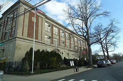
Staten Island Technical High School Address: Colgate Place street in Staten Island
Attractions near Staten Island Technical High School
10,United Activities Unlimited,Staten Island Technical High School,Staten Island Tech HS,Arby's,Cannon Blvd 10th St,Telco,Elite Auto Shipping,Mario M Marchini,Ebbitts St (ebbitts street & hylan blvd),Ebbitts St (hylan blvd and ebbitts),Lindbergh Ave / Hylan,NY Refrigerator & Stove Repair,Accurate Cleaning Service,Nesbitt Athletic Foundation,Sinani Piping & Heating,Davinci Carpet Cleaning - Staten Island,Big Ideas Contractor's,Platinum Property Management,Consola Cleaning CompanyHow to get to popular attractions in Staten Island with public transit
The Standard Grill, Manhattan,The Tippler, Manhattan,The Plaza Hotel, Manhattan,Ulysses Folk House, Manhattan,Jersey Shore University Medical Center, Neptune, Nj,The Dutch, Manhattan,High Line, Manhattan,Jackson Heights, NY, Queens,Upper West Side, Manhattan,The Dead Rabbit, Manhattan,Peter Luger Steak House,Gyu-Kaku Japanese BBQ, Manhattan,Great Lawn, Manhattan,Jing Fong Restaurant 金豐大酒樓, Manhattan,The Stumble Inn, Manhattan,Barrage, Manhattan,Cookshop, Manhattan,Caesars Atlantic City Hotel and Casino, Atlantic City, Nj,Veselka, Manhattan,New Jersey, Nutley, NjGet around Staten Island by public transit!
Traveling around Staten Island has never been so easy. See step by step directions as you travel to any attraction, street or major public transit station. View bus and train schedules, arrival times, service alerts and detailed routes on a map, so you know exactly how to get to anywhere in Staten Island.
When traveling to any destination around Staten Island use Moovit's Live Directions with Get Off Notifications to know exactly where and how far to walk, how long to wait for your line, and how many stops are left. Moovit will alert you when it's time to get off — no need to constantly re-check whether yours is the next stop.
Wondering how to use public transit in Staten Island or how to pay for public transit in Staten Island? Moovit public transit app can help you navigate your way with public transit easily, and at minimum cost. It includes public transit fees, ticket prices, and costs. Looking for a map of Staten Island public transit lines? Moovit public transit app shows all public transit maps in Staten Island with all bus, train or subway routes and stops on an interactive map.
Staten Island has 3 transit type(s), including: bus, train or subway, operated by several transit agencies, including MTA Subway, Metro-North Railroad, LIRR, PATH, Shore Line East, MTA Bus Company, MTA New York City Transit - Express routes, MTA Bus, NJ Transit, NYC Ferry, NICE bus, Bee-Line Bus, NJ Transit Rail, NJ Transit Rail and Norwalk Transit District