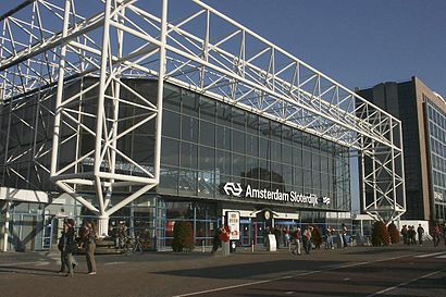
Directions to Station Sloterdijk (Amsterdam) with public transportation
The following transit lines have routes that pass near Station Sloterdijk
How to get to Station Sloterdijk by bus?
Click on the bus route to see step by step directions with maps, line arrival times and updated time schedules.
How to get to Station Sloterdijk by train?
Click on the train route to see step by step directions with maps, line arrival times and updated time schedules.
How to get to Station Sloterdijk by metro?
Click on the metro route to see step by step directions with maps, line arrival times and updated time schedules.
Which bus lines stop near Station Sloterdijk?
These bus lines stop near Station Sloterdijk: 15, 382, 395, 61, 69.
Which train lines stop near Station Sloterdijk?
These train lines stop near Station Sloterdijk: INTERCITY, SPRINTER.
Which metro lines stop near Station Sloterdijk?
These metro lines stop near Station Sloterdijk: 50, 51.
Which light rail line stops near Station Sloterdijk?
19
See Station Sloterdijk, Amsterdam, on the map
Public Transit to Station Sloterdijk in Amsterdam
Wondering how to get to Station Sloterdijk in Amsterdam, Netherlands? Moovit helps you find the best way to get to Station Sloterdijk with step-by-step directions from the nearest public transit station.
Moovit provides free maps and live directions to help you navigate through your city. View schedules, routes, timetables, and find out how long does it take to get to Station Sloterdijk in real time.
Bus: 15, 382, 395, 61, 69.Train: INTERCITY, SPRINTER.Metro: 50, 51.Light Rail: 19.
Want to see if there’s another route that gets you there at an earlier time? Moovit helps you find alternative routes or times. Get directions from and directions to Station Sloterdijk easily from the Moovit App or Website.
We make riding to Station Sloterdijk easy, which is why over 1.5 million users, including users in Amsterdam, trust Moovit as the best app for public transit. You don’t need to download an individual bus app or train app, Moovit is your all-in-one transit app that helps you find the best bus time or train time available.
For information on prices of bus, train, metro and light rail, costs and ride fares to Station Sloterdijk, please check the Moovit app.
Use the app to navigate to popular places including to the airport, hospital, stadium, grocery store, mall, coffee shop, school, college, and university.
Station Sloterdijk Address: Radarweg street in Amsterdam
Popular routes to Station Sloterdijk, Amsterdam
Popular routes from Station Sloterdijk, Amsterdam
Attractions near Station Sloterdijk
Flixbus Amsterdam - Parijs,OuiBus Amsterdam - Rotterdam - Antwerp - Lille - Paris,Flixbus N94 Muchen,Amsterdam Brussels Ouibus,Flixbus Amsterdam,Nordman,Intercity Amsterdam - Den Helder,Bret,Sprinter Sloterdijk - Den Haag CS,Bloemenkiosk Henk Bout Vof,Orlyplein,178 Bottles, 1 Message,Deloitte & Touche Consulting Group / Ics B,GWK Travelex,Starbucks Station Amsterdam,Starbucks Station Amsterdam Sloterdijk,Servex Amsterdam,Amsterdam, Station Sloterdijk,Station Amsterdam Sloterdijk (Metro-Station Sloterdijk),HavenfietsenHow to get to popular attractions in Amsterdam with public transit
Kleiweg, Rotterdam,Plaswijckpark, Rotterdam,Center Parcs de Kempervennen, Bergeijk,Hotel Arena, Amsterdam,Visserijplein Markt, Rotterdam,bushalte aletta jacobsstraat, Amsterdam,Safaripark Beekse Bergen, Hilvarenbeek,Havelte, Johannes Postkazerne, Westerveld,Busstation Amsterdam Sloterdijk, Amsterdam,De Oosterpoort, Groningen,Leonardo Royal Hotel Amsterdam, Amsterdam,Roompot - Weerterbergen, Weert,Bus 340 Hoofddorp - Haarlem, Haarlemmermeer,Rhoneweg, Amsterdam,Sparta Rotterdam, Rotterdam,Festivalterrein De Roost Erp, Veghel,Fletcher Hotel, Amersfoort,ijmuiden, Amsterdam,Zevenhuizen, Zuidplas,Afas Live, AmsterdamGet around Netherlands by public transit!
Traveling around Netherlands has never been so easy. See step by step directions as you travel to any attraction, street or major public transit station. View bus and train schedules, arrival times, service alerts and detailed routes on a map, so you know exactly how to get to anywhere in Netherlands.
When traveling to any destination around Netherlands use Moovit's Live Directions with Get Off Notifications to know exactly where and how far to walk, how long to wait for your line, and how many stops are left. Moovit will alert you when it's time to get off — no need to constantly re-check whether yours is the next stop.
Wondering how to use public transit in Netherlands or how to pay for public transit in Netherlands? Moovit public transit app can help you navigate your way with public transit easily, and at minimum cost. It includes public transit fees, ticket prices, and costs. Looking for a map of Netherlands public transit lines? Moovit public transit app shows all public transit maps in Netherlands with all Bus, Train, Metro, Light Rail and Ferry routes and stops on an interactive map.
Netherlands has 5 transit type(s), including: Bus, Train, Metro, Light Rail and Ferry, operated by several transit agencies, including NS, NS International, GVB, U-OV, Overal, HTM, R-net, RET, De Lijn, Connexxion, Eurobahn, Arriva, Breng, EBS, Bravo (Hermes)