Directions to Stellar :Performance (Milton) with public transportation
The following transit lines have routes that pass near Stellar :Performance
 Bus: 240, 245, 12.
- Train: FAIRMOUNT, FRANKLIN/FOXBORO, PROVIDENCE/STOUGHTON.
- Subway: MATTAPAN LINE.
How to get to Stellar :Performance by bus?
Click on the bus route to see step by step directions with maps, line arrival times and updated time schedules.
From The Cheesecake Factory, Boston
68 minFrom Jamaica Plain, Boston
57 minFrom SoWa Winter Market, Boston
71 minFrom Sweet Cheeks Q, Boston
77 minFrom The Verb Hotel, Boston
82 minFrom Beth Israel Deaconess Medical Center West Campus, Boston
71 minFrom Rosenberg Building Bidmc, Boston
70 minFrom The Colonnade Hotel, Boston
68 minFrom Four Seasons Hotel One Dalton, Boston
69 minFrom Landmark Center, Boston
76 min
How to get to Stellar :Performance by train?
Click on the train route to see step by step directions with maps, line arrival times and updated time schedules.
From The Cheesecake Factory, Boston
71 minFrom Jamaica Plain, Boston
180 minFrom SoWa Winter Market, Boston
75 minFrom Sweet Cheeks Q, Boston
79 minFrom The Verb Hotel, Boston
78 minFrom Beth Israel Deaconess Medical Center West Campus, Boston
90 minFrom Rosenberg Building Bidmc, Boston
90 minFrom The Colonnade Hotel, Boston
70 minFrom Four Seasons Hotel One Dalton, Boston
73 minFrom Landmark Center, Boston
79 min
How to get to Stellar :Performance by subway?
Click on the subway route to see step by step directions with maps, line arrival times and updated time schedules.
From The Cheesecake Factory, Boston
80 minFrom Jamaica Plain, Boston
83 minFrom SoWa Winter Market, Boston
76 minFrom Sweet Cheeks Q, Boston
85 minFrom The Verb Hotel, Boston
84 minFrom Beth Israel Deaconess Medical Center West Campus, Boston
89 minFrom Rosenberg Building Bidmc, Boston
89 minFrom The Colonnade Hotel, Boston
80 minFrom Four Seasons Hotel One Dalton, Boston
83 minFrom Landmark Center, Boston
83 min
Bus stops near Stellar :Performance in Milton
- Reedsdale Rd @ Walnut St, 1 min walk,VIEW
Subway station near Stellar :Performance in Milton
- Capen Street, 3 min walk,VIEW
Train station near Stellar :Performance in Milton
- Blue Hill Avenue, 22 min walk,VIEW
Bus lines to Stellar :Performance in Milton
What are the closest stations to Stellar :Performance?
The closest stations to Stellar :Performance are:
- Reedsdale Rd @ Walnut St is 8 yards away, 1 min walk.
- Capen Street is 238 yards away, 3 min walk.
- Blue Hill Avenue is 1843 yards away, 22 min walk.
Which bus line stops near Stellar :Performance?
240 (Avon Square)
Which train line stops near Stellar :Performance?
FAIRMOUNT (#1619 | Fairmount)
Which subway line stops near Stellar :Performance?
MATTAPAN LINE (Mattapan)
What’s the nearest subway station to Stellar :Performance in Milton?
The nearest subway station to Stellar :Performance in Milton is Capen Street. It’s a 3 min walk away.
What’s the nearest train station to Stellar :Performance in Milton?
The nearest train station to Stellar :Performance in Milton is Blue Hill Avenue. It’s a 22 min walk away.
What’s the nearest bus station to Stellar :Performance in Milton?
The nearest bus station to Stellar :Performance in Milton is Reedsdale Rd @ Walnut St. It’s a 1 min walk away.
What time is the first subway to Stellar :Performance in Milton?
The MATTAPAN LINE is the first subway that goes to Stellar :Performance in Milton. It stops nearby at 5:00 AM.
What time is the last subway to Stellar :Performance in Milton?
The MATTAPAN LINE is the last subway that goes to Stellar :Performance in Milton. It stops nearby at 2:40 AM.
What time is the first train to Stellar :Performance in Milton?
The FAIRMOUNT is the first train that goes to Stellar :Performance in Milton. It stops nearby at 4:36 AM.
What time is the last train to Stellar :Performance in Milton?
The FAIRMOUNT is the last train that goes to Stellar :Performance in Milton. It stops nearby at 12:08 AM.
What time is the first bus to Stellar :Performance in Milton?
The 240 is the first bus that goes to Stellar :Performance in Milton. It stops nearby at 4:56 AM.
What time is the last bus to Stellar :Performance in Milton?
The 240 is the last bus that goes to Stellar :Performance in Milton. It stops nearby at 1:03 AM.
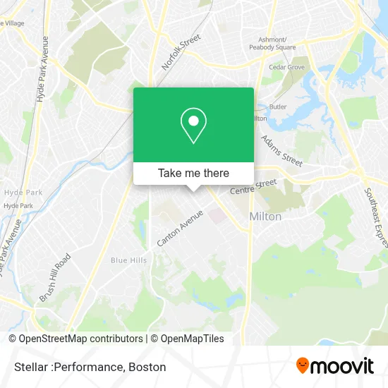
See Stellar :Performance, Milton, on the map
Public Transit to Stellar :Performance in Milton
Wondering how to get to Stellar :Performance in Milton? Moovit helps you find the best way to get to Stellar :Performance with step-by-step directions from the nearest public transit station.
Moovit provides free maps and live directions to help you navigate through your city. View schedules, routes, timetables, and find out how long does it take to get to Stellar :Performance in real time.
Looking for the nearest stop or station to Stellar :Performance? Check out this list of stops closest to your destination: Reedsdale Rd @ Walnut St; Capen Street; Blue Hill Avenue.
Bus: 240, 245, 12.Train: FAIRMOUNT, FRANKLIN/FOXBORO, PROVIDENCE/STOUGHTON.Subway: MATTAPAN LINE.
Want to see if there’s another route that gets you there at an earlier time? Moovit helps you find alternative routes or times. Get directions from and directions to Stellar :Performance easily from the Moovit App or Website.
We make riding to Stellar :Performance easy, which is why over 1.7 million users, including users in Milton, trust Moovit as the best app for public transit. You don’t need to download an individual bus app or train app, Moovit is your all-in-one transit app that helps you find the best bus time or train time available.
For information on prices of bus, subway and train, costs and ride fares to Stellar :Performance, please check the Moovit app.
Use the app to navigate to popular places including to the airport, hospital, stadium, grocery store, mall, coffee shop, school, college, and university.
Stellar :Performance Address: 121 Clapp St street in Milton
- Milton My Locksmith,
- Shazzys Sweets,
- Milton Fire Department,
- Kneaded Therapy,
- Boston Church - Milton,
- Milton Access TV,
- Pierce Middle School (Charles S Pierce Middle),
- The Ministerial Search Committee,
- Mullen James G Jr,
- Pierce Middle School,
- Pepsi-Cola Bottling,
- Gulliver St Locksmith Company,
- Michael Mahoney,
- E&J's Dopeington Auto Detailing,
- Milton Public Library,
- Milton, MA,
- Milton, Massachusetts,
- Next LVL Entertainment,
- Beth Israel Deaconess Hospital-Milton,
- To Life Coach
Places Near Stellar :Performance (Milton)
- North End, Boston,
- Wilbur Theatre, Boston,
- Boston Medical Center, Boston,
- Td Garden, Boston,
- Boston Children's Hospital, Boston,
- Seaport District, Boston,
- Museum Of Science, Boston,
- Faneuil Hall, Boston,
- House Of Blues, Boston,
- Cheers, Boston,
- Prudential Center, Boston,
- Boston Convention & Exhibition Center, Boston,
- Castle Island, Boston,
- Mgm Music Hall, Boston,
- Massachusetts General Hospital, Boston,
- Isabella Stewart Gardner Museum, Boston,
- Wang Theater, Boston,
- Quincy Market, Boston,
- Boston Common, Boston,
- Leader Bank Pavilion (Leader Bank Pavillion), Boston
How to get to popular places in Boston with public transit
Get around Milton by public transit!
Traveling around Milton has never been so easy. See step by step directions as you travel to any attraction, street or major public transit station. View bus and train schedules, arrival times, service alerts and detailed routes on a map, so you know exactly how to get to anywhere in Milton.
When traveling to any destination around Milton use Moovit's Live Directions with Get Off Notifications to know exactly where and how far to walk, how long to wait for your line, and how many stops are left. Moovit will alert you when it's time to get off — no need to constantly re-check whether yours is the next stop.
Wondering how to use public transit in Milton or how to pay for public transit in Milton? Moovit public transit app can help you navigate your way with public transit easily, and at minimum cost. It includes public transit fees, ticket prices, and costs. Looking for a map of Milton public transit lines? Moovit public transit app shows all public transit maps in Milton with all Bus, Train, Subway and Ferry routes and stops on an interactive map.
Boston has 4 transit type(s), including: Bus, Train, Subway and Ferry, operated by several transit agencies, including MBTA, Southeastern Regional Transit Authority, MetroWest Regional Transit Authority, Rhode Island Public Transit Authority, WRTA, Lowell Regional Transit Authority, Merrimack Valley Transit, Montachusett Regional Transit Authority, Cape Cod Regional Transit Authority, Brockton Area Transit Authority, Martha's Vineyard Transit Authority, the WAVE - Nantucket Regional Transit Authority, GATRA, Cape Ann Transportation Authority and Massport