Directions to Stephen A Lazarou (Wellesley) with public transportation
The following transit lines have routes that pass near Stephen A Lazarou
 Bus: 01, 505, 558, 59.
- Train: FRAMINGHAM/WORCESTER.
- Subway: GREEN LINE D.
How to get to Stephen A Lazarou by bus?
Click on the bus route to see step by step directions with maps, line arrival times and updated time schedules.
From FOUR POINTS BY SHERATON Boston Newton, Newton
52 minFrom Chestnut Hill, Boston
106 minFrom the mall at rockingham park mall, Boston
103 minFrom Warrior Ice Arena, Boston
82 minFrom The TJX Companies Inc., Framingham
58 minFrom Boston College (BC), Boston
105 minFrom The Track at New Balance, Boston
82 minFrom Massachusetts, Boston
83 minFrom Arsenal Yards, Watertown Town
94 minFrom Belmont, MA, Belmont
109 min
How to get to Stephen A Lazarou by train?
Click on the train route to see step by step directions with maps, line arrival times and updated time schedules.
How to get to Stephen A Lazarou by subway?
Click on the subway route to see step by step directions with maps, line arrival times and updated time schedules.
Bus stop near Stephen A Lazarou in Wellesley
- Lower Falls (Washington St/Concord St), 4 min walk,VIEW
Train station near Stephen A Lazarou in Wellesley
- Wellesley Hills, 27 min walk,VIEW
Subway station near Stephen A Lazarou in Wellesley
- Woodland, 50 min walk,VIEW
Bus lines to Stephen A Lazarou in Wellesley
- 01, Natick Mall - Wegmans,VIEW
What are the closest stations to Stephen A Lazarou?
The closest stations to Stephen A Lazarou are:
- Lower Falls (Washington St/Concord St) is 311 yards away, 4 min walk.
- Wellesley Hills is 2274 yards away, 27 min walk.
- Woodland is 4215 yards away, 50 min walk.
Which bus lines stop near Stephen A Lazarou?
These bus lines stop near Stephen A Lazarou: 01, 505, 558, 59.
Which train line stops near Stephen A Lazarou?
FRAMINGHAM/WORCESTER (#521 | Worcester)
Which subway line stops near Stephen A Lazarou?
GREEN LINE D (Riverside)
What’s the nearest train station to Stephen A Lazarou in Wellesley?
The nearest train station to Stephen A Lazarou in Wellesley is Wellesley Hills. It’s a 27 min walk away.
What’s the nearest bus station to Stephen A Lazarou in Wellesley?
The nearest bus station to Stephen A Lazarou in Wellesley is Lower Falls (Washington St/Concord St). It’s a 4 min walk away.
What time is the first subway to Stephen A Lazarou in Wellesley?
The GREEN LINE D is the first subway that goes to Stephen A Lazarou in Wellesley. It stops nearby at 4:45 AM.
What time is the last subway to Stephen A Lazarou in Wellesley?
The GREEN LINE D is the last subway that goes to Stephen A Lazarou in Wellesley. It stops nearby at 2:48 AM.
What time is the first train to Stephen A Lazarou in Wellesley?
The FRAMINGHAM/WORCESTER is the first train that goes to Stephen A Lazarou in Wellesley. It stops nearby at 5:09 AM.
What time is the last train to Stephen A Lazarou in Wellesley?
The FRAMINGHAM/WORCESTER is the last train that goes to Stephen A Lazarou in Wellesley. It stops nearby at 12:29 AM.
What time is the first bus to Stephen A Lazarou in Wellesley?
The 01 is the first bus that goes to Stephen A Lazarou in Wellesley. It stops nearby at 6:12 AM.
What time is the last bus to Stephen A Lazarou in Wellesley?
The 01 is the last bus that goes to Stephen A Lazarou in Wellesley. It stops nearby at 8:39 PM.
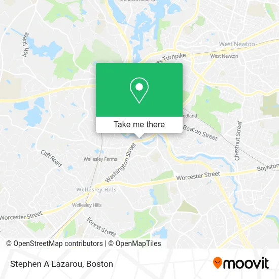
See Stephen A Lazarou, Wellesley, on the map
Public Transit to Stephen A Lazarou in Wellesley
Wondering how to get to Stephen A Lazarou in Wellesley? Moovit helps you find the best way to get to Stephen A Lazarou with step-by-step directions from the nearest public transit station.
Moovit provides free maps and live directions to help you navigate through your city. View schedules, routes, timetables, and find out how long does it take to get to Stephen A Lazarou in real time.
Looking for the nearest stop or station to Stephen A Lazarou? Check out this list of stops closest to your destination: Lower Falls (Washington St/Concord St); Wellesley Hills; Woodland.
Bus: 01, 505, 558, 59.Train: FRAMINGHAM/WORCESTER.Subway: GREEN LINE D.
Want to see if there’s another route that gets you there at an earlier time? Moovit helps you find alternative routes or times. Get directions from and directions to Stephen A Lazarou easily from the Moovit App or Website.
We make riding to Stephen A Lazarou easy, which is why over 1.7 million users, including users in Wellesley, trust Moovit as the best app for public transit. You don’t need to download an individual bus app or train app, Moovit is your all-in-one transit app that helps you find the best bus time or train time available.
For information on prices of bus, subway and train, costs and ride fares to Stephen A Lazarou, please check the Moovit app.
Use the app to navigate to popular places including to the airport, hospital, stadium, grocery store, mall, coffee shop, school, college, and university.
Stephen A Lazarou Address: 1 Washington St Ste 206 street in Wellesley
- Dr. Katherine D. Hein,
- Happily Insured,
- Lte - Wellesley,
- Tim Ridge, Psyd, LMHC, LMFT,
- Dunsky Joel L, DDS,
- Truong Duc Huu, DMD,
- Miller Leslie I, DDS,
- Dr. Madeline C. Krauss, Md,
- State Street Eye, Newton-Wellesley; Formerly Newtoneye,
- Six Flags New England - Boston Office,
- Color Me Nail Spa,
- Phoenix Mechanical,
- Cooks Window Italian Pizza And Catering,
- Steven Tashjian - Personal Training and Fitness Coaching,
- Carp Stephen,
- Acupuncture by Alana,
- Pizza Peddler Deli,
- Id Web Solutions Company,
- Evolston Cleaning,
- Kumins Joann
Places Near Stephen A Lazarou (Wellesley)
- Boston Convention & Exhibition Center, Boston,
- Cheers, Boston,
- Seaport District, Boston,
- Quincy Market, Boston,
- Leader Bank Pavilion (Leader Bank Pavillion), Boston,
- Faneuil Hall, Boston,
- Massachusetts General Hospital, Boston,
- Boston Children's Hospital, Boston,
- Mgm Music Hall, Boston,
- Castle Island, Boston,
- North End, Boston,
- Wilbur Theatre, Boston,
- Wang Theater, Boston,
- Museum Of Science, Boston,
- Boston Medical Center, Boston,
- Boston Common, Boston,
- Td Garden, Boston,
- Prudential Center, Boston,
- Isabella Stewart Gardner Museum, Boston,
- House Of Blues, Boston
How to get to popular places in Boston with public transit
Get around Wellesley by public transit!
Traveling around Wellesley has never been so easy. See step by step directions as you travel to any attraction, street or major public transit station. View bus and train schedules, arrival times, service alerts and detailed routes on a map, so you know exactly how to get to anywhere in Wellesley.
When traveling to any destination around Wellesley use Moovit's Live Directions with Get Off Notifications to know exactly where and how far to walk, how long to wait for your line, and how many stops are left. Moovit will alert you when it's time to get off — no need to constantly re-check whether yours is the next stop.
Wondering how to use public transit in Wellesley or how to pay for public transit in Wellesley? Moovit public transit app can help you navigate your way with public transit easily, and at minimum cost. It includes public transit fees, ticket prices, and costs. Looking for a map of Wellesley public transit lines? Moovit public transit app shows all public transit maps in Wellesley with all Bus, Train, Subway and Ferry routes and stops on an interactive map.
Boston has 4 transit type(s), including: Bus, Train, Subway and Ferry, operated by several transit agencies, including MBTA, Southeastern Regional Transit Authority, MetroWest Regional Transit Authority, Rhode Island Public Transit Authority, WRTA, Lowell Regional Transit Authority, Merrimack Valley Transit, Montachusett Regional Transit Authority, Cape Cod Regional Transit Authority, Brockton Area Transit Authority, Martha's Vineyard Transit Authority, the WAVE - Nantucket Regional Transit Authority, GATRA, Cape Ann Transportation Authority and Massport