Directions to Stephen Grigoriou Photography (Boston) with public transportation
The following transit lines have routes that pass near Stephen Grigoriou Photography
 Bus: 10, 19, 39, 450, 501.
- Train: NEEDHAM, NEWBURYPORT/ROCKPORT, FOXBORO EVENT SERVICE, FRAMINGHAM/WORCESTER, FRANKLIN/FOXBORO.
- Subway: GREEN LINE B, GREEN LINE C, ORANGE LINE, GREEN LINE D, GREEN LINE E.
How to get to Stephen Grigoriou Photography by bus?
Click on the bus route to see step by step directions with maps, line arrival times and updated time schedules.
From TownePlace Suites Boston Logan Airport/Chelsea, Chelsea
49 minFrom Market Basket, Revere
63 minFrom West Roxbury, Boston
58 minFrom Qea, Quincy
101 minFrom JFK Library, Boston
60 minFrom DoubleTree by Hilton Boston Logan Airport Chelsea, Chelsea
55 minFrom Four Points by Sheraton Boston Logan Airport, Revere
71 minFrom Marina Bay, Quincy
136 minFrom Arlington, MA, Arlington
89 minFrom Hilton Garden Inn Boston Logan Airport, Boston
48 min
How to get to Stephen Grigoriou Photography by train?
Click on the train route to see step by step directions with maps, line arrival times and updated time schedules.
How to get to Stephen Grigoriou Photography by subway?
Click on the subway route to see step by step directions with maps, line arrival times and updated time schedules.
Bus stops near Stephen Grigoriou Photography in Boston
- Boylston St @ Clarendon St, 2 min walk,VIEW
- Copley - Opp 575 Boylston St, 4 min walk,VIEW
- Boston, MA - Copley Square (Corner Of Clarendon St. & St. James Ave. In Front Of Trinity Church), 4 min walk,VIEW
- Copley - Saint James Ave @ Trinity Pl, 5 min walk,VIEW
- Saint James Ave @ Berkeley St, 5 min walk,VIEW
- Boylston St @ Dartmouth St, 6 min walk,VIEW
- Stuart St @ Dartmouth St, 6 min walk,VIEW
- Copley - Boylston St @ Dartmouth St, 6 min walk,VIEW
- Saint James Ave @ Dartmouth St, 7 min walk,VIEW
Subway station near Stephen Grigoriou Photography in Boston
- Copley, 5 min walk,VIEW
Train station near Stephen Grigoriou Photography in Boston
- Back Bay - South End, 9 min walk,VIEW
Bus lines to Stephen Grigoriou Photography in Boston
- 9, Kenmore Via Boston Latin,VIEW
- 10, Arlington Via South Bay Center,VIEW
- 39, Haymarket Via Forest Hills,VIEW
- 55, West Fenway,VIEW
- 57, Haymarket Via Kenmore,VIEW
- GREEN LINE D SHUTTLE, Riverside (Shuttle),VIEW
- ORANGE LINE SHUTTLE, Back Bay Via Copley (Shuttle),VIEW
- ORANGE LINE SHUTTLE, Forest Hills (Shuttle),VIEW
- ACTON/CONCORD COMMUTER, Acton,VIEW
- GREEN LINE B SHUTTLE, Babcock Street (Shuttle),VIEW
- 501, Downtown Via Cambridge St And Copley (Express),VIEW
- 504, Downtown Via Copley (Express),VIEW
- GREEN LINE B SHUTTLE, Boston University East - Back Bay,VIEW
- GREEN LINE C SHUTTLE, Saint Mary's Street - Back Bay,VIEW
- GREEN LINE E SHUTTLE, Heath Street - Park Street,VIEW
- GREEN LINE SHUTTLE, Boston University East - Park Street,VIEW
- ORANGE LINE SHUTTLE, Ruggles - Copley,VIEW
- GREEN LINE B SHUTTLE, Babcock Street - Back Bay,VIEW
- GREEN LINE B SHUTTLE, Boston College - Back Bay (Shuttle),VIEW
- GREEN LINE B SHUTTLE, Kenmore - Back Bay via Copley (Shuttle),VIEW
What are the closest stations to Stephen Grigoriou Photography?
The closest stations to Stephen Grigoriou Photography are:
- Boylston St @ Clarendon St is 132 yards away, 2 min walk.
- Copley - Opp 575 Boylston St is 237 yards away, 4 min walk.
- Boston, MA - Copley Square (Corner Of Clarendon St. & St. James Ave. In Front Of Trinity Church) is 254 yards away, 4 min walk.
- Copley - Saint James Ave @ Trinity Pl is 320 yards away, 5 min walk.
- Saint James Ave @ Berkeley St is 364 yards away, 5 min walk.
- Copley is 378 yards away, 5 min walk.
- Boylston St @ Dartmouth St is 435 yards away, 6 min walk.
- Stuart St @ Dartmouth St is 457 yards away, 6 min walk.
- Copley - Boylston St @ Dartmouth St is 478 yards away, 6 min walk.
- Saint James Ave @ Dartmouth St is 541 yards away, 7 min walk.
- Back Bay - South End is 733 yards away, 9 min walk.
Which bus lines stop near Stephen Grigoriou Photography?
These bus lines stop near Stephen Grigoriou Photography: 10, 19, 39, 450, 501, 504, 9.
Which train lines stop near Stephen Grigoriou Photography?
These train lines stop near Stephen Grigoriou Photography: NEEDHAM, NEWBURYPORT/ROCKPORT.
Which subway lines stop near Stephen Grigoriou Photography?
These subway lines stop near Stephen Grigoriou Photography: GREEN LINE B, GREEN LINE C, ORANGE LINE.
What’s the nearest subway station to Stephen Grigoriou Photography in Boston?
The nearest subway station to Stephen Grigoriou Photography in Boston is Copley. It’s a 5 min walk away.
What’s the nearest train station to Stephen Grigoriou Photography in Boston?
The nearest train station to Stephen Grigoriou Photography in Boston is Back Bay - South End. It’s a 9 min walk away.
What’s the nearest bus station to Stephen Grigoriou Photography in Boston?
The nearest bus station to Stephen Grigoriou Photography in Boston is Boylston St @ Clarendon St. It’s a 2 min walk away.
What time is the first subway to Stephen Grigoriou Photography in Boston?
The GREEN LINE D is the first subway that goes to Stephen Grigoriou Photography in Boston. It stops nearby at 5:05 AM.
What time is the last subway to Stephen Grigoriou Photography in Boston?
The GREEN LINE E is the last subway that goes to Stephen Grigoriou Photography in Boston. It stops nearby at 2:14 AM.
What time is the first train to Stephen Grigoriou Photography in Boston?
The PROVIDENCE/STOUGHTON is the first train that goes to Stephen Grigoriou Photography in Boston. It stops nearby at 4:25 AM.
What time is the last train to Stephen Grigoriou Photography in Boston?
The LAKE SHORE LIMITED is the last train that goes to Stephen Grigoriou Photography in Boston. It stops nearby at 8:26 PM.
What time is the first bus to Stephen Grigoriou Photography in Boston?
The 57 is the first bus that goes to Stephen Grigoriou Photography in Boston. It stops nearby at 4:53 AM.
What time is the last bus to Stephen Grigoriou Photography in Boston?
The 10 is the last bus that goes to Stephen Grigoriou Photography in Boston. It stops nearby at 1:19 AM.
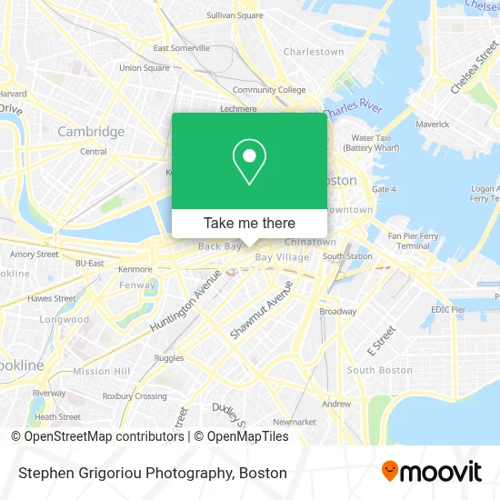
See Stephen Grigoriou Photography, Boston, on the map
Public Transit to Stephen Grigoriou Photography in Boston
Wondering how to get to Stephen Grigoriou Photography in Boston? Moovit helps you find the best way to get to Stephen Grigoriou Photography with step-by-step directions from the nearest public transit station.
Moovit provides free maps and live directions to help you navigate through your city. View schedules, routes, timetables, and find out how long does it take to get to Stephen Grigoriou Photography in real time.
Looking for the nearest stop or station to Stephen Grigoriou Photography? Check out this list of stops closest to your destination: Boylston St @ Clarendon St; Copley - Opp 575 Boylston St; Boston, MA - Copley Square (Corner Of Clarendon St. & St. James Ave. In Front Of Trinity Church); Copley - Saint James Ave @ Trinity Pl; Saint James Ave @ Berkeley St; Copley; Boylston St @ Dartmouth St; Stuart St @ Dartmouth St; Copley - Boylston St @ Dartmouth St; Saint James Ave @ Dartmouth St; Back Bay - South End.
Bus: 10, 19, 39, 450, 501, 504, 9, 55, 57, ORANGE LINE SHUTTLE, ACTON/CONCORD COMMUTER, GREEN LINE B SHUTTLE.Train: NEEDHAM, NEWBURYPORT/ROCKPORT, FOXBORO EVENT SERVICE, FRAMINGHAM/WORCESTER, FRANKLIN/FOXBORO, ORANGE LINE.Subway: GREEN LINE B, GREEN LINE C, ORANGE LINE, GREEN LINE D, GREEN LINE E.
Want to see if there’s another route that gets you there at an earlier time? Moovit helps you find alternative routes or times. Get directions from and directions to Stephen Grigoriou Photography easily from the Moovit App or Website.
We make riding to Stephen Grigoriou Photography easy, which is why over 1.7 million users, including users in Boston, trust Moovit as the best app for public transit. You don’t need to download an individual bus app or train app, Moovit is your all-in-one transit app that helps you find the best bus time or train time available.
For information on prices of bus, subway and train, costs and ride fares to Stephen Grigoriou Photography, please check the Moovit app.
Use the app to navigate to popular places including to the airport, hospital, stadium, grocery store, mall, coffee shop, school, college, and university.
Stephen Grigoriou Photography Address: St James Ave street in Boston
- Consulado General de España,
- Bracebridge Capital (Atv Capital Management),
- Craftsmen Standard Flooring,
- SoulCycle Back Bay,
- Trinity Church Boston,
- John Hancock Hall,
- Talbots,
- John Hancock,
- John Hancock Tower (200 Clarendon),
- Wework 200 Berkeley,
- Deloitte,
- Nordstrom Rack Newbury,
- Dorothy Quincy Suite,
- Nordstrom Rack,
- Summit Partners (Summit Partnrs Eurpe Private Eqty FND),
- Trade & Reference Pubhs Div (K-12 Publishers Div),
- FiRE + iCE Boston,
- Pearson,
- Alicia McPherson Aesthetics,
- Fire & Ice (Fire Ice Restaurant)
Places Near Stephen Grigoriou Photography (Boston)
- Boston Medical Center, Boston,
- Mgm Music Hall, Boston,
- Wang Theater, Boston,
- House Of Blues, Boston,
- Wilbur Theatre, Boston,
- Boston Children's Hospital, Boston,
- Prudential Center, Boston,
- Cheers, Boston,
- Quincy Market, Boston,
- Castle Island, Boston,
- Boston Convention & Exhibition Center, Boston,
- Isabella Stewart Gardner Museum, Boston,
- Faneuil Hall, Boston,
- Boston Common, Boston,
- Leader Bank Pavilion (Leader Bank Pavillion), Boston,
- Seaport District, Boston,
- North End, Boston,
- Td Garden, Boston,
- Museum Of Science, Boston,
- Massachusetts General Hospital, Boston
How to get to popular places in Boston with public transit
Get around Boston by public transit!
Traveling around Boston has never been so easy. See step by step directions as you travel to any attraction, street or major public transit station. View bus and train schedules, arrival times, service alerts and detailed routes on a map, so you know exactly how to get to anywhere in Boston.
When traveling to any destination around Boston use Moovit's Live Directions with Get Off Notifications to know exactly where and how far to walk, how long to wait for your line, and how many stops are left. Moovit will alert you when it's time to get off — no need to constantly re-check whether yours is the next stop.
Wondering how to use public transit in Boston or how to pay for public transit in Boston? Moovit public transit app can help you navigate your way with public transit easily, and at minimum cost. It includes public transit fees, ticket prices, and costs. Looking for a map of Boston public transit lines? Moovit public transit app shows all public transit maps in Boston with all Bus, Train, Subway and Ferry routes and stops on an interactive map.
Boston has 4 transit type(s), including: Bus, Train, Subway and Ferry, operated by several transit agencies, including MBTA, Southeastern Regional Transit Authority, MetroWest Regional Transit Authority, Rhode Island Public Transit Authority, WRTA, Lowell Regional Transit Authority, Merrimack Valley Transit, Montachusett Regional Transit Authority, Cape Cod Regional Transit Authority, Brockton Area Transit Authority, Martha's Vineyard Transit Authority, the WAVE - Nantucket Regional Transit Authority, GATRA, Cape Ann Transportation Authority and Massport