Directions to Stepstone Church Of Boston (Cambridge) with public transportation
The following transit lines have routes that pass near Stepstone Church Of Boston
 Bus: 83, 87, 89, 96, 94.
- Train: FITCHBURG.
- Subway: RED LINE, GREEN LINE B, GREEN LINE C, GREEN LINE E.
How to get to Stepstone Church Of Boston by bus?
Click on the bus route to see step by step directions with maps, line arrival times and updated time schedules.
From Comfort Inn & Suites Logan International Airport, Revere
72 minFrom 240 Mount Vernon Street, Boston
78 minFrom Hampton Inn & Suites Boston Crosstown Ctr, Boston
48 minFrom Amtrak-Boston South Station, Boston
62 minFrom James P. Kelleher Rose Garden, Boston
63 minFrom Arnold Arboretum, Boston
89 minFrom Suffolk County Superior Court, Boston
42 minFrom Uscis Biometrics Office, Revere
71 minFrom 7F Everett Street, Revere
77 minFrom Massachusetts Eye And Ear, Boston
41 min
How to get to Stepstone Church Of Boston by train?
Click on the train route to see step by step directions with maps, line arrival times and updated time schedules.
How to get to Stepstone Church Of Boston by subway?
Click on the subway route to see step by step directions with maps, line arrival times and updated time schedules.
From Comfort Inn & Suites Logan International Airport, Revere
65 minFrom 240 Mount Vernon Street, Boston
42 minFrom Hampton Inn & Suites Boston Crosstown Ctr, Boston
50 minFrom Amtrak-Boston South Station, Boston
30 minFrom James P. Kelleher Rose Garden, Boston
52 minFrom Arnold Arboretum, Boston
64 minFrom Suffolk County Superior Court, Boston
31 minFrom Uscis Biometrics Office, Revere
64 minFrom 7F Everett Street, Revere
63 minFrom Massachusetts Eye And Ear, Boston
27 min
Subway stations near Stepstone Church Of Boston in Cambridge
Bus stops near Stepstone Church Of Boston in Cambridge
Train station near Stepstone Church Of Boston in Cambridge
- Porter, 15 min walk,VIEW
Bus lines to Stepstone Church Of Boston in Cambridge
- 89, Sullivan,VIEW
- 94, Davis,VIEW
- 96, Medford Square,VIEW
- 87, Lechmere - Arlington Center,VIEW
- 88, Lechmere - Clarendon Hill,VIEW
- 90, Assembly - Davis,VIEW
- RED LINE SHUTTLE, Alewife - Park Street,VIEW
- RED LINE SHUTTLE, Alewife - Kendall/MIT,VIEW
- RED LINE SHUTTLE, Alewife - Harvard via Brattle Street,VIEW
- RED LINE SHUTTLE, Alewife - Harvard via Holyoke Street,VIEW
- RED LINE SHUTTLE, Alewife - Davis,VIEW
- 77, Harvard,VIEW
- 83, Central Square,VIEW
What are the closest stations to Stepstone Church Of Boston?
The closest stations to Stepstone Church Of Boston are:
- Davis Sq. is 44 yards away, 1 min walk.
- College Ave @ Highland Ave is 65 yards away, 1 min walk.
- Davis is 101 yards away, 2 min walk.
- Massachusetts Ave @ Rindge Ave is 407 yards away, 5 min walk.
- Massachusetts Ave Opp Walden St is 663 yards away, 8 min walk.
- Porter is 1190 yards away, 15 min walk.
- Ball Square Station is 1346 yards away, 17 min walk.
Which bus lines stop near Stepstone Church Of Boston?
These bus lines stop near Stepstone Church Of Boston: 83, 87, 89, 96.
Which train line stops near Stepstone Church Of Boston?
FITCHBURG (#409 | Wachusett)
Which subway line stops near Stepstone Church Of Boston?
RED LINE (Alewife)
What’s the nearest subway station to Stepstone Church Of Boston in Cambridge?
The nearest subway station to Stepstone Church Of Boston in Cambridge is Davis Sq.. It’s a 1 min walk away.
What’s the nearest train station to Stepstone Church Of Boston in Cambridge?
The nearest train station to Stepstone Church Of Boston in Cambridge is Porter. It’s a 15 min walk away.
What’s the nearest bus station to Stepstone Church Of Boston in Cambridge?
The nearest bus station to Stepstone Church Of Boston in Cambridge is College Ave @ Highland Ave. It’s a 1 min walk away.
What time is the first subway to Stepstone Church Of Boston in Cambridge?
The GREEN LINE E is the first subway that goes to Stepstone Church Of Boston in Cambridge. It stops nearby at 4:53 AM.
What time is the last subway to Stepstone Church Of Boston in Cambridge?
The GREEN LINE E is the last subway that goes to Stepstone Church Of Boston in Cambridge. It stops nearby at 2:41 AM.
What time is the first train to Stepstone Church Of Boston in Cambridge?
The FITCHBURG is the first train that goes to Stepstone Church Of Boston in Cambridge. It stops nearby at 5:47 AM.
What time is the last train to Stepstone Church Of Boston in Cambridge?
The FITCHBURG is the last train that goes to Stepstone Church Of Boston in Cambridge. It stops nearby at 12:17 AM.
What time is the first bus to Stepstone Church Of Boston in Cambridge?
The 77 is the first bus that goes to Stepstone Church Of Boston in Cambridge. It stops nearby at 5:02 AM.
What time is the last bus to Stepstone Church Of Boston in Cambridge?
The 89 is the last bus that goes to Stepstone Church Of Boston in Cambridge. It stops nearby at 1:38 AM.
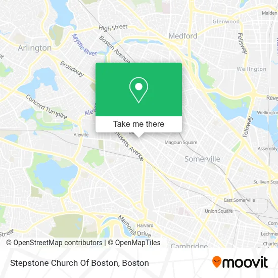
See Stepstone Church Of Boston, Cambridge, on the map
Public Transit to Stepstone Church Of Boston in Cambridge
Wondering how to get to Stepstone Church Of Boston in Cambridge? Moovit helps you find the best way to get to Stepstone Church Of Boston with step-by-step directions from the nearest public transit station.
Moovit provides free maps and live directions to help you navigate through your city. View schedules, routes, timetables, and find out how long does it take to get to Stepstone Church Of Boston in real time.
Looking for the nearest stop or station to Stepstone Church Of Boston? Check out this list of stops closest to your destination: Davis Sq.; College Ave @ Highland Ave; Davis; Massachusetts Ave @ Rindge Ave; Massachusetts Ave Opp Walden St; Porter; Ball Square Station.
Bus: 83, 87, 89, 96, 94, 88, 90, RED LINE SHUTTLE, RED LINE SHUTTLE, 77.Train: FITCHBURG.Subway: RED LINE, GREEN LINE B, GREEN LINE C, GREEN LINE E.
Want to see if there’s another route that gets you there at an earlier time? Moovit helps you find alternative routes or times. Get directions from and directions to Stepstone Church Of Boston easily from the Moovit App or Website.
We make riding to Stepstone Church Of Boston easy, which is why over 1.7 million users, including users in Cambridge, trust Moovit as the best app for public transit. You don’t need to download an individual bus app or train app, Moovit is your all-in-one transit app that helps you find the best bus time or train time available.
For information on prices of bus, subway and train, costs and ride fares to Stepstone Church Of Boston, please check the Moovit app.
Use the app to navigate to popular places including to the airport, hospital, stadium, grocery store, mall, coffee shop, school, college, and university.
Stepstone Church Of Boston Address: 52 Russell St street in Cambridge
- Seven Hills Presbyterian,
- Dish Network,
- 202 Elm St Parking,
- Glass Ripples,
- Pat Murphy,
- Tibco,
- All Screens Entertainment,
- Chris Maloney,
- Choesang,
- Posto,
- Dancing Fools - West Coast Swing,
- Eat Greek,
- Davis353,
- Summer Street Condominium Trust,
- The Dancing Fools,
- Somerville String Lessons,
- The Goodwill Store,
- Davis Square Electrology & Skin Care,
- Kong Dog,
- Buffalo Exchange
Places Near Stepstone Church Of Boston (Cambridge)
- Prudential Center, Boston,
- Boston Medical Center, Boston,
- Castle Island, Boston,
- Seaport District, Boston,
- Boston Children's Hospital, Boston,
- Museum Of Science, Boston,
- Cheers, Boston,
- Massachusetts General Hospital, Boston,
- Wang Theater, Boston,
- Leader Bank Pavilion (Leader Bank Pavillion), Boston,
- Isabella Stewart Gardner Museum, Boston,
- Faneuil Hall, Boston,
- Mgm Music Hall, Boston,
- North End, Boston,
- House Of Blues, Boston,
- Wilbur Theatre, Boston,
- Quincy Market, Boston,
- Boston Common, Boston,
- Boston Convention & Exhibition Center, Boston,
- Td Garden, Boston
How to get to popular places in Boston with public transit
Get around Cambridge by public transit!
Traveling around Cambridge has never been so easy. See step by step directions as you travel to any attraction, street or major public transit station. View bus and train schedules, arrival times, service alerts and detailed routes on a map, so you know exactly how to get to anywhere in Cambridge.
When traveling to any destination around Cambridge use Moovit's Live Directions with Get Off Notifications to know exactly where and how far to walk, how long to wait for your line, and how many stops are left. Moovit will alert you when it's time to get off — no need to constantly re-check whether yours is the next stop.
Wondering how to use public transit in Cambridge or how to pay for public transit in Cambridge? Moovit public transit app can help you navigate your way with public transit easily, and at minimum cost. It includes public transit fees, ticket prices, and costs. Looking for a map of Cambridge public transit lines? Moovit public transit app shows all public transit maps in Cambridge with all Bus, Train, Subway and Ferry routes and stops on an interactive map.
Boston has 4 transit type(s), including: Bus, Train, Subway and Ferry, operated by several transit agencies, including MBTA, Southeastern Regional Transit Authority, MetroWest Regional Transit Authority, Rhode Island Public Transit Authority, WRTA, Lowell Regional Transit Authority, Merrimack Valley Transit, Montachusett Regional Transit Authority, Cape Cod Regional Transit Authority, Brockton Area Transit Authority, Martha's Vineyard Transit Authority, the WAVE - Nantucket Regional Transit Authority, GATRA, Cape Ann Transportation Authority and Massport