See Stevens Creek Reservoir, San Francisco - San Jose, CA, on the map
Directions to Stevens Creek Reservoir (San Francisco - San Jose, CA) with public transportation
The following transit lines have routes that pass near Stevens Creek Reservoir
 Bus:
Bus:
How to get to Stevens Creek Reservoir by bus?
Click on the bus route to see step by step directions with maps, line arrival times and updated time schedules.
Bus stations near Stevens Creek Reservoir in San Francisco - San Jose, CA
- Stevens Creek & Foothill,39 min walk,
Bus lines to Stevens Creek Reservoir in San Francisco - San Jose, CA
- 51,West Valley College,
What are the closest stations to Stevens Creek Reservoir?
The closest stations to Stevens Creek Reservoir are:
- Stevens Creek & Foothill is 3284 yards away, 39 min walk.
Which bus line stops near Stevens Creek Reservoir?
81
See Stevens Creek Reservoir, San Francisco - San Jose, CA, on the map
Public Transit to Stevens Creek Reservoir in San Francisco - San Jose, CA
Wondering how to get to Stevens Creek Reservoir in San Francisco - San Jose, CA, United States? Moovit helps you find the best way to get to Stevens Creek Reservoir with step-by-step directions from the nearest public transit station.
Moovit provides free maps and live directions to help you navigate through your city. View schedules, routes, timetables, and find out how long does it take to get to Stevens Creek Reservoir in real time.
Looking for the nearest stop or station to Stevens Creek Reservoir? Check out this list of stops closest to your destination: Stevens Creek & Foothill.
Bus:
Want to see if there’s another route that gets you there at an earlier time? Moovit helps you find alternative routes or times. Get directions from and directions to Stevens Creek Reservoir easily from the Moovit App or Website.
We make riding to Stevens Creek Reservoir easy, which is why over 1.5 million users, including users in San Francisco - San Jose, CA, trust Moovit as the best app for public transit. You don’t need to download an individual bus app or train app, Moovit is your all-in-one transit app that helps you find the best bus time or train time available.
For information on prices of bus, costs and ride fares to Stevens Creek Reservoir, please check the Moovit app.
Use the app to navigate to popular places including to the airport, hospital, stadium, grocery store, mall, coffee shop, school, college, and university.
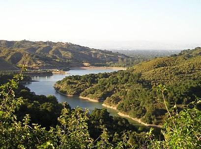
Stevens Creek Reservoir Address: 12401 Stevens Canyon Rd street in San Francisco - San Jose, CA
Attractions near Stevens Creek Reservoir
Stevens Creek Quarry,Picchetti Ranch Open Space Preserve,Sunnyvale Rod and Gun Club,Joyce's Bench,Stevens Creek County Park,Bear Meadow Trail Trailhead,Picchetti Ranch Open Space Preserve,Picchetti Winery,Zinfandel Trail,Stevens Creek Quarry,Picchetti Bros Vinyard,DIRECTV,Better Home & Loan,Peacock Court,Stevens Canyon,Picchetti Winery,Maisie's Peak,Tap House,Deep Cliff Golf Course,Monte Bello Elementary School (Historic)How to get to popular attractions in San Francisco - San Jose, CA with public transit
Googleplex - Charlie's Cafe,Kaiser Permanente Medical Center, Santa Clara,Nordstrom Broadway Plaza in Walnut Creek, Walnut Creek,Nordstrom Stoneridge Mall in Pleasanton, Pleasanton,Japantown, Western Addition, Sf,City of Newark, Newark,Boudin Bakery Café SFO, Sfo,City of Antioch, Antioch,Costco Wholesale, San Jose,Sunnyvale, CA, Sunnyvale,Sfo, Sfo,City of San Carlos, San Carlos,Costco Wholesale, Sunnyvale,Apple Valley Fair, San Jose,Googleplex - B40 Gym,Campbell, CA, Campbell,City of Fremont, Fremont,Milpitas Library, Milpitas,The Castro, Castro/Upper Market,Walmart Supercenter, AntiochGet around San Francisco - San Jose, CA by public transit!
Traveling around San Francisco - San Jose, CA has never been so easy. See step by step directions as you travel to any attraction, street or major public transit station. View bus and train schedules, arrival times, service alerts and detailed routes on a map, so you know exactly how to get to anywhere in San Francisco - San Jose, CA.
When traveling to any destination around San Francisco - San Jose, CA use Moovit's Live Directions with Get Off Notifications to know exactly where and how far to walk, how long to wait for your line, and how many stops are left. Moovit will alert you when it's time to get off — no need to constantly re-check whether yours is the next stop.
Wondering how to use public transit in San Francisco - San Jose, CA or how to pay for public transit in San Francisco - San Jose, CA? Moovit public transit app can help you navigate your way with public transit easily, and at minimum cost. It includes public transit fees, ticket prices, and costs. Looking for a map of San Francisco - San Jose, CA public transit lines? Moovit public transit app shows all public transit maps in San Francisco - San Jose, CA with all bus routes and stops on an interactive map.
San Francisco - San Jose, CA has 1 transit type(s), including: bus, operated by several transit agencies, including BART, Bay Area Rapid Transit, Muni Metro, Caltrain, VTA, Capitol Corridor, Sonoma Marin Area Rail Transit, MUNI, VTA, SF Cable Car, AC Transit, Dumbarton Express, Golden Gate Transit, County Connection and SamTrans