Directions to Stio Mountain Studio - Boston with public transportation
The following transit lines have routes that pass near Stio Mountain Studio - Boston
 Bus: 4, SL1, SL2, SL3, SLW.
- Train: FITCHBURG.
- Subway: ORANGE LINE, RED LINE.
- Ferry: FAST FERRY, QUINCY FERRY, WINTHROP FERRY, WINTHROP/QUINCY FERRY.
How to get to Stio Mountain Studio - Boston by bus?
Click on the bus route to see step by step directions with maps, line arrival times and updated time schedules.
How to get to Stio Mountain Studio - Boston by train?
Click on the train route to see step by step directions with maps, line arrival times and updated time schedules.
How to get to Stio Mountain Studio - Boston by subway?
Click on the subway route to see step by step directions with maps, line arrival times and updated time schedules.
Bus stops near Stio Mountain Studio - Boston
Ferry stations near Stio Mountain Studio - Boston
Bus lines to Stio Mountain Studio - Boston
What are the closest stations to Stio Mountain Studio - Boston?
The closest stations to Stio Mountain Studio - Boston are:
- Purchase St @ Pearl St is 67 yards away, 2 min walk.
- Courthouse is 264 yards away, 4 min walk.
- World Trade Center Pier, Boston, MA is 633 yards away, 8 min walk.
- Central Wharf (South) is 675 yards away, 9 min walk.
- Summer St @ Melcher St is 818 yards away, 10 min walk.
- Seaport (Fan Pier) is 1124 yards away, 14 min walk.
- A St @ Necco St is 1255 yards away, 15 min walk.
- Rowes Wharf is 1765 yards away, 22 min walk.
Which bus lines stop near Stio Mountain Studio - Boston?
These bus lines stop near Stio Mountain Studio - Boston: 4, SL1, SL2, SL3.
Which train line stops near Stio Mountain Studio - Boston?
FITCHBURG (#410 | North Station)
Which subway lines stop near Stio Mountain Studio - Boston?
These subway lines stop near Stio Mountain Studio - Boston: ORANGE LINE, RED LINE.
What’s the nearest bus station to Stio Mountain Studio - Boston?
The nearest bus station to Stio Mountain Studio - Boston is Purchase St @ Pearl St. It’s a 2 min walk away.
What’s the nearest ferry station to Stio Mountain Studio - Boston?
The nearest ferry station to Stio Mountain Studio - Boston is World Trade Center Pier, Boston, MA. It’s a 8 min walk away.
What time is the first bus to Stio Mountain Studio - Boston?
The SLW is the first bus that goes to Stio Mountain Studio - Boston. It stops nearby at 4:14 AM.
What time is the last bus to Stio Mountain Studio - Boston?
The SL1 is the last bus that goes to Stio Mountain Studio - Boston. It stops nearby at 1:26 AM.
What time is the first ferry to Stio Mountain Studio - Boston?
The EAST is the first ferry that goes to Stio Mountain Studio - Boston. It stops nearby at 6:01 AM.
What time is the last ferry to Stio Mountain Studio - Boston?
The FAST FERRY is the last ferry that goes to Stio Mountain Studio - Boston. It stops nearby at 9:05 PM.
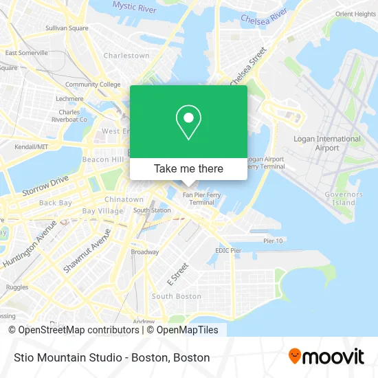
See Stio Mountain Studio - Boston on the map
Public Transportation to Stio Mountain Studio - Boston
Wondering how to get to Stio Mountain Studio - Boston? Moovit helps you find the best way to get to Stio Mountain Studio - Boston with step-by-step directions from the nearest public transit station.
Moovit provides free maps and live directions to help you navigate through your city. View schedules, routes, timetables, and find out how long does it take to get to Stio Mountain Studio - Boston in real time.
Looking for the nearest stop or station to Stio Mountain Studio - Boston? Check out this list of stops closest to your destination: Purchase St @ Pearl St; Courthouse; World Trade Center Pier; Central Wharf (South); Summer St @ Melcher St; Seaport (Fan Pier); A St @ Necco St; Rowes Wharf.
Bus: 4, SL1, SL2, SL3, SLW, 7, 11.Train: FITCHBURG.Subway: ORANGE LINE, RED LINE.Ferry: FAST FERRY, QUINCY FERRY, WINTHROP FERRY, WINTHROP/QUINCY FERRY.
Want to see if there’s another route that gets you there at an earlier time? Moovit helps you find alternative routes or times. Get directions from and directions to Stio Mountain Studio - Boston easily from the Moovit App or Website.
We make riding to Stio Mountain Studio - Boston easy, which is why over 1.7 million users, including users in Boston, trust Moovit as the best app for public transit. You don’t need to download an individual bus app or train app, Moovit is your all-in-one transit app that helps you find the best bus time or train time available.
For information on prices of subway, bus and train, costs and ride fares to Stio Mountain Studio - Boston, please check the Moovit app.
Use the app to navigate to popular places including to the airport, hospital, stadium, grocery store, mall, coffee shop, school, college, and university.
Stio Mountain Studio - Boston Address: 49 Northern Ave street in Boston
- Vertex Pharmaceuticals (Fan Pier),
- Via Seaport,
- Seaport Holiday Farmers Market,
- Lola Burger Boston,
- Lola Burger,
- Serafina - Seaport,
- Caffè Nero,
- Corepower Yoga (Corepower-Ma Seaport),
- Tuscan Kitchen,
- SEPHORA,
- Equinox Seaport,
- Snowport Winter Village,
- MBTA Courthouse Station,
- CJ Eyelash Seaport,
- Fan Pier Yacht Club,
- Ceo Mobile Car Wash,
- Yotel,
- Empire Restaurant & Lounge,
- Our Lady Of Good Voyage,
- United States Court of Appeals (Tracy Jean Fink US Court of Appeals)
Places Near Stio Mountain Studio - Boston
- Mgm Music Hall, Boston,
- House Of Blues, Boston,
- Boston Convention & Exhibition Center, Boston,
- Seaport District, Boston,
- North End, Boston,
- Boston Medical Center, Boston,
- Wilbur Theatre, Boston,
- Castle Island, Boston,
- Isabella Stewart Gardner Museum, Boston,
- Boston Children's Hospital, Boston,
- Massachusetts General Hospital, Boston,
- Quincy Market, Boston,
- Leader Bank Pavilion (Leader Bank Pavillion), Boston,
- Cheers, Boston,
- Prudential Center, Boston,
- Museum Of Science, Boston,
- Td Garden, Boston,
- Boston Common, Boston,
- Faneuil Hall, Boston,
- Wang Theater, Boston
How to get to popular places in Boston with public transit
Get around Boston by public transit!
Traveling around Boston has never been so easy. See step by step directions as you travel to any attraction, street or major public transit station. View bus and train schedules, arrival times, service alerts and detailed routes on a map, so you know exactly how to get to anywhere in Boston.
When traveling to any destination around Boston use Moovit's Live Directions with Get Off Notifications to know exactly where and how far to walk, how long to wait for your line, and how many stops are left. Moovit will alert you when it's time to get off — no need to constantly re-check whether yours is the next stop.
Wondering how to use public transit in Boston or how to pay for public transit in Boston? Moovit public transit app can help you navigate your way with public transit easily, and at minimum cost. It includes public transit fees, ticket prices, and costs. Looking for a map of Boston public transit lines? Moovit public transit app shows all public transit maps in Boston with all Bus, Train, Subway and Ferry routes and stops on an interactive map.
Boston has 4 transit type(s), including: Bus, Train, Subway and Ferry, operated by several transit agencies, including MBTA, Southeastern Regional Transit Authority, MetroWest Regional Transit Authority, Rhode Island Public Transit Authority, WRTA, Lowell Regional Transit Authority, Merrimack Valley Transit, Montachusett Regional Transit Authority, Cape Cod Regional Transit Authority, Brockton Area Transit Authority, Martha's Vineyard Transit Authority, the WAVE - Nantucket Regional Transit Authority, GATRA, Cape Ann Transportation Authority and Massport