Directions to Stoneforest Estates (Attleboro) with public transportation
The following transit lines have routes that pass near Stoneforest Estates
 Bus: 16.
- Train: PROVIDENCE/STOUGHTON, FOXBORO EVENT SERVICE.
How to get to Stoneforest Estates by bus?
Click on the bus route to see step by step directions with maps, line arrival times and updated time schedules.
How to get to Stoneforest Estates by train?
Click on the train route to see step by step directions with maps, line arrival times and updated time schedules.
Bus stop near Stoneforest Estates in Attleboro
- S Main St., 2 min walk,VIEW
Train station near Stoneforest Estates in Attleboro
- Attleboro, 42 min walk,VIEW
Bus lines to Stoneforest Estates in Attleboro
- 16, Market Basket,VIEW
What are the closest stations to Stoneforest Estates?
The closest stations to Stoneforest Estates are:
- S Main St. is 160 yards away, 2 min walk.
- Attleboro is 3612 yards away, 42 min walk.
Which bus line stops near Stoneforest Estates?
16 (Attleboro T.C.→Market Basket)
Which train line stops near Stoneforest Estates?
PROVIDENCE/STOUGHTON (#828 | South Station)
What’s the nearest bus station to Stoneforest Estates in Attleboro?
The nearest bus station to Stoneforest Estates in Attleboro is S Main St.. It’s a 2 min walk away.
What time is the first train to Stoneforest Estates in Attleboro?
The PROVIDENCE/STOUGHTON is the first train that goes to Stoneforest Estates in Attleboro. It stops nearby at 4:32 AM.
What time is the last train to Stoneforest Estates in Attleboro?
The PROVIDENCE/STOUGHTON is the last train that goes to Stoneforest Estates in Attleboro. It stops nearby at 12:47 AM.
What time is the first bus to Stoneforest Estates in Attleboro?
The 16 is the first bus that goes to Stoneforest Estates in Attleboro. It stops nearby at 6:08 AM.
What time is the last bus to Stoneforest Estates in Attleboro?
The 16 is the last bus that goes to Stoneforest Estates in Attleboro. It stops nearby at 6:44 PM.
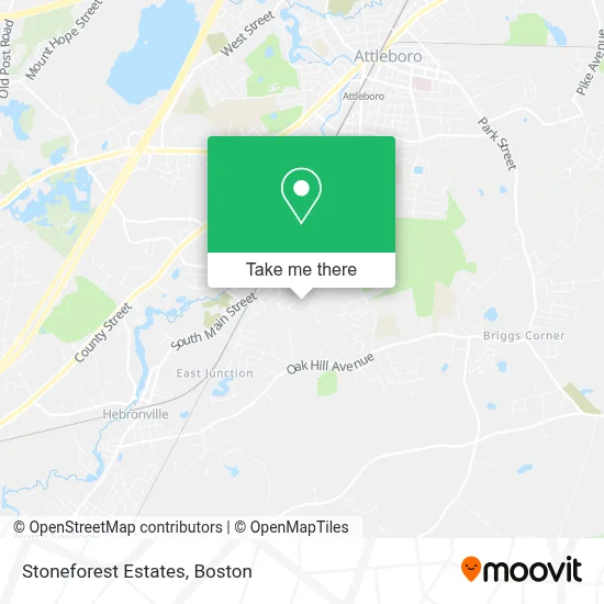
See Stoneforest Estates, Attleboro, on the map
Public Transit to Stoneforest Estates in Attleboro
Wondering how to get to Stoneforest Estates in Attleboro? Moovit helps you find the best way to get to Stoneforest Estates with step-by-step directions from the nearest public transit station.
Moovit provides free maps and live directions to help you navigate through your city. View schedules, routes, timetables, and find out how long does it take to get to Stoneforest Estates in real time.
Looking for the nearest stop or station to Stoneforest Estates? Check out this list of stops closest to your destination: S Main St.; Attleboro.
Bus: 16.Train: PROVIDENCE/STOUGHTON, FOXBORO EVENT SERVICE.
Want to see if there’s another route that gets you there at an earlier time? Moovit helps you find alternative routes or times. Get directions from and directions to Stoneforest Estates easily from the Moovit App or Website.
We make riding to Stoneforest Estates easy, which is why over 1.7 million users, including users in Attleboro, trust Moovit as the best app for public transit. You don’t need to download an individual bus app or train app, Moovit is your all-in-one transit app that helps you find the best bus time or train time available.
For information on prices of bus and train, costs and ride fares to Stoneforest Estates, please check the Moovit app.
Use the app to navigate to popular places including to the airport, hospital, stadium, grocery store, mall, coffee shop, school, college, and university.
Stoneforest Estates Address: 141 Downing Dr street in Attleboro
- Dab Tax,
- Demers Brothers Trucking Inc,
- Sellravo,
- Dodgeville,
- Romantix,
- Blue Rhino Propane Exchange,
- USPS Collection Box - Blue Box,
- Dodgeville Pond Dam,
- Matt's Landscaping,
- Photography by Casey,
- Teknor Apex Co.,
- Twin Village Swimming Pool,
- Tilda B Stone Upper Field,
- St Stephens Cemetery,
- Harmony Hands Massage Therapy,
- Poncin Hewitt Field,
- Dorothy's Sewing Center,
- Sagr,
- Alfred Electric,
- Dal-Trac Oil - Heating Delivery Discount Fuel
Places Near Stoneforest Estates (Attleboro)
- North End, Boston,
- Cheers, Boston,
- Boston Children's Hospital, Boston,
- Seaport District, Boston,
- Wilbur Theatre, Boston,
- Wang Theater, Boston,
- Isabella Stewart Gardner Museum, Boston,
- Leader Bank Pavilion (Leader Bank Pavillion), Boston,
- Castle Island, Boston,
- Museum Of Science, Boston,
- Massachusetts General Hospital, Boston,
- Quincy Market, Boston,
- Boston Common, Boston,
- Faneuil Hall, Boston,
- Td Garden, Boston,
- Boston Convention & Exhibition Center, Boston,
- House Of Blues, Boston,
- Mgm Music Hall, Boston,
- Prudential Center, Boston,
- Boston Medical Center, Boston
How to get to popular places in Boston with public transit
Get around Attleboro by public transit!
Traveling around Attleboro has never been so easy. See step by step directions as you travel to any attraction, street or major public transit station. View bus and train schedules, arrival times, service alerts and detailed routes on a map, so you know exactly how to get to anywhere in Attleboro.
When traveling to any destination around Attleboro use Moovit's Live Directions with Get Off Notifications to know exactly where and how far to walk, how long to wait for your line, and how many stops are left. Moovit will alert you when it's time to get off — no need to constantly re-check whether yours is the next stop.
Wondering how to use public transit in Attleboro or how to pay for public transit in Attleboro? Moovit public transit app can help you navigate your way with public transit easily, and at minimum cost. It includes public transit fees, ticket prices, and costs. Looking for a map of Attleboro public transit lines? Moovit public transit app shows all public transit maps in Attleboro with all Bus, Train, Subway and Ferry routes and stops on an interactive map.
Boston has 4 transit type(s), including: Bus, Train, Subway and Ferry, operated by several transit agencies, including MBTA, Southeastern Regional Transit Authority, MetroWest Regional Transit Authority, Rhode Island Public Transit Authority, WRTA, Lowell Regional Transit Authority, Merrimack Valley Transit, Montachusett Regional Transit Authority, Cape Cod Regional Transit Authority, Brockton Area Transit Authority, Martha's Vineyard Transit Authority, the WAVE - Nantucket Regional Transit Authority, GATRA, Cape Ann Transportation Authority and Massport