How to get to Stonehead Rock Gardens by bus?
Click on the bus route to see step by step directions with maps, line arrival times and updated time schedules.
Bus stop near Stonehead Rock Gardens in Worcester
- Ymca Shore Dr., 12 min walk,VIEW
Bus lines to Stonehead Rock Gardens in Worcester
- 825, Central Hub,VIEW
What are the closest stations to Stonehead Rock Gardens?
The closest stations to Stonehead Rock Gardens are:
- Ymca Shore Dr. is 1023 yards away, 12 min walk.
Which bus lines stop near Stonehead Rock Gardens?
These bus lines stop near Stonehead Rock Gardens: 30, 825.
What’s the nearest bus station to Stonehead Rock Gardens in Worcester?
The nearest bus station to Stonehead Rock Gardens in Worcester is Ymca Shore Dr.. It’s a 12 min walk away.
What time is the first bus to Stonehead Rock Gardens in Worcester?
The 825 is the first bus that goes to Stonehead Rock Gardens in Worcester. It stops nearby at 6:44 AM.
What time is the last bus to Stonehead Rock Gardens in Worcester?
The 825 is the last bus that goes to Stonehead Rock Gardens in Worcester. It stops nearby at 8:57 PM.
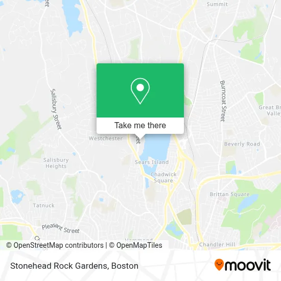
See Stonehead Rock Gardens, Worcester, on the map
Public Transit to Stonehead Rock Gardens in Worcester
Wondering how to get to Stonehead Rock Gardens in Worcester? Moovit helps you find the best way to get to Stonehead Rock Gardens with step-by-step directions from the nearest public transit station.
Moovit provides free maps and live directions to help you navigate through your city. View schedules, routes, timetables, and find out how long does it take to get to Stonehead Rock Gardens in real time.
Looking for the nearest stop or station to Stonehead Rock Gardens? Check out this list of stops closest to your destination: Ymca Shore Dr..
Bus: 30, 825.
Want to see if there’s another route that gets you there at an earlier time? Moovit helps you find alternative routes or times. Get directions from and directions to Stonehead Rock Gardens easily from the Moovit App or Website.
We make riding to Stonehead Rock Gardens easy, which is why over 1.7 million users, including users in Worcester, trust Moovit as the best app for public transit. You don’t need to download an individual bus app or train app, Moovit is your all-in-one transit app that helps you find the best bus time or train time available.
For information on prices of bus and train, costs and ride fares to Stonehead Rock Gardens, please check the Moovit app.
Use the app to navigate to popular places including to the airport, hospital, stadium, grocery store, mall, coffee shop, school, college, and university.
Stonehead Rock Gardens Address: 42 Holden St street in Worcester
- Apm Asphalt,
- Lilypad Family Childcare,
- Indian Lake Pathway Trailhead Information,
- Hearing and Brain Centers of America - New England,
- Lahair & Gallagher Pediatric Dentistry & Orthodontics, LLC,
- Bancroft School,
- Quinsigamond Community College,
- Greendale Family Branch YMCA,
- Maura O'Shea, NP,
- Lisa Noble, MD,
- Select Physical Therapy - Worcester,
- Dr. Sean Thornton DC,
- 44 Huntington,
- Indian Lake Pathway Waypoint Directions,
- Daniel Haran,
- Chadwick Foodmart,
- Home Team,
- Majestic Carpet-Upholstery,
- Bird Lawn Care,
- Mass State Lottery
Places Near Stonehead Rock Gardens (Worcester)
- Boston Convention & Exhibition Center, Boston,
- Massachusetts General Hospital, Boston,
- Boston Medical Center, Boston,
- Td Garden, Boston,
- Quincy Market, Boston,
- Seaport District, Boston,
- Leader Bank Pavilion (Leader Bank Pavillion), Boston,
- Museum Of Science, Boston,
- Prudential Center, Boston,
- Wilbur Theatre, Boston,
- House Of Blues, Boston,
- Mgm Music Hall, Boston,
- North End, Boston,
- Isabella Stewart Gardner Museum, Boston,
- Wang Theater, Boston,
- Faneuil Hall, Boston,
- Castle Island, Boston,
- Cheers, Boston,
- Boston Children's Hospital, Boston,
- Boston Common, Boston
How to get to popular places in Boston with public transit
Get around Worcester by public transit!
Traveling around Worcester has never been so easy. See step by step directions as you travel to any attraction, street or major public transit station. View bus and train schedules, arrival times, service alerts and detailed routes on a map, so you know exactly how to get to anywhere in Worcester.
When traveling to any destination around Worcester use Moovit's Live Directions with Get Off Notifications to know exactly where and how far to walk, how long to wait for your line, and how many stops are left. Moovit will alert you when it's time to get off — no need to constantly re-check whether yours is the next stop.
Wondering how to use public transit in Worcester or how to pay for public transit in Worcester? Moovit public transit app can help you navigate your way with public transit easily, and at minimum cost. It includes public transit fees, ticket prices, and costs. Looking for a map of Worcester public transit lines? Moovit public transit app shows all public transit maps in Worcester with all Bus, Train, Subway and Ferry routes and stops on an interactive map.
Boston has 4 transit type(s), including: Bus, Train, Subway and Ferry, operated by several transit agencies, including MBTA, Southeastern Regional Transit Authority, MetroWest Regional Transit Authority, Rhode Island Public Transit Authority, WRTA, Lowell Regional Transit Authority, Merrimack Valley Transit, Montachusett Regional Transit Authority, Cape Cod Regional Transit Authority, Brockton Area Transit Authority, Martha's Vineyard Transit Authority, the WAVE - Nantucket Regional Transit Authority, GATRA, Cape Ann Transportation Authority and Massport