Directions to Stones by Crowne (Peabody) with public transportation
The following transit lines have routes that pass near Stones by Crowne
 Bus: 435, 450.
- Train: NEWBURYPORT/ROCKPORT.
How to get to Stones by Crowne by bus?
Click on the bus route to see step by step directions with maps, line arrival times and updated time schedules.
How to get to Stones by Crowne by train?
Click on the train route to see step by step directions with maps, line arrival times and updated time schedules.
Bus stop near Stones by Crowne in Peabody
- Central St @ Walnut St, 5 min walk,VIEW
Bus lines to Stones by Crowne in Peabody
- 435, Salem Depot,VIEW
What are the closest stations to Stones by Crowne?
The closest stations to Stones by Crowne are:
- Central St @ Walnut St is 347 yards away, 5 min walk.
Which bus lines stop near Stones by Crowne?
These bus lines stop near Stones by Crowne: 435, 450.
Which train line stops near Stones by Crowne?
NEWBURYPORT/ROCKPORT (#125 | Newburyport)
What’s the nearest bus station to Stones by Crowne in Peabody?
The nearest bus station to Stones by Crowne in Peabody is Central St @ Walnut St. It’s a 5 min walk away.
What time is the first bus to Stones by Crowne in Peabody?
The 435 is the first bus that goes to Stones by Crowne in Peabody. It stops nearby at 6:21 AM.
What time is the last bus to Stones by Crowne in Peabody?
The 435 is the last bus that goes to Stones by Crowne in Peabody. It stops nearby at 11:27 PM.
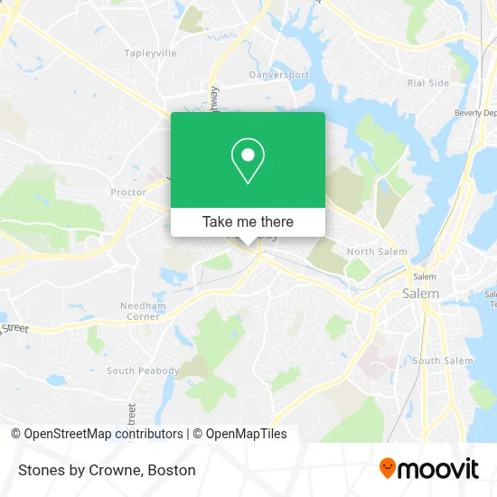
See Stones by Crowne, Peabody, on the map
Public Transit to Stones by Crowne in Peabody
Wondering how to get to Stones by Crowne in Peabody? Moovit helps you find the best way to get to Stones by Crowne with step-by-step directions from the nearest public transit station.
Moovit provides free maps and live directions to help you navigate through your city. View schedules, routes, timetables, and find out how long does it take to get to Stones by Crowne in real time.
Looking for the nearest stop or station to Stones by Crowne? Check out this list of stops closest to your destination: Central St @ Walnut St.
Bus: 435, 450.Train: NEWBURYPORT/ROCKPORT.
Want to see if there’s another route that gets you there at an earlier time? Moovit helps you find alternative routes or times. Get directions from and directions to Stones by Crowne easily from the Moovit App or Website.
We make riding to Stones by Crowne easy, which is why over 1.7 million users, including users in Peabody, trust Moovit as the best app for public transit. You don’t need to download an individual bus app or train app, Moovit is your all-in-one transit app that helps you find the best bus time or train time available.
For information on prices of bus and train, costs and ride fares to Stones by Crowne, please check the Moovit app.
Use the app to navigate to popular places including to the airport, hospital, stadium, grocery store, mall, coffee shop, school, college, and university.
Stones by Crowne Address: 49 Lowell St street in Peabody
- Crowne Team MA,
- Metrokleen, Inc,
- Peabody Fire Chief,
- Peabody Fire Department Headquarters Station,
- Bolden & Bonfiglio Llc,
- Carpe Diem Beauty Spa,
- Jms Auto Care,
- Mariama Digital Hub,
- It’S A Buzz Life,
- Budget Overhead Door,
- Nm Carpentry & Painting,
- Graceann’S Hair Salon,
- Peabody, Massachusetts,
- Bishop Fenwick High School Library,
- Independent Electric S,
- Turkish Towel Co. (Turkish Towels Company),
- Wiggin Auditorium at Peabody City Hall,
- Drug Rehab Peabody,
- Glen's Auto Detailing,
- Brothers Mariano Iron Works
Places Near Stones by Crowne (Peabody)
- Massachusetts General Hospital, Boston,
- Seaport District, Boston,
- Wang Theater, Boston,
- Cheers, Boston,
- Mgm Music Hall, Boston,
- Faneuil Hall, Boston,
- Museum Of Science, Boston,
- North End, Boston,
- Leader Bank Pavilion (Leader Bank Pavillion), Boston,
- Wilbur Theatre, Boston,
- House Of Blues, Boston,
- Boston Medical Center, Boston,
- Boston Convention & Exhibition Center, Boston,
- Boston Common, Boston,
- Castle Island, Boston,
- Quincy Market, Boston,
- Isabella Stewart Gardner Museum, Boston,
- Td Garden, Boston,
- Boston Children's Hospital, Boston,
- Prudential Center, Boston
How to get to popular places in Boston with public transit
Get around Peabody by public transit!
Traveling around Peabody has never been so easy. See step by step directions as you travel to any attraction, street or major public transit station. View bus and train schedules, arrival times, service alerts and detailed routes on a map, so you know exactly how to get to anywhere in Peabody.
When traveling to any destination around Peabody use Moovit's Live Directions with Get Off Notifications to know exactly where and how far to walk, how long to wait for your line, and how many stops are left. Moovit will alert you when it's time to get off — no need to constantly re-check whether yours is the next stop.
Wondering how to use public transit in Peabody or how to pay for public transit in Peabody? Moovit public transit app can help you navigate your way with public transit easily, and at minimum cost. It includes public transit fees, ticket prices, and costs. Looking for a map of Peabody public transit lines? Moovit public transit app shows all public transit maps in Peabody with all Bus, Train, Subway and Ferry routes and stops on an interactive map.
Boston has 4 transit type(s), including: Bus, Train, Subway and Ferry, operated by several transit agencies, including MBTA, Southeastern Regional Transit Authority, MetroWest Regional Transit Authority, Rhode Island Public Transit Authority, WRTA, Lowell Regional Transit Authority, Merrimack Valley Transit, Montachusett Regional Transit Authority, Cape Cod Regional Transit Authority, Brockton Area Transit Authority, Martha's Vineyard Transit Authority, the WAVE - Nantucket Regional Transit Authority, GATRA, Cape Ann Transportation Authority and Massport