Directions to Stoneturn (Boston) with public transportation
The following transit lines have routes that pass near Stoneturn
 Bus: 354, 504, 7, SL4, 4.
- Train: FRAMINGHAM/WORCESTER, GREENBUSH, HAVERHILL, LOWELL.
- Subway: GREEN LINE B, GREEN LINE D, GREEN LINE E, ORANGE LINE, BLUE LINE.
- Ferry: CHARLESTOWN FERRY.
How to get to Stoneturn by bus?
Click on the bus route to see step by step directions with maps, line arrival times and updated time schedules.
From Agganis Arena, Boston
69 minFrom The Mall At Chestnut Hill, Newton
81 minFrom Terrace Room, Paige Hall, Medford
51 minFrom Regent Theatre, Arlington
54 minFrom Arlington, MA, Arlington
76 minFrom Melrose, MA, Melrose
65 minFrom JFK Library, Boston
65 minFrom Homewood Suites by Hilton Boston Brookline-Longwood Medical, Brookline
56 minFrom Qea, Quincy
106 minFrom Angell Animal Medical Center (Mspca Angell), Boston
54 min
How to get to Stoneturn by train?
Click on the train route to see step by step directions with maps, line arrival times and updated time schedules.
How to get to Stoneturn by subway?
Click on the subway route to see step by step directions with maps, line arrival times and updated time schedules.
From Agganis Arena, Boston
36 minFrom The Mall At Chestnut Hill, Newton
67 minFrom Terrace Room, Paige Hall, Medford
34 minFrom JFK Library, Boston
42 minFrom Homewood Suites by Hilton Boston Brookline-Longwood Medical, Brookline
38 minFrom Qea, Quincy
34 minFrom Angell Animal Medical Center (Mspca Angell), Boston
34 min
Bus stops near Stoneturn in Boston
Subway stations near Stoneturn in Boston
Ferry stations near Stoneturn in Boston
Bus lines to Stoneturn in Boston
- 4, North Station Via South Station,VIEW
- 15, Haymarket Via Fields Corner & Nubian,VIEW
- 39, Haymarket Via Forest Hills,VIEW
- 57, Haymarket Via Kenmore,VIEW
- 92, Sullivan,VIEW
- 93, Sullivan Via Navy Yard,VIEW
- RED LINE SHUTTLE, Jfk/Umass (Shuttle),VIEW
- RED LINE SHUTTLE, Harvard (Shuttle),VIEW
- RED LINE SHUTTLE, Kendall/MIT (Shuttle),VIEW
- ORANGE LINE SHUTTLE, State (Shuttle),VIEW
- BLUE LINE SHUTTLE, Airport - Government Center (Express),VIEW
- BLUE LINE SHUTTLE, Airport - Government Center via Maverick,VIEW
- BLUE LINE SHUTTLE, Orient Heights - Government Center (Local),VIEW
- BLUE LINE SHUTTLE, Orient Heights - Government Center (Express),VIEW
- BLUE LINE SHUTTLE, Airport - Government Center (Local),VIEW
- BLUE LINE SHUTTLE, Government Center (Shuttle),VIEW
- 116, Wonderland Via Maverick,VIEW
- 354, Burlington (Express) Via Woburn,VIEW
What are the closest stations to Stoneturn?
The closest stations to Stoneturn are:
- Congress St @ State St is 47 yards away, 1 min walk.
- State is 70 yards away, 1 min walk.
- Aquarium - State St Opp Mckinley Sq is 367 yards away, 5 min walk.
- Aquarium is 374 yards away, 5 min walk.
- Long Wharf (South) is 490 yards away, 6 min walk.
- Aquarium - Surface Rd @ State St is 505 yards away, 7 min walk.
- Government Center is 549 yards away, 7 min walk.
- State Street is 584 yards away, 7 min walk.
- Long Wharf North is 685 yards away, 9 min walk.
- State St @ Washington Mall - State St Sta is 725 yards away, 9 min walk.
Which bus lines stop near Stoneturn?
These bus lines stop near Stoneturn: 354, 504, 7, SL4.
Which train lines stop near Stoneturn?
These train lines stop near Stoneturn: FRAMINGHAM/WORCESTER, GREENBUSH, HAVERHILL, LOWELL.
Which subway lines stop near Stoneturn?
These subway lines stop near Stoneturn: GREEN LINE B, GREEN LINE D, GREEN LINE E, ORANGE LINE.
What’s the nearest subway station to Stoneturn in Boston?
The nearest subway station to Stoneturn in Boston is Aquarium. It’s a 5 min walk away.
What’s the nearest bus station to Stoneturn in Boston?
The nearest bus stations to Stoneturn in Boston are Congress St @ State St and State. The closest one is a 1 min walk away.
What’s the nearest ferry station to Stoneturn in Boston?
The nearest ferry station to Stoneturn in Boston is Long Wharf (South). It’s a 6 min walk away.
What time is the first subway to Stoneturn in Boston?
The GREEN LINE E is the first subway that goes to Stoneturn in Boston. It stops nearby at 5:05 AM.
What time is the last subway to Stoneturn in Boston?
The GREEN LINE E is the last subway that goes to Stoneturn in Boston. It stops nearby at 2:20 AM.
What time is the first bus to Stoneturn in Boston?
The 57 is the first bus that goes to Stoneturn in Boston. It stops nearby at 5:02 AM.
What time is the last bus to Stoneturn in Boston?
The 116 is the last bus that goes to Stoneturn in Boston. It stops nearby at 1:58 AM.
What time is the first ferry to Stoneturn in Boston?
The CHARLESTOWN FERRY is the first ferry that goes to Stoneturn in Boston. It stops nearby at 6:30 AM.
What time is the last ferry to Stoneturn in Boston?
The CHARLESTOWN FERRY is the last ferry that goes to Stoneturn in Boston. It stops nearby at 8:25 PM.
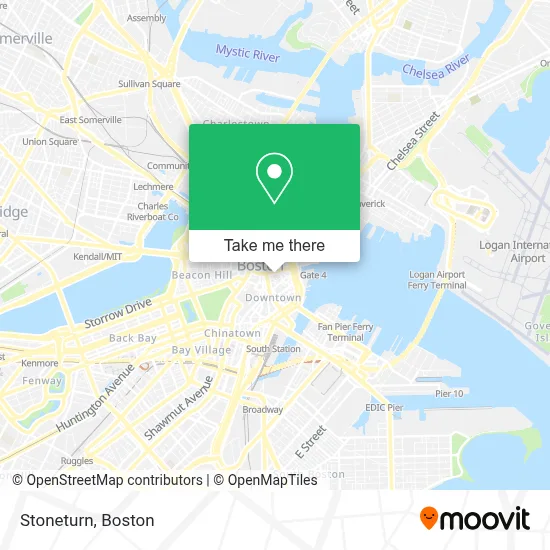
See Stoneturn, Boston, on the map
Public Transit to Stoneturn in Boston
Wondering how to get to Stoneturn in Boston? Moovit helps you find the best way to get to Stoneturn with step-by-step directions from the nearest public transit station.
Moovit provides free maps and live directions to help you navigate through your city. View schedules, routes, timetables, and find out how long does it take to get to Stoneturn in real time.
Looking for the nearest stop or station to Stoneturn? Check out this list of stops closest to your destination: Congress St @ State St; State; Aquarium - State St Opp Mckinley Sq; Aquarium; Long Wharf (South); Aquarium - Surface Rd @ State St; Government Center; State Street; Long Wharf North; State St @ Washington Mall - State St Sta.
Bus: 354, 504, 7, SL4, 4, 15, 39, 57, 92, ORANGE LINE SHUTTLE.Train: FRAMINGHAM/WORCESTER, GREENBUSH, HAVERHILL, LOWELL.Subway: GREEN LINE B, GREEN LINE D, GREEN LINE E, ORANGE LINE, BLUE LINE, GREEN LINE C.Ferry: CHARLESTOWN FERRY.
Want to see if there’s another route that gets you there at an earlier time? Moovit helps you find alternative routes or times. Get directions from and directions to Stoneturn easily from the Moovit App or Website.
We make riding to Stoneturn easy, which is why over 1.7 million users, including users in Boston, trust Moovit as the best app for public transit. You don’t need to download an individual bus app or train app, Moovit is your all-in-one transit app that helps you find the best bus time or train time available.
For information on prices of bus, subway and train, costs and ride fares to Stoneturn, please check the Moovit app.
Use the app to navigate to popular places including to the airport, hospital, stadium, grocery store, mall, coffee shop, school, college, and university.
Stoneturn Address: 75 State St Ste 1710 street in Boston
- SP+ Parking @ 75 State Street Garage at 5 Broad St,
- Psychic Connections,
- State Street Realty Advisors (State Street Lawyers),
- Boston Consulting Group,
- 33 Broad St,
- Bertucci's,
- Financial District,
- Bostonia Public House,
- One Liberty Square,
- Broad St & Water St,
- WESTERN UNION,
- 60 State Street Parking Garage,
- Boston, Massachusetts,
- 60 State St,
- Chris Farley Rehab,
- Robert W Mahoney Lawyer,
- Shann Kerner,
- Lisa Cameron,
- 1 Day Demolition,
- Webster First Federal Credit Union
Places Near Stoneturn (Boston)
- Boston Medical Center, Boston,
- Mgm Music Hall, Boston,
- Wang Theater, Boston,
- House Of Blues, Boston,
- Wilbur Theatre, Boston,
- Boston Children's Hospital, Boston,
- Prudential Center, Boston,
- Cheers, Boston,
- Quincy Market, Boston,
- Castle Island, Boston,
- Boston Convention & Exhibition Center, Boston,
- Isabella Stewart Gardner Museum, Boston,
- Faneuil Hall, Boston,
- Boston Common, Boston,
- Leader Bank Pavilion (Leader Bank Pavillion), Boston,
- Seaport District, Boston,
- North End, Boston,
- Td Garden, Boston,
- Museum Of Science, Boston,
- Massachusetts General Hospital, Boston
How to get to popular places in Boston with public transit
Get around Boston by public transit!
Traveling around Boston has never been so easy. See step by step directions as you travel to any attraction, street or major public transit station. View bus and train schedules, arrival times, service alerts and detailed routes on a map, so you know exactly how to get to anywhere in Boston.
When traveling to any destination around Boston use Moovit's Live Directions with Get Off Notifications to know exactly where and how far to walk, how long to wait for your line, and how many stops are left. Moovit will alert you when it's time to get off — no need to constantly re-check whether yours is the next stop.
Wondering how to use public transit in Boston or how to pay for public transit in Boston? Moovit public transit app can help you navigate your way with public transit easily, and at minimum cost. It includes public transit fees, ticket prices, and costs. Looking for a map of Boston public transit lines? Moovit public transit app shows all public transit maps in Boston with all Bus, Train, Subway and Ferry routes and stops on an interactive map.
Boston has 4 transit type(s), including: Bus, Train, Subway and Ferry, operated by several transit agencies, including MBTA, Southeastern Regional Transit Authority, MetroWest Regional Transit Authority, Rhode Island Public Transit Authority, WRTA, Lowell Regional Transit Authority, Merrimack Valley Transit, Montachusett Regional Transit Authority, Cape Cod Regional Transit Authority, Brockton Area Transit Authority, Martha's Vineyard Transit Authority, the WAVE - Nantucket Regional Transit Authority, GATRA, Cape Ann Transportation Authority and Massport