Directions to Stony Hedge Farm (Boston) with public transportation
The following transit lines have routes that pass near Stony Hedge Farm
 Bus: 60.
How to get to Stony Hedge Farm by bus?
Click on the bus route to see step by step directions with maps, line arrival times and updated time schedules.
From Walmart Fall River Supercenter, Fall River
129 minFrom Lizzy Borden House, Fall River
70 minFrom Amazon Fulfillment Bos7, Fall River
126 minFrom Charlton Memorial Hospital, Fall River
134 minFrom Barahona Express, Providence
53 minFrom B.M.C. Durfee High School, Fall River
115 minFrom Bristol Community College, Fall River
77 min
Bus stop near Stony Hedge Farm in Boston
- Main After Bagy Wrinkle, 4 min walk,VIEW
Bus lines to Stony Hedge Farm in Boston
- 60, Newport Via W Main Rd,VIEW
What are the closest stations to Stony Hedge Farm?
The closest stations to Stony Hedge Farm are:
- Main After Bagy Wrinkle is 315 yards away, 4 min walk.
Which bus line stops near Stony Hedge Farm?
60 (Providence Via E Main Rd)
What’s the nearest bus station to Stony Hedge Farm in Boston?
The nearest bus station to Stony Hedge Farm in Boston is Main After Bagy Wrinkle. It’s a 4 min walk away.
What time is the first bus to Stony Hedge Farm in Boston?
The 60 is the first bus that goes to Stony Hedge Farm in Boston. It stops nearby at 5:16 AM.
What time is the last bus to Stony Hedge Farm in Boston?
The 60 is the last bus that goes to Stony Hedge Farm in Boston. It stops nearby at 12:44 AM.
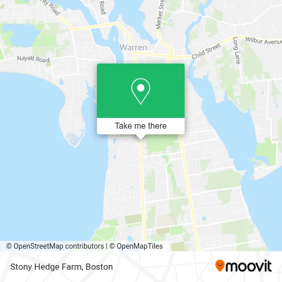
See Stony Hedge Farm, Boston, on the map
Public Transit to Stony Hedge Farm in Boston
Wondering how to get to Stony Hedge Farm in Boston? Moovit helps you find the best way to get to Stony Hedge Farm with step-by-step directions from the nearest public transit station.
Moovit provides free maps and live directions to help you navigate through your city. View schedules, routes, timetables, and find out how long does it take to get to Stony Hedge Farm in real time.
Looking for the nearest stop or station to Stony Hedge Farm? Check out this list of stops closest to your destination: Main After Bagy Wrinkle.
Bus: 60.
Want to see if there’s another route that gets you there at an earlier time? Moovit helps you find alternative routes or times. Get directions from and directions to Stony Hedge Farm easily from the Moovit App or Website.
We make riding to Stony Hedge Farm easy, which is why over 1.7 million users, including users in Boston, trust Moovit as the best app for public transit. You don’t need to download an individual bus app or train app, Moovit is your all-in-one transit app that helps you find the best bus time or train time available.
For information on prices of bus, costs and ride fares to Stony Hedge Farm, please check the Moovit app.
Use the app to navigate to popular places including to the airport, hospital, stadium, grocery store, mall, coffee shop, school, college, and university.
Stony Hedge Farm Address: 1362 Hope St street in Boston
- Indie Growers,
- Aflac,
- Raptor Weekend,
- Bristol Aluminum,
- Wadson Associates Inc,
- Vacuum Service Center,
- Serpa's Getty,
- Cove Condominium Assoc,
- Bristol,
- East Bay Dental,
- South Coast Ninjutsu,
- East Bay Dental Associates,
- ATM,
- Joseph Francis Plumbing And Heating Co,
- Paxton Enterprises,
- Yeshua Adonai -Christian Bookstore / Libreria Cristiana,
- Puppy Pan,
- Hertz Car Renta - Bristol - Broadcommon,
- Component Solutions Inc,
- Deep Blue Composites
Places Near Stony Hedge Farm (Boston)
- Wilbur Theatre, Boston,
- Seaport District, Boston,
- Faneuil Hall, Boston,
- Massachusetts General Hospital, Boston,
- Prudential Center, Boston,
- House Of Blues, Boston,
- Castle Island, Boston,
- Museum Of Science, Boston,
- Boston Medical Center, Boston,
- Isabella Stewart Gardner Museum, Boston,
- Boston Common, Boston,
- Boston Children's Hospital, Boston,
- North End, Boston,
- Td Garden, Boston,
- Boston Convention & Exhibition Center, Boston,
- Leader Bank Pavilion (Leader Bank Pavillion), Boston,
- Cheers, Boston,
- Mgm Music Hall, Boston,
- Wang Theater, Boston,
- Quincy Market, Boston
How to get to popular places in Boston with public transit
Get around Boston by public transit!
Traveling around Boston has never been so easy. See step by step directions as you travel to any attraction, street or major public transit station. View bus and train schedules, arrival times, service alerts and detailed routes on a map, so you know exactly how to get to anywhere in Boston.
When traveling to any destination around Boston use Moovit's Live Directions with Get Off Notifications to know exactly where and how far to walk, how long to wait for your line, and how many stops are left. Moovit will alert you when it's time to get off — no need to constantly re-check whether yours is the next stop.
Wondering how to use public transit in Boston or how to pay for public transit in Boston? Moovit public transit app can help you navigate your way with public transit easily, and at minimum cost. It includes public transit fees, ticket prices, and costs. Looking for a map of Boston public transit lines? Moovit public transit app shows all public transit maps in Boston with all Bus, Train, Subway and Ferry routes and stops on an interactive map.
Boston has 4 transit type(s), including: Bus, Train, Subway and Ferry, operated by several transit agencies, including MBTA, Southeastern Regional Transit Authority, MetroWest Regional Transit Authority, Rhode Island Public Transit Authority, WRTA, Lowell Regional Transit Authority, Merrimack Valley Transit, Montachusett Regional Transit Authority, Cape Cod Regional Transit Authority, Brockton Area Transit Authority, Martha's Vineyard Transit Authority, the WAVE - Nantucket Regional Transit Authority, GATRA, Cape Ann Transportation Authority and Massport