Directions to Stop N Shop Main Store (Quincy) with public transportation
The following transit lines have routes that pass near Stop N Shop Main Store
 Bus: 210, 211, 215, 238, RED LINE SHUTTLE.
- Train: FALL RIVER/NEW BEDFORD, GREENBUSH.
- Subway: RED LINE.
How to get to Stop N Shop Main Store by bus?
Click on the bus route to see step by step directions with maps, line arrival times and updated time schedules.
From Target, Boston
78 minFrom Marina Bay, Quincy
49 minFrom South Boston, Boston
72 minFrom Randolph, MA, Randolph
47 minFrom Best Buy, Boston
79 minFrom 1010 MASS AVE, Boston
76 minFrom JFK Library, Boston
82 minFrom Childrens Museum, Boston
59 minFrom Uphams Corner, Boston
64 minFrom Boston Latin Academy, Boston
60 min
How to get to Stop N Shop Main Store by train?
Click on the train route to see step by step directions with maps, line arrival times and updated time schedules.
How to get to Stop N Shop Main Store by subway?
Click on the subway route to see step by step directions with maps, line arrival times and updated time schedules.
Bus stops near Stop N Shop Main Store in Quincy
Bus lines to Stop N Shop Main Store in Quincy
- RED LINE SHUTTLE, Ashmont - Braintree,VIEW
- RED LINE SHUTTLE, Braintree - Broadway,VIEW
- RED LINE SHUTTLE, Braintree - JFK/UMass (Shuttle),VIEW
- RED LINE SHUTTLE, Quincy Center - Broadway (Express),VIEW
- RED LINE SHUTTLE, Quincy Center - Broadway (Shuttle),VIEW
- 215, East Milton,VIEW
- 225, Quincy Center Via Quincy Ave,VIEW
- 230, Montello,VIEW
- 236, South Shore Plaza,VIEW
- 238, Quincy Center,VIEW
- 216, Quincy Center Via Mcgrath,VIEW
- 220, Quincy Center Via Shipyard,VIEW
- 222, East Weymouth,VIEW
- 210, Fields Corner,VIEW
- 211, Squantum,VIEW
- 217, Quincy Center Via North Quincy,VIEW
- 245, Beale & Newport,VIEW
- FALL RIVER/NEW BEDFORD, #2022 | South Station,VIEW
- GREENBUSH, #1096 | South Station,VIEW
- KINGSTON, #6021 | Kingston,VIEW
What are the closest stations to Stop N Shop Main Store?
The closest stations to Stop N Shop Main Store are:
- Quincy Center - Opp 1250 Hancock St is 163 yards away, 2 min walk.
- Hancock St @ Walter J Hannon Pkwy is 174 yards away, 3 min walk.
- 1250 Hancock St is 187 yards away, 3 min walk.
- Quincy Center is 258 yards away, 4 min walk.
- Quincy Center - Burgin Pkwy @ Saville St is 379 yards away, 5 min walk.
- Burgin Pkwy @ Quincy Center Station is 392 yards away, 5 min walk.
Which bus lines stop near Stop N Shop Main Store?
These bus lines stop near Stop N Shop Main Store: 210, 211, 215, 238.
Which train lines stop near Stop N Shop Main Store?
These train lines stop near Stop N Shop Main Store: FALL RIVER/NEW BEDFORD, GREENBUSH.
Which subway line stops near Stop N Shop Main Store?
RED LINE (Ashmont/Braintree)
What’s the nearest bus station to Stop N Shop Main Store in Quincy?
The nearest bus station to Stop N Shop Main Store in Quincy is Quincy Center - Opp 1250 Hancock St. It’s a 2 min walk away.
What time is the first subway to Stop N Shop Main Store in Quincy?
The RED LINE is the first subway that goes to Stop N Shop Main Store in Quincy. It stops nearby at 5:15 AM.
What time is the last subway to Stop N Shop Main Store in Quincy?
The RED LINE is the last subway that goes to Stop N Shop Main Store in Quincy. It stops nearby at 1:52 AM.
What time is the first train to Stop N Shop Main Store in Quincy?
The KINGSTON is the first train that goes to Stop N Shop Main Store in Quincy. It stops nearby at 5:41 AM.
What time is the last train to Stop N Shop Main Store in Quincy?
The FALL RIVER/NEW BEDFORD is the last train that goes to Stop N Shop Main Store in Quincy. It stops nearby at 12:14 AM.
What time is the first bus to Stop N Shop Main Store in Quincy?
The 216 is the first bus that goes to Stop N Shop Main Store in Quincy. It stops nearby at 4:40 AM.
What time is the last bus to Stop N Shop Main Store in Quincy?
The 220 is the last bus that goes to Stop N Shop Main Store in Quincy. It stops nearby at 1:54 AM.
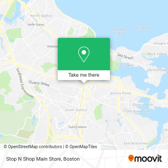
See Stop N Shop Main Store, Quincy, on the map
Public Transit to Stop N Shop Main Store in Quincy
Wondering how to get to Stop N Shop Main Store in Quincy? Moovit helps you find the best way to get to Stop N Shop Main Store with step-by-step directions from the nearest public transit station.
Moovit provides free maps and live directions to help you navigate through your city. View schedules, routes, timetables, and find out how long does it take to get to Stop N Shop Main Store in real time.
Looking for the nearest stop or station to Stop N Shop Main Store? Check out this list of stops closest to your destination: Quincy Center - Opp 1250 Hancock St; Hancock St @ Walter J Hannon Pkwy; 1250 Hancock St; Quincy Center; Quincy Center - Burgin Pkwy @ Saville St; Burgin Pkwy @ Quincy Center Station.
Bus: 210, 211, 215, 238, RED LINE SHUTTLE, RED LINE SHUTTLE, RED LINE SHUTTLE, RED LINE SHUTTLE, RED LINE SHUTTLE, 216, 220, 222, 225, 230, 236, 217, 245, FALL RIVER/NEW BEDFORD, RED LINE SHUTTLE, RED LINE SHUTTLE.Train: FALL RIVER/NEW BEDFORD, GREENBUSH.Subway: RED LINE.
Want to see if there’s another route that gets you there at an earlier time? Moovit helps you find alternative routes or times. Get directions from and directions to Stop N Shop Main Store easily from the Moovit App or Website.
We make riding to Stop N Shop Main Store easy, which is why over 1.7 million users, including users in Quincy, trust Moovit as the best app for public transit. You don’t need to download an individual bus app or train app, Moovit is your all-in-one transit app that helps you find the best bus time or train time available.
For information on prices of bus, subway and train, costs and ride fares to Stop N Shop Main Store, please check the Moovit app.
Use the app to navigate to popular places including to the airport, hospital, stadium, grocery store, mall, coffee shop, school, college, and university.
Stop N Shop Main Store Address: 1385 Hancock St street in Quincy
- Stop & Shop Corporate Headquarters,
- Gutter Pro.Com,
- South Shore Neptunes Dive Club,
- Hancock Cemetery,
- Atm Quincy Credit Union,
- Unlimited Touch Bodywork,
- Resilience Home Maintenance,
- A 1 Dependable Electric,
- Quincy Market,
- US Post Office,
- Quincy City Hall,
- Done Right Masonry,
- Five Guys,
- Hancock St @ Quincy Center - Red Line Braintree Shuttle,
- Quincy College,
- City of Quincy Welcome Center,
- Harvard Vanguard Medical Associates,
- Thomas Crane Public Library,
- Keating William Congressman,
- Wen Yanping MD
Places Near Stop N Shop Main Store (Quincy)
- Faneuil Hall, Boston,
- Boston Children's Hospital, Boston,
- Boston Common, Boston,
- Quincy Market, Boston,
- Boston Medical Center, Boston,
- Boston Convention & Exhibition Center, Boston,
- Wang Theater, Boston,
- House Of Blues, Boston,
- Museum Of Science, Boston,
- North End, Boston,
- Leader Bank Pavilion (Leader Bank Pavillion), Boston,
- Castle Island, Boston,
- Isabella Stewart Gardner Museum, Boston,
- Wilbur Theatre, Boston,
- Seaport District, Boston,
- Mgm Music Hall, Boston,
- Td Garden, Boston,
- Cheers, Boston,
- Prudential Center, Boston,
- Massachusetts General Hospital, Boston
How to get to popular places in Boston with public transit
Get around Quincy by public transit!
Traveling around Quincy has never been so easy. See step by step directions as you travel to any attraction, street or major public transit station. View bus and train schedules, arrival times, service alerts and detailed routes on a map, so you know exactly how to get to anywhere in Quincy.
When traveling to any destination around Quincy use Moovit's Live Directions with Get Off Notifications to know exactly where and how far to walk, how long to wait for your line, and how many stops are left. Moovit will alert you when it's time to get off — no need to constantly re-check whether yours is the next stop.
Wondering how to use public transit in Quincy or how to pay for public transit in Quincy? Moovit public transit app can help you navigate your way with public transit easily, and at minimum cost. It includes public transit fees, ticket prices, and costs. Looking for a map of Quincy public transit lines? Moovit public transit app shows all public transit maps in Quincy with all Bus, Train, Subway and Ferry routes and stops on an interactive map.
Boston has 4 transit type(s), including: Bus, Train, Subway and Ferry, operated by several transit agencies, including MBTA, Southeastern Regional Transit Authority, MetroWest Regional Transit Authority, Rhode Island Public Transit Authority, WRTA, Lowell Regional Transit Authority, Merrimack Valley Transit, Montachusett Regional Transit Authority, Cape Cod Regional Transit Authority, Brockton Area Transit Authority, Martha's Vineyard Transit Authority, the WAVE - Nantucket Regional Transit Authority, GATRA, Cape Ann Transportation Authority and Massport