How to get to Stop & Shop by bus?
Click on the bus route to see step by step directions with maps, line arrival times and updated time schedules.
From Hyatt Regency-Boston Harbor (Hyatt Harborside At Boston's Logan International Airport Hotel Boston), Boston
69 minFrom Terminal E- Logan International Airport, Boston
56 minFrom Massachusetts Institute of Technology (MIT), Cambridge
65 minFrom The Langham Boston, Boston
25 minFrom Boston Logan International Airport (Bos), Boston
58 minFrom Joe's on Newbury (Joe's American Bar and Grill), Boston
56 minFrom Whole Foods, Boston
42 minFrom Element Boston Seaport, Boston
44 minFrom Copley MBTA Station, Boston
43 minFrom Fairmont Copley Plaza Boston, Boston
41 min
How to get to Stop & Shop by subway?
Click on the subway route to see step by step directions with maps, line arrival times and updated time schedules.
From Terminal E- Logan International Airport, Boston
68 minFrom Massachusetts Institute of Technology (MIT), Cambridge
97 minFrom The Langham Boston, Boston
74 minFrom Joe's on Newbury (Joe's American Bar and Grill), Boston
83 minFrom Whole Foods, Boston
83 minFrom Copley MBTA Station, Boston
80 minFrom Fairmont Copley Plaza Boston, Boston
82 min
Bus stops near Stop & Shop in Revere
Subway station near Stop & Shop in Revere
- Wonderland, 49 min walk,VIEW
Train station near Stop & Shop in Revere
- Chelsea, 58 min walk,VIEW
Bus lines to Stop & Shop in Revere
What are the closest stations to Stop & Shop?
The closest stations to Stop & Shop are:
- Squire Rd @ Super Stop + Shop is 147 yards away, 3 min walk.
- Wesley St @ Lynn St - Linden Sq is 593 yards away, 8 min walk.
- Lynn St @ Beach St Berth B - Linden Sq is 628 yards away, 8 min walk.
- Wonderland is 4108 yards away, 49 min walk.
- Chelsea is 4906 yards away, 58 min walk.
Which bus lines stop near Stop & Shop?
These bus lines stop near Stop & Shop: 109, 119, 426.
Which subway line stops near Stop & Shop?
BLUE LINE (Wonderland)
What’s the nearest bus station to Stop & Shop in Revere?
The nearest bus station to Stop & Shop in Revere is Squire Rd @ Super Stop + Shop. It’s a 3 min walk away.
What time is the first subway to Stop & Shop in Revere?
The BLUE LINE is the first subway that goes to Stop & Shop in Revere. It stops nearby at 5:12 AM.
What time is the last subway to Stop & Shop in Revere?
The BLUE LINE is the last subway that goes to Stop & Shop in Revere. It stops nearby at 1:11 AM.
What time is the first train to Stop & Shop in Revere?
The NEWBURYPORT/ROCKPORT is the first train that goes to Stop & Shop in Revere. It stops nearby at 5:40 AM.
What time is the last train to Stop & Shop in Revere?
The NEWBURYPORT/ROCKPORT is the last train that goes to Stop & Shop in Revere. It stops nearby at 12:06 AM.
What time is the first bus to Stop & Shop in Revere?
The 109 is the first bus that goes to Stop & Shop in Revere. It stops nearby at 4:30 AM.
What time is the last bus to Stop & Shop in Revere?
The 108 is the last bus that goes to Stop & Shop in Revere. It stops nearby at 1:46 AM.
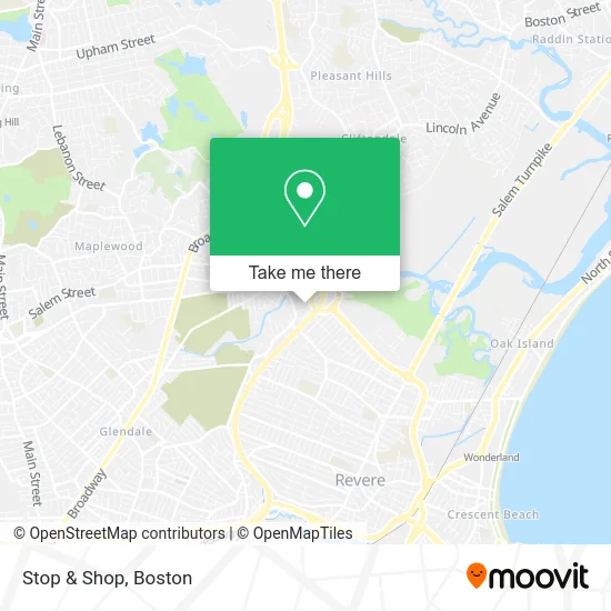
See Stop & Shop, Revere, on the map
Public Transit to Stop & Shop in Revere
Wondering how to get to Stop & Shop in Revere? Moovit helps you find the best way to get to Stop & Shop with step-by-step directions from the nearest public transit station.
Moovit provides free maps and live directions to help you navigate through your city. View schedules, routes, timetables, and find out how long does it take to get to Stop & Shop in real time.
Looking for the nearest stop or station to Stop & Shop? Check out this list of stops closest to your destination: Squire Rd @ Super Stop + Shop; Wesley St @ Lynn St - Linden Sq; Lynn St @ Beach St Berth B - Linden Sq; Wonderland; Chelsea.
Bus: 109, 119, 426, 411, 428, 429, 108.Train: NEWBURYPORT/ROCKPORT.Subway: BLUE LINE.
Want to see if there’s another route that gets you there at an earlier time? Moovit helps you find alternative routes or times. Get directions from and directions to Stop & Shop easily from the Moovit App or Website.
We make riding to Stop & Shop easy, which is why over 1.5 million users, including users in Revere, trust Moovit as the best app for public transit. You don’t need to download an individual bus app or train app, Moovit is your all-in-one transit app that helps you find the best bus time or train time available.
For information on prices of bus and subway, costs and ride fares to Stop & Shop, please check the Moovit app.
Use the app to navigate to popular places including to the airport, hospital, stadium, grocery store, mall, coffee shop, school, college, and university.
Stop & Shop Address: Marble Street street in Revere
- Squire Lounge,
- Copeland Circle / Cutler Circle,
- Amazon,
- Perfect Dental,
- Route 60/Rt. 1 N/S Rotary,
- Steam Pro Carpet Cleaners,
- Trubright Dental,
- Harley-Davidson,
- Olufunke Osineye DMD L,
- Linden Square,
- Dacey Heating and Air Conditioning,
- Four Points by Sheraton Boston Logan Airport,
- Charido Electric Co.,
- Extra Space Storage,
- 455 Linden Square,
- Hirerush Blog,
- Joseph L. Mottolo VFW Post 4524,
- Global Couture Hats,
- DUNKIN',
- Coinflip Bitcoin Atm
Places Near Stop & Shop (Revere)
- Prudential Center, Boston,
- Museum Of Science, Boston,
- House Of Blues, Boston,
- North End, Boston,
- Quincy Market, Boston,
- Boston Common, Boston,
- Castle Island, Boston,
- Seaport District, Boston,
- Boston Medical Center, Boston,
- Wang Theater, Boston,
- Isabella Stewart Gardner Museum, Boston,
- Faneuil Hall, Boston,
- Td Garden, Boston,
- Cheers, Boston,
- Massachusetts General Hospital, Boston,
- Wilbur Theatre, Boston,
- Leader Bank Pavilion (Leader Bank Pavillion), Boston,
- Boston Convention & Exhibition Center, Boston,
- Boston Children's Hospital, Boston,
- Mgm Music Hall, Boston
How to get to popular places in Boston with public transit
Get around Revere by public transit!
Traveling around Revere has never been so easy. See step by step directions as you travel to any attraction, street or major public transit station. View bus and train schedules, arrival times, service alerts and detailed routes on a map, so you know exactly how to get to anywhere in Revere.
When traveling to any destination around Revere use Moovit's Live Directions with Get Off Notifications to know exactly where and how far to walk, how long to wait for your line, and how many stops are left. Moovit will alert you when it's time to get off — no need to constantly re-check whether yours is the next stop.
Wondering how to use public transit in Revere or how to pay for public transit in Revere? Moovit public transit app can help you navigate your way with public transit easily, and at minimum cost. It includes public transit fees, ticket prices, and costs. Looking for a map of Revere public transit lines? Moovit public transit app shows all public transit maps in Revere with all Bus, Train, Subway and Ferry routes and stops on an interactive map.
Boston has 4 transit type(s), including: Bus, Train, Subway and Ferry, operated by several transit agencies, including MBTA, Southeastern Regional Transit Authority, MetroWest Regional Transit Authority, Rhode Island Public Transit Authority, WRTA, Lowell Regional Transit Authority, Merrimack Valley Transit, Montachusett Regional Transit Authority, Cape Cod Regional Transit Authority, Brockton Area Transit Authority, Martha's Vineyard Transit Authority, the WAVE - Nantucket Regional Transit Authority, GATRA, Cape Ann Transportation Authority and Massport
Public transit lines with stations closest to Stop & Shop in Revere
Subway lines with stations closest to Stop & Shop in Revere
Train lines with stations closest to Stop & Shop in Revere
Bus lines with stations closest to Stop & Shop in Revere
Squire Rd @ Super Stop + Shop
 119Beachmont via Tomasello Way - Northgate via Tomasello Way
- 411Malden - Jack Satter House
- 426Haymarket via Cliftondale - Central Square via Cliftondale
- 428Haymarket via Cliftondale (Express) - Oaklandvale via Cliftondale (Express)
- 429Central Square via Square One Mall - Northgate Shopping Center via Square One Mall