Directions to Stop & Shop #0429 (Boston) with public transportation
The following transit lines have routes that pass near Stop & Shop #0429
 Bus: 10, 11, 16, 8, CT3.
- Train: FAIRMOUNT, FRANKLIN/FOXBORO, PROVIDENCE/STOUGHTON, FALL RIVER/NEW BEDFORD, GREENBUSH.
- Subway: RED LINE.
How to get to Stop & Shop #0429 by bus?
Click on the bus route to see step by step directions with maps, line arrival times and updated time schedules.
From VA Hospital, Boston
57 minFrom Revere, MA, Revere
86 minFrom Newton, MA, Newton
79 minFrom USS Constitution, Boston
66 minFrom Medford, MA, Medford
106 minFrom Watertown, MA, Watertown Town
56 minFrom Warren St, Boston
56 minFrom Mass Eye And Ear, Boston
71 minFrom MBTA Suffolk Downs Station, Boston
80 minFrom Rino's Place, Boston
73 min
How to get to Stop & Shop #0429 by train?
Click on the train route to see step by step directions with maps, line arrival times and updated time schedules.
How to get to Stop & Shop #0429 by subway?
Click on the subway route to see step by step directions with maps, line arrival times and updated time schedules.
Bus stops near Stop & Shop #0429 in Boston
Subway station near Stop & Shop #0429 in Boston
- Broadway, 3 min walk,VIEW
Train stations near Stop & Shop #0429 in Boston
Bus lines to Stop & Shop #0429 in Boston
- 8, Kenmore via South Bay Center - Harbor Point via South Bay Center,VIEW
- 16, Andrew via South Bay Center - Forest Hills via South Bay Center,VIEW
- 10, Townsend & Humboldt,VIEW
- CT3, Avenue Louis Pasteur (Limited Stops),VIEW
- FAIRMOUNT LINE SHUTTLE, South Station (Shuttle),VIEW
- 9, City Point,VIEW
- 171, Logan Airport Via Andrew,VIEW
What are the closest stations to Stop & Shop #0429?
The closest stations to Stop & Shop #0429 are:
- Massachusetts Ave @ Clapp St is 128 yards away, 2 min walk.
- Massachusetts Ave @ Magazine St is 156 yards away, 2 min walk.
- Broadway is 225 yards away, 3 min walk.
- Newmarket Sq @ Massachusetts Ave1024 is 359 yards away, 5 min walk.
- Newmarket is 373 yards away, 5 min walk.
- Southampton St @ Newmarket Sq is 825 yards away, 10 min walk.
- Jfk/Umass is 1171 yards away, 14 min walk.
Which bus lines stop near Stop & Shop #0429?
These bus lines stop near Stop & Shop #0429: 10, 11, 16.
Which train line stops near Stop & Shop #0429?
FAIRMOUNT (#1619 | Fairmount)
Which subway line stops near Stop & Shop #0429?
RED LINE (Ashmont/Braintree)
What’s the nearest subway station to Stop & Shop #0429 in Boston?
The nearest subway station to Stop & Shop #0429 in Boston is Broadway. It’s a 3 min walk away.
What’s the nearest train station to Stop & Shop #0429 in Boston?
The nearest train station to Stop & Shop #0429 in Boston is Newmarket. It’s a 5 min walk away.
What’s the nearest bus station to Stop & Shop #0429 in Boston?
The nearest bus stations to Stop & Shop #0429 in Boston are Massachusetts Ave @ Clapp St and Massachusetts Ave @ Magazine St. The closest one is a 2 min walk away.
What time is the first subway to Stop & Shop #0429 in Boston?
The RED LINE is the first subway that goes to Stop & Shop #0429 in Boston. It stops nearby at 5:23 AM.
What time is the last subway to Stop & Shop #0429 in Boston?
The RED LINE is the last subway that goes to Stop & Shop #0429 in Boston. It stops nearby at 1:55 AM.
What time is the first train to Stop & Shop #0429 in Boston?
The FAIRMOUNT is the first train that goes to Stop & Shop #0429 in Boston. It stops nearby at 4:47 AM.
What time is the last train to Stop & Shop #0429 in Boston?
The FAIRMOUNT is the last train that goes to Stop & Shop #0429 in Boston. It stops nearby at 11:57 PM.
What time is the first bus to Stop & Shop #0429 in Boston?
The 171 is the first bus that goes to Stop & Shop #0429 in Boston. It stops nearby at 3:57 AM.
What time is the last bus to Stop & Shop #0429 in Boston?
The 10 is the last bus that goes to Stop & Shop #0429 in Boston. It stops nearby at 1:29 AM.
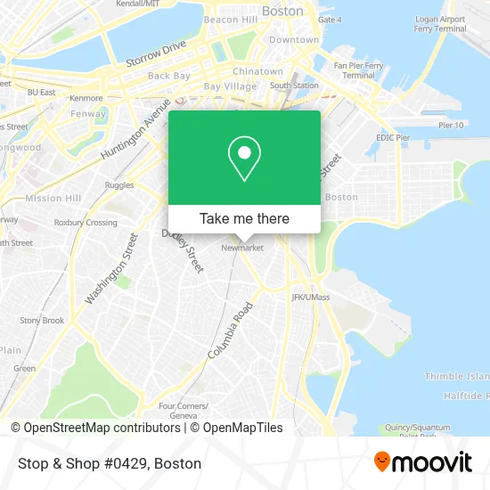
See Stop & Shop #0429, Boston, on the map
Public Transit to Stop & Shop #0429 in Boston
Wondering how to get to Stop & Shop #0429 in Boston? Moovit helps you find the best way to get to Stop & Shop #0429 with step-by-step directions from the nearest public transit station.
Moovit provides free maps and live directions to help you navigate through your city. View schedules, routes, timetables, and find out how long does it take to get to Stop & Shop #0429 in real time.
Looking for the nearest stop or station to Stop & Shop #0429? Check out this list of stops closest to your destination: Massachusetts Ave @ Clapp St; Massachusetts Ave @ Magazine St; Broadway; Newmarket Sq @ Massachusetts Ave1024; Newmarket; Southampton St @ Newmarket Sq; Jfk/Umass.
Bus: 10, 11, 16, 8, CT3, FAIRMOUNT LINE SHUTTLE.Train: FAIRMOUNT, FRANKLIN/FOXBORO, PROVIDENCE/STOUGHTON, FALL RIVER/NEW BEDFORD, GREENBUSH, KINGSTON.Subway: RED LINE.
Want to see if there’s another route that gets you there at an earlier time? Moovit helps you find alternative routes or times. Get directions from and directions to Stop & Shop #0429 easily from the Moovit App or Website.
We make riding to Stop & Shop #0429 easy, which is why over 1.7 million users, including users in Boston, trust Moovit as the best app for public transit. You don’t need to download an individual bus app or train app, Moovit is your all-in-one transit app that helps you find the best bus time or train time available.
For information on prices of bus, subway and train, costs and ride fares to Stop & Shop #0429, please check the Moovit app.
Use the app to navigate to popular places including to the airport, hospital, stadium, grocery store, mall, coffee shop, school, college, and university.
Stop & Shop #0429 Address: 1100 Massachusetts Ave street in Boston
- South Bay Mall @ Stop & Shop,
- Coinstar - Bitcoin ATM,
- Roofing Shingle by Shingle,
- Coinme,
- Charles River Esplanade,
- Stop & Shop,
- Lower Roxbury,
- Metro Credit Union,
- Newmarket Square,
- Nike Factory Store,
- ATM,
- Marshalls-South Bay Center,
- South Bay,
- Conference Hotels in Boston,
- Automotive Glass Service,
- 7 Allstate Rd Parking,
- Olive Garden,
- DTA Office,
- STARBUCKS,
- The Home Depot
Places Near Stop & Shop #0429 (Boston)
- Museum Of Science, Boston,
- Boston Children's Hospital, Boston,
- Mgm Music Hall, Boston,
- Leader Bank Pavilion (Leader Bank Pavillion), Boston,
- North End, Boston,
- Boston Convention & Exhibition Center, Boston,
- Wilbur Theatre, Boston,
- Castle Island, Boston,
- Prudential Center, Boston,
- Wang Theater, Boston,
- House Of Blues, Boston,
- Cheers, Boston,
- Massachusetts General Hospital, Boston,
- Td Garden, Boston,
- Faneuil Hall, Boston,
- Seaport District, Boston,
- Boston Common, Boston,
- Isabella Stewart Gardner Museum, Boston,
- Boston Medical Center, Boston,
- Quincy Market, Boston
How to get to popular places in Boston with public transit
Get around Boston by public transit!
Traveling around Boston has never been so easy. See step by step directions as you travel to any attraction, street or major public transit station. View bus and train schedules, arrival times, service alerts and detailed routes on a map, so you know exactly how to get to anywhere in Boston.
When traveling to any destination around Boston use Moovit's Live Directions with Get Off Notifications to know exactly where and how far to walk, how long to wait for your line, and how many stops are left. Moovit will alert you when it's time to get off — no need to constantly re-check whether yours is the next stop.
Wondering how to use public transit in Boston or how to pay for public transit in Boston? Moovit public transit app can help you navigate your way with public transit easily, and at minimum cost. It includes public transit fees, ticket prices, and costs. Looking for a map of Boston public transit lines? Moovit public transit app shows all public transit maps in Boston with all Bus, Train, Subway and Ferry routes and stops on an interactive map.
Boston has 4 transit type(s), including: Bus, Train, Subway and Ferry, operated by several transit agencies, including MBTA, Southeastern Regional Transit Authority, MetroWest Regional Transit Authority, Rhode Island Public Transit Authority, WRTA, Lowell Regional Transit Authority, Merrimack Valley Transit, Montachusett Regional Transit Authority, Cape Cod Regional Transit Authority, Brockton Area Transit Authority, Martha's Vineyard Transit Authority, the WAVE - Nantucket Regional Transit Authority, GATRA, Cape Ann Transportation Authority and Massport