Directions to Stop & Shop #498 (Somerville) with public transportation
The following transit lines have routes that pass near Stop & Shop #498
 Bus: 101, 85, 95, 89, 90.
- Subway: ORANGE LINE, GREEN LINE B, GREEN LINE C, GREEN LINE E.
How to get to Stop & Shop #498 by bus?
Click on the bus route to see step by step directions with maps, line arrival times and updated time schedules.
From The Mapparium, Boston
53 minFrom Fort Independence, Boston
80 minFrom Forest Hills Station MBTA, Boston
83 minFrom Holiday Inn Express-Saugus, Saugus
70 minFrom JFK Library, Boston
107 minFrom Showa Boston Institute, Boston
111 minFrom Walmart, Saugus
69 minFrom Northeastern University, Boston
67 minFrom Malden Catholic High School, Malden
47 minFrom Lemuel Shattuck Hospital, Boston
94 min
How to get to Stop & Shop #498 by subway?
Click on the subway route to see step by step directions with maps, line arrival times and updated time schedules.
Bus stops near Stop & Shop #498 in Somerville
Subway stations near Stop & Shop #498 in Somerville
Bus lines to Stop & Shop #498 in Somerville
What are the closest stations to Stop & Shop #498?
The closest stations to Stop & Shop #498 are:
- Broadway @ Cross St is 83 yards away, 2 min walk.
- Grand Union Blvd @ Foley St is 108 yards away, 2 min walk.
- Broadway @ Glen St is 170 yards away, 3 min walk.
- Mystic Ave @ Wheatland St is 256 yards away, 4 min walk.
- East Somerville Station is 968 yards away, 12 min walk.
- Sullivan Square is 1619 yards away, 20 min walk.
Which bus lines stop near Stop & Shop #498?
These bus lines stop near Stop & Shop #498: 101, 85, 95.
Which subway line stops near Stop & Shop #498?
ORANGE LINE (Oak Grove)
What’s the nearest subway station to Stop & Shop #498 in Somerville?
The nearest subway station to Stop & Shop #498 in Somerville is East Somerville Station. It’s a 12 min walk away.
What’s the nearest bus station to Stop & Shop #498 in Somerville?
The nearest bus stations to Stop & Shop #498 in Somerville are Broadway @ Cross St and Grand Union Blvd @ Foley St. The closest one is a 2 min walk away.
What time is the first subway to Stop & Shop #498 in Somerville?
The GREEN LINE E is the first subway that goes to Stop & Shop #498 in Somerville. It stops nearby at 4:49 AM.
What time is the last subway to Stop & Shop #498 in Somerville?
The GREEN LINE E is the last subway that goes to Stop & Shop #498 in Somerville. It stops nearby at 2:36 AM.
What time is the first bus to Stop & Shop #498 in Somerville?
The 89/93 is the first bus that goes to Stop & Shop #498 in Somerville. It stops nearby at 4:41 AM.
What time is the last bus to Stop & Shop #498 in Somerville?
The 89 is the last bus that goes to Stop & Shop #498 in Somerville. It stops nearby at 1:49 AM.
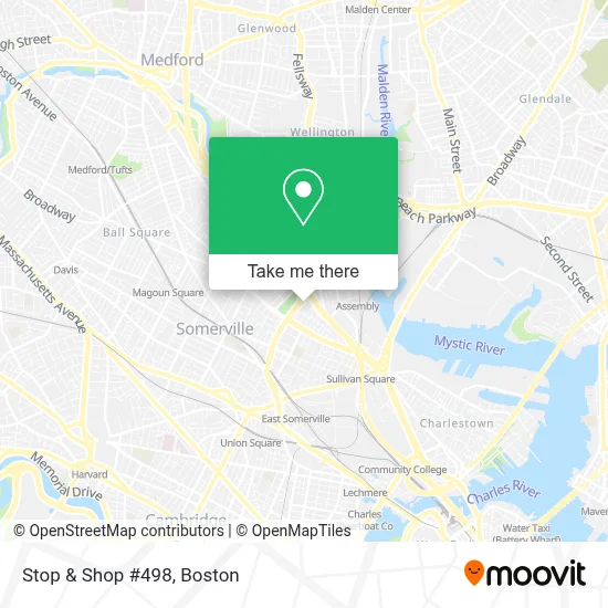
See Stop & Shop #498, Somerville, on the map
Public Transit to Stop & Shop #498 in Somerville
Wondering how to get to Stop & Shop #498 in Somerville? Moovit helps you find the best way to get to Stop & Shop #498 with step-by-step directions from the nearest public transit station.
Moovit provides free maps and live directions to help you navigate through your city. View schedules, routes, timetables, and find out how long does it take to get to Stop & Shop #498 in real time.
Looking for the nearest stop or station to Stop & Shop #498? Check out this list of stops closest to your destination: Broadway @ Cross St; Grand Union Blvd @ Foley St; Broadway @ Glen St; Mystic Ave @ Wheatland St; East Somerville Station; Sullivan Square.
Bus: 101, 85, 95, 89, 90, ORANGE LINE SHUTTLE, ORANGE LINE SHUTTLE, 89/93.Subway: ORANGE LINE, GREEN LINE B, GREEN LINE C, GREEN LINE E.
Want to see if there’s another route that gets you there at an earlier time? Moovit helps you find alternative routes or times. Get directions from and directions to Stop & Shop #498 easily from the Moovit App or Website.
We make riding to Stop & Shop #498 easy, which is why over 1.7 million users, including users in Somerville, trust Moovit as the best app for public transit. You don’t need to download an individual bus app or train app, Moovit is your all-in-one transit app that helps you find the best bus time or train time available.
For information on prices of bus and subway, costs and ride fares to Stop & Shop #498, please check the Moovit app.
Use the app to navigate to popular places including to the airport, hospital, stadium, grocery store, mall, coffee shop, school, college, and university.
Stop & Shop #498 Address: 779 Mcgrath Hwy street in Somerville
- Coinstar - Bitcoin ATM,
- All Seasons Carpet Cleaning,
- SIGNARAMA,
- Veterans Venture,
- Minuteman Power Sweeping,
- Somerville High Security Locksmith,
- Worldsong Schools,
- Christ Episcopal Church,
- Foss Park,
- Chiropractic for Lower Back Pain,
- Eastern Bank,
- Cheap Carpet Cleaning Services,
- City Nails & Spa,
- Broadway Residence,
- MBTA Bus Route 95,
- Somerville Carpet Cleaning,
- Crescent Locksmith & Key,
- DUNKIN',
- Lock and Lockout Service,
- Project Soup
Places Near Stop & Shop #498 (Somerville)
- Cheers, Boston,
- North End, Boston,
- Isabella Stewart Gardner Museum, Boston,
- Boston Medical Center, Boston,
- Seaport District, Boston,
- Boston Children's Hospital, Boston,
- Quincy Market, Boston,
- Wilbur Theatre, Boston,
- Museum Of Science, Boston,
- Leader Bank Pavilion (Leader Bank Pavillion), Boston,
- Boston Common, Boston,
- Prudential Center, Boston,
- Faneuil Hall, Boston,
- Wang Theater, Boston,
- Td Garden, Boston,
- Boston Convention & Exhibition Center, Boston,
- House Of Blues, Boston,
- Castle Island, Boston,
- Massachusetts General Hospital, Boston,
- Mgm Music Hall, Boston
How to get to popular places in Boston with public transit
Get around Somerville by public transit!
Traveling around Somerville has never been so easy. See step by step directions as you travel to any attraction, street or major public transit station. View bus and train schedules, arrival times, service alerts and detailed routes on a map, so you know exactly how to get to anywhere in Somerville.
When traveling to any destination around Somerville use Moovit's Live Directions with Get Off Notifications to know exactly where and how far to walk, how long to wait for your line, and how many stops are left. Moovit will alert you when it's time to get off — no need to constantly re-check whether yours is the next stop.
Wondering how to use public transit in Somerville or how to pay for public transit in Somerville? Moovit public transit app can help you navigate your way with public transit easily, and at minimum cost. It includes public transit fees, ticket prices, and costs. Looking for a map of Somerville public transit lines? Moovit public transit app shows all public transit maps in Somerville with all Bus, Train, Subway and Ferry routes and stops on an interactive map.
Boston has 4 transit type(s), including: Bus, Train, Subway and Ferry, operated by several transit agencies, including MBTA, Southeastern Regional Transit Authority, MetroWest Regional Transit Authority, Rhode Island Public Transit Authority, WRTA, Lowell Regional Transit Authority, Merrimack Valley Transit, Montachusett Regional Transit Authority, Cape Cod Regional Transit Authority, Brockton Area Transit Authority, Martha's Vineyard Transit Authority, the WAVE - Nantucket Regional Transit Authority, GATRA, Cape Ann Transportation Authority and Massport