Directions to Stop & Shop Fuel (Medford) with public transportation
The following transit lines have routes that pass near Stop & Shop Fuel
 Bus: 100, 108, 134, 85.
- Train: NEWBURYPORT/ROCKPORT.
- Subway: ORANGE LINE, GREEN LINE B, GREEN LINE C, GREEN LINE E.
How to get to Stop & Shop Fuel by bus?
Click on the bus route to see step by step directions with maps, line arrival times and updated time schedules.
From FOUR POINTS BY SHERATON Boston Newton, Newton
102 minFrom Doubletree-Boston Bayside, Boston
117 minFrom Chinatown Station MBTA, Boston
84 minFrom MCPHS University-Boston, Boston
72 minFrom 240 Mount Vernon Street, Boston
116 minFrom Saugus, MA, Saugus
46 minFrom The Banshee Bar, Boston
105 minFrom Boston Latin Academy, Boston
90 minFrom Mass Eye and Ear Infirmary, Boston
73 minFrom City Hall Plaza, Boston
61 min
How to get to Stop & Shop Fuel by train?
Click on the train route to see step by step directions with maps, line arrival times and updated time schedules.
How to get to Stop & Shop Fuel by subway?
Click on the subway route to see step by step directions with maps, line arrival times and updated time schedules.
From Doubletree-Boston Bayside, Boston
46 minFrom Chinatown Station MBTA, Boston
27 minFrom MCPHS University-Boston, Boston
51 minFrom 240 Mount Vernon Street, Boston
45 minFrom The Banshee Bar, Boston
44 minFrom Boston Latin Academy, Boston
59 minFrom Mass Eye and Ear Infirmary, Boston
36 minFrom City Hall Plaza, Boston
26 min
Bus stops near Stop & Shop Fuel in Medford
Subway stations near Stop & Shop Fuel in Medford
Bus lines to Stop & Shop Fuel in Medford
What are the closest stations to Stop & Shop Fuel?
The closest stations to Stop & Shop Fuel are:
- Riverside Ave @ Bradbury Ave is 69 yards away, 1 min walk.
- Fellsway @ Bradbury Ave is 226 yards away, 3 min walk.
- Gilman Square is 766 yards away, 9 min walk.
- Assembly is 1757 yards away, 21 min walk.
Which bus lines stop near Stop & Shop Fuel?
These bus lines stop near Stop & Shop Fuel: 100, 108, 134, 85.
Which train line stops near Stop & Shop Fuel?
NEWBURYPORT/ROCKPORT (#125 | Newburyport)
Which subway line stops near Stop & Shop Fuel?
ORANGE LINE (Oak Grove)
What’s the nearest subway station to Stop & Shop Fuel in Medford?
The nearest subway station to Stop & Shop Fuel in Medford is Gilman Square. It’s a 9 min walk away.
What’s the nearest bus station to Stop & Shop Fuel in Medford?
The nearest bus station to Stop & Shop Fuel in Medford is Riverside Ave @ Bradbury Ave. It’s a 1 min walk away.
What time is the first subway to Stop & Shop Fuel in Medford?
The GREEN LINE E is the first subway that goes to Stop & Shop Fuel in Medford. It stops nearby at 4:51 AM.
What time is the last subway to Stop & Shop Fuel in Medford?
The GREEN LINE E is the last subway that goes to Stop & Shop Fuel in Medford. It stops nearby at 2:39 AM.
What time is the first bus to Stop & Shop Fuel in Medford?
The 100 is the first bus that goes to Stop & Shop Fuel in Medford. It stops nearby at 5:03 AM.
What time is the last bus to Stop & Shop Fuel in Medford?
The 108 is the last bus that goes to Stop & Shop Fuel in Medford. It stops nearby at 1:29 AM.
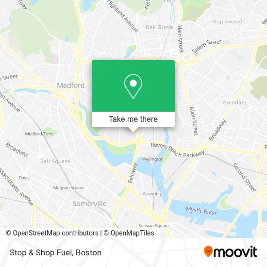
See Stop & Shop Fuel, Medford, on the map
Public Transit to Stop & Shop Fuel in Medford
Wondering how to get to Stop & Shop Fuel in Medford? Moovit helps you find the best way to get to Stop & Shop Fuel with step-by-step directions from the nearest public transit station.
Moovit provides free maps and live directions to help you navigate through your city. View schedules, routes, timetables, and find out how long does it take to get to Stop & Shop Fuel in real time.
Looking for the nearest stop or station to Stop & Shop Fuel? Check out this list of stops closest to your destination: Riverside Ave @ Bradbury Ave; Fellsway @ Bradbury Ave; Gilman Square; Assembly.
Bus: 100, 108, 134, 85.Train: NEWBURYPORT/ROCKPORT.Subway: ORANGE LINE, GREEN LINE B, GREEN LINE C, GREEN LINE E.
Want to see if there’s another route that gets you there at an earlier time? Moovit helps you find alternative routes or times. Get directions from and directions to Stop & Shop Fuel easily from the Moovit App or Website.
We make riding to Stop & Shop Fuel easy, which is why over 1.7 million users, including users in Medford, trust Moovit as the best app for public transit. You don’t need to download an individual bus app or train app, Moovit is your all-in-one transit app that helps you find the best bus time or train time available.
For information on prices of bus, subway and train, costs and ride fares to Stop & Shop Fuel, please check the Moovit app.
Use the app to navigate to popular places including to the airport, hospital, stadium, grocery store, mall, coffee shop, school, college, and university.
Stop & Shop Fuel Address: 630 Fellsway street in Medford
- Amazon Locker-Mintaka,
- Aldi,
- Biolife,
- Wellington Circle Shopping Plaza,
- Lowe's,
- Camellia 66 Nails & Spa,
- EVgo,
- Dave's Hot Chicken,
- Boston Market,
- Stretchlab,
- Quick Lane(R) Tire & Auto Center,
- Fellsway Plaza,
- Mystic Valley Pkwy,
- Stop & Shop,
- Brancato Barber,
- Mystic Valley Pkwy & Revere Beach Pkwy,
- Kappy's Liquors (Kappys Fine Wine Medfo),
- Massachusetts State Police A-4 Medford,
- Lafountain & Wollman P.C.,
- STARBUCKS
Places Near Stop & Shop Fuel (Medford)
- Massachusetts General Hospital, Boston,
- Faneuil Hall, Boston,
- Wang Theater, Boston,
- Boston Medical Center, Boston,
- Boston Common, Boston,
- Wilbur Theatre, Boston,
- Seaport District, Boston,
- Quincy Market, Boston,
- Isabella Stewart Gardner Museum, Boston,
- Museum Of Science, Boston,
- Cheers, Boston,
- Leader Bank Pavilion (Leader Bank Pavillion), Boston,
- Boston Children's Hospital, Boston,
- House Of Blues, Boston,
- Boston Convention & Exhibition Center, Boston,
- Castle Island, Boston,
- North End, Boston,
- Td Garden, Boston,
- Mgm Music Hall, Boston,
- Prudential Center, Boston
How to get to popular places in Boston with public transit
Get around Medford by public transit!
Traveling around Medford has never been so easy. See step by step directions as you travel to any attraction, street or major public transit station. View bus and train schedules, arrival times, service alerts and detailed routes on a map, so you know exactly how to get to anywhere in Medford.
When traveling to any destination around Medford use Moovit's Live Directions with Get Off Notifications to know exactly where and how far to walk, how long to wait for your line, and how many stops are left. Moovit will alert you when it's time to get off — no need to constantly re-check whether yours is the next stop.
Wondering how to use public transit in Medford or how to pay for public transit in Medford? Moovit public transit app can help you navigate your way with public transit easily, and at minimum cost. It includes public transit fees, ticket prices, and costs. Looking for a map of Medford public transit lines? Moovit public transit app shows all public transit maps in Medford with all Bus, Train, Subway and Ferry routes and stops on an interactive map.
Boston has 4 transit type(s), including: Bus, Train, Subway and Ferry, operated by several transit agencies, including MBTA, Southeastern Regional Transit Authority, MetroWest Regional Transit Authority, Rhode Island Public Transit Authority, WRTA, Lowell Regional Transit Authority, Merrimack Valley Transit, Montachusett Regional Transit Authority, Cape Cod Regional Transit Authority, Brockton Area Transit Authority, Martha's Vineyard Transit Authority, the WAVE - Nantucket Regional Transit Authority, GATRA, Cape Ann Transportation Authority and Massport