Directions to Story Club Boston with public transportation
The following transit lines have routes that pass near Story Club Boston
 Bus: 22, 42, 29, 44, ORANGE LINE SHUTTLE.
- Train: NEEDHAM, FRANKLIN/FOXBORO, PROVIDENCE/STOUGHTON.
- Subway: ORANGE LINE, GREEN LINE E.
How to get to Story Club Boston by bus?
Click on the bus route to see step by step directions with maps, line arrival times and updated time schedules.
From Tufts University
33 minFrom USS Constitution
82 minFrom Tufts University
97 minFrom Bos17 - Amazon
51 minFrom US Coast Guard Base Boston
58 minFrom Ac Hotel Cambridge
97 minFrom Legal Harborside
63 minFrom Wegmans
121 minFrom Terrace Room, Paige Hall
98 minFrom Hampton Inn Boston Logan Airport Chelsea
94 min
How to get to Story Club Boston by train?
Click on the train route to see step by step directions with maps, line arrival times and updated time schedules.
How to get to Story Club Boston by subway?
Click on the subway route to see step by step directions with maps, line arrival times and updated time schedules.
Bus stops near Story Club Boston
Train station near Story Club Boston
- Forest Hills, 19 min walk,VIEW
Bus lines to Story Club Boston
- 42, Nubian,VIEW
- 22, Kenmore Via Ruggles,VIEW
- 29, Jackson Square,VIEW
- 44, Ruggles,VIEW
- ORANGE LINE SHUTTLE, Forest Hills - Jackson Square,VIEW
- ORANGE LINE SHUTTLE, Forest Hills - Back Bay (Shuttle),VIEW
- ORANGE LINE SHUTTLE, Forest Hills - Jackson Square (Shuttle),VIEW
- ORANGE LINE SHUTTLE, Forest Hills - Back Bay via Ruggles Busway (Shuttle),VIEW
- ORANGE LINE SHUTTLE, Forest Hills - Ruggles,VIEW
- ORANGE LINE SHUTTLE, Forest Hills - Copley,VIEW
- ORANGE LINE SHUTTLE, Forest Hills - Back Bay via Copley (Shuttle),VIEW
What are the closest stations to Story Club Boston?
The closest stations to Story Club Boston are:
- Washington St @ School St is 27 yards away, 1 min walk.
- Columbus Ave @ Weld Ave - Egleston Sq is 324 yards away, 4 min walk.
- Green Street - Amory St @ Green St is 526 yards away, 7 min walk.
- Heath Street is 1017 yards away, 13 min walk.
- Green Street is 1056 yards away, 13 min walk.
- Forest Hills is 1552 yards away, 19 min walk.
Which bus lines stop near Story Club Boston?
These bus lines stop near Story Club Boston: 22, 42.
Which train line stops near Story Club Boston?
NEEDHAM (#625 | Needham Heights)
Which subway line stops near Story Club Boston?
ORANGE LINE (Forest Hills)
What’s the nearest subway station to Story Club Boston?
The nearest subway stations to Story Club Boston are Heath Street and Green Street. The closest one is a 13 min walk away.
What’s the nearest train station to Story Club Boston?
The nearest train station to Story Club Boston is Forest Hills. It’s a 19 min walk away.
What’s the nearest bus station to Story Club Boston?
The nearest bus station to Story Club Boston is Washington St @ School St. It’s a 1 min walk away.
What time is the first subway to Story Club Boston?
The ORANGE LINE is the first subway that goes to Story Club Boston. It stops nearby at 5:15 AM.
What time is the last subway to Story Club Boston?
The GREEN LINE E is the last subway that goes to Story Club Boston. It stops nearby at 2:00 AM.
What time is the first train to Story Club Boston?
The NEEDHAM is the first train that goes to Story Club Boston. It stops nearby at 7:34 AM.
What time is the last train to Story Club Boston?
The PROVIDENCE/STOUGHTON is the last train that goes to Story Club Boston. It stops nearby at 12:08 AM.
What time is the first bus to Story Club Boston?
The 42 is the first bus that goes to Story Club Boston. It stops nearby at 5:01 AM.
What time is the last bus to Story Club Boston?
The 22 is the last bus that goes to Story Club Boston. It stops nearby at 2:10 AM.
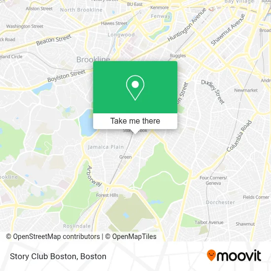
See Story Club Boston on the map
Public Transportation to Story Club Boston
Wondering how to get to Story Club Boston? Moovit helps you find the best way to get to Story Club Boston with step-by-step directions from the nearest public transit station.
Moovit provides free maps and live directions to help you navigate through your city. View schedules, routes, timetables, and find out how long does it take to get to Story Club Boston in real time.
Looking for the nearest stop or station to Story Club Boston? Check out this list of stops closest to your destination: Washington St @ School St; Columbus Ave @ Weld Ave - Egleston Sq; Green Street - Amory St @ Green St; Heath Street; Green Street; Forest Hills.
Bus: 22, 42, 29, 44, ORANGE LINE SHUTTLE, ORANGE LINE SHUTTLE, ORANGE LINE SHUTTLE, ORANGE LINE SHUTTLE, ORANGE LINE SHUTTLE.Train: NEEDHAM, FRANKLIN/FOXBORO, PROVIDENCE/STOUGHTON.Subway: ORANGE LINE, GREEN LINE E.
Want to see if there’s another route that gets you there at an earlier time? Moovit helps you find alternative routes or times. Get directions from and directions to Story Club Boston easily from the Moovit App or Website.
We make riding to Story Club Boston easy, which is why over 1.7 million users, including users in Boston, trust Moovit as the best app for public transit. You don’t need to download an individual bus app or train app, Moovit is your all-in-one transit app that helps you find the best bus time or train time available.
For information on prices of subway, bus and train, costs and ride fares to Story Club Boston, please check the Moovit app.
Use the app to navigate to popular places including to the airport, hospital, stadium, grocery store, mall, coffee shop, school, college, and university.
Story Club Boston Address: 284 Amory St street in Boston
- The Haven,
- A 24 Hour Jamaica Plain Emergency Loc,
- Dance Freedom,
- Peer Education Recovery Center,
- Haven,
- City Ballet Boston,
- Haffenreffer Brewery,
- Migrant Winds,
- Samuel Adams Boston Brewery (Boston Beer Co-Samuel Adams Brewery),
- Samuel Adams,
- Boston Beer Co-Samuel Adams Brewery,
- Sam Adams Boston Brewery Tour,
- Samuel Adams Brewery,
- Union Square Donuts,
- Just Add Cooking,
- Sam Adams Party Trolley,
- Golden Living West Newton,
- Boston Magazine,
- Nutri Lawn,
- Skatepark
Places Near Story Club Boston
- Wang Theater, Boston,
- North End, Boston,
- Wilbur Theatre, Boston,
- Isabella Stewart Gardner Museum, Boston,
- Seaport District, Boston,
- Td Garden, Boston,
- Boston Children's Hospital, Boston,
- Castle Island, Boston,
- Mgm Music Hall, Boston,
- Cheers, Boston,
- Museum Of Science, Boston,
- Faneuil Hall, Boston,
- Massachusetts General Hospital, Boston,
- House Of Blues, Boston,
- Quincy Market, Boston,
- Boston Medical Center, Boston,
- Boston Common, Boston,
- Prudential Center, Boston,
- Boston Convention & Exhibition Center, Boston,
- Leader Bank Pavilion (Leader Bank Pavillion), Boston
How to get to popular places in Boston with public transit
Get around Boston by public transit!
Traveling around Boston has never been so easy. See step by step directions as you travel to any attraction, street or major public transit station. View bus and train schedules, arrival times, service alerts and detailed routes on a map, so you know exactly how to get to anywhere in Boston.
When traveling to any destination around Boston use Moovit's Live Directions with Get Off Notifications to know exactly where and how far to walk, how long to wait for your line, and how many stops are left. Moovit will alert you when it's time to get off — no need to constantly re-check whether yours is the next stop.
Wondering how to use public transit in Boston or how to pay for public transit in Boston? Moovit public transit app can help you navigate your way with public transit easily, and at minimum cost. It includes public transit fees, ticket prices, and costs. Looking for a map of Boston public transit lines? Moovit public transit app shows all public transit maps in Boston with all Bus, Train, Subway and Ferry routes and stops on an interactive map.
Boston has 4 transit type(s), including: Bus, Train, Subway and Ferry, operated by several transit agencies, including MBTA, Southeastern Regional Transit Authority, MetroWest Regional Transit Authority, Rhode Island Public Transit Authority, WRTA, Lowell Regional Transit Authority, Merrimack Valley Transit, Montachusett Regional Transit Authority, Cape Cod Regional Transit Authority, Brockton Area Transit Authority, Martha's Vineyard Transit Authority, the WAVE - Nantucket Regional Transit Authority, GATRA, Cape Ann Transportation Authority and Massport