Directions to Strategic Communications Inc. (Framingham) with public transportation
The following transit lines have routes that pass near Strategic Communications Inc.
 Bus: 03, 04N, MWES, FH, FLIXBUS 2611.
- Train: FRAMINGHAM/WORCESTER, LAKE SHORE LIMITED.
How to get to Strategic Communications Inc. by bus?
Click on the bus route to see step by step directions with maps, line arrival times and updated time schedules.
From Wellesley, MA, Wellesley
64 minFrom I-95 / Route 128 & Route 16 Interchange (Exit 21), Newton
67 minFrom Hopkinton, MA, Hopkinton
68 minFrom Babson College, Wellesley
62 minFrom Marlborough, MA, Marlborough
112 minFrom Bose Corp, Framingham
51 minFrom Newton-Wellesley Hospital, Newton
70 minFrom Newton Wellesley Hospital Green Building, Newton
70 minFrom Staples Corporate HQ, Framingham
53 minFrom Boston Marriott Newton, Newton
93 min
How to get to Strategic Communications Inc. by train?
Click on the train route to see step by step directions with maps, line arrival times and updated time schedules.
Bus stops near Strategic Communications Inc. in Framingham
Train stations near Strategic Communications Inc. in Framingham
Bus lines to Strategic Communications Inc. in Framingham
What are the closest stations to Strategic Communications Inc.?
The closest stations to Strategic Communications Inc. are:
- Remote Terminal Parking Lot is 679 yards away, 9 min walk.
- Stop And Shop & Bjs Wholesale is 753 yards away, 9 min walk.
- Shoppers World Shelter is 1002 yards away, 13 min walk.
- Walmart is 1027 yards away, 13 min walk.
- Eagle Rock Apartments is 1267 yards away, 15 min walk.
- West Natick is 3418 yards away, 40 min walk.
- Framingham Amtrak is 5386 yards away, 64 min walk.
Which bus lines stop near Strategic Communications Inc.?
These bus lines stop near Strategic Communications Inc.: 03, 04N, MWES.
Which train line stops near Strategic Communications Inc.?
FRAMINGHAM/WORCESTER (#521 | Worcester)
What’s the nearest bus station to Strategic Communications Inc. in Framingham?
The nearest bus stations to Strategic Communications Inc. in Framingham are Remote Terminal Parking Lot and Stop And Shop & Bjs Wholesale. The closest one is a 9 min walk away.
What time is the first train to Strategic Communications Inc. in Framingham?
The FRAMINGHAM/WORCESTER is the first train that goes to Strategic Communications Inc. in Framingham. It stops nearby at 4:54 AM.
What time is the last train to Strategic Communications Inc. in Framingham?
The LAKE SHORE LIMITED is the last train that goes to Strategic Communications Inc. in Framingham. It stops nearby at 8:00 PM.
What time is the first bus to Strategic Communications Inc. in Framingham?
The FH is the first bus that goes to Strategic Communications Inc. in Framingham. It stops nearby at 3:00 AM.
What time is the last bus to Strategic Communications Inc. in Framingham?
The FH is the last bus that goes to Strategic Communications Inc. in Framingham. It stops nearby at 2:15 AM.
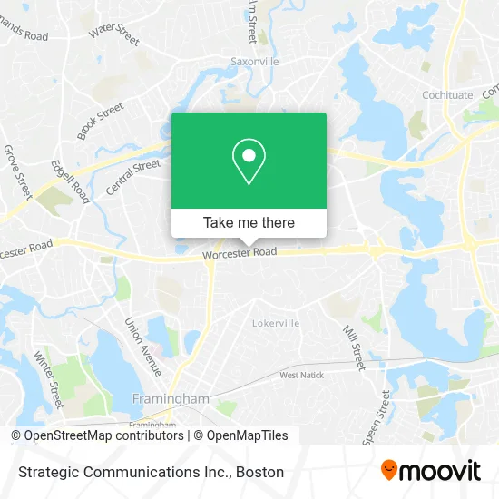
See Strategic Communications Inc., Framingham, on the map
Public Transit to Strategic Communications Inc. in Framingham
Wondering how to get to Strategic Communications Inc. in Framingham? Moovit helps you find the best way to get to Strategic Communications Inc. with step-by-step directions from the nearest public transit station.
Moovit provides free maps and live directions to help you navigate through your city. View schedules, routes, timetables, and find out how long does it take to get to Strategic Communications Inc. in real time.
Looking for the nearest stop or station to Strategic Communications Inc.? Check out this list of stops closest to your destination: Remote Terminal Parking Lot; Stop And Shop & Bjs Wholesale; Shoppers World Shelter; Walmart; Eagle Rock Apartments; West Natick; Framingham Amtrak.
Bus: 03, 04N, MWES, FH, FLIXBUS 2611, 02, 09.Train: FRAMINGHAM/WORCESTER, LAKE SHORE LIMITED.
Want to see if there’s another route that gets you there at an earlier time? Moovit helps you find alternative routes or times. Get directions from and directions to Strategic Communications Inc. easily from the Moovit App or Website.
We make riding to Strategic Communications Inc. easy, which is why over 1.7 million users, including users in Framingham, trust Moovit as the best app for public transit. You don’t need to download an individual bus app or train app, Moovit is your all-in-one transit app that helps you find the best bus time or train time available.
For information on prices of bus and train, costs and ride fares to Strategic Communications Inc., please check the Moovit app.
Use the app to navigate to popular places including to the airport, hospital, stadium, grocery store, mall, coffee shop, school, college, and university.
Strategic Communications Inc. Address: 161 Worcester Rd street in Framingham
- Winter Properties Realty Group,
- Maura A Greene Attorney,
- Carol Lynn May Attorney,
- Boston Metrowest,
- Hydronic Heating Maintenance,
- Patrick Roddy Roddy Realty Group,
- A Finder,
- Tiger Garage Doors Services,
- CRP Three the Meadows,
- MGFS Insurance Brokerage,
- Mary T Feeney,
- Flatbed Towing,
- Towing & Locksout Towing,
- Kims Towing,
- Wrecker Towing,
- Tow Nando Towing,
- Route 9 East / West Framingham,
- Walmart Framingham,
- Dentusa P C,
- Seven Days Long Distance Moving
Places Near Strategic Communications Inc. (Framingham)
- Massachusetts General Hospital, Boston,
- Boston Convention & Exhibition Center, Boston,
- Faneuil Hall, Boston,
- Mgm Music Hall, Boston,
- Wang Theater, Boston,
- House Of Blues, Boston,
- Castle Island, Boston,
- Boston Medical Center, Boston,
- Quincy Market, Boston,
- Isabella Stewart Gardner Museum, Boston,
- Wilbur Theatre, Boston,
- Museum Of Science, Boston,
- Seaport District, Boston,
- Leader Bank Pavilion (Leader Bank Pavillion), Boston,
- Prudential Center, Boston,
- Boston Common, Boston,
- Cheers, Boston,
- Td Garden, Boston,
- North End, Boston,
- Boston Children's Hospital, Boston
How to get to popular places in Boston with public transit
Get around Framingham by public transit!
Traveling around Framingham has never been so easy. See step by step directions as you travel to any attraction, street or major public transit station. View bus and train schedules, arrival times, service alerts and detailed routes on a map, so you know exactly how to get to anywhere in Framingham.
When traveling to any destination around Framingham use Moovit's Live Directions with Get Off Notifications to know exactly where and how far to walk, how long to wait for your line, and how many stops are left. Moovit will alert you when it's time to get off — no need to constantly re-check whether yours is the next stop.
Wondering how to use public transit in Framingham or how to pay for public transit in Framingham? Moovit public transit app can help you navigate your way with public transit easily, and at minimum cost. It includes public transit fees, ticket prices, and costs. Looking for a map of Framingham public transit lines? Moovit public transit app shows all public transit maps in Framingham with all Bus, Train, Subway and Ferry routes and stops on an interactive map.
Boston has 4 transit type(s), including: Bus, Train, Subway and Ferry, operated by several transit agencies, including MBTA, Southeastern Regional Transit Authority, MetroWest Regional Transit Authority, Rhode Island Public Transit Authority, WRTA, Lowell Regional Transit Authority, Merrimack Valley Transit, Montachusett Regional Transit Authority, Cape Cod Regional Transit Authority, Brockton Area Transit Authority, Martha's Vineyard Transit Authority, the WAVE - Nantucket Regional Transit Authority, GATRA, Cape Ann Transportation Authority and Massport