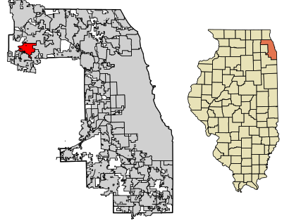
See Streamwood, Illinois on the map
Directions to Streamwood, Illinois with public transportation
The following transit lines have routes that pass near Streamwood, Illinois
 Bus:
Bus: - Train:
How to get to Streamwood, Illinois by bus?
Click on the bus route to see step by step directions with maps, line arrival times and updated time schedules.
Bus stations near Streamwood, Illinois
- Irving Park Rd & Bartlett Rd,10 min walk,
Train stations near Streamwood, Illinois
- Hanover Park,38 min walk,
Bus lines to Streamwood, Illinois
- 554,Elgin Transportation Center Bay 4,
What are the closest stations to Streamwood, Illinois?
The closest stations to Streamwood, Illinois are:
- Irving Park Rd & Bartlett Rd is 773 yards away, 10 min walk.
- Hanover Park is 3206 yards away, 38 min walk.
Which bus line stops near Streamwood, Illinois?
554
What’s the nearest bus stop to Streamwood, Illinois?
The nearest bus stop to Streamwood, Illinois is Irving Park Rd & Bartlett Rd. It’s a 10 min walk away.
What time is the first train to Streamwood, Illinois?
The MD-W is the first train that goes to Streamwood, Illinois. It stops nearby at 4:30 AM.
What time is the last train to Streamwood, Illinois?
The MD-W is the last train that goes to Streamwood, Illinois. It stops nearby at 12:10 AM.
What time is the first bus to Streamwood, Illinois?
The 554 is the first bus that goes to Streamwood, Illinois. It stops nearby at 5:36 AM.
What time is the last bus to Streamwood, Illinois?
The 554 is the last bus that goes to Streamwood, Illinois. It stops nearby at 7:48 PM.
How much is the bus fare to Streamwood, Illinois?
The bus fare to Streamwood, Illinois costs about $2.00.
See Streamwood, Illinois on the map
Public Transportation to Streamwood, Illinois
Wondering how to get to Streamwood, Illinois, United States? Moovit helps you find the best way to get to Streamwood, Illinois with step-by-step directions from the nearest public transit station.
Moovit provides free maps and live directions to help you navigate through your city. View schedules, routes, timetables, and find out how long does it take to get to Streamwood, Illinois in real time.
Looking for the nearest stop or station to Streamwood, Illinois? Check out this list of stops closest to your destination: Irving Park Rd & Bartlett Rd; Hanover Park.
Bus:Train:
Want to see if there’s another route that gets you there at an earlier time? Moovit helps you find alternative routes or times. Get directions from and directions to Streamwood, Illinois easily from the Moovit App or Website.
We make riding to Streamwood, Illinois easy, which is why over 1.5 million users, including users in Streamwood, trust Moovit as the best app for public transit. You don’t need to download an individual bus app or train app, Moovit is your all-in-one transit app that helps you find the best bus time or train time available.
For information on prices of bus, costs and ride fares to Streamwood, Illinois, please check the Moovit app.
Use the app to navigate to popular places including to the airport, hospital, stadium, grocery store, mall, coffee shop, school, college, and university.
Streamwood, Illinois Address: Cook, IL street in Streamwood
Attractions near Streamwood, Illinois
Streamwood Summer Celebration,Elgin Community College,Maringas Towing,US Rnal Care Strmwood Dlysis,Streamwood Locksmith,Village News,Angel Clouds,Coinstar,TCF,Huntington Bank,Coinstar - Bitcoin ATM,Rahlf Woods,Er Doors - the Door Doctor,Allen J Back Plumbing,Discovery Clothing,Trusty Painter,Amazon Locker-Soap,Credit Union 1,US Bank,Lynn's Lavish LootHow to get to popular attractions in Streamwood with public transit
Elgin O'Hare Expressway, Itasca,Holiday Inn Express & Suites Chicago O'Hare, Rosemont,Metra - Wheaton, Wheaton,Jewel-Osco,Zurich North America, Schaumburg,Target, South Elgin,Metra - Glenview, Glenview,Al Bawadi Grill, Bridgeview,Metra - Itasca, Itasca,Metra - Lake Forest, Lake Forest,CTA - Oak Park (Blue Line), Oak Park,Rosalind Franklin University, North Chicago,Harold Washington College, Chicago,Portage Park Neighborhood, Chicago,Hamburger Mary's / Andersonville Brewing, Chicago,Chama Gaucha Brazilian Steakhouse, Downers Grove,Chicago Marriott Naperville, Naperville,120 S. LaSalle St., Chicago,10 S Lasalle, Chicago,Saint Xavier University (Warde Academic Center), ChicagoGet around Streamwood by public transit!
Traveling around Streamwood has never been so easy. See step by step directions as you travel to any attraction, street or major public transit station. View bus and train schedules, arrival times, service alerts and detailed routes on a map, so you know exactly how to get to anywhere in Streamwood.
When traveling to any destination around Streamwood use Moovit's Live Directions with Get Off Notifications to know exactly where and how far to walk, how long to wait for your line, and how many stops are left. Moovit will alert you when it's time to get off — no need to constantly re-check whether yours is the next stop.
Wondering how to use public transit in Streamwood or how to pay for public transit in Streamwood? Moovit public transit app can help you navigate your way with public transit easily, and at minimum cost. It includes public transit fees, ticket prices, and costs. Looking for a map of Streamwood public transit lines? Moovit public transit app shows all public transit maps in Streamwood with all bus routes and stops on an interactive map.
Streamwood has 1 transit type(s), including: bus, operated by several transit agencies, including CTA 'L', Metra, Northern Indiana Commuter Transportation District, CTA, PACE, O'Hare International Airport Shuttle Bus, Gary Public Transit, Amtrak, River Valley Metro, Valpo Transit, DeKalb Public Transit, FlixBus-us, Greyhound-us, Van Galder (Coach USA) and Wisconsin Coach Lines