How to get to Stretchlab by bus?
Click on the bus route to see step by step directions with maps, line arrival times and updated time schedules.
From The Falls, Kendall-Palmetto Bay
42 minFrom Consulado-Geral do Brasil Em Miami, Miami
52 minFrom Chase, Miami
54 minFrom SW 8 St & 27 Ave, Miami
89 minFrom NW 7th St / NW 43rd Ave, Miami
83 minFrom Consulado General de España en Miami, Miami
60 minFrom The Casino at Dania Beach, Miami
90 minFrom Calle Ocho Festival, Miami
88 minFrom Casa, Miami
93 minFrom Mancebo Law, Miami
79 min
How to get to Stretchlab by train?
Click on the train route to see step by step directions with maps, line arrival times and updated time schedules.
Bus stops near Stretchlab in Miami
- Sw 67 Av & Sw 80 St, 5 min walk,VIEW
- Dadeland North Bay 4, 8 min walk,VIEW
- Dadeland North Bay 3, 8 min walk,VIEW
- Dadeland North Bay 2, 8 min walk,VIEW
- Dadeland North Bay 5, 8 min walk,VIEW
- S Dixie Hwy & Sw 68 Ct (N/n), 8 min walk,VIEW
- Dadeland North Bay 6, 8 min walk,VIEW
- Dadeland North Bay 1, 9 min walk,VIEW
Train station near Stretchlab in Miami
- Dadeland North, 7 min walk,VIEW
Bus lines to Stretchlab in Miami
- 73, 73 - Dadeland North Station,VIEW
- 272, 272 - West Kendall Park & Ride,VIEW
- 204, 204 - West Kendall Park & Ride,VIEW
- 104, 104a - Dadeland North Station Via Hammocks Blvd,VIEW
- 87, 87 - Dadeland North Station,VIEW
- 400, 400 - Downtown Miami,VIEW
- 88, 88 - West Kendall Park & Ride,VIEW
- 288, 288 - Dadeland North Station,VIEW
What are the closest stations to Stretchlab?
The closest stations to Stretchlab are:
- Sw 67 Av & Sw 80 St is 364 yards away, 5 min walk.
- Dadeland North Bay 4 is 495 yards away, 8 min walk.
- Dadeland North Bay 3 is 495 yards away, 8 min walk.
- Dadeland North Bay 2 is 495 yards away, 8 min walk.
- Dadeland North Bay 5 is 495 yards away, 8 min walk.
- Dadeland North is 495 yards away, 7 min walk.
- S Dixie Hwy & Sw 68 Ct (N/n) is 632 yards away, 8 min walk.
- Dadeland North Bay 6 is 651 yards away, 8 min walk.
- Dadeland North Bay 1 is 677 yards away, 9 min walk.
Which bus lines stop near Stretchlab?
These bus lines stop near Stretchlab: 37, 602, 73, 87.
Which train lines stop near Stretchlab?
These train lines stop near Stretchlab: GREEN, ORANGE.
What’s the nearest train station to Stretchlab in Miami?
The nearest train station to Stretchlab in Miami is Dadeland North. It’s a 7 min walk away.
What’s the nearest bus station to Stretchlab in Miami?
The nearest bus station to Stretchlab in Miami is Sw 67 Av & Sw 80 St. It’s a 5 min walk away.
What time is the first train to Stretchlab in Miami?
The GREEN is the first train that goes to Stretchlab in Miami. It stops nearby at 5:00 AM.
What time is the last train to Stretchlab in Miami?
The GREEN is the last train that goes to Stretchlab in Miami. It stops nearby at 1:04 AM.
What time is the first bus to Stretchlab in Miami?
The 400 is the first bus that goes to Stretchlab in Miami. It stops nearby at 3:28 AM.
What time is the last bus to Stretchlab in Miami?
The 400 is the last bus that goes to Stretchlab in Miami. It stops nearby at 2:32 AM.
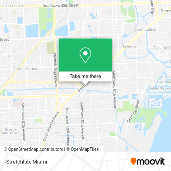
See Stretchlab, Miami, on the map
Public Transit to Stretchlab in Miami
Wondering how to get to Stretchlab in Miami? Moovit helps you find the best way to get to Stretchlab with step-by-step directions from the nearest public transit station.
Moovit provides free maps and live directions to help you navigate through your city. View schedules, routes, timetables, and find out how long does it take to get to Stretchlab in real time.
Looking for the nearest stop or station to Stretchlab? Check out this list of stops closest to your destination: Sw 67 Av & Sw 80 St; Dadeland North Bay 4; Dadeland North Bay 3; Dadeland North Bay 2; Dadeland North Bay 5; Dadeland North; S Dixie Hwy & Sw 68 Ct (N/n); Dadeland North Bay 6; Dadeland North Bay 1.
Bus: 37, 602, 73, 87, 272, 204, 104.Train: GREEN, ORANGE.
Want to see if there’s another route that gets you there at an earlier time? Moovit helps you find alternative routes or times. Get directions from and directions to Stretchlab easily from the Moovit App or Website.
We make riding to Stretchlab easy, which is why over 1.5 million users, including users in Miami, trust Moovit as the best app for public transit. You don’t need to download an individual bus app or train app, Moovit is your all-in-one transit app that helps you find the best bus time or train time available.
For information on prices of bus and train, costs and ride fares to Stretchlab, please check the Moovit app.
Use the app to navigate to popular places including to the airport, hospital, stadium, grocery store, mall, coffee shop, school, college, and university.
Stretchlab Address: 8245 S Dixie Hwy Miami, FL 33143 street in Miami
- Cricket Wireless,
- Southwest 67th Avenue & Us 1,
- Dadeland Dental Arts,
- Sirrious Smiles,
- Safer Kids and Homes,
- 2 Chefs,
- Enzo's Italian Eatery,
- Toysrus,
- Jennifer Nicole Lee,
- Mecc,
- Shred Nations,
- Baby Abuelita Productions,
- The Language Factory, Inc.,
- Ots Films,
- Amazon Locker-Paricutin,
- Kimberly Nails and Spa,
- Yuzu,
- STARBUCKS,
- Focust Logistic Services,
- Zara
Places Near Stretchlab (Miami)
- Aventura Mall, Miami Beach,
- Miami-Dade County Courthouse, Miami,
- Keiser University Flagship Campus, West Palm Beach,
- Sawgrass Mall, Miami,
- Brickell City Centre, Miami,
- Dolphin Mall Bus, Miami,
- Miami Freedom Park, Miami,
- Sawgrass mall ( FL ), Miami Beach,
- Richard E. Gerstein Justice Building, Miami,
- Marlins Park, Miami,
- Zoo Miami, Miami,
- Port of Miami Cruise Terminal, Miami,
- Dolphin Mall, Miami,
- Little Havana, Miami,
- Aventura Mall, Miami,
- Wynwood, Miami,
- Miami Design District, Miami,
- Hard Rock Stadium, Miami Gardens,
- Bayside Marketplace, Miami,
- Miami VA Hospital, Miami
How to get to popular places in Miami with public transit
Get around Miami by public transit!
Traveling around Miami has never been so easy. See step by step directions as you travel to any attraction, street or major public transit station. View bus and train schedules, arrival times, service alerts and detailed routes on a map, so you know exactly how to get to anywhere in Miami.
When traveling to any destination around Miami use Moovit's Live Directions with Get Off Notifications to know exactly where and how far to walk, how long to wait for your line, and how many stops are left. Moovit will alert you when it's time to get off — no need to constantly re-check whether yours is the next stop.
Wondering how to use public transit in Miami or how to pay for public transit in Miami? Moovit public transit app can help you navigate your way with public transit easily, and at minimum cost. It includes public transit fees, ticket prices, and costs. Looking for a map of Miami public transit lines? Moovit public transit app shows all public transit maps in Miami with all Bus, Train, Light Rail and Ferry routes and stops on an interactive map.
Miami has 4 transit type(s), including: Bus, Train, Light Rail and Ferry, operated by several transit agencies, including Broward County Transit, Miami-Dade Transit, Metrorail, Palm Tran, Tri-Rail, Brightline, MARTY, City of Homestead Trolley, Key West Transit, Treasure Coast Connector, GoLine IRT, Amtrak, Greyhound-us, FlixBus-us and Aventura Express Shuttle Bus