Directions to Strive (Boston) with public transportation
The following transit lines have routes that pass near Strive
 Bus: 21, 22, 23, 26.
- Train: FAIRMOUNT, FRANKLIN/FOXBORO, FAIRMOUNT LINE SHUTTLE, PROVIDENCE/STOUGHTON.
- Subway: RED LINE, MATTAPAN LINE.
How to get to Strive by bus?
Click on the bus route to see step by step directions with maps, line arrival times and updated time schedules.
From Pine Street Inn, Boston
47 minFrom Rental Car Center - Logan Airport, Boston
83 minFrom East Boston, Boston
84 minFrom Westin Copley Place Hotel Boston, Boston
48 minFrom Boston Harbor, Boston
78 minFrom Boston College (BC), Boston
91 minFrom Christian A Herter Park, Boston
89 minFrom Cambridge Hospital, Cambridge
85 minFrom Mount Ida College, Newton
80 minFrom The Fairmont Copley Plaza Hotel, Boston
48 min
How to get to Strive by train?
Click on the train route to see step by step directions with maps, line arrival times and updated time schedules.
How to get to Strive by subway?
Click on the subway route to see step by step directions with maps, line arrival times and updated time schedules.
Bus stops near Strive in Boston
Train stations near Strive in Boston
- Talbot Avenue, 22 min walk,VIEW
Bus lines to Strive in Boston
What are the closest stations to Strive?
The closest stations to Strive are:
- Washington St @ Ashmont St is 252 yards away, 4 min walk.
- Talbot Ave @ Welles Ave is 474 yards away, 6 min walk.
- Fields Corner is 892 yards away, 11 min walk.
- Talbot Avenue is 1807 yards away, 22 min walk.
- Cedar Grove is 1882 yards away, 23 min walk.
Which bus lines stop near Strive?
These bus lines stop near Strive: 21, 22, 23, 26.
Which train line stops near Strive?
FAIRMOUNT (#1619 | Fairmount)
Which subway line stops near Strive?
RED LINE (Ashmont/Braintree)
What’s the nearest subway station to Strive in Boston?
The nearest subway station to Strive in Boston is Fields Corner. It’s a 11 min walk away.
What’s the nearest train station to Strive in Boston?
The nearest train station to Strive in Boston is Talbot Avenue. It’s a 22 min walk away.
What’s the nearest bus station to Strive in Boston?
The nearest bus station to Strive in Boston is Washington St @ Ashmont St. It’s a 4 min walk away.
What time is the first subway to Strive in Boston?
The MATTAPAN LINE is the first subway that goes to Strive in Boston. It stops nearby at 5:10 AM.
What time is the last subway to Strive in Boston?
The MATTAPAN LINE is the last subway that goes to Strive in Boston. It stops nearby at 2:31 AM.
What time is the first train to Strive in Boston?
The FAIRMOUNT is the first train that goes to Strive in Boston. It stops nearby at 4:41 AM.
What time is the last train to Strive in Boston?
The FAIRMOUNT is the last train that goes to Strive in Boston. It stops nearby at 12:03 AM.
What time is the first bus to Strive in Boston?
The 23 is the first bus that goes to Strive in Boston. It stops nearby at 4:50 AM.
What time is the last bus to Strive in Boston?
The 23 is the last bus that goes to Strive in Boston. It stops nearby at 2:41 AM.
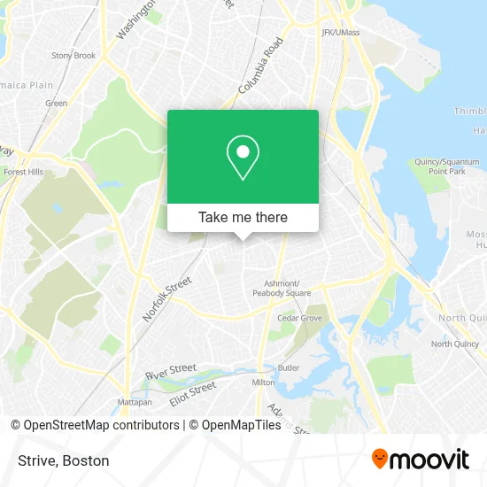
See Strive, Boston, on the map
Public Transit to Strive in Boston
Wondering how to get to Strive in Boston? Moovit helps you find the best way to get to Strive with step-by-step directions from the nearest public transit station.
Moovit provides free maps and live directions to help you navigate through your city. View schedules, routes, timetables, and find out how long does it take to get to Strive in real time.
Looking for the nearest stop or station to Strive? Check out this list of stops closest to your destination: Washington St @ Ashmont St; Talbot Ave @ Welles Ave; Fields Corner; Talbot Avenue; Cedar Grove.
Bus: 21, 22, 23, 26.Train: FAIRMOUNT, FRANKLIN/FOXBORO, FAIRMOUNT LINE SHUTTLE, PROVIDENCE/STOUGHTON.Subway: RED LINE, MATTAPAN LINE.
Want to see if there’s another route that gets you there at an earlier time? Moovit helps you find alternative routes or times. Get directions from and directions to Strive easily from the Moovit App or Website.
We make riding to Strive easy, which is why over 1.7 million users, including users in Boston, trust Moovit as the best app for public transit. You don’t need to download an individual bus app or train app, Moovit is your all-in-one transit app that helps you find the best bus time or train time available.
For information on prices of bus, subway and train, costs and ride fares to Strive, please check the Moovit app.
Use the app to navigate to popular places including to the airport, hospital, stadium, grocery store, mall, coffee shop, school, college, and university.
Strive Address: 651 Washington St street in Boston
- Boston Public Library - Codman Square Branch,
- Codman Square Park,
- Boston Latin Academy,
- Emmanuel Gospel Center (Egc),
- BMO Harris Bank,
- TD Bank,
- Millennium Avery Condominiums,
- Codman Square,
- Dorchester Center, Massachusetts,
- Nakri Healing Center,
- We Are Mobile,
- Spa Parties by Shauna,
- Don Negro Barber Shop,
- Sam Mickey Consulting,
- Stealth Junk Removal,
- Ashtonia Handy Man Help Fix Anything,
- Superstar Builders,
- RGC Renovation,
- Mike and George's Professional Junk Removal Services,
- Namels Barbershop
Places Near Strive (Boston)
- Faneuil Hall, Boston,
- Castle Island, Boston,
- Prudential Center, Boston,
- Wilbur Theatre, Boston,
- Isabella Stewart Gardner Museum, Boston,
- House Of Blues, Boston,
- Boston Children's Hospital, Boston,
- Td Garden, Boston,
- Boston Convention & Exhibition Center, Boston,
- Boston Medical Center, Boston,
- Leader Bank Pavilion (Leader Bank Pavillion), Boston,
- North End, Boston,
- Mgm Music Hall, Boston,
- Cheers, Boston,
- Quincy Market, Boston,
- Museum Of Science, Boston,
- Massachusetts General Hospital, Boston,
- Seaport District, Boston,
- Boston Common, Boston,
- Wang Theater, Boston
How to get to popular places in Boston with public transit
Get around Boston by public transit!
Traveling around Boston has never been so easy. See step by step directions as you travel to any attraction, street or major public transit station. View bus and train schedules, arrival times, service alerts and detailed routes on a map, so you know exactly how to get to anywhere in Boston.
When traveling to any destination around Boston use Moovit's Live Directions with Get Off Notifications to know exactly where and how far to walk, how long to wait for your line, and how many stops are left. Moovit will alert you when it's time to get off — no need to constantly re-check whether yours is the next stop.
Wondering how to use public transit in Boston or how to pay for public transit in Boston? Moovit public transit app can help you navigate your way with public transit easily, and at minimum cost. It includes public transit fees, ticket prices, and costs. Looking for a map of Boston public transit lines? Moovit public transit app shows all public transit maps in Boston with all Bus, Train, Subway and Ferry routes and stops on an interactive map.
Boston has 4 transit type(s), including: Bus, Train, Subway and Ferry, operated by several transit agencies, including MBTA, Southeastern Regional Transit Authority, MetroWest Regional Transit Authority, Rhode Island Public Transit Authority, WRTA, Lowell Regional Transit Authority, Merrimack Valley Transit, Montachusett Regional Transit Authority, Cape Cod Regional Transit Authority, Brockton Area Transit Authority, Martha's Vineyard Transit Authority, the WAVE - Nantucket Regional Transit Authority, GATRA, Cape Ann Transportation Authority and Massport