How to get to Stronghold Foundation & Waterproofing by bus?
Click on the bus route to see step by step directions with maps, line arrival times and updated time schedules.
From UMass Boston Campus Center, Boston
117 minFrom Children's Hospital, Boston
112 minFrom The Strand Theater, Boston
87 minFrom The Banshee Bar, Boston
99 minFrom Wollaston Beach, Quincy
69 minFrom Doubletree-Boston Bayside, Boston
113 minFrom Uphams Corner, Boston
103 minFrom John F. Kennedy Presidential Library And Museum, Boston
94 minFrom Ramada Boston, Boston
73 minFrom JFK Library, Boston
117 min
How to get to Stronghold Foundation & Waterproofing by train?
Click on the train route to see step by step directions with maps, line arrival times and updated time schedules.
How to get to Stronghold Foundation & Waterproofing by subway?
Click on the subway route to see step by step directions with maps, line arrival times and updated time schedules.
Bus stop near Stronghold Foundation & Waterproofing in Quincy
- Opp 859 Willard St, 2 min walk,VIEW
Train station near Stronghold Foundation & Waterproofing in Quincy
- Braintree, 55 min walk,VIEW
Subway station near Stronghold Foundation & Waterproofing in Quincy
- Braintree, 56 min walk,VIEW
Bus lines to Stronghold Foundation & Waterproofing in Quincy
- 238, Quincy Center,VIEW
What are the closest stations to Stronghold Foundation & Waterproofing?
The closest stations to Stronghold Foundation & Waterproofing are:
- Opp 859 Willard St is 105 yards away, 2 min walk.
- Braintree is 4602 yards away, 55 min walk.
Which bus lines stop near Stronghold Foundation & Waterproofing?
These bus lines stop near Stronghold Foundation & Waterproofing: 215, 238.
Which train line stops near Stronghold Foundation & Waterproofing?
GREENBUSH (#1061 | Greenbush)
Which subway line stops near Stronghold Foundation & Waterproofing?
RED LINE (Ashmont/Braintree)
What’s the nearest bus station to Stronghold Foundation & Waterproofing in Quincy?
The nearest bus station to Stronghold Foundation & Waterproofing in Quincy is Opp 859 Willard St. It’s a 2 min walk away.
What time is the first subway to Stronghold Foundation & Waterproofing in Quincy?
The RED LINE is the first subway that goes to Stronghold Foundation & Waterproofing in Quincy. It stops nearby at 5:09 AM.
What time is the last subway to Stronghold Foundation & Waterproofing in Quincy?
The RED LINE is the last subway that goes to Stronghold Foundation & Waterproofing in Quincy. It stops nearby at 2:00 AM.
What time is the first train to Stronghold Foundation & Waterproofing in Quincy?
The FALL RIVER/NEW BEDFORD is the first train that goes to Stronghold Foundation & Waterproofing in Quincy. It stops nearby at 5:27 AM.
What time is the last train to Stronghold Foundation & Waterproofing in Quincy?
The KINGSTON is the last train that goes to Stronghold Foundation & Waterproofing in Quincy. It stops nearby at 12:25 AM.
What time is the first bus to Stronghold Foundation & Waterproofing in Quincy?
The 238 is the first bus that goes to Stronghold Foundation & Waterproofing in Quincy. It stops nearby at 5:20 AM.
What time is the last bus to Stronghold Foundation & Waterproofing in Quincy?
The 238 is the last bus that goes to Stronghold Foundation & Waterproofing in Quincy. It stops nearby at 11:25 PM.
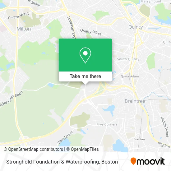
See Stronghold Foundation & Waterproofing, Quincy, on the map
Public Transit to Stronghold Foundation & Waterproofing in Quincy
Wondering how to get to Stronghold Foundation & Waterproofing in Quincy? Moovit helps you find the best way to get to Stronghold Foundation & Waterproofing with step-by-step directions from the nearest public transit station.
Moovit provides free maps and live directions to help you navigate through your city. View schedules, routes, timetables, and find out how long does it take to get to Stronghold Foundation & Waterproofing in real time.
Looking for the nearest stop or station to Stronghold Foundation & Waterproofing? Check out this list of stops closest to your destination: Opp 859 Willard St; Braintree.
Bus: 215, 238.Train: GREENBUSH, CAPEFLYER, FALL RIVER/NEW BEDFORD, KINGSTON.Subway: RED LINE.
Want to see if there’s another route that gets you there at an earlier time? Moovit helps you find alternative routes or times. Get directions from and directions to Stronghold Foundation & Waterproofing easily from the Moovit App or Website.
We make riding to Stronghold Foundation & Waterproofing easy, which is why over 1.7 million users, including users in Quincy, trust Moovit as the best app for public transit. You don’t need to download an individual bus app or train app, Moovit is your all-in-one transit app that helps you find the best bus time or train time available.
For information on prices of bus, subway and train, costs and ride fares to Stronghold Foundation & Waterproofing, please check the Moovit app.
Use the app to navigate to popular places including to the airport, hospital, stadium, grocery store, mall, coffee shop, school, college, and university.
Stronghold Foundation & Waterproofing Address: 859 Willard St Ste 400 street in Quincy
- Sunrich Power,
- South Shore Homecare, Inc,
- J. Morgan Hargrove,
- Conquest Funds,
- Flying Locksmiths,
- Regus - Massachusetts, Quincy - Braintree Quincy Center,
- Caru International,
- Champagne Law Group,
- K & G Legal Services,
- Comparequotesonline,
- DLB Insurance,
- Bulens Law,
- Planned Lifetime Assistance Network - Plan of Ma & Ri,
- Plumbing Repair Pros,
- Top Mark Masonry & Construction,
- Kings & Queens Consulting,
- Patriot Constable Service,
- Elephant Room Counseling,
- Import & Export BCS Construction Services,
- John Fossetti
Places Near Stronghold Foundation & Waterproofing (Quincy)
- Boston Common, Boston,
- Castle Island, Boston,
- Prudential Center, Boston,
- Massachusetts General Hospital, Boston,
- Boston Convention & Exhibition Center, Boston,
- House Of Blues, Boston,
- Wang Theater, Boston,
- Cheers, Boston,
- Leader Bank Pavilion (Leader Bank Pavillion), Boston,
- Quincy Market, Boston,
- Wilbur Theatre, Boston,
- Faneuil Hall, Boston,
- Mgm Music Hall, Boston,
- Seaport District, Boston,
- Isabella Stewart Gardner Museum, Boston,
- Boston Children's Hospital, Boston,
- Museum Of Science, Boston,
- Td Garden, Boston,
- North End, Boston,
- Boston Medical Center, Boston
How to get to popular places in Boston with public transit
Get around Quincy by public transit!
Traveling around Quincy has never been so easy. See step by step directions as you travel to any attraction, street or major public transit station. View bus and train schedules, arrival times, service alerts and detailed routes on a map, so you know exactly how to get to anywhere in Quincy.
When traveling to any destination around Quincy use Moovit's Live Directions with Get Off Notifications to know exactly where and how far to walk, how long to wait for your line, and how many stops are left. Moovit will alert you when it's time to get off — no need to constantly re-check whether yours is the next stop.
Wondering how to use public transit in Quincy or how to pay for public transit in Quincy? Moovit public transit app can help you navigate your way with public transit easily, and at minimum cost. It includes public transit fees, ticket prices, and costs. Looking for a map of Quincy public transit lines? Moovit public transit app shows all public transit maps in Quincy with all Bus, Train, Subway and Ferry routes and stops on an interactive map.
Boston has 4 transit type(s), including: Bus, Train, Subway and Ferry, operated by several transit agencies, including MBTA, Southeastern Regional Transit Authority, MetroWest Regional Transit Authority, Rhode Island Public Transit Authority, WRTA, Lowell Regional Transit Authority, Merrimack Valley Transit, Montachusett Regional Transit Authority, Cape Cod Regional Transit Authority, Brockton Area Transit Authority, Martha's Vineyard Transit Authority, the WAVE - Nantucket Regional Transit Authority, GATRA, Cape Ann Transportation Authority and Massport