How to get to Studentsoftheabyss by bus?
Click on the bus route to see step by step directions with maps, line arrival times and updated time schedules.
From The Strand Theater, Boston
85 minFrom Citizens Bank Opera House, Boston
78 minFrom Melrose, MA, Melrose
65 minFrom Boston Common, Boston
41 minFrom Coolidge Corner Theatre, Brookline
89 minFrom Mission Hill, Boston
88 minFrom Copley Square, Boston
58 minFrom Mass Eye & Ear, Boston
86 minFrom L.L.Bean, Boston
44 minFrom Andrew Station - MBTA - Red Line, Boston
74 min
How to get to Studentsoftheabyss by train?
Click on the train route to see step by step directions with maps, line arrival times and updated time schedules.
How to get to Studentsoftheabyss by subway?
Click on the subway route to see step by step directions with maps, line arrival times and updated time schedules.
From The Strand Theater, Boston
91 minFrom Citizens Bank Opera House, Boston
91 minFrom Boston Common, Boston
56 minFrom Coolidge Corner Theatre, Brookline
81 minFrom Mission Hill, Boston
82 minFrom Copley Square, Boston
63 minFrom Mass Eye & Ear, Boston
82 minFrom L.L.Bean, Boston
65 minFrom Andrew Station - MBTA - Red Line, Boston
66 min
Bus stops near Studentsoftheabyss in Chelsea
Subway station near Studentsoftheabyss in Chelsea
- Wood Island, 32 min walk,VIEW
Train station near Studentsoftheabyss in Chelsea
- Chelsea, 54 min walk,VIEW
Bus lines to Studentsoftheabyss in Chelsea
What are the closest stations to Studentsoftheabyss?
The closest stations to Studentsoftheabyss are:
- Sagamore Ave @ Garfield Ave is 49 yards away, 1 min walk.
- Broadway @ Eleanor St is 681 yards away, 9 min walk.
- Summit Ave @ Lafayette Ave is 941 yards away, 12 min walk.
- Wood Island is 2703 yards away, 32 min walk.
- Chelsea is 4531 yards away, 54 min walk.
Which bus lines stop near Studentsoftheabyss?
These bus lines stop near Studentsoftheabyss: 111, 112, 116, SL3.
Which train line stops near Studentsoftheabyss?
NEWBURYPORT/ROCKPORT (#27 | Rockport)
Which subway line stops near Studentsoftheabyss?
BLUE LINE (Wonderland)
What’s the nearest bus station to Studentsoftheabyss in Chelsea?
The nearest bus station to Studentsoftheabyss in Chelsea is Sagamore Ave @ Garfield Ave. It’s a 1 min walk away.
What time is the first subway to Studentsoftheabyss in Chelsea?
The BLUE LINE is the first subway that goes to Studentsoftheabyss in Chelsea. It stops nearby at 5:08 AM.
What time is the last subway to Studentsoftheabyss in Chelsea?
The BLUE LINE is the last subway that goes to Studentsoftheabyss in Chelsea. It stops nearby at 2:04 AM.
What time is the first train to Studentsoftheabyss in Chelsea?
The NEWBURYPORT/ROCKPORT is the first train that goes to Studentsoftheabyss in Chelsea. It stops nearby at 5:40 AM.
What time is the last train to Studentsoftheabyss in Chelsea?
The NEWBURYPORT/ROCKPORT is the last train that goes to Studentsoftheabyss in Chelsea. It stops nearby at 12:06 AM.
What time is the first bus to Studentsoftheabyss in Chelsea?
The 116 is the first bus that goes to Studentsoftheabyss in Chelsea. It stops nearby at 4:31 AM.
What time is the last bus to Studentsoftheabyss in Chelsea?
The 111 is the last bus that goes to Studentsoftheabyss in Chelsea. It stops nearby at 2:34 AM.
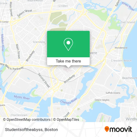
See Studentsoftheabyss, Chelsea, on the map
Public Transit to Studentsoftheabyss in Chelsea
Wondering how to get to Studentsoftheabyss in Chelsea? Moovit helps you find the best way to get to Studentsoftheabyss with step-by-step directions from the nearest public transit station.
Moovit provides free maps and live directions to help you navigate through your city. View schedules, routes, timetables, and find out how long does it take to get to Studentsoftheabyss in real time.
Looking for the nearest stop or station to Studentsoftheabyss? Check out this list of stops closest to your destination: Sagamore Ave @ Garfield Ave; Broadway @ Eleanor St; Summit Ave @ Lafayette Ave; Wood Island; Chelsea.
Bus: 111, 112, 116, SL3.Train: NEWBURYPORT/ROCKPORT.Subway: BLUE LINE.
Want to see if there’s another route that gets you there at an earlier time? Moovit helps you find alternative routes or times. Get directions from and directions to Studentsoftheabyss easily from the Moovit App or Website.
We make riding to Studentsoftheabyss easy, which is why over 1.7 million users, including users in Chelsea, trust Moovit as the best app for public transit. You don’t need to download an individual bus app or train app, Moovit is your all-in-one transit app that helps you find the best bus time or train time available.
For information on prices of bus, subway and train, costs and ride fares to Studentsoftheabyss, please check the Moovit app.
Use the app to navigate to popular places including to the airport, hospital, stadium, grocery store, mall, coffee shop, school, college, and university.
Studentsoftheabyss Address: 61 Summit Ave street in Chelsea
- Family Dollar,
- The Home Depot,
- Massachusetts Soldiers Home,
- Santander,
- Cabot St & Revere Beach Pkwy,
- Cary Square,
- Parkway Plaza Shopping Center,
- Bispo Paulo Tenorio Ap Boston,
- Iglesia La Luz De Cristo,
- Camilas Fashion,
- Spencer Ave Building 113,
- Canobie Lake Park,
- MBTA Bus Route 117,
- Home Depot Chelsea,Ma,
- Novelty Bias Binding,
- Beth Israel Deaconess Medical Center (Narayanaswami Pushpa MD Beth Israel Deaconess Healthcare),
- Bidhc,
- Beth Israel Deaconess Urgent Care at Chelsea,
- Prattville,
- El Xielo
Places Near Studentsoftheabyss (Chelsea)
- Boston Convention & Exhibition Center, Boston,
- Leader Bank Pavilion (Leader Bank Pavillion), Boston,
- Prudential Center, Boston,
- House Of Blues, Boston,
- Mgm Music Hall, Boston,
- Boston Children's Hospital, Boston,
- Boston Medical Center, Boston,
- Wang Theater, Boston,
- Faneuil Hall, Boston,
- Massachusetts General Hospital, Boston,
- Td Garden, Boston,
- Boston Common, Boston,
- Cheers, Boston,
- Museum Of Science, Boston,
- Quincy Market, Boston,
- North End, Boston,
- Isabella Stewart Gardner Museum, Boston,
- Wilbur Theatre, Boston,
- Castle Island, Boston,
- Seaport District, Boston
How to get to popular places in Boston with public transit
Get around Chelsea by public transit!
Traveling around Chelsea has never been so easy. See step by step directions as you travel to any attraction, street or major public transit station. View bus and train schedules, arrival times, service alerts and detailed routes on a map, so you know exactly how to get to anywhere in Chelsea.
When traveling to any destination around Chelsea use Moovit's Live Directions with Get Off Notifications to know exactly where and how far to walk, how long to wait for your line, and how many stops are left. Moovit will alert you when it's time to get off — no need to constantly re-check whether yours is the next stop.
Wondering how to use public transit in Chelsea or how to pay for public transit in Chelsea? Moovit public transit app can help you navigate your way with public transit easily, and at minimum cost. It includes public transit fees, ticket prices, and costs. Looking for a map of Chelsea public transit lines? Moovit public transit app shows all public transit maps in Chelsea with all Bus, Train, Subway and Ferry routes and stops on an interactive map.
Boston has 4 transit type(s), including: Bus, Train, Subway and Ferry, operated by several transit agencies, including MBTA, Southeastern Regional Transit Authority, MetroWest Regional Transit Authority, Rhode Island Public Transit Authority, WRTA, Lowell Regional Transit Authority, Merrimack Valley Transit, Montachusett Regional Transit Authority, Cape Cod Regional Transit Authority, Brockton Area Transit Authority, Martha's Vineyard Transit Authority, the WAVE - Nantucket Regional Transit Authority, GATRA, Cape Ann Transportation Authority and Massport