Directions to Studio56hairdesign.Com (Watertown Town) with public transportation
The following transit lines have routes that pass near Studio56hairdesign.Com
 Bus: 504, 57, 70, 71, 59.
- Train: FITCHBURG, FRAMINGHAM/WORCESTER.
- Subway: GREEN LINE B.
How to get to Studio56hairdesign.Com by bus?
Click on the bus route to see step by step directions with maps, line arrival times and updated time schedules.
From 197 Friend St, Boston
53 minFrom Beth Israel Deaconess Medical Center (Shapiro Garage), Boston
53 minFrom Godfrey Hotel Boston, Boston
42 minFrom Embassy Suites by Hilton Boston Waltham, Waltham
51 minFrom MGH Shuttle, Boston
68 minFrom Myers + Chang (Myers & Chang), Boston
37 minFrom Lemuel Shattuck Hospital, Boston
80 minFrom SoWa Vintage Market, Boston
39 minFrom Boston Theatre District, Boston
32 minFrom Pine Street Inn, Boston
38 min
How to get to Studio56hairdesign.Com by train?
Click on the train route to see step by step directions with maps, line arrival times and updated time schedules.
From 197 Friend St, Boston
64 minFrom Beth Israel Deaconess Medical Center (Shapiro Garage), Boston
67 minFrom Godfrey Hotel Boston, Boston
79 minFrom MGH Shuttle, Boston
68 minFrom Myers + Chang (Myers & Chang), Boston
68 minFrom Lemuel Shattuck Hospital, Boston
158 minFrom SoWa Vintage Market, Boston
131 minFrom Boston Theatre District, Boston
68 minFrom Pine Street Inn, Boston
131 min
Bus stops near Studio56hairdesign.Com in Watertown Town
Train stations near Studio56hairdesign.Com in Watertown Town
Subway station near Studio56hairdesign.Com in Watertown Town
- South Street, 50 min walk,VIEW
Bus lines to Studio56hairdesign.Com in Watertown Town
What are the closest stations to Studio56hairdesign.Com?
The closest stations to Studio56hairdesign.Com are:
- Mt Auburn St @ Patten St is 125 yards away, 2 min walk.
- Main St @ Merchants Row is 387 yards away, 5 min walk.
- Watertown Square is 440 yards away, 6 min walk.
- Galen St @ Water St is 540 yards away, 7 min walk.
- Belmont is 1441 yards away, 18 min walk.
- Newtonville is 4184 yards away, 50 min walk.
- South Street is 4230 yards away, 50 min walk.
Which bus lines stop near Studio56hairdesign.Com?
These bus lines stop near Studio56hairdesign.Com: 504, 57, 70, 71.
Which train lines stop near Studio56hairdesign.Com?
These train lines stop near Studio56hairdesign.Com: FITCHBURG, FRAMINGHAM/WORCESTER.
What’s the nearest train station to Studio56hairdesign.Com in Watertown Town?
The nearest train station to Studio56hairdesign.Com in Watertown Town is Belmont. It’s a 18 min walk away.
What’s the nearest bus station to Studio56hairdesign.Com in Watertown Town?
The nearest bus station to Studio56hairdesign.Com in Watertown Town is Mt Auburn St @ Patten St. It’s a 2 min walk away.
What time is the first subway to Studio56hairdesign.Com in Watertown Town?
The GREEN LINE B is the first subway that goes to Studio56hairdesign.Com in Watertown Town. It stops nearby at 5:01 AM.
What time is the last subway to Studio56hairdesign.Com in Watertown Town?
The GREEN LINE B is the last subway that goes to Studio56hairdesign.Com in Watertown Town. It stops nearby at 2:39 AM.
What time is the first train to Studio56hairdesign.Com in Watertown Town?
The FRAMINGHAM/WORCESTER is the first train that goes to Studio56hairdesign.Com in Watertown Town. It stops nearby at 5:25 AM.
What time is the last train to Studio56hairdesign.Com in Watertown Town?
The FRAMINGHAM/WORCESTER is the last train that goes to Studio56hairdesign.Com in Watertown Town. It stops nearby at 12:17 AM.
What time is the first bus to Studio56hairdesign.Com in Watertown Town?
The 57 is the first bus that goes to Studio56hairdesign.Com in Watertown Town. It stops nearby at 4:30 AM.
What time is the last bus to Studio56hairdesign.Com in Watertown Town?
The 57 is the last bus that goes to Studio56hairdesign.Com in Watertown Town. It stops nearby at 2:34 AM.
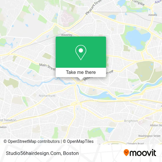
See Studio56hairdesign.Com, Watertown Town, on the map
Public Transit to Studio56hairdesign.Com in Watertown Town
Wondering how to get to Studio56hairdesign.Com in Watertown Town? Moovit helps you find the best way to get to Studio56hairdesign.Com with step-by-step directions from the nearest public transit station.
Moovit provides free maps and live directions to help you navigate through your city. View schedules, routes, timetables, and find out how long does it take to get to Studio56hairdesign.Com in real time.
Looking for the nearest stop or station to Studio56hairdesign.Com? Check out this list of stops closest to your destination: Mt Auburn St @ Patten St; Main St @ Merchants Row; Watertown Square; Galen St @ Water St; Belmont; Newtonville; South Street.
Bus: 504, 57, 70, 71, 59.Train: FITCHBURG, FRAMINGHAM/WORCESTER.Subway: GREEN LINE B.
Want to see if there’s another route that gets you there at an earlier time? Moovit helps you find alternative routes or times. Get directions from and directions to Studio56hairdesign.Com easily from the Moovit App or Website.
We make riding to Studio56hairdesign.Com easy, which is why over 1.7 million users, including users in Watertown Town, trust Moovit as the best app for public transit. You don’t need to download an individual bus app or train app, Moovit is your all-in-one transit app that helps you find the best bus time or train time available.
For information on prices of bus, train and subway, costs and ride fares to Studio56hairdesign.Com, please check the Moovit app.
Use the app to navigate to popular places including to the airport, hospital, stadium, grocery store, mall, coffee shop, school, college, and university.
Studio56hairdesign.Com Address: 56 Mt Auburn St street in Watertown Town
- Tabrizi,
- Mindful Wellness,
- Alex Realty,
- Erie 1928,
- Halva Kebab,
- ATM,
- SUBWAY,
- Kumu Consulting,
- Medvadis Research,
- DUNKIN',
- Belleza Studio,
- Luminous Dental,
- Argand Realty Capital,
- Michael Computer Repair & Tech Services,
- M&T Bank,
- People's United Bank,
- Matthew Chen,
- Relax & Therapy Center,
- Verizon Wireless,
- Russell Cellular
Places Near Studio56hairdesign.Com (Watertown Town)
- Boston Common, Boston,
- Td Garden, Boston,
- Isabella Stewart Gardner Museum, Boston,
- Wilbur Theatre, Boston,
- Boston Medical Center, Boston,
- Museum Of Science, Boston,
- Prudential Center, Boston,
- Leader Bank Pavilion (Leader Bank Pavillion), Boston,
- Boston Children's Hospital, Boston,
- Wang Theater, Boston,
- Faneuil Hall, Boston,
- Massachusetts General Hospital, Boston,
- House Of Blues, Boston,
- Castle Island, Boston,
- Boston Convention & Exhibition Center, Boston,
- Seaport District, Boston,
- North End, Boston,
- Mgm Music Hall, Boston,
- Cheers, Boston,
- Quincy Market, Boston
How to get to popular places in Boston with public transit
Get around Watertown Town by public transit!
Traveling around Watertown Town has never been so easy. See step by step directions as you travel to any attraction, street or major public transit station. View bus and train schedules, arrival times, service alerts and detailed routes on a map, so you know exactly how to get to anywhere in Watertown Town.
When traveling to any destination around Watertown Town use Moovit's Live Directions with Get Off Notifications to know exactly where and how far to walk, how long to wait for your line, and how many stops are left. Moovit will alert you when it's time to get off — no need to constantly re-check whether yours is the next stop.
Wondering how to use public transit in Watertown Town or how to pay for public transit in Watertown Town? Moovit public transit app can help you navigate your way with public transit easily, and at minimum cost. It includes public transit fees, ticket prices, and costs. Looking for a map of Watertown Town public transit lines? Moovit public transit app shows all public transit maps in Watertown Town with all Bus, Train, Subway and Ferry routes and stops on an interactive map.
Boston has 4 transit type(s), including: Bus, Train, Subway and Ferry, operated by several transit agencies, including MBTA, Southeastern Regional Transit Authority, MetroWest Regional Transit Authority, Rhode Island Public Transit Authority, WRTA, Lowell Regional Transit Authority, Merrimack Valley Transit, Montachusett Regional Transit Authority, Cape Cod Regional Transit Authority, Brockton Area Transit Authority, Martha's Vineyard Transit Authority, the WAVE - Nantucket Regional Transit Authority, GATRA, Cape Ann Transportation Authority and Massport