Directions to Studio | Joli Ayn Wood (Beverly) with public transportation
The following transit lines have routes that pass near Studio | Joli Ayn Wood
 Bus: 435, 451, 455, CITY OF BEVERLY SHUTTLE.
- Train: NEWBURYPORT/ROCKPORT.
How to get to Studio | Joli Ayn Wood by bus?
Click on the bus route to see step by step directions with maps, line arrival times and updated time schedules.
How to get to Studio | Joli Ayn Wood by train?
Click on the train route to see step by step directions with maps, line arrival times and updated time schedules.
Bus stops near Studio | Joli Ayn Wood in Beverly
Train station near Studio | Joli Ayn Wood in Beverly
- North Beverly, 6 min walk,VIEW
Bus lines to Studio | Joli Ayn Wood in Beverly
What are the closest stations to Studio | Joli Ayn Wood?
The closest stations to Studio | Joli Ayn Wood are:
- Cabot St Opp Elliot St is 411 yards away, 5 min walk.
- North Beverly is 498 yards away, 6 min walk.
- Beverly City Hall is 503 yards away, 7 min walk.
Which bus lines stop near Studio | Joli Ayn Wood?
These bus lines stop near Studio | Joli Ayn Wood: 435, 451, 455.
Which train line stops near Studio | Joli Ayn Wood?
NEWBURYPORT/ROCKPORT (#125 | Newburyport)
What’s the nearest train station to Studio | Joli Ayn Wood in Beverly?
The nearest train station to Studio | Joli Ayn Wood in Beverly is North Beverly. It’s a 6 min walk away.
What’s the nearest bus station to Studio | Joli Ayn Wood in Beverly?
The nearest bus station to Studio | Joli Ayn Wood in Beverly is Cabot St Opp Elliot St. It’s a 5 min walk away.
What time is the first train to Studio | Joli Ayn Wood in Beverly?
The NEWBURYPORT/ROCKPORT is the first train that goes to Studio | Joli Ayn Wood in Beverly. It stops nearby at 5:11 AM.
What time is the last train to Studio | Joli Ayn Wood in Beverly?
The NEWBURYPORT/ROCKPORT is the last train that goes to Studio | Joli Ayn Wood in Beverly. It stops nearby at 12:36 AM.
What time is the first bus to Studio | Joli Ayn Wood in Beverly?
The 451 is the first bus that goes to Studio | Joli Ayn Wood in Beverly. It stops nearby at 6:10 AM.
What time is the last bus to Studio | Joli Ayn Wood in Beverly?
The 451 is the last bus that goes to Studio | Joli Ayn Wood in Beverly. It stops nearby at 7:39 PM.
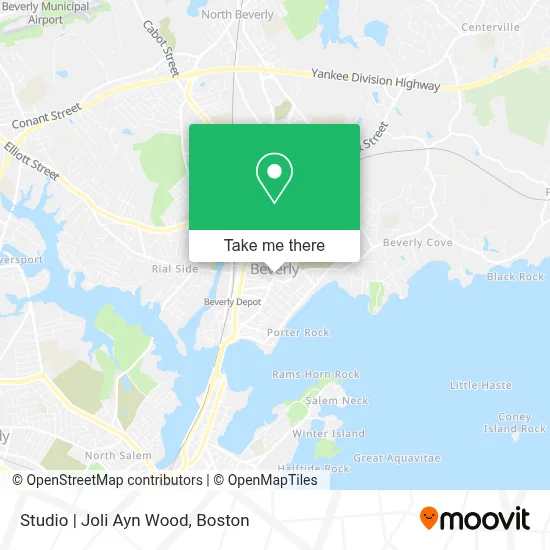
See Studio | Joli Ayn Wood, Beverly, on the map
Public Transit to Studio | Joli Ayn Wood in Beverly
Wondering how to get to Studio | Joli Ayn Wood in Beverly? Moovit helps you find the best way to get to Studio | Joli Ayn Wood with step-by-step directions from the nearest public transit station.
Moovit provides free maps and live directions to help you navigate through your city. View schedules, routes, timetables, and find out how long does it take to get to Studio | Joli Ayn Wood in real time.
Looking for the nearest stop or station to Studio | Joli Ayn Wood? Check out this list of stops closest to your destination: Cabot St Opp Elliot St; North Beverly; Beverly City Hall.
Bus: 435, 451, 455, CITY OF BEVERLY SHUTTLE.Train: NEWBURYPORT/ROCKPORT.
Want to see if there’s another route that gets you there at an earlier time? Moovit helps you find alternative routes or times. Get directions from and directions to Studio | Joli Ayn Wood easily from the Moovit App or Website.
We make riding to Studio | Joli Ayn Wood easy, which is why over 1.7 million users, including users in Beverly, trust Moovit as the best app for public transit. You don’t need to download an individual bus app or train app, Moovit is your all-in-one transit app that helps you find the best bus time or train time available.
For information on prices of bus and train, costs and ride fares to Studio | Joli Ayn Wood, please check the Moovit app.
Use the app to navigate to popular places including to the airport, hospital, stadium, grocery store, mall, coffee shop, school, college, and university.
Studio | Joli Ayn Wood Address: 248 Cabot St street in Beverly
- Pond Street Parking Lot,
- Beverly 24 7 Locksmith Store,
- G Phelps Arthur Attorney at Law,
- Cheryl Consedine,
- Lux Salon + Spa,
- Atypical Yoga Studio,
- Well Kneaded Therapeutic Massage,
- Holistic Therapies 4 Life,
- Fourth Street Press,
- Champions at Pioneer Charter School of Science II - Beverly Campus,
- Sports Tek,
- Yes Art Space,
- Folk Magic,
- Delphine' S Ki,
- Motif by Monarch - Beverly,
- WKND,
- Purr Beauty Parlor,
- Karrah Rose Hair Studio,
- Lien Nails and Spa,
- Cabot Lodge
Places Near Studio | Joli Ayn Wood (Beverly)
- Leader Bank Pavilion (Leader Bank Pavillion), Boston,
- Museum Of Science, Boston,
- Mgm Music Hall, Boston,
- Boston Common, Boston,
- Castle Island, Boston,
- House Of Blues, Boston,
- Boston Children's Hospital, Boston,
- Td Garden, Boston,
- Quincy Market, Boston,
- North End, Boston,
- Prudential Center, Boston,
- Cheers, Boston,
- Boston Convention & Exhibition Center, Boston,
- Wang Theater, Boston,
- Seaport District, Boston,
- Massachusetts General Hospital, Boston,
- Boston Medical Center, Boston,
- Isabella Stewart Gardner Museum, Boston,
- Faneuil Hall, Boston,
- Wilbur Theatre, Boston
How to get to popular places in Boston with public transit
Get around Beverly by public transit!
Traveling around Beverly has never been so easy. See step by step directions as you travel to any attraction, street or major public transit station. View bus and train schedules, arrival times, service alerts and detailed routes on a map, so you know exactly how to get to anywhere in Beverly.
When traveling to any destination around Beverly use Moovit's Live Directions with Get Off Notifications to know exactly where and how far to walk, how long to wait for your line, and how many stops are left. Moovit will alert you when it's time to get off — no need to constantly re-check whether yours is the next stop.
Wondering how to use public transit in Beverly or how to pay for public transit in Beverly? Moovit public transit app can help you navigate your way with public transit easily, and at minimum cost. It includes public transit fees, ticket prices, and costs. Looking for a map of Beverly public transit lines? Moovit public transit app shows all public transit maps in Beverly with all Bus, Train, Subway and Ferry routes and stops on an interactive map.
Boston has 4 transit type(s), including: Bus, Train, Subway and Ferry, operated by several transit agencies, including MBTA, Southeastern Regional Transit Authority, MetroWest Regional Transit Authority, Rhode Island Public Transit Authority, WRTA, Lowell Regional Transit Authority, Merrimack Valley Transit, Montachusett Regional Transit Authority, Cape Cod Regional Transit Authority, Brockton Area Transit Authority, Martha's Vineyard Transit Authority, the WAVE - Nantucket Regional Transit Authority, GATRA, Cape Ann Transportation Authority and Massport