Directions to Studio 617 (Boston) with public transportation
The following transit lines have routes that pass near Studio 617
 Bus: 10, 39, 426, 450, 501.
- Train: FRAMINGHAM/WORCESTER, NEEDHAM, FOXBORO EVENT SERVICE, FRANKLIN/FOXBORO, ORANGE LINE.
- Subway: GREEN LINE B, GREEN LINE C, GREEN LINE D, ORANGE LINE, GREEN LINE E.
How to get to Studio 617 by bus?
Click on the bus route to see step by step directions with maps, line arrival times and updated time schedules.
From John F. Kennedy Presidential Library And Museum, Boston
58 minFrom Belmont, MA, Belmont
54 minFrom The Track at New Balance, Boston
55 minFrom Qea, Quincy
102 minFrom Showa Boston Institute, Boston
54 minFrom Four Points by Sheraton Boston Logan Airport, Revere
82 minFrom VFW Parkway, Boston
54 minFrom Milton Academy, Milton
96 minFrom Boston Landing Station, Boston
57 minFrom Market Basket, Revere
65 min
How to get to Studio 617 by train?
Click on the train route to see step by step directions with maps, line arrival times and updated time schedules.
How to get to Studio 617 by subway?
Click on the subway route to see step by step directions with maps, line arrival times and updated time schedules.
Train station near Studio 617 in Boston
- Back Bay - South End, 2 min walk,VIEW
Bus stops near Studio 617 in Boston
- Boylston St @ Clarendon St, 3 min walk,VIEW
- Copley - Opp 575 Boylston St, 4 min walk,VIEW
- Dartmouth Street Opposite Back Bay Station, 5 min walk,VIEW
- Back Bay - 167 Dartmouth St, 5 min walk,VIEW
- Copley - Saint James Ave @ Trinity Pl, 5 min walk,VIEW
- Copley - Boylston St @ Dartmouth St, 5 min walk,VIEW
- Saint James Ave @ Berkeley St, 5 min walk,VIEW
- Stuart St @ Dartmouth St, 5 min walk,VIEW
- Saint James Ave @ Dartmouth St, 5 min walk,VIEW
- Boylston St @ Dartmouth St, 6 min walk,VIEW
- Boston, MA - Copley Square (Corner Of Clarendon St. & St. James Ave. In Front Of Trinity Church), 6 min walk,VIEW
Subway station near Studio 617 in Boston
- Copley, 9 min walk,VIEW
Bus lines to Studio 617 in Boston
- 9, Kenmore Via Boston Latin,VIEW
- 10, Arlington Via South Bay Center,VIEW
- 39, Haymarket Via Forest Hills,VIEW
- 55, West Fenway,VIEW
- 57, Haymarket Via Kenmore,VIEW
- GREEN LINE D SHUTTLE, Riverside (Shuttle),VIEW
- ORANGE LINE SHUTTLE, Back Bay Via Copley (Shuttle),VIEW
- ORANGE LINE SHUTTLE, Forest Hills (Shuttle),VIEW
- BB, Back Bay,VIEW
- GREEN LINE SHUTTLE, Back Bay (Shuttle),VIEW
- GREEN LINE B SHUTTLE, Babcock Street (Shuttle),VIEW
- ORANGE LINE SHUTTLE, Copley (Shuttle),VIEW
- 501, Downtown Via Cambridge St And Copley (Express),VIEW
- 504, Downtown Via Copley (Express),VIEW
- GREEN LINE B SHUTTLE, Babcock Street - Back Bay,VIEW
- GREEN LINE B SHUTTLE, Boston College - Back Bay (Shuttle),VIEW
- GREEN LINE B SHUTTLE, Kenmore - Back Bay via Copley (Shuttle),VIEW
- GREEN LINE B SHUTTLE, Babcock Street - Back Bay via Copley (Shuttle),VIEW
- GREEN LINE D SHUTTLE, Brookline Hills - Back Bay (Shuttle),VIEW
- GREEN LINE SHUTTLE, Kenmore - Back Bay,VIEW
What are the closest stations to Studio 617?
The closest stations to Studio 617 are:
- Back Bay - South End is 96 yards away, 2 min walk.
- Boylston St @ Clarendon St is 206 yards away, 3 min walk.
- Copley - Opp 575 Boylston St is 312 yards away, 4 min walk.
- Dartmouth Street Opposite Back Bay Station is 327 yards away, 5 min walk.
- Back Bay - 167 Dartmouth St is 376 yards away, 5 min walk.
- Copley - Saint James Ave @ Trinity Pl is 377 yards away, 5 min walk.
- Copley - Boylston St @ Dartmouth St is 381 yards away, 5 min walk.
- Saint James Ave @ Berkeley St is 387 yards away, 5 min walk.
- Stuart St @ Dartmouth St is 402 yards away, 5 min walk.
- Saint James Ave @ Dartmouth St is 406 yards away, 5 min walk.
- Boylston St @ Dartmouth St is 416 yards away, 6 min walk.
- Boston, MA - Copley Square (Corner Of Clarendon St. & St. James Ave. In Front Of Trinity Church) is 439 yards away, 6 min walk.
- Copley is 689 yards away, 9 min walk.
Which bus lines stop near Studio 617?
These bus lines stop near Studio 617: 10, 39, 426, 450, 501, 504.
Which train lines stop near Studio 617?
These train lines stop near Studio 617: FRAMINGHAM/WORCESTER, NEEDHAM.
Which subway lines stop near Studio 617?
These subway lines stop near Studio 617: GREEN LINE B, GREEN LINE C, GREEN LINE D, ORANGE LINE.
What’s the nearest subway station to Studio 617 in Boston?
The nearest subway station to Studio 617 in Boston is Copley. It’s a 9 min walk away.
What’s the nearest train station to Studio 617 in Boston?
The nearest train station to Studio 617 in Boston is Back Bay - South End. It’s a 2 min walk away.
What’s the nearest bus station to Studio 617 in Boston?
The nearest bus station to Studio 617 in Boston is Boylston St @ Clarendon St. It’s a 3 min walk away.
What time is the first subway to Studio 617 in Boston?
The GREEN LINE D is the first subway that goes to Studio 617 in Boston. It stops nearby at 5:03 AM.
What time is the last subway to Studio 617 in Boston?
The GREEN LINE D is the last subway that goes to Studio 617 in Boston. It stops nearby at 2:15 AM.
What time is the first train to Studio 617 in Boston?
The PROVIDENCE/STOUGHTON is the first train that goes to Studio 617 in Boston. It stops nearby at 4:25 AM.
What time is the last train to Studio 617 in Boston?
The LAKE SHORE LIMITED is the last train that goes to Studio 617 in Boston. It stops nearby at 8:26 PM.
What time is the first bus to Studio 617 in Boston?
The 57 is the first bus that goes to Studio 617 in Boston. It stops nearby at 4:53 AM.
What time is the last bus to Studio 617 in Boston?
The 10 is the last bus that goes to Studio 617 in Boston. It stops nearby at 1:18 AM.
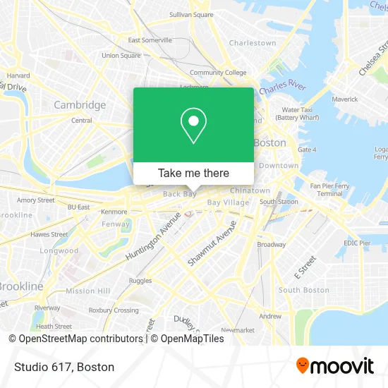
See Studio 617, Boston, on the map
Public Transit to Studio 617 in Boston
Wondering how to get to Studio 617 in Boston? Moovit helps you find the best way to get to Studio 617 with step-by-step directions from the nearest public transit station.
Moovit provides free maps and live directions to help you navigate through your city. View schedules, routes, timetables, and find out how long does it take to get to Studio 617 in real time.
Looking for the nearest stop or station to Studio 617? Check out this list of stops closest to your destination: Back Bay - South End; Boylston St @ Clarendon St; Copley - Opp 575 Boylston St; Dartmouth Street Opposite Back Bay Station; Back Bay - 167 Dartmouth St; Copley - Saint James Ave @ Trinity Pl; Copley - Boylston St @ Dartmouth St; Saint James Ave @ Berkeley St; Stuart St @ Dartmouth St; Saint James Ave @ Dartmouth St; Boylston St @ Dartmouth St; Boston, MA - Copley Square (Corner Of Clarendon St. & St. James Ave. In Front Of Trinity Church); Copley.
Bus: 10, 39, 426, 450, 501, 504, 9, 55, 57, ORANGE LINE SHUTTLE, BB, GREEN LINE SHUTTLE.Train: FRAMINGHAM/WORCESTER, NEEDHAM, FOXBORO EVENT SERVICE, FRANKLIN/FOXBORO, ORANGE LINE.Subway: GREEN LINE B, GREEN LINE C, GREEN LINE D, ORANGE LINE, GREEN LINE E.
Want to see if there’s another route that gets you there at an earlier time? Moovit helps you find alternative routes or times. Get directions from and directions to Studio 617 easily from the Moovit App or Website.
We make riding to Studio 617 easy, which is why over 1.7 million users, including users in Boston, trust Moovit as the best app for public transit. You don’t need to download an individual bus app or train app, Moovit is your all-in-one transit app that helps you find the best bus time or train time available.
For information on prices of bus, subway and train, costs and ride fares to Studio 617, please check the Moovit app.
Use the app to navigate to popular places including to the airport, hospital, stadium, grocery store, mall, coffee shop, school, college, and university.
Studio 617 Address: 557 Boylston St street in Boston
- Total Security,
- Kaufman Marina M,
- Juni Learning,
- Vlora Private Events,
- Dr Laura Latham /Sports Chiropractor,
- Yamoto II (Yamato 2),
- Smashburger,
- Asia Vu Mobile Body Rubs,
- The Abbey Building,
- Gnc,
- Bmc,
- Finagle A Bagel,
- Riccardi,
- Ocean Dreams,
- Consulate General of Haiti,
- Cuyana,
- TD Bank,
- Baa 5k,
- Le Labo,
- Kiehl's
Places Near Studio 617 (Boston)
- Boston Children's Hospital, Boston,
- Cheers, Boston,
- Prudential Center, Boston,
- Massachusetts General Hospital, Boston,
- House Of Blues, Boston,
- North End, Boston,
- Seaport District, Boston,
- Wilbur Theatre, Boston,
- Museum Of Science, Boston,
- Castle Island, Boston,
- Wang Theater, Boston,
- Boston Medical Center, Boston,
- Isabella Stewart Gardner Museum, Boston,
- Boston Convention & Exhibition Center, Boston,
- Mgm Music Hall, Boston,
- Quincy Market, Boston,
- Td Garden, Boston,
- Boston Common, Boston,
- Faneuil Hall, Boston,
- Leader Bank Pavilion (Leader Bank Pavillion), Boston
How to get to popular places in Boston with public transit
Get around Boston by public transit!
Traveling around Boston has never been so easy. See step by step directions as you travel to any attraction, street or major public transit station. View bus and train schedules, arrival times, service alerts and detailed routes on a map, so you know exactly how to get to anywhere in Boston.
When traveling to any destination around Boston use Moovit's Live Directions with Get Off Notifications to know exactly where and how far to walk, how long to wait for your line, and how many stops are left. Moovit will alert you when it's time to get off — no need to constantly re-check whether yours is the next stop.
Wondering how to use public transit in Boston or how to pay for public transit in Boston? Moovit public transit app can help you navigate your way with public transit easily, and at minimum cost. It includes public transit fees, ticket prices, and costs. Looking for a map of Boston public transit lines? Moovit public transit app shows all public transit maps in Boston with all Bus, Train, Subway and Ferry routes and stops on an interactive map.
Boston has 4 transit type(s), including: Bus, Train, Subway and Ferry, operated by several transit agencies, including MBTA, Southeastern Regional Transit Authority, MetroWest Regional Transit Authority, Rhode Island Public Transit Authority, WRTA, Lowell Regional Transit Authority, Merrimack Valley Transit, Montachusett Regional Transit Authority, Cape Cod Regional Transit Authority, Brockton Area Transit Authority, Martha's Vineyard Transit Authority, the WAVE - Nantucket Regional Transit Authority, GATRA, Cape Ann Transportation Authority and Massport