Directions to Studio Nine Photography (Norwood) with public transportation
The following transit lines have routes that pass near Studio Nine Photography
How to get to Studio Nine Photography by bus?
Click on the bus route to see step by step directions with maps, line arrival times and updated time schedules.
How to get to Studio Nine Photography by train?
Click on the train route to see step by step directions with maps, line arrival times and updated time schedules.
Bus stops near Studio Nine Photography in Norwood
Train station near Studio Nine Photography in Norwood
- Norwood Depot, 7 min walk,VIEW
Bus lines to Studio Nine Photography in Norwood
What are the closest stations to Studio Nine Photography?
The closest stations to Studio Nine Photography are:
- Washington St @ Guild St is 352 yards away, 5 min walk.
- Norwood Depot is 517 yards away, 7 min walk.
- Norwood Central is 691 yards away, 10 min walk.
Which bus line stops near Studio Nine Photography?
34E (Walpole Center Via Washington St)
Which train line stops near Studio Nine Photography?
FRANKLIN/FOXBORO (#1708 | South Station)
What’s the nearest train station to Studio Nine Photography in Norwood?
The nearest train station to Studio Nine Photography in Norwood is Norwood Depot. It’s a 7 min walk away.
What’s the nearest bus station to Studio Nine Photography in Norwood?
The nearest bus station to Studio Nine Photography in Norwood is Washington St @ Guild St. It’s a 5 min walk away.
What time is the first bus to Studio Nine Photography in Norwood?
The 34E is the first bus that goes to Studio Nine Photography in Norwood. It stops nearby at 5:12 AM.
What time is the last bus to Studio Nine Photography in Norwood?
The 34E is the last bus that goes to Studio Nine Photography in Norwood. It stops nearby at 1:06 AM.
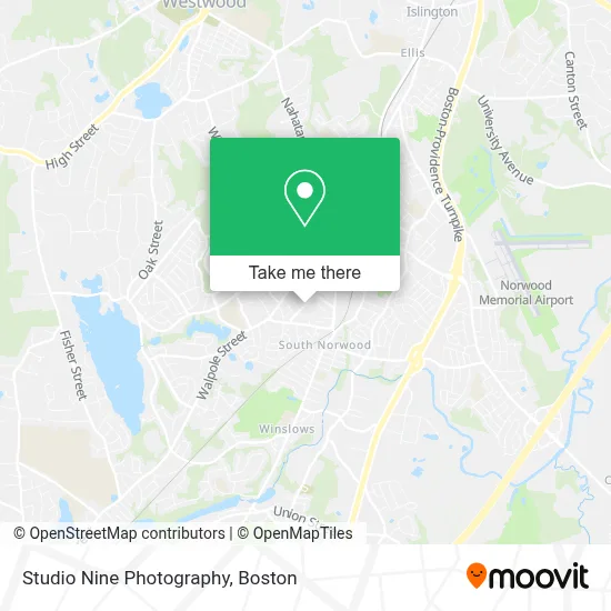
See Studio Nine Photography, Norwood, on the map
Public Transit to Studio Nine Photography in Norwood
Wondering how to get to Studio Nine Photography in Norwood? Moovit helps you find the best way to get to Studio Nine Photography with step-by-step directions from the nearest public transit station.
Moovit provides free maps and live directions to help you navigate through your city. View schedules, routes, timetables, and find out how long does it take to get to Studio Nine Photography in real time.
Looking for the nearest stop or station to Studio Nine Photography? Check out this list of stops closest to your destination: Washington St @ Guild St; Norwood Depot; Norwood Central.
Bus: 34E, FRANKLIN LINE SHUTTLE, FRANKLIN LINE SHUTTLE, FRANKLIN LINE SHUTTLE.Train: FRANKLIN/FOXBORO.
Want to see if there’s another route that gets you there at an earlier time? Moovit helps you find alternative routes or times. Get directions from and directions to Studio Nine Photography easily from the Moovit App or Website.
We make riding to Studio Nine Photography easy, which is why over 1.7 million users, including users in Norwood, trust Moovit as the best app for public transit. You don’t need to download an individual bus app or train app, Moovit is your all-in-one transit app that helps you find the best bus time or train time available.
For information on prices of bus and train, costs and ride fares to Studio Nine Photography, please check the Moovit app.
Use the app to navigate to popular places including to the airport, hospital, stadium, grocery store, mall, coffee shop, school, college, and university.
Studio Nine Photography Address: 142 Winslow Ave street in Norwood
- Norwood Medical Associates (Jupiter Medical Associates),
- American Legion,
- Classical Dance Center of Norwood Ma, Arlene Zolla, Instructor,
- Rached Landscape & Outdoor Maintenance,
- Mr Franks Gas and Food Mart,
- Salvation Army,
- Eastwest Painting & Restoration,
- Red Baron Insurance Agency,
- Straight Shot, Pistol Instructor,
- Robert Dalton Garage Doors,
- Trust Roofing,
- Norwood Physical Therapy,
- Hayes Building & Remodeling,
- Westview Masonry & Construction,
- Jayapriya Raj MD,
- Move Well Physical Therapy,
- Corning Clinical Laboratories,
- Sweet Deal,
- US National Board Certified,
- Skincare Therapy
Places Near Studio Nine Photography (Norwood)
- Museum Of Science, Boston,
- Quincy Market, Boston,
- House Of Blues, Boston,
- Cheers, Boston,
- Mgm Music Hall, Boston,
- Isabella Stewart Gardner Museum, Boston,
- Boston Children's Hospital, Boston,
- Td Garden, Boston,
- Castle Island, Boston,
- Prudential Center, Boston,
- Faneuil Hall, Boston,
- Boston Convention & Exhibition Center, Boston,
- North End, Boston,
- Massachusetts General Hospital, Boston,
- Wilbur Theatre, Boston,
- Seaport District, Boston,
- Leader Bank Pavilion (Leader Bank Pavillion), Boston,
- Wang Theater, Boston,
- Boston Medical Center, Boston,
- Boston Common, Boston
How to get to popular places in Boston with public transit
Get around Norwood by public transit!
Traveling around Norwood has never been so easy. See step by step directions as you travel to any attraction, street or major public transit station. View bus and train schedules, arrival times, service alerts and detailed routes on a map, so you know exactly how to get to anywhere in Norwood.
When traveling to any destination around Norwood use Moovit's Live Directions with Get Off Notifications to know exactly where and how far to walk, how long to wait for your line, and how many stops are left. Moovit will alert you when it's time to get off — no need to constantly re-check whether yours is the next stop.
Wondering how to use public transit in Norwood or how to pay for public transit in Norwood? Moovit public transit app can help you navigate your way with public transit easily, and at minimum cost. It includes public transit fees, ticket prices, and costs. Looking for a map of Norwood public transit lines? Moovit public transit app shows all public transit maps in Norwood with all Bus, Train, Subway and Ferry routes and stops on an interactive map.
Boston has 4 transit type(s), including: Bus, Train, Subway and Ferry, operated by several transit agencies, including MBTA, Southeastern Regional Transit Authority, MetroWest Regional Transit Authority, Rhode Island Public Transit Authority, WRTA, Lowell Regional Transit Authority, Merrimack Valley Transit, Montachusett Regional Transit Authority, Cape Cod Regional Transit Authority, Brockton Area Transit Authority, Martha's Vineyard Transit Authority, the WAVE - Nantucket Regional Transit Authority, GATRA, Cape Ann Transportation Authority and Massport