Directions to Stull & Lee (Boston) with public transportation
The following transit lines have routes that pass near Stull & Lee
 Bus: 14, 22, 41, 66, ORANGE LINE SHUTTLE.
- Train: NEEDHAM, PROVIDENCE/STOUGHTON.
- Subway: ORANGE LINE, GREEN LINE E.
How to get to Stull & Lee by bus?
Click on the bus route to see step by step directions with maps, line arrival times and updated time schedules.
From JFK Library, Boston
57 minFrom Curry College, Milton
66 minFrom Arsenal Mall, Watertown Town
64 minFrom Chevalier Theatre (Chevalier Theater Show Line), Medford
97 minFrom Highland Ave Somerville MA, Somerville
83 minFrom Sheraton-Needham Hotel (Sheraton Boston Needham Hotel), Needham
118 minFrom Santarpio's Pizza, Boston
74 minFrom Best Western Adams Inn Quincy - Boston, Quincy
77 minFrom SharkNinja Operating LLC, Needham
122 minFrom Chevalier Theater, Medford
97 min
How to get to Stull & Lee by train?
Click on the train route to see step by step directions with maps, line arrival times and updated time schedules.
How to get to Stull & Lee by subway?
Click on the subway route to see step by step directions with maps, line arrival times and updated time schedules.
Bus stops near Stull & Lee in Boston
Subway stations near Stull & Lee in Boston
Bus lines to Stull & Lee in Boston
- 22, Ruggles - Ashmont,VIEW
- ORANGE LINE SHUTTLE, Forest Hills - Back Bay (Shuttle),VIEW
- ORANGE LINE SHUTTLE, Forest Hills - Ruggles,VIEW
- ORANGE LINE SHUTTLE, Forest Hills - Copley,VIEW
- ORANGE LINE SHUTTLE, Forest Hills - Back Bay via Ruggles Busway (Shuttle),VIEW
- ORANGE LINE SHUTTLE, Jackson Square - Copley,VIEW
- ORANGE LINE SHUTTLE, Jackson Square - Back Bay,VIEW
- ORANGE LINE SHUTTLE, Forest Hills - Back Bay via Copley (Shuttle),VIEW
- 19, Avenue Louis Pasteur,VIEW
- 66, Brighton Center Via Brookline,VIEW
- 14, Heath St,VIEW
- 41, Centre St & Eliot St,VIEW
What are the closest stations to Stull & Lee?
The closest stations to Stull & Lee are:
- Tremont St @ Roxbury Crossing Station is 152 yards away, 3 min walk.
- Tremont St Opp Roxbury Crossing Sta is 171 yards away, 3 min walk.
- Centre St @ New Heath St is 188 yards away, 3 min walk.
- Roxbury Crossing is 211 yards away, 3 min walk.
- Fenwood Road is 827 yards away, 11 min walk.
Which bus lines stop near Stull & Lee?
These bus lines stop near Stull & Lee: 14, 22, 41, 66.
Which train lines stop near Stull & Lee?
These train lines stop near Stull & Lee: NEEDHAM, PROVIDENCE/STOUGHTON.
Which subway line stops near Stull & Lee?
ORANGE LINE (Forest Hills)
What’s the nearest subway station to Stull & Lee in Boston?
The nearest subway station to Stull & Lee in Boston is Roxbury Crossing. It’s a 3 min walk away.
What’s the nearest bus station to Stull & Lee in Boston?
The nearest bus stations to Stull & Lee in Boston are Tremont St @ Roxbury Crossing Station, Tremont St Opp Roxbury Crossing Sta and Centre St @ New Heath St. The closest one is a 3 min walk away.
What time is the first subway to Stull & Lee in Boston?
The ORANGE LINE is the first subway that goes to Stull & Lee in Boston. It stops nearby at 5:20 AM.
What time is the last subway to Stull & Lee in Boston?
The GREEN LINE E is the last subway that goes to Stull & Lee in Boston. It stops nearby at 2:03 AM.
What time is the first bus to Stull & Lee in Boston?
The 66 is the first bus that goes to Stull & Lee in Boston. It stops nearby at 4:50 AM.
What time is the last bus to Stull & Lee in Boston?
The 66 is the last bus that goes to Stull & Lee in Boston. It stops nearby at 2:27 AM.
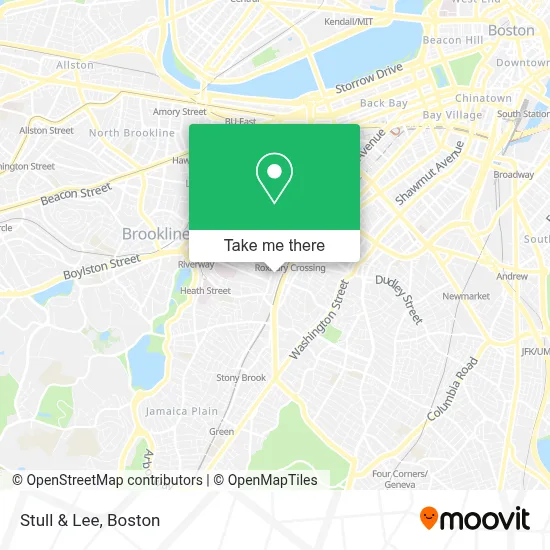
See Stull & Lee, Boston, on the map
Public Transit to Stull & Lee in Boston
Wondering how to get to Stull & Lee in Boston? Moovit helps you find the best way to get to Stull & Lee with step-by-step directions from the nearest public transit station.
Moovit provides free maps and live directions to help you navigate through your city. View schedules, routes, timetables, and find out how long does it take to get to Stull & Lee in real time.
Looking for the nearest stop or station to Stull & Lee? Check out this list of stops closest to your destination: Tremont St @ Roxbury Crossing Station; Tremont St Opp Roxbury Crossing Sta; Centre St @ New Heath St; Roxbury Crossing; Fenwood Road.
Bus: 14, 22, 41, 66, ORANGE LINE SHUTTLE, ORANGE LINE SHUTTLE, ORANGE LINE SHUTTLE, ORANGE LINE SHUTTLE, 19.Train: NEEDHAM, PROVIDENCE/STOUGHTON.Subway: ORANGE LINE, GREEN LINE E.
Want to see if there’s another route that gets you there at an earlier time? Moovit helps you find alternative routes or times. Get directions from and directions to Stull & Lee easily from the Moovit App or Website.
We make riding to Stull & Lee easy, which is why over 1.7 million users, including users in Boston, trust Moovit as the best app for public transit. You don’t need to download an individual bus app or train app, Moovit is your all-in-one transit app that helps you find the best bus time or train time available.
For information on prices of bus, subway and train, costs and ride fares to Stull & Lee, please check the Moovit app.
Use the app to navigate to popular places including to the airport, hospital, stadium, grocery store, mall, coffee shop, school, college, and university.
Stull & Lee Address: 103 Terrace St # 2 street in Boston
- Place Tailor,
- Orleans Plaza,
- Fresh Truck,
- Greg's Auto & Collisio,
- R&R's Finest Auto Glass,
- Philip Mahoney,
- US Census Bureau,
- Roxbury Community College Media Arts Center,
- Roxbury Repertory Theater,
- Servpro,
- geometry.xxx,
- Roxbury Community College,
- Parking Lot #1 (Roxbury Community College),
- Fenway High School,
- 37 Hillside St Parking,
- Roxbury Community College Bookstore,
- Local Locksmith Company,
- Boston Art Review,
- MBTA Roxbury Crossing Station,
- Titus Foundation I
Places Near Stull & Lee (Boston)
- Massachusetts General Hospital, Boston,
- Faneuil Hall, Boston,
- Wang Theater, Boston,
- Boston Medical Center, Boston,
- Boston Common, Boston,
- Wilbur Theatre, Boston,
- Seaport District, Boston,
- Quincy Market, Boston,
- Isabella Stewart Gardner Museum, Boston,
- Museum Of Science, Boston,
- Cheers, Boston,
- Leader Bank Pavilion (Leader Bank Pavillion), Boston,
- Boston Children's Hospital, Boston,
- House Of Blues, Boston,
- Boston Convention & Exhibition Center, Boston,
- Castle Island, Boston,
- North End, Boston,
- Td Garden, Boston,
- Mgm Music Hall, Boston,
- Prudential Center, Boston
How to get to popular places in Boston with public transit
Get around Boston by public transit!
Traveling around Boston has never been so easy. See step by step directions as you travel to any attraction, street or major public transit station. View bus and train schedules, arrival times, service alerts and detailed routes on a map, so you know exactly how to get to anywhere in Boston.
When traveling to any destination around Boston use Moovit's Live Directions with Get Off Notifications to know exactly where and how far to walk, how long to wait for your line, and how many stops are left. Moovit will alert you when it's time to get off — no need to constantly re-check whether yours is the next stop.
Wondering how to use public transit in Boston or how to pay for public transit in Boston? Moovit public transit app can help you navigate your way with public transit easily, and at minimum cost. It includes public transit fees, ticket prices, and costs. Looking for a map of Boston public transit lines? Moovit public transit app shows all public transit maps in Boston with all Bus, Train, Subway and Ferry routes and stops on an interactive map.
Boston has 4 transit type(s), including: Bus, Train, Subway and Ferry, operated by several transit agencies, including MBTA, Southeastern Regional Transit Authority, MetroWest Regional Transit Authority, Rhode Island Public Transit Authority, WRTA, Lowell Regional Transit Authority, Merrimack Valley Transit, Montachusett Regional Transit Authority, Cape Cod Regional Transit Authority, Brockton Area Transit Authority, Martha's Vineyard Transit Authority, the WAVE - Nantucket Regional Transit Authority, GATRA, Cape Ann Transportation Authority and Massport