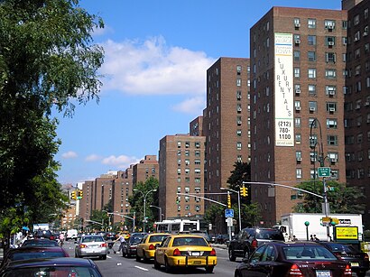
Directions to Stuytown (Manhattan) with public transportation
The following transit lines have routes that pass near Stuytown
How to get to Stuytown by bus?
Click on the bus route to see step by step directions with maps, line arrival times and updated time schedules.
How to get to Stuytown by train?
Click on the train route to see step by step directions with maps, line arrival times and updated time schedules.
How to get to Stuytown by subway?
Click on the subway route to see step by step directions with maps, line arrival times and updated time schedules.
Bus stations near Stuytown in Manhattan
- Av C/E 16 St,3 min walk,
- E 14 St/Av B,4 min walk,
- Av C/E 20 St,6 min walk,
- Fdr Service Rd/E 16 St,6 min walk,
- E 14 St/Av A,7 min walk,
Subway stations near Stuytown in Manhattan
- 3 Av,11 min walk,
- Astor Pl,21 min walk,
Ferry stations near Stuytown in Manhattan
- Stuyvesant Cove,13 min walk,
Bus lines to Stuytown in Manhattan
- M9,Kips Bay 1 Av - 26 St Via Avenue C,
- M14D-SBS,Select Bus Les Delancey-Fdr Via 14 St,
- M23-SBS,Select Bus East Side Avenue C Crosstown,
- SIM3,Port Richmond Via Watchogue Rd,
- SIM6,Eltvlle Trans Ctr Via F Cap Bl Via Gfrds,
- SIM10,Eltingville Trans Ctr Via Hylan Via Rich,
- SIM11,New Dorp Via Hylan Bl,
- SIM31,Eltingville Trans Ctr Via Forest Hill Rd,
- M14A-SBS,Select Bus Abingdon Sq Via 14 St,
What are the closest stations to Stuytown?
The closest stations to Stuytown are:
- Av C/E 16 St is 166 yards away, 3 min walk.
- E 14 St/Av B is 306 yards away, 4 min walk.
- Av C/E 20 St is 424 yards away, 6 min walk.
- Fdr Service Rd/E 16 St is 442 yards away, 6 min walk.
- E 14 St/Av A is 500 yards away, 7 min walk.
- 3 Av is 862 yards away, 11 min walk.
- Stuyvesant Cove is 1019 yards away, 13 min walk.
- Astor Pl is 1746 yards away, 21 min walk.
Which bus lines stop near Stuytown?
These bus lines stop near Stuytown: M14A-SBS, M14D-SBS, M15, M34A-SBS, SIM10.
Which train lines stop near Stuytown?
These train lines stop near Stuytown: FAR ROCKAWAY BRANCH, HARLEM, PATH, PORT WASHINGTON BRANCH.
Which subway line stops near Stuytown?
L
What’s the nearest subway station to Stuytown in Manhattan?
The nearest subway station to Stuytown in Manhattan is 3 Av. It’s a 11 min walk away.
What’s the nearest bus stop to Stuytown in Manhattan?
The nearest bus stop to Stuytown in Manhattan is Av C/E 16 St. It’s a 3 min walk away.
What’s the nearest ferry station to Stuytown in Manhattan?
The nearest ferry station to Stuytown in Manhattan is Stuyvesant Cove. It’s a 13 min walk away.
What time is the first subway to Stuytown in Manhattan?
The 4 is the first subway that goes to Stuytown in Manhattan. It stops nearby at 3:02 AM.
What time is the last subway to Stuytown in Manhattan?
The 6 is the last subway that goes to Stuytown in Manhattan. It stops nearby at 3:51 AM.
What time is the first bus to Stuytown in Manhattan?
The M23-SBS is the first bus that goes to Stuytown in Manhattan. It stops nearby at 3:00 AM.
What time is the last bus to Stuytown in Manhattan?
The M23-SBS is the last bus that goes to Stuytown in Manhattan. It stops nearby at 2:55 AM.
What time is the first ferry to Stuytown in Manhattan?
The SV is the first ferry that goes to Stuytown in Manhattan. It stops nearby at 5:44 AM.
What time is the last ferry to Stuytown in Manhattan?
The SV is the last ferry that goes to Stuytown in Manhattan. It stops nearby at 8:49 PM.
How much is the bus fare to Stuytown?
The bus fare to Stuytown costs about $2.90.
How much is the subway fare to Stuytown?
The subway fare to Stuytown costs about $2.90.
See Stuytown, Manhattan, on the map
Public Transit to Stuytown in Manhattan
Wondering how to get to Stuytown in Manhattan, United States? Moovit helps you find the best way to get to Stuytown with step-by-step directions from the nearest public transit station.
Moovit provides free maps and live directions to help you navigate through your city. View schedules, routes, timetables, and find out how long does it take to get to Stuytown in real time.
Looking for the nearest stop or station to Stuytown? Check out this list of stops closest to your destination: Av C/E 16 St; E 14 St/Av B; Av C/E 20 St; Fdr Service Rd/E 16 St; E 14 St/Av A; 3 Av; Stuyvesant Cove; Astor Pl.
Bus:M14A-SBSM14D-SBSM15M34A-SBSSIM10M9M23-SBSTrain:FAR ROCKAWAY BRANCHHARLEMPATHPORT WASHINGTON BRANCHSubway:L466XFerry:SV
Want to see if there’s another route that gets you there at an earlier time? Moovit helps you find alternative routes or times. Get directions from and directions to Stuytown easily from the Moovit App or Website.
We make riding to Stuytown easy, which is why over 1.5 million users, including users in Manhattan, trust Moovit as the best app for public transit. You don’t need to download an individual bus app or train app, Moovit is your all-in-one transit app that helps you find the best bus time or train time available.
For information on prices of subway, bus and train, costs and ride fares to Stuytown, please check the Moovit app.
Use the app to navigate to popular places including to the airport, hospital, stadium, grocery store, mall, coffee shop, school, college, and university.
Stuytown Address: Avenue C Loop New York, NY 10009 street in Manhattan
Attractions near Stuytown
283 Avenue C,Annie Liebovitz Studio,Star Max,Stuytown Playground 11,CSC PCV 653 655 E1,D Media,CSC PCV 6stuyvesan,Rodan + Fields Dermatologists,Oval Kids by Apple Seeds (Oval Kids by Appleseeds),Make It Happen Management,Stuytown Paddle Tennis Courts,CSC PCV 309 Avenue,Webuyhousesnassausuffolk.Com,Paris,CSC PCV 647 649 E1,Avenue C Loop,Stuyvesant C,626 E 20th St ,Stuyvesant Town,Super GoodHow to get to popular attractions in Manhattan with public transit
Bryant Park, Manhattan,Track 3 - Stamford Metro North Station, Stamford, Ct,City Winery, Manhattan,Century 21 Department Store, Manhattan,The Manhattan at Times Square Hotel, Manhattan,290, Manhattan,Grand Central Station, Manhattan,17 Battery Pl, Manhattan,Peter Pan Bus Lines, Manhattan,Walmart, Secaucus, Nj,165-08 88th Avenue, Queens,Middle Village, NY, Queens,Whitney Museum of American Art, Manhattan,MetLife Stadium, East Rutherford, Nj,Howard Beach, Queens,Sojo Spa, Edgewater, Nj,78 John Miller Way, Kearny, Nj,Jamaica Ave, Queens,Nassau Community College, East Garden City, Ny,28 Liberty, ManhattanGet around Manhattan by public transit!
Traveling around Manhattan has never been so easy. See step by step directions as you travel to any attraction, street or major public transit station. View bus and train schedules, arrival times, service alerts and detailed routes on a map, so you know exactly how to get to anywhere in Manhattan.
When traveling to any destination around Manhattan use Moovit's Live Directions with Get Off Notifications to know exactly where and how far to walk, how long to wait for your line, and how many stops are left. Moovit will alert you when it's time to get off — no need to constantly re-check whether yours is the next stop.
Wondering how to use public transit in Manhattan or how to pay for public transit in Manhattan? Moovit public transit app can help you navigate your way with public transit easily, and at minimum cost. It includes public transit fees, ticket prices, and costs. Looking for a map of Manhattan public transit lines? Moovit public transit app shows all public transit maps in Manhattan with all subway, bus or train routes and stops on an interactive map.
Manhattan has 3 transit type(s), including: subway, bus or train, operated by several transit agencies, including MTA Subway, Metro-North Railroad, LIRR, PATH, Shore Line East, MTA Bus Company, MTA New York City Transit - Express routes, MTA Bus, NJ Transit, NYC Ferry, NICE bus, Bee-Line Bus, NJ Transit Rail, NJ Transit Rail and Norwalk Transit District