How to get to Style Fix Studio by bus?
Click on the bus route to see step by step directions with maps, line arrival times and updated time schedules.
From Brighton District Court, Boston
38 minFrom Terrace Room, Paige Hall, Medford
82 minFrom Cambridge, MA, Cambridge
70 minFrom Sheraton-Needham Hotel (Sheraton Boston Needham Hotel), Needham
66 minFrom Paradise Rock Club, Boston
47 minFrom Tufts University, Medford
81 minFrom Ac Hotel Cambridge, Cambridge
90 minFrom Babson College, Wellesley
157 minFrom VFW Parkway, Boston
65 minFrom Spaulding Hospital, Cambridge
70 min
How to get to Style Fix Studio by train?
Click on the train route to see step by step directions with maps, line arrival times and updated time schedules.
Bus stops near Style Fix Studio in Waltham
Train stations near Style Fix Studio in Waltham
What are the closest stations to Style Fix Studio?
The closest stations to Style Fix Studio are:
- High St @ Newton St is 184 yards away, 3 min walk.
- River St @ Newton St is 274 yards away, 4 min walk.
- Newtonville is 1951 yards away, 23 min walk.
- Brandeis/Roberts is 3144 yards away, 37 min walk.
Which bus lines stop near Style Fix Studio?
These bus lines stop near Style Fix Studio: 553, 554, 558, 70.
Which train lines stop near Style Fix Studio?
These train lines stop near Style Fix Studio: FITCHBURG, FRAMINGHAM/WORCESTER.
What’s the nearest train station to Style Fix Studio in Waltham?
The nearest train station to Style Fix Studio in Waltham is Newtonville. It’s a 23 min walk away.
What’s the nearest bus station to Style Fix Studio in Waltham?
The nearest bus station to Style Fix Studio in Waltham is High St @ Newton St. It’s a 3 min walk away.
What time is the first train to Style Fix Studio in Waltham?
The FRAMINGHAM/WORCESTER is the first train that goes to Style Fix Studio in Waltham. It stops nearby at 5:19 AM.
What time is the last train to Style Fix Studio in Waltham?
The FRAMINGHAM/WORCESTER is the last train that goes to Style Fix Studio in Waltham. It stops nearby at 12:22 AM.
What time is the first bus to Style Fix Studio in Waltham?
The 556 is the first bus that goes to Style Fix Studio in Waltham. It stops nearby at 6:20 AM.
What time is the last bus to Style Fix Studio in Waltham?
The 556 is the last bus that goes to Style Fix Studio in Waltham. It stops nearby at 7:57 PM.
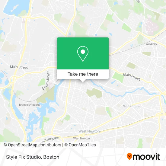
See Style Fix Studio, Waltham, on the map
Public Transit to Style Fix Studio in Waltham
Wondering how to get to Style Fix Studio in Waltham? Moovit helps you find the best way to get to Style Fix Studio with step-by-step directions from the nearest public transit station.
Moovit provides free maps and live directions to help you navigate through your city. View schedules, routes, timetables, and find out how long does it take to get to Style Fix Studio in real time.
Looking for the nearest stop or station to Style Fix Studio? Check out this list of stops closest to your destination: High St @ Newton St; River St @ Newton St; Newtonville; Brandeis/Roberts.
Bus: 553, 554, 558, 70, 556.Train: FITCHBURG, FRAMINGHAM/WORCESTER.
Want to see if there’s another route that gets you there at an earlier time? Moovit helps you find alternative routes or times. Get directions from and directions to Style Fix Studio easily from the Moovit App or Website.
We make riding to Style Fix Studio easy, which is why over 1.7 million users, including users in Waltham, trust Moovit as the best app for public transit. You don’t need to download an individual bus app or train app, Moovit is your all-in-one transit app that helps you find the best bus time or train time available.
For information on prices of bus, train and subway, costs and ride fares to Style Fix Studio, please check the Moovit app.
Use the app to navigate to popular places including to the airport, hospital, stadium, grocery store, mall, coffee shop, school, college, and university.
Style Fix Studio Address: 216 R Newton St street in Waltham
- Permanent Productions,
- Woods Real Estate,
- Perez Gardini,
- Renee Tracy, L.Ac., Nutritionist, Maom,
- KD Colour,
- TP Nails & Waxing,
- Salon,
- Barrett and Company,
- Groundup Construction,
- Extreme Motor Sport,
- Jlas Painting and Clea,
- Local Locksmiths,
- Procuts,
- IGA General Construction,
- Tita's Kitchen,
- Chiropractic,
- AJ's Automotive,
- Multicultural Neurobehavioral Rehabilitation Center,
- Carolina Court,
- Sacred Heart Church, Waltham
Places Near Style Fix Studio (Waltham)
- Td Garden, Boston,
- Museum Of Science, Boston,
- Boston Medical Center, Boston,
- Boston Common, Boston,
- North End, Boston,
- Quincy Market, Boston,
- Prudential Center, Boston,
- Faneuil Hall, Boston,
- Wang Theater, Boston,
- Wilbur Theatre, Boston,
- Castle Island, Boston,
- Leader Bank Pavilion (Leader Bank Pavillion), Boston,
- Cheers, Boston,
- Isabella Stewart Gardner Museum, Boston,
- Seaport District, Boston,
- Mgm Music Hall, Boston,
- Boston Children's Hospital, Boston,
- Boston Convention & Exhibition Center, Boston,
- Massachusetts General Hospital, Boston,
- House Of Blues, Boston
How to get to popular places in Boston with public transit
Get around Waltham by public transit!
Traveling around Waltham has never been so easy. See step by step directions as you travel to any attraction, street or major public transit station. View bus and train schedules, arrival times, service alerts and detailed routes on a map, so you know exactly how to get to anywhere in Waltham.
When traveling to any destination around Waltham use Moovit's Live Directions with Get Off Notifications to know exactly where and how far to walk, how long to wait for your line, and how many stops are left. Moovit will alert you when it's time to get off — no need to constantly re-check whether yours is the next stop.
Wondering how to use public transit in Waltham or how to pay for public transit in Waltham? Moovit public transit app can help you navigate your way with public transit easily, and at minimum cost. It includes public transit fees, ticket prices, and costs. Looking for a map of Waltham public transit lines? Moovit public transit app shows all public transit maps in Waltham with all Bus, Train, Subway and Ferry routes and stops on an interactive map.
Boston has 4 transit type(s), including: Bus, Train, Subway and Ferry, operated by several transit agencies, including MBTA, Southeastern Regional Transit Authority, MetroWest Regional Transit Authority, Rhode Island Public Transit Authority, WRTA, Lowell Regional Transit Authority, Merrimack Valley Transit, Montachusett Regional Transit Authority, Cape Cod Regional Transit Authority, Brockton Area Transit Authority, Martha's Vineyard Transit Authority, the WAVE - Nantucket Regional Transit Authority, GATRA, Cape Ann Transportation Authority and Massport