Directions to Styles Cleaning Service (Brookline) with public transportation
The following transit lines have routes that pass near Styles Cleaning Service
 Bus: 66, GREEN LINE C SHUTTLE, SHUTTLE, GREEN LINE C SHUTTLE, FLIXBUS 2610.
- Train: FRAMINGHAM/WORCESTER.
- Subway: GREEN LINE C.
How to get to Styles Cleaning Service by bus?
Click on the bus route to see step by step directions with maps, line arrival times and updated time schedules.
From Aloft Boston Seaport, Boston
53 minFrom Lasell College, Newton
84 minFrom Milton, MA, Milton
104 minFrom Old North Church, Boston
67 minFrom 100 Cambridge Street Garage, Boston
56 minFrom Target, Everett
78 minFrom Malden, MA, Malden
94 minFrom Constitution Beach, Boston
90 minFrom Milton Academy, Milton
103 minFrom Greyhound:Bus Station, Boston
45 min
How to get to Styles Cleaning Service by train?
Click on the train route to see step by step directions with maps, line arrival times and updated time schedules.
How to get to Styles Cleaning Service by subway?
Click on the subway route to see step by step directions with maps, line arrival times and updated time schedules.
From Aloft Boston Seaport, Boston
53 minFrom Lasell College, Newton
58 minFrom Milton, MA, Milton
95 minFrom Old North Church, Boston
40 minFrom 100 Cambridge Street Garage, Boston
30 minFrom Target, Everett
59 minFrom Malden, MA, Malden
57 minFrom Constitution Beach, Boston
49 minFrom Milton Academy, Milton
77 minFrom Greyhound:Bus Station, Boston
30 min
Bus stops near Styles Cleaning Service in Brookline
Subway station near Styles Cleaning Service in Brookline
- Saint Paul Street, 2 min walk,VIEW
Bus lines to Styles Cleaning Service in Brookline
- GREEN LINE C SHUTTLE, Saint Mary's Street (Shuttle),VIEW
- SHUTTLE, Cleveland Circle (Shuttle),VIEW
- 66, Brighton Center Via Brookline,VIEW
- GREEN LINE C SHUTTLE, Coolidge Corner (Shuttle),VIEW
- FLIXBUS 2610, New York (Hudson Yards),VIEW
- FLIXBUS N2605, Henrico (Parham Rd Park & Ride),VIEW
- FLIXBUS N2610, Boston (South Station),VIEW
What are the closest stations to Styles Cleaning Service?
The closest stations to Styles Cleaning Service are:
- Saint Paul Street is 30 yards away, 1 min walk.
- Harvard St @ Harris St is 243 yards away, 4 min walk.
- Coolidge Corner is 449 yards away, 6 min walk.
- Brookline is 558 yards away, 7 min walk.
Which bus line stops near Styles Cleaning Service?
66 (Harvard Via Allston)
Which train line stops near Styles Cleaning Service?
FRAMINGHAM/WORCESTER (#525 | Worcester)
Which subway line stops near Styles Cleaning Service?
GREEN LINE C (Cleveland Circle)
What’s the nearest subway station to Styles Cleaning Service in Brookline?
The nearest subway station to Styles Cleaning Service in Brookline is Saint Paul Street. It’s a 2 min walk away.
What’s the nearest bus station to Styles Cleaning Service in Brookline?
The nearest bus station to Styles Cleaning Service in Brookline is Saint Paul Street. It’s a 1 min walk away.
What time is the first subway to Styles Cleaning Service in Brookline?
The GREEN LINE C is the first subway that goes to Styles Cleaning Service in Brookline. It stops nearby at 5:07 AM.
What time is the last subway to Styles Cleaning Service in Brookline?
The GREEN LINE C is the last subway that goes to Styles Cleaning Service in Brookline. It stops nearby at 2:15 AM.
What time is the first bus to Styles Cleaning Service in Brookline?
The 66 is the first bus that goes to Styles Cleaning Service in Brookline. It stops nearby at 4:59 AM.
What time is the last bus to Styles Cleaning Service in Brookline?
The FLIXBUS N2605 is the last bus that goes to Styles Cleaning Service in Brookline. It stops nearby at 9:05 AM.
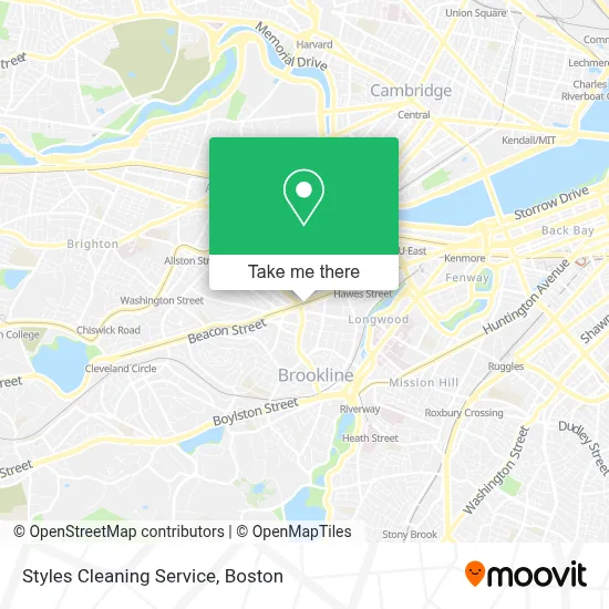
See Styles Cleaning Service, Brookline, on the map
Public Transit to Styles Cleaning Service in Brookline
Wondering how to get to Styles Cleaning Service in Brookline? Moovit helps you find the best way to get to Styles Cleaning Service with step-by-step directions from the nearest public transit station.
Moovit provides free maps and live directions to help you navigate through your city. View schedules, routes, timetables, and find out how long does it take to get to Styles Cleaning Service in real time.
Looking for the nearest stop or station to Styles Cleaning Service? Check out this list of stops closest to your destination: Saint Paul Street; Harvard St @ Harris St; Coolidge Corner; Brookline.
Bus: 66, GREEN LINE C SHUTTLE, SHUTTLE, GREEN LINE C SHUTTLE, FLIXBUS 2610, FLIXBUS N2605, FLIXBUS N2610.Train: FRAMINGHAM/WORCESTER.Subway: GREEN LINE C.
Want to see if there’s another route that gets you there at an earlier time? Moovit helps you find alternative routes or times. Get directions from and directions to Styles Cleaning Service easily from the Moovit App or Website.
We make riding to Styles Cleaning Service easy, which is why over 1.7 million users, including users in Brookline, trust Moovit as the best app for public transit. You don’t need to download an individual bus app or train app, Moovit is your all-in-one transit app that helps you find the best bus time or train time available.
For information on prices of subway, bus and train, costs and ride fares to Styles Cleaning Service, please check the Moovit app.
Use the app to navigate to popular places including to the airport, hospital, stadium, grocery store, mall, coffee shop, school, college, and university.
Styles Cleaning Service Address: 1309 Beacon St street in Brookline
- Trader Joe's-Brookline,MA,
- MBTA Coolidge Corner Station,
- Trader Joe's,
- Coolidge Corner Yoga,
- Hops n Scotch,
- Magic Beans Headquarters,
- Jas M Kickham Lawyer,
- Israel, Van Kooy, & Days, LLC,
- Green Line Growers,
- Harvard St & Longwood Ave,
- Schwartz Evan I,
- McKinney William - Partners Urgent Care,
- Mass General Brigham Urgent Care - Brookline,
- Erica Lee Medium,
- Bus Stop 66 Coolidge Corner,
- Fugakyu,
- Coolidge Corner, Massachusetts,
- Coolidge Corner Theatre,
- The Public Library of Brookline (Coolidge Corner),
- Six Po Hot Pot
Places Near Styles Cleaning Service (Brookline)
- Mgm Music Hall, Boston,
- Boston Children's Hospital, Boston,
- Quincy Market, Boston,
- Boston Medical Center, Boston,
- Leader Bank Pavilion (Leader Bank Pavillion), Boston,
- Prudential Center, Boston,
- Cheers, Boston,
- Faneuil Hall, Boston,
- Boston Convention & Exhibition Center, Boston,
- Massachusetts General Hospital, Boston,
- Isabella Stewart Gardner Museum, Boston,
- Wilbur Theatre, Boston,
- Boston Common, Boston,
- Td Garden, Boston,
- Wang Theater, Boston,
- North End, Boston,
- Castle Island, Boston,
- Museum Of Science, Boston,
- Seaport District, Boston,
- House Of Blues, Boston
How to get to popular places in Boston with public transit
Get around Brookline by public transit!
Traveling around Brookline has never been so easy. See step by step directions as you travel to any attraction, street or major public transit station. View bus and train schedules, arrival times, service alerts and detailed routes on a map, so you know exactly how to get to anywhere in Brookline.
When traveling to any destination around Brookline use Moovit's Live Directions with Get Off Notifications to know exactly where and how far to walk, how long to wait for your line, and how many stops are left. Moovit will alert you when it's time to get off — no need to constantly re-check whether yours is the next stop.
Wondering how to use public transit in Brookline or how to pay for public transit in Brookline? Moovit public transit app can help you navigate your way with public transit easily, and at minimum cost. It includes public transit fees, ticket prices, and costs. Looking for a map of Brookline public transit lines? Moovit public transit app shows all public transit maps in Brookline with all Bus, Train, Subway and Ferry routes and stops on an interactive map.
Boston has 4 transit type(s), including: Bus, Train, Subway and Ferry, operated by several transit agencies, including MBTA, Southeastern Regional Transit Authority, MetroWest Regional Transit Authority, Rhode Island Public Transit Authority, WRTA, Lowell Regional Transit Authority, Merrimack Valley Transit, Montachusett Regional Transit Authority, Cape Cod Regional Transit Authority, Brockton Area Transit Authority, Martha's Vineyard Transit Authority, the WAVE - Nantucket Regional Transit Authority, GATRA, Cape Ann Transportation Authority and Massport