Directions to Subang Jaya (Petaling Jaya) with public transportation
The following transit lines have routes that pass near Subang Jaya
How to get to Subang Jaya by bus?
Click on the bus route to see step by step directions with maps, line arrival times and updated time schedules.
How to get to Subang Jaya by train?
Click on the train route to see step by step directions with maps, line arrival times and updated time schedules.
How to get to Subang Jaya by MRT & LRT?
Click on the MRT & LRT route to see step by step directions with maps, line arrival times and updated time schedules.
Bus stops near Subang Jaya in Petaling Jaya
- KTM / LRT Subang Jaya (Selatan), 5 min walk,
- Aeon Big Subang Jaya, 7 min walk,
Bus lines to Subang Jaya in Petaling Jaya
- SJ01, Brt / LRT Usj7 ↺ KTM / LRT Subang Jaya,
- 641, Pearl Point,
- 708, Klang Via Hentian Bandar Shah Alam,
- 771, USJ 1 Subang Mewah,
- 783, LRT Kelana Jaya ↺ Subang Parade,
What are the closest stations to Subang Jaya?
The closest stations to Subang Jaya are:
- KTM / LRT Subang Jaya (Selatan) is 298 meters away, 5 min walk.
- Aeon Big Subang Jaya is 478 meters away, 7 min walk.
Which bus lines stop near Subang Jaya?
These bus lines stop near Subang Jaya: 641, 783, P701, T770.
Which train lines stop near Subang Jaya?
These train lines stop near Subang Jaya: 10, 2.
Which MRT & LRT line stops near Subang Jaya?
5
What’s the nearest bus stop to Subang Jaya in Petaling Jaya?
The nearest bus stop to Subang Jaya in Petaling Jaya is KTM / LRT Subang Jaya (Selatan). It’s a 5 min walk away.
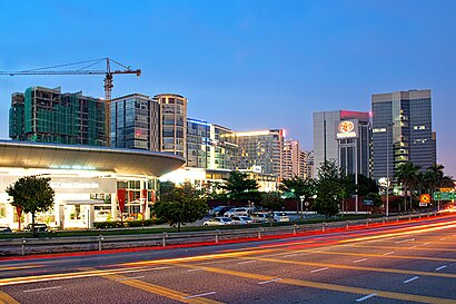
See Subang Jaya, Petaling Jaya, on the map
Public Transit to Subang Jaya in Petaling Jaya
Wondering how to get to Subang Jaya in Petaling Jaya, Malaysia? Moovit helps you find the best way to get to Subang Jaya with step-by-step directions from the nearest public transit station.
Moovit provides free maps and live directions to help you navigate through your city. View schedules, routes, timetables, and find out how long does it take to get to Subang Jaya in real time.
Looking for the nearest stop or station to Subang Jaya? Check out this list of stops closest to your destination: KTM / LRT Subang Jaya (Selatan); Aeon Big Subang Jaya.
Bus: 641, 783, P701, T770, SJ01, 708, 771.Train: 10, 2.MRT & LRT: 5.
Want to see if there’s another route that gets you there at an earlier time? Moovit helps you find alternative routes or times. Get directions from and directions to Subang Jaya easily from the Moovit App or Website.
We make riding to Subang Jaya easy, which is why over 1.5 million users, including users in Petaling Jaya, trust Moovit as the best app for public transit. You don’t need to download an individual bus app or train app, Moovit is your all-in-one transit app that helps you find the best bus time or train time available.
For information on prices of bus, MRT & LRT and train, costs and ride fares to Subang Jaya, please check the Moovit app.
Use the app to navigate to popular places including to the airport, hospital, stadium, grocery store, mall, coffee shop, school, college, and university.
Subang Jaya Address: Subang Jaya, Ss 16, 47500 Subang Jaya, Selangor, Malaysia street in Petaling Jaya
Attractions near Subang Jaya
KTM Line - Subang Jaya Station (KD09),Jalan Kemajuan Subang,Mini Bus 99,Surau Lot 43,Non Halal Section Jaya Grocers,AMRA Mag & News @ KTM Subang jaya,Subang Jaya Komuter Station,Kd09 Subang Jaya,Bank Simpanan Nasional,Western Union, Carrefour,Salero Negori,RapidKL Subang Jaya (KJ28) LRT Station,Cruise Bintang,Ktm Subang Jaya,Stesen LRT Subang Jaya,Surau KTM Subang Jaya,Rapidkl Subang Jaya LRT Station,Kj28 Subang Jaya,Subang Jaya (Lrt),rapidKL U80How to get to popular attractions in Petaling Jaya with public transit
Sri Pentas TV3, Petaling Jaya,KLCC, Kuala Lumpur,PETRONAS Management Training Centre (PERMATA), Sepang,MZ Cafe @ Kpg Dato Abu Bakar Baginda, Bangi, Sepang,SUBWAY, Petaling Jaya,Petronas, Shah Alam,Masjid Jamek Sultan Ibrahim, Kuala Selangor,Kompleks Sukan Pandamaran, Klang,Burger King, Petaling Jaya,Plaza Tol Tanjung Malim, Hulu Selangor,Presint 5 (Precinct), Sepang,Sama-Sama Hotel, Sepang,Valencia, Gombak,Restoran Original Penang Kayu Nasi Kandar, Petaling Jaya,San Francisco Pizza, Shah Alam,Nasi Kukus Sotong Besar, Klang,Secret Recipe, Hulu Langat,Restoran Rezeki Al-Mubarak, Klang,999 Nine Nine Nine Restoran, Gombak,Sultan Arabic and Iranian Restaurant, SepangGet around Kuala Lumpur by public transit!
Traveling around Kuala Lumpur has never been so easy. See step by step directions as you travel to any attraction, street or major public transit station. View bus and train schedules, arrival times, service alerts and detailed routes on a map, so you know exactly how to get to anywhere in Kuala Lumpur.
When traveling to any destination around Kuala Lumpur use Moovit's Live Directions with Get Off Notifications to know exactly where and how far to walk, how long to wait for your line, and how many stops are left. Moovit will alert you when it's time to get off — no need to constantly re-check whether yours is the next stop.
Wondering how to use public transit in Kuala Lumpur or how to pay for public transit in Kuala Lumpur? Moovit public transit app can help you navigate your way with public transit easily, and at minimum cost. It includes public transit fees, ticket prices, and costs. Looking for a map of Kuala Lumpur public transit lines? Moovit public transit app shows all public transit maps in Kuala Lumpur with all Bus, Train, MRT & LRT, Monorail, Ferry and Cable Car routes and stops on an interactive map.
Kuala Lumpur has 6 transit type(s), including: Bus, Train, MRT & LRT, Monorail, Ferry and Cable Car, operated by several transit agencies, including rapidKL, rapidKL MRT, Express Rail Link - ERL, Keretapi Tanah Melayu - KTM, rapidKL BRT, rapidKL Bus, MRT Feeder Bus (Operated by RapidKL), GOKL City Bus, PJ City Bus (operated by rapidKL), Smart Selangor (operated by rapidKL), Smart Selangor, Nadiputra (Operated by RapidKL), Free Shuttle Service, Causeway Link (Handal Ceria Sdn Bhd), Universiti Malaya