How to get to Subway by bus?
Click on the bus route to see step by step directions with maps, line arrival times and updated time schedules.
From Amazon Fulfillment Bos7, Fall River
102 minFrom Walmart Fall River Supercenter, Fall River
71 minFrom Charlton Memorial Hospital, Fall River
77 minFrom Bedford Industrial Park, New Bedford
82 minFrom B.M.C. Durfee High School, Fall River
57 minFrom Lizzy Borden House, Fall River
60 minFrom RMV New Bedford, New Bedford
79 minFrom Bristol Community College, Fall River
58 minFrom Mass Maritime Academy, Buzzards Bay
117 minFrom Falmouth MA USA, Falmouth
90 min
How to get to Subway by train?
Click on the train route to see step by step directions with maps, line arrival times and updated time schedules.
Bus stops near Subway in New Bedford
Train station near Subway in New Bedford
- Church Street, 34 min walk,VIEW
Ferry stations near Subway in New Bedford
Bus lines to Subway in New Bedford
- 9, SRTA New Bedford Terminal - SRTA Fall River Terminal,VIEW
- 206, Rockway St and Carriage Dr - SRTA New Bedford Terminal,VIEW
- 208, SRTA New Bedford Terminal - King's Highway Stop & Shop,VIEW
- 210, Ann & Hope Plaza - SRTA New Bedford Terminal,VIEW
- 202, Terminal,VIEW
- 204, Ashley Blvd & Industrial Park,VIEW
- 299, New Bedford High School / Keith North,VIEW
- WNB, SRTA,VIEW
- 201, Fort Rodman,VIEW
- 203, Terminal,VIEW
- 205, South Central,VIEW
- 211, Fairhaven,VIEW
- WARE, Wareham,VIEW
- PETER PAN, Providence (Bus Terminal) Ri,VIEW
- PETER PAN, Hyannis,VIEW
What are the closest stations to Subway?
The closest stations to Subway are:
- Mill St And Summer St is 49 yards away, 2 min walk.
- Purchase St And Maxfield St is 160 yards away, 2 min walk.
- SRTA is 267 yards away, 4 min walk.
- SRTA Terminal New Bedford is 267 yards away, 4 min walk.
- Church Street is 2841 yards away, 34 min walk.
- New Bedford, MA is 4047 yards away, 48 min walk.
- Cuttyhunk Ferry Pier, New Bedford, MA is 4276 yards away, 50 min walk.
Which bus lines stop near Subway?
These bus lines stop near Subway: 204, 9, PETER PAN, WNB.
Which train line stops near Subway?
FALL RIVER/NEW BEDFORD (#2011 | New Bedford)
What’s the nearest bus station to Subway in New Bedford?
The nearest bus stations to Subway in New Bedford are Mill St And Summer St and Purchase St And Maxfield St. The closest one is a 2 min walk away.
What time is the first train to Subway in New Bedford?
The FALL RIVER/NEW BEDFORD is the first train that goes to Subway in New Bedford. It stops nearby at 4:16 AM.
What time is the last train to Subway in New Bedford?
The FALL RIVER/NEW BEDFORD is the last train that goes to Subway in New Bedford. It stops nearby at 1:38 AM.
What time is the first bus to Subway in New Bedford?
The 202 is the first bus that goes to Subway in New Bedford. It stops nearby at 5:20 AM.
What time is the last bus to Subway in New Bedford?
The 9 is the last bus that goes to Subway in New Bedford. It stops nearby at 10:10 PM.
What time is the first ferry to Subway in New Bedford?
The SEASTREAK is the first ferry that goes to Subway in New Bedford. It stops nearby at 8:20 AM.
What time is the last ferry to Subway in New Bedford?
The SEASTREAK is the last ferry that goes to Subway in New Bedford. It stops nearby at 8:40 PM.
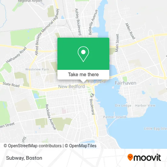
See Subway, New Bedford, on the map
Public Transit to Subway in New Bedford
Wondering how to get to Subway in New Bedford? Moovit helps you find the best way to get to Subway with step-by-step directions from the nearest public transit station.
Moovit provides free maps and live directions to help you navigate through your city. View schedules, routes, timetables, and find out how long does it take to get to Subway in real time.
Looking for the nearest stop or station to Subway? Check out this list of stops closest to your destination: Mill St And Summer St; Purchase St And Maxfield St; SRTA; SRTA Terminal New Bedford; Church Street; New Bedford, MA; Cuttyhunk Ferry Pier.
Bus: 204, 9, PETER PAN, WNB, 206, 208, 210, 202, 299, 201, 203, 205, 211, WARE.Train: FALL RIVER/NEW BEDFORD.Ferry: SEASTREAK, SEASTREAK.
Want to see if there’s another route that gets you there at an earlier time? Moovit helps you find alternative routes or times. Get directions from and directions to Subway easily from the Moovit App or Website.
We make riding to Subway easy, which is why over 1.7 million users, including users in New Bedford, trust Moovit as the best app for public transit. You don’t need to download an individual bus app or train app, Moovit is your all-in-one transit app that helps you find the best bus time or train time available.
For information on prices of bus and train, costs and ride fares to Subway, please check the Moovit app.
Use the app to navigate to popular places including to the airport, hospital, stadium, grocery store, mall, coffee shop, school, college, and university.
Subway Address: 836 Pleasant St street in New Bedford
- Blue Rhino,
- Law Firm at 39 Foster,
- Polaria Garage Door Opener,
- John M Janiak Attorney,
- Auto Insurance Bureau of Masschstts,
- Family Care Clinic,
- Hillman Street and Tower Drive,
- New Bedford Hotel Apartments,
- Purchase Street and Hillman Street,
- Gas Leak Detection Plumbers,
- Vintage Beauty Love,
- Forensic Health Services,
- North End Taxi,
- Jackson Hewitt Tax Service,
- Nbcu,
- WCTK,
- Ameridys,
- New England Aba,
- Seacoast Financial Advisors,
- Koczera Andrew S
Places Near Subway (New Bedford)
- North End, Boston,
- Mgm Music Hall, Boston,
- Isabella Stewart Gardner Museum, Boston,
- Boston Common, Boston,
- Boston Medical Center, Boston,
- Boston Convention & Exhibition Center, Boston,
- Faneuil Hall, Boston,
- Wang Theater, Boston,
- Castle Island, Boston,
- Prudential Center, Boston,
- Massachusetts General Hospital, Boston,
- House Of Blues, Boston,
- Museum Of Science, Boston,
- Leader Bank Pavilion (Leader Bank Pavillion), Boston,
- Quincy Market, Boston,
- Wilbur Theatre, Boston,
- Cheers, Boston,
- Seaport District, Boston,
- Boston Children's Hospital, Boston,
- Td Garden, Boston
How to get to popular places in Boston with public transit
Get around New Bedford by public transit!
Traveling around New Bedford has never been so easy. See step by step directions as you travel to any attraction, street or major public transit station. View bus and train schedules, arrival times, service alerts and detailed routes on a map, so you know exactly how to get to anywhere in New Bedford.
When traveling to any destination around New Bedford use Moovit's Live Directions with Get Off Notifications to know exactly where and how far to walk, how long to wait for your line, and how many stops are left. Moovit will alert you when it's time to get off — no need to constantly re-check whether yours is the next stop.
Wondering how to use public transit in New Bedford or how to pay for public transit in New Bedford? Moovit public transit app can help you navigate your way with public transit easily, and at minimum cost. It includes public transit fees, ticket prices, and costs. Looking for a map of New Bedford public transit lines? Moovit public transit app shows all public transit maps in New Bedford with all Bus, Train, Subway and Ferry routes and stops on an interactive map.
Boston has 4 transit type(s), including: Bus, Train, Subway and Ferry, operated by several transit agencies, including MBTA, Southeastern Regional Transit Authority, MetroWest Regional Transit Authority, Rhode Island Public Transit Authority, WRTA, Lowell Regional Transit Authority, Merrimack Valley Transit, Montachusett Regional Transit Authority, Cape Cod Regional Transit Authority, Brockton Area Transit Authority, Martha's Vineyard Transit Authority, the WAVE - Nantucket Regional Transit Authority, GATRA, Cape Ann Transportation Authority and Massport