Directions to Suffolk University Police Dispatch Center (Boston) with public transportation
The following transit lines have routes that pass near Suffolk University Police Dispatch Center
 Bus: 354, 504, 93, SL5, RED LINE SHUTTLE.
- Train: FITCHBURG, FRAMINGHAM/WORCESTER, GREENBUSH, HAVERHILL, NEWBURYPORT/ROCKPORT.
- Subway: GREEN LINE D, ORANGE LINE, RED LINE, BLUE LINE, GREEN LINE B.
How to get to Suffolk University Police Dispatch Center by bus?
Click on the bus route to see step by step directions with maps, line arrival times and updated time schedules.
From FOUR POINTS BY SHERATON Boston Newton, Newton
33 minFrom Arlington, MA, Arlington
80 minFrom Everett, MA, Everett
49 minFrom JFK Library, Boston
55 minFrom MBTA / Alewife #6, Cambridge
96 minFrom Danehy Park, Cambridge
77 minFrom The Mall At Chestnut Hill, Newton
73 minFrom Melrose, MA, Melrose
68 minFrom Qea, Quincy
107 minFrom Hotel Hilton Boston/Woburn, Boston
49 min
How to get to Suffolk University Police Dispatch Center by train?
Click on the train route to see step by step directions with maps, line arrival times and updated time schedules.
How to get to Suffolk University Police Dispatch Center by subway?
Click on the subway route to see step by step directions with maps, line arrival times and updated time schedules.
Subway stations near Suffolk University Police Dispatch Center in Boston
Bus stops near Suffolk University Police Dispatch Center in Boston
- State - Devonshire St @ State St, 2 min walk,VIEW
- Milk St @ Devonshire St, 3 min walk,VIEW
- Devonshire St @ Water St, 3 min walk,VIEW
- Otis St @ Summer St, 4 min walk,VIEW
- Cambridge St @ Government Ctr Sta, 4 min walk,VIEW
- Chauncy St @ Summer St, 5 min walk,VIEW
- Temple Pl @ Washington St, 5 min walk,VIEW
- Park Street - Tremont St Opp Hamilton Pl, 5 min walk,VIEW
- Park Street - Tremont St @ Winter St, 6 min walk,VIEW
- Tremont St Opp Temple Pl, 6 min walk,VIEW
Bus lines to Suffolk University Police Dispatch Center in Boston
- RED LINE SHUTTLE, Jfk/Umass (Shuttle),VIEW
- 15, Haymarket Via Fields Corner & Nubian,VIEW
- 39, Haymarket Via Forest Hills,VIEW
- 57, Haymarket Via Kenmore,VIEW
- 4, Design Center,VIEW
- 92, Sullivan,VIEW
- 93, Sullivan Via Navy Yard,VIEW
- 7, Otis & Summer - City Point,VIEW
- 501, Downtown via Copley (Express) - Brighton via Copley (Express),VIEW
- 504, Downtown via Copley (Express) - Watertown via Copley and Newton Corner (Express),VIEW
- 505, Downtown (Express) - Waltham (Express),VIEW
- RED LINE SHUTTLE, Harvard - JFK/UMass via Congress Street,VIEW
- RED LINE SHUTTLE, Harvard - Broadway,VIEW
- RED LINE SHUTTLE, Kendall/MIT - JFK/UMass,VIEW
- RED LINE SHUTTLE, JFK/UMass - Kendall/MIT (Shuttle),VIEW
- 116, Wonderland Via Maverick,VIEW
- 354, Burlington (Express) Via Woburn,VIEW
- BLUE LINE SHUTTLE, Orient Heights (Local Shuttle),VIEW
- BLUE LINE SHUTTLE, Government Center (Express Shuttle),VIEW
- BLUE LINE SHUTTLE, Orient Heights (Express Shuttle),VIEW
What are the closest stations to Suffolk University Police Dispatch Center?
The closest stations to Suffolk University Police Dispatch Center are:
- State Street is 58 yards away, 1 min walk.
- State - Devonshire St @ State St is 135 yards away, 2 min walk.
- Government Center is 210 yards away, 3 min walk.
- Milk St @ Devonshire St is 219 yards away, 3 min walk.
- Devonshire St @ Water St is 240 yards away, 3 min walk.
- Otis St @ Summer St is 267 yards away, 4 min walk.
- Cambridge St @ Government Ctr Sta is 296 yards away, 4 min walk.
- Chauncy St @ Summer St is 347 yards away, 5 min walk.
- Temple Pl @ Washington St is 361 yards away, 5 min walk.
- Park Street - Tremont St Opp Hamilton Pl is 379 yards away, 5 min walk.
- Park Street - Tremont St @ Winter St is 402 yards away, 6 min walk.
- Tremont St Opp Temple Pl is 429 yards away, 6 min walk.
- Downtown Crossing is 466 yards away, 6 min walk.
Which bus lines stop near Suffolk University Police Dispatch Center?
These bus lines stop near Suffolk University Police Dispatch Center: 354, 504, 93, SL5.
Which train lines stop near Suffolk University Police Dispatch Center?
These train lines stop near Suffolk University Police Dispatch Center: FITCHBURG, FRAMINGHAM/WORCESTER, GREENBUSH, HAVERHILL, NEWBURYPORT/ROCKPORT.
Which subway lines stop near Suffolk University Police Dispatch Center?
These subway lines stop near Suffolk University Police Dispatch Center: GREEN LINE D, ORANGE LINE, RED LINE.
What’s the nearest subway station to Suffolk University Police Dispatch Center in Boston?
The nearest subway station to Suffolk University Police Dispatch Center in Boston is State Street. It’s a 1 min walk away.
What’s the nearest bus station to Suffolk University Police Dispatch Center in Boston?
The nearest bus station to Suffolk University Police Dispatch Center in Boston is State - Devonshire St @ State St. It’s a 2 min walk away.
What time is the first subway to Suffolk University Police Dispatch Center in Boston?
The GREEN LINE E is the first subway that goes to Suffolk University Police Dispatch Center in Boston. It stops nearby at 5:05 AM.
What time is the last subway to Suffolk University Police Dispatch Center in Boston?
The GREEN LINE E is the last subway that goes to Suffolk University Police Dispatch Center in Boston. It stops nearby at 2:20 AM.
What time is the first bus to Suffolk University Police Dispatch Center in Boston?
The 57 is the first bus that goes to Suffolk University Police Dispatch Center in Boston. It stops nearby at 5:00 AM.
What time is the last bus to Suffolk University Police Dispatch Center in Boston?
The 116 is the last bus that goes to Suffolk University Police Dispatch Center in Boston. It stops nearby at 1:58 AM.
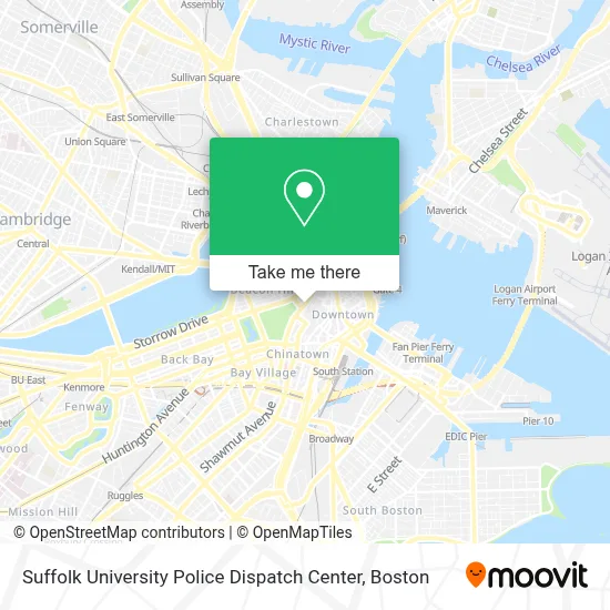
See Suffolk University Police Dispatch Center, Boston, on the map
Public Transit to Suffolk University Police Dispatch Center in Boston
Wondering how to get to Suffolk University Police Dispatch Center in Boston? Moovit helps you find the best way to get to Suffolk University Police Dispatch Center with step-by-step directions from the nearest public transit station.
Moovit provides free maps and live directions to help you navigate through your city. View schedules, routes, timetables, and find out how long does it take to get to Suffolk University Police Dispatch Center in real time.
Looking for the nearest stop or station to Suffolk University Police Dispatch Center? Check out this list of stops closest to your destination: State Street; State - Devonshire St @ State St; Government Center; Milk St @ Devonshire St; Devonshire St @ Water St; Otis St @ Summer St; Cambridge St @ Government Ctr Sta; Chauncy St @ Summer St; Temple Pl @ Washington St; Park Street - Tremont St Opp Hamilton Pl; Park Street - Tremont St @ Winter St; Tremont St Opp Temple Pl; Downtown Crossing.
Bus: 354, 504, 93, SL5, RED LINE SHUTTLE, 15, 39, 57, 4, 92.Train: FITCHBURG, FRAMINGHAM/WORCESTER, GREENBUSH, HAVERHILL, NEWBURYPORT/ROCKPORT.Subway: GREEN LINE D, ORANGE LINE, RED LINE, BLUE LINE, GREEN LINE B, GREEN LINE C, GREEN LINE E.
Want to see if there’s another route that gets you there at an earlier time? Moovit helps you find alternative routes or times. Get directions from and directions to Suffolk University Police Dispatch Center easily from the Moovit App or Website.
We make riding to Suffolk University Police Dispatch Center easy, which is why over 1.7 million users, including users in Boston, trust Moovit as the best app for public transit. You don’t need to download an individual bus app or train app, Moovit is your all-in-one transit app that helps you find the best bus time or train time available.
For information on prices of bus, subway and train, costs and ride fares to Suffolk University Police Dispatch Center, please check the Moovit app.
Use the app to navigate to popular places including to the airport, hospital, stadium, grocery store, mall, coffee shop, school, college, and university.
Suffolk University Police Dispatch Center Address: 120 Tremont St street in Boston
- Suffolk University Law School,
- Sargent Hall Suffolk Law School,
- Orpheum Theatre (Orpheum Theatre Boston),
- Cfjj,
- Granary Burying Ground,
- Park Street Church,
- Beantown Pub,
- Park Street Church (Park Street Beginners),
- Insomnia Cookies,
- Robyn,
- Green Line (Inbound) | Red Line (All Trains),
- The Freedom Trail,
- Outlets at Assembly Row,
- Boston Psychic Center (Park Street Psychic Palm Readings Tarot Card Readi),
- Orpheum Theatre,
- Park Street - to Ashmont / Braintree,
- Franklin Monument,
- Citadel Martial Arts,
- Promote Concert, Music, Magic, Festival, Nightlife Shows,
- 90 Tremont Street
Places Near Suffolk University Police Dispatch Center (Boston)
- Boston Medical Center, Boston,
- House Of Blues, Boston,
- Castle Island, Boston,
- Museum Of Science, Boston,
- Wang Theater, Boston,
- Td Garden, Boston,
- Leader Bank Pavilion (Leader Bank Pavillion), Boston,
- Quincy Market, Boston,
- Faneuil Hall, Boston,
- Seaport District, Boston,
- Boston Children's Hospital, Boston,
- Boston Convention & Exhibition Center, Boston,
- Cheers, Boston,
- Mgm Music Hall, Boston,
- Prudential Center, Boston,
- Boston Common, Boston,
- Isabella Stewart Gardner Museum, Boston,
- North End, Boston,
- Massachusetts General Hospital, Boston,
- Wilbur Theatre, Boston
How to get to popular places in Boston with public transit
Get around Boston by public transit!
Traveling around Boston has never been so easy. See step by step directions as you travel to any attraction, street or major public transit station. View bus and train schedules, arrival times, service alerts and detailed routes on a map, so you know exactly how to get to anywhere in Boston.
When traveling to any destination around Boston use Moovit's Live Directions with Get Off Notifications to know exactly where and how far to walk, how long to wait for your line, and how many stops are left. Moovit will alert you when it's time to get off — no need to constantly re-check whether yours is the next stop.
Wondering how to use public transit in Boston or how to pay for public transit in Boston? Moovit public transit app can help you navigate your way with public transit easily, and at minimum cost. It includes public transit fees, ticket prices, and costs. Looking for a map of Boston public transit lines? Moovit public transit app shows all public transit maps in Boston with all Bus, Train, Subway and Ferry routes and stops on an interactive map.
Boston has 4 transit type(s), including: Bus, Train, Subway and Ferry, operated by several transit agencies, including MBTA, Southeastern Regional Transit Authority, MetroWest Regional Transit Authority, Rhode Island Public Transit Authority, WRTA, Lowell Regional Transit Authority, Merrimack Valley Transit, Montachusett Regional Transit Authority, Cape Cod Regional Transit Authority, Brockton Area Transit Authority, Martha's Vineyard Transit Authority, the WAVE - Nantucket Regional Transit Authority, GATRA, Cape Ann Transportation Authority and Massport