Directions to Sugar Creek Condominiums (Attleboro) with public transportation
The following transit lines have routes that pass near Sugar Creek Condominiums
 Bus: 12.
- Train: PROVIDENCE/STOUGHTON, FOXBORO EVENT SERVICE.
How to get to Sugar Creek Condominiums by bus?
Click on the bus route to see step by step directions with maps, line arrival times and updated time schedules.
How to get to Sugar Creek Condominiums by train?
Click on the train route to see step by step directions with maps, line arrival times and updated time schedules.
Bus stop near Sugar Creek Condominiums in Attleboro
- Maple Terrace, 2 min walk,VIEW
Train station near Sugar Creek Condominiums in Attleboro
- Attleboro, 17 min walk,VIEW
Bus lines to Sugar Creek Condominiums in Attleboro
- 12, Benefit St.,VIEW
What are the closest stations to Sugar Creek Condominiums?
The closest stations to Sugar Creek Condominiums are:
- Maple Terrace is 104 yards away, 2 min walk.
- Attleboro is 1405 yards away, 17 min walk.
Which bus line stops near Sugar Creek Condominiums?
12 (Attleboro T.C.→Benefit St.)
Which train line stops near Sugar Creek Condominiums?
PROVIDENCE/STOUGHTON (#824 | South Station)
What’s the nearest train station to Sugar Creek Condominiums in Attleboro?
The nearest train station to Sugar Creek Condominiums in Attleboro is Attleboro. It’s a 17 min walk away.
What’s the nearest bus station to Sugar Creek Condominiums in Attleboro?
The nearest bus station to Sugar Creek Condominiums in Attleboro is Maple Terrace. It’s a 2 min walk away.
What time is the first train to Sugar Creek Condominiums in Attleboro?
The PROVIDENCE/STOUGHTON is the first train that goes to Sugar Creek Condominiums in Attleboro. It stops nearby at 4:32 AM.
What time is the last train to Sugar Creek Condominiums in Attleboro?
The PROVIDENCE/STOUGHTON is the last train that goes to Sugar Creek Condominiums in Attleboro. It stops nearby at 12:47 AM.
What time is the first bus to Sugar Creek Condominiums in Attleboro?
The 12 is the first bus that goes to Sugar Creek Condominiums in Attleboro. It stops nearby at 6:02 AM.
What time is the last bus to Sugar Creek Condominiums in Attleboro?
The 12 is the last bus that goes to Sugar Creek Condominiums in Attleboro. It stops nearby at 6:50 PM.
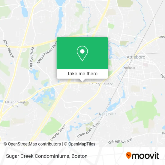
See Sugar Creek Condominiums, Attleboro, on the map
Public Transit to Sugar Creek Condominiums in Attleboro
Wondering how to get to Sugar Creek Condominiums in Attleboro? Moovit helps you find the best way to get to Sugar Creek Condominiums with step-by-step directions from the nearest public transit station.
Moovit provides free maps and live directions to help you navigate through your city. View schedules, routes, timetables, and find out how long does it take to get to Sugar Creek Condominiums in real time.
Looking for the nearest stop or station to Sugar Creek Condominiums? Check out this list of stops closest to your destination: Maple Terrace; Attleboro.
Bus: 12.Train: PROVIDENCE/STOUGHTON, FOXBORO EVENT SERVICE.
Want to see if there’s another route that gets you there at an earlier time? Moovit helps you find alternative routes or times. Get directions from and directions to Sugar Creek Condominiums easily from the Moovit App or Website.
We make riding to Sugar Creek Condominiums easy, which is why over 1.7 million users, including users in Attleboro, trust Moovit as the best app for public transit. You don’t need to download an individual bus app or train app, Moovit is your all-in-one transit app that helps you find the best bus time or train time available.
For information on prices of bus and train, costs and ride fares to Sugar Creek Condominiums, please check the Moovit app.
Use the app to navigate to popular places including to the airport, hospital, stadium, grocery store, mall, coffee shop, school, college, and university.
Sugar Creek Condominiums Address: 101 South Ave street in Attleboro
- Mansfield Insurance Office,
- Government Offices City City Of Attleboro,
- Tracy Dupuis Photography,
- Live Event, Wedding Painting by Vesna,
- Carlon St Auto Locksmith,
- Patriot Riders of New England Chapter Two,
- Pedro’S Citgo,
- Blue Rhino Propane Exchange,
- Studley Elementary School,
- Brennan Middle School,
- Southeastern Massachusetts Arts Collaborative (Smarts),
- Attleboro High School,
- Gary's Lawn Care,
- EvGateway,
- Runaways Running Club,
- Tozier Cassidy Field,
- Attleboro Athletic Hall Of Fame,
- Project Connect Family Center -Attleboro Cfce,
- Attleboro Virtual Academy,
- Bardi's Construction Up on the Roof
Places Near Sugar Creek Condominiums (Attleboro)
- Boston Common, Boston,
- House Of Blues, Boston,
- Museum Of Science, Boston,
- Prudential Center, Boston,
- Wilbur Theatre, Boston,
- Quincy Market, Boston,
- Massachusetts General Hospital, Boston,
- Leader Bank Pavilion (Leader Bank Pavillion), Boston,
- Cheers, Boston,
- Seaport District, Boston,
- Isabella Stewart Gardner Museum, Boston,
- Faneuil Hall, Boston,
- Td Garden, Boston,
- Mgm Music Hall, Boston,
- Boston Children's Hospital, Boston,
- Boston Medical Center, Boston,
- Wang Theater, Boston,
- North End, Boston,
- Boston Convention & Exhibition Center, Boston,
- Castle Island, Boston
How to get to popular places in Boston with public transit
Get around Attleboro by public transit!
Traveling around Attleboro has never been so easy. See step by step directions as you travel to any attraction, street or major public transit station. View bus and train schedules, arrival times, service alerts and detailed routes on a map, so you know exactly how to get to anywhere in Attleboro.
When traveling to any destination around Attleboro use Moovit's Live Directions with Get Off Notifications to know exactly where and how far to walk, how long to wait for your line, and how many stops are left. Moovit will alert you when it's time to get off — no need to constantly re-check whether yours is the next stop.
Wondering how to use public transit in Attleboro or how to pay for public transit in Attleboro? Moovit public transit app can help you navigate your way with public transit easily, and at minimum cost. It includes public transit fees, ticket prices, and costs. Looking for a map of Attleboro public transit lines? Moovit public transit app shows all public transit maps in Attleboro with all Bus, Train, Subway and Ferry routes and stops on an interactive map.
Boston has 4 transit type(s), including: Bus, Train, Subway and Ferry, operated by several transit agencies, including MBTA, Southeastern Regional Transit Authority, MetroWest Regional Transit Authority, Rhode Island Public Transit Authority, WRTA, Lowell Regional Transit Authority, Merrimack Valley Transit, Montachusett Regional Transit Authority, Cape Cod Regional Transit Authority, Brockton Area Transit Authority, Martha's Vineyard Transit Authority, the WAVE - Nantucket Regional Transit Authority, GATRA, Cape Ann Transportation Authority and Massport