Directions to Suite Escape (Boston) with public transportation
The following transit lines have routes that pass near Suite Escape
 Bus: 93, LOWER MYSTIC LINK, 89/93.
- Train: FRAMINGHAM/WORCESTER, LOWELL, NEEDHAM, PROVIDENCE/STOUGHTON.
- Subway: ORANGE LINE.
- Ferry: LOVEJOY - FAN PIER - PIER 10, CHARLESTOWN FERRY.
How to get to Suite Escape by bus?
Click on the bus route to see step by step directions with maps, line arrival times and updated time schedules.
How to get to Suite Escape by train?
Click on the train route to see step by step directions with maps, line arrival times and updated time schedules.
How to get to Suite Escape by subway?
Click on the subway route to see step by step directions with maps, line arrival times and updated time schedules.
Bus stops near Suite Escape in Boston
Ferry stations near Suite Escape in Boston
Subway station near Suite Escape in Boston
- Community Collge, 12 min walk,VIEW
Bus lines to Suite Escape in Boston
What are the closest stations to Suite Escape?
The closest stations to Suite Escape are:
- Bunker Hill St @ N Mead St is 252 yards away, 4 min walk.
- Bunker Hill St @ Clarken Ct is 278 yards away, 4 min walk.
- Bcyf Community Center is 315 yards away, 4 min walk.
- North Station (Lovejoy Wharf) is 437 yards away, 6 min walk.
- Community Collge is 972 yards away, 12 min walk.
- Charlestown Navy Yard is 1059 yards away, 13 min walk.
Which bus lines stop near Suite Escape?
These bus lines stop near Suite Escape: 93, LOWER MYSTIC LINK.
Which train lines stop near Suite Escape?
These train lines stop near Suite Escape: FRAMINGHAM/WORCESTER, LOWELL, NEEDHAM, PROVIDENCE/STOUGHTON.
Which subway line stops near Suite Escape?
ORANGE LINE (Oak Grove)
What’s the nearest subway station to Suite Escape in Boston?
The nearest subway station to Suite Escape in Boston is Community Collge. It’s a 12 min walk away.
What’s the nearest bus station to Suite Escape in Boston?
The nearest bus stations to Suite Escape in Boston are Bunker Hill St @ N Mead St, Bunker Hill St @ Clarken Ct and Bcyf Community Center. The closest one is a 4 min walk away.
What’s the nearest ferry station to Suite Escape in Boston?
The nearest ferry station to Suite Escape in Boston is North Station (Lovejoy Wharf). It’s a 6 min walk away.
What time is the first subway to Suite Escape in Boston?
The ORANGE LINE is the first subway that goes to Suite Escape in Boston. It stops nearby at 5:23 AM.
What time is the last subway to Suite Escape in Boston?
The ORANGE LINE is the last subway that goes to Suite Escape in Boston. It stops nearby at 1:49 AM.
What time is the first bus to Suite Escape in Boston?
The 89/93 is the first bus that goes to Suite Escape in Boston. It stops nearby at 4:48 AM.
What time is the last bus to Suite Escape in Boston?
The 93 is the last bus that goes to Suite Escape in Boston. It stops nearby at 1:46 AM.
What time is the first ferry to Suite Escape in Boston?
The LOVEJOY - FAN PIER - PIER 10 is the first ferry that goes to Suite Escape in Boston. It stops nearby at 6:20 AM.
What time is the last ferry to Suite Escape in Boston?
The CHARLESTOWN FERRY is the last ferry that goes to Suite Escape in Boston. It stops nearby at 8:15 PM.
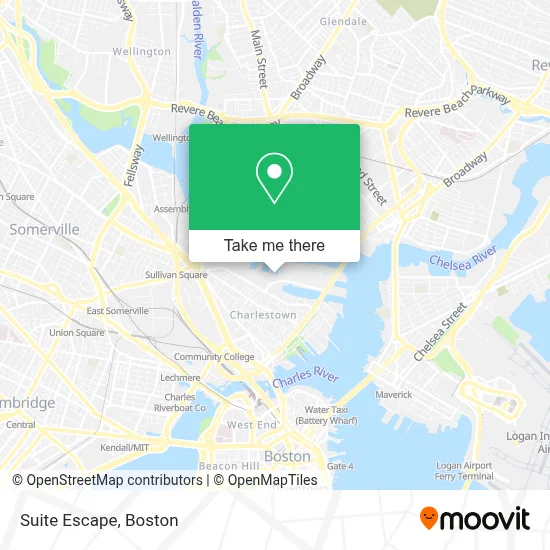
See Suite Escape, Boston, on the map
Public Transit to Suite Escape in Boston
Wondering how to get to Suite Escape in Boston? Moovit helps you find the best way to get to Suite Escape with step-by-step directions from the nearest public transit station.
Moovit provides free maps and live directions to help you navigate through your city. View schedules, routes, timetables, and find out how long does it take to get to Suite Escape in real time.
Looking for the nearest stop or station to Suite Escape? Check out this list of stops closest to your destination: Bunker Hill St @ N Mead St; Bunker Hill St @ Clarken Ct; Bcyf Community Center; North Station (Lovejoy Wharf); Community Collge; Charlestown Navy Yard.
Bus: 93, LOWER MYSTIC LINK, 89/93.Train: FRAMINGHAM/WORCESTER, LOWELL, NEEDHAM, PROVIDENCE/STOUGHTON.Subway: ORANGE LINE.Ferry: LOVEJOY - FAN PIER - PIER 10, CHARLESTOWN FERRY.
Want to see if there’s another route that gets you there at an earlier time? Moovit helps you find alternative routes or times. Get directions from and directions to Suite Escape easily from the Moovit App or Website.
We make riding to Suite Escape easy, which is why over 1.7 million users, including users in Boston, trust Moovit as the best app for public transit. You don’t need to download an individual bus app or train app, Moovit is your all-in-one transit app that helps you find the best bus time or train time available.
For information on prices of bus, subway, train and ferry, costs and ride fares to Suite Escape, please check the Moovit app.
Use the app to navigate to popular places including to the airport, hospital, stadium, grocery store, mall, coffee shop, school, college, and university.
Suite Escape Address: 200 Terminal E street in Boston
- Kkkk,
- Bunker Hill,
- Charlestown High School Track,
- Abm Janitorial Services,
- Charlestown High School,
- The Cooperative Of Charlesnewtown,
- Boston Harbor Cruises/Autoport,
- Hospice of Boston & Greater Brockton,
- Philip Edward Salon (Austria and Helaine Hair Salon),
- Charlestown,
- Carr Funeral Service (Carr Funeral Home Funeral Director),
- Silver Lining On The Hard,
- All American Locksmith,
- Costa Fruit & Produce,
- Concord Ave & Lexington Ave,
- Doherty Park - Charlestown Heights,
- Mass Eye And Ear,
- Top Of Bunker Hill Monument,
- MGH Charlestown Healthcare Center (Simmons, Leigh, MD - MGH Charlestown Health Care),
- Bunker Hill Monument
Places Near Suite Escape (Boston)
- Isabella Stewart Gardner Museum, Boston,
- Cheers, Boston,
- House Of Blues, Boston,
- Boston Convention & Exhibition Center, Boston,
- North End, Boston,
- Castle Island, Boston,
- Seaport District, Boston,
- Wang Theater, Boston,
- Td Garden, Boston,
- Quincy Market, Boston,
- Mgm Music Hall, Boston,
- Boston Medical Center, Boston,
- Faneuil Hall, Boston,
- Wilbur Theatre, Boston,
- Boston Children's Hospital, Boston,
- Museum Of Science, Boston,
- Boston Common, Boston,
- Massachusetts General Hospital, Boston,
- Leader Bank Pavilion (Leader Bank Pavillion), Boston,
- Prudential Center, Boston
How to get to popular places in Boston with public transit
Get around Boston by public transit!
Traveling around Boston has never been so easy. See step by step directions as you travel to any attraction, street or major public transit station. View bus and train schedules, arrival times, service alerts and detailed routes on a map, so you know exactly how to get to anywhere in Boston.
When traveling to any destination around Boston use Moovit's Live Directions with Get Off Notifications to know exactly where and how far to walk, how long to wait for your line, and how many stops are left. Moovit will alert you when it's time to get off — no need to constantly re-check whether yours is the next stop.
Wondering how to use public transit in Boston or how to pay for public transit in Boston? Moovit public transit app can help you navigate your way with public transit easily, and at minimum cost. It includes public transit fees, ticket prices, and costs. Looking for a map of Boston public transit lines? Moovit public transit app shows all public transit maps in Boston with all Bus, Train, Subway and Ferry routes and stops on an interactive map.
Boston has 4 transit type(s), including: Bus, Train, Subway and Ferry, operated by several transit agencies, including MBTA, Southeastern Regional Transit Authority, MetroWest Regional Transit Authority, Rhode Island Public Transit Authority, WRTA, Lowell Regional Transit Authority, Merrimack Valley Transit, Montachusett Regional Transit Authority, Cape Cod Regional Transit Authority, Brockton Area Transit Authority, Martha's Vineyard Transit Authority, the WAVE - Nantucket Regional Transit Authority, GATRA, Cape Ann Transportation Authority and Massport