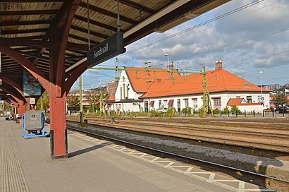
Directions to Sundsvalls Central station (Stockholm) with public transit
The following transit lines have routes that pass near Sundsvalls Central
How to get to Sundsvalls Central station by bus?
Click on the bus route to see step by step directions with maps, line arrival times and updated time schedules.
How to get to Sundsvalls Central station by train?
Click on the train route to see step by step directions with maps, line arrival times and updated time schedules.
Bus stops near Sundsvalls Central in Stockholm
- Sundsvall Tullgatan, 5 min walk,
- Köpmangatan/Esplanaden, 8 min walk,
- Sundsvall Stenstan, 12 min walk,
Train stations near Sundsvalls Central in Stockholm
- Sundsvall Västra, 59 min walk,
- Sundsvall Västra Station, 59 min walk,
- Sundsvall Centralstation, 64 min walk,
- Sundsvall Central, 64 min walk,
Bus lines to Sundsvalls Central station in Stockholm
- 3, Sundsvall Mårtensro - Sundsvall Strömstadsvägen,
- 4, Sundsvall Strömstadsvägen - Bredsand Syntesvägen,
- 120, Sörberge Norra - Njurunda Resecentrum,
- 141, Matfors skola - Sundsvall Centralstation,
- 142, Sundsvall Centralstation - Matfors skola,
- 191, Sundsvall Centralstation - Ånge station,
- 3, Sundsvall Paviljongvägen,
- 4, Sundsvall Strömstadsvägen,
- 120, Sundsvall Stenstan,
- 141, Matfors Skola,
- 142, Matfors Skola,
- 191, Torpshammar Konsum,
- 2, Johannedal Ekebovägen,
- 2, Sundsvall Havsörnsvägen,
- 1, Bergsåker Selångergården - Vi Ögården,
- 5, Sundsbruk Gångvikens skola - Sundsvall Stenstan,
- 28, Holm Anundgård - Kovlands Bussterminal,
- 29, Hudiksvall - Sundsvall Stenstan,
- 30, Liden skola - Sundsvall Centralstation,
- 71, Sundsvall Stenstan - Sundsvall Södra berget,
What are the closest stations to Sundsvalls Central?
The closest stations to Sundsvalls Central are:
- Sundsvall Tullgatan is 318 meters away, 5 min walk.
- Köpmangatan/Esplanaden is 577 meters away, 8 min walk.
- Sundsvall Stenstan is 849 meters away, 12 min walk.
- Sundsvall Västra is 4574 meters away, 59 min walk.
- Sundsvall Västra Station is 4574 meters away, 59 min walk.
- Sundsvall Centralstation is 4927 meters away, 64 min walk.
- Sundsvall Central is 4927 meters away, 64 min walk.
Which bus lines stop near Sundsvalls Central?
These bus lines stop near Sundsvalls Central: 30112, 775.
Which train line stops near Sundsvalls Central?
7507 (Sundsvall Centralstation)
What’s the nearest bus stop to Sundsvalls Central in Stockholm?
The nearest bus stop to Sundsvalls Central in Stockholm is Sundsvall Tullgatan. It’s a 5 min walk away.
What time is the first train to Sundsvalls Central in Stockholm?
The LULEÅ CENTRAL - STOCKHOLM CENTRAL is the first train that goes to Sundsvalls Central in Stockholm. It stops nearby at 3:11 AM.
What time is the last train to Sundsvalls Central in Stockholm?
The LULEÅ CENTRALSTATION - STOCKHOLM CENTRALSTATION is the last train that goes to Sundsvalls Central in Stockholm. It stops nearby at 5:37 AM.
What time is the first bus to Sundsvalls Central in Stockholm?
The 4 is the first bus that goes to Sundsvalls Central in Stockholm. It stops nearby at 5:20 AM.
What time is the last bus to Sundsvalls Central in Stockholm?
The 120 is the last bus that goes to Sundsvalls Central in Stockholm. It stops nearby at 11:18 PM.
See Sundsvalls Central, Stockholm, on the map
Public Transit to Sundsvalls Central in Stockholm
How to get to Sundsvalls Central in Stockholm, Sweden?
It’s easy with Moovit. Type in your street address and Moovit’s route finder will locate the fastest way to get you there! Not sure where to get off on the street? Download the Moovit App to find live directions (including where to get off on Sundsvalls Central), see timetables and get the estimated arrival times for your favorite bus or train lines.
Looking for the nearest stop or station to Sundsvalls Central? Check out this list of closest stops available to your destination: Sundsvall Tullgatan; Köpmangatan/Esplanaden; Sundsvall Stenstan; Sundsvall Västra; Sundsvall Västra Station; Sundsvall Centralstation; Sundsvall Central.
Bus: 30112, 775, 3, 4, 120, 141, 142.Train: 7507, 7401, 7402, 7405, 7406, 7407, 7401, 7402, 7405, 7406, 7407, Y-BUSS, Y-BUSS, 8361, 8362, 8368, DUVED STATION - STOCKHOLM CENTRALSTATION, LULEÅ CENTRALSTATION - STOCKHOLM CENTRALSTATION, NARVIK STATION - STOCKHOLM CENTRALSTATION, STOCKHOLM CENTRALSTATION - DUVED STATION, STOCKHOLM CENTRALSTATION - LULEÅ CENTRALSTATION, DUVED STATION - STOCKHOLM CENTRAL, LULEÅ CENTRAL - STOCKHOLM CENTRAL, NARVIK STATION - STOCKHOLM CENTRAL, STOCKHOLM CENTRAL - SUNDSVALL CENTRAL, STOCKHOLM CENTRAL - UMEÅ CENTRAL.
Download the Moovit App to see the current schedule and routes available for Stockholm. No need to install a special bus app to check the bus time or a train app to get train time. Moovit is the only all-in-one transit app that helps you get where you need to go.
We make riding on public transit to Sundsvalls Central easy, which is why over 1.5 million users, including users in Stockholm trust Moovit as the best app for public transit.
Use the app to navigate to popular places including to the airport, hospital, stadium, grocery store, mall, coffee shop, school, college, and university.
Location: Stockholm
Streets near Sundsvalls Central, Stockholm
Get around Stockholm by public transit!
Traveling around Stockholm has never been so easy. See step by step directions as you travel to any attraction, street or major public transit station. View bus and train schedules, arrival times, service alerts and detailed routes on a map, so you know exactly how to get to anywhere in Stockholm.
When traveling to any destination around Stockholm use Moovit's Live Directions with Get Off Notifications to know exactly where and how far to walk, how long to wait for your line, and how many stops are left. Moovit will alert you when it's time to get off — no need to constantly re-check whether yours is the next stop.
Wondering how to use public transit in Stockholm or how to pay for public transit in Stockholm? Moovit public transit app can help you navigate your way with public transit easily, and at minimum cost. It includes public transit fees, ticket prices, and costs. Looking for a map of Stockholm public transit lines? Moovit public transit app shows all public transit maps in Stockholm with all Bus, Train, Metro, Light Rail, Ferry and Cable Car routes and stops on an interactive map.
Stockholm has 6 transit type(s), including: Bus, Train, Metro, Light Rail, Ferry and Cable Car, operated by several transit agencies, including SL Rail, Flygbussarna, Arlanda Express, TJF Smalspåret, Region Gotland, Länstrafiken Västerbotten, Värmlandstrafik stadstrafik, Öresundståg, Hallandstrafiken, Destination Gotland, Ressels Rederi, Vy Bus4You, VR Snabbtåg, Länstrafiken Kronoberg and Ventrafiken