Directions to Sunny's Smoke Shop (Gloucester) with public transportation
The following transit lines have routes that pass near Sunny's Smoke Shop
How to get to Sunny's Smoke Shop by bus?
Click on the bus route to see step by step directions with maps, line arrival times and updated time schedules.
How to get to Sunny's Smoke Shop by train?
Click on the train route to see step by step directions with maps, line arrival times and updated time schedules.
Bus stops near Sunny's Smoke Shop in Gloucester
Train station near Sunny's Smoke Shop in Gloucester
- Gloucester, 15 min walk,VIEW
Bus lines to Sunny's Smoke Shop in Gloucester
- GLOUCESTER - WEST GLOUCESTER - ESSEX, Martin St & Western Ave,VIEW
- GLOUCESTER CROSSING/BLACKBURN EXPRESS, Rose Baker Senior Center,VIEW
- GLOUCESTER CROSSING/BUSINESS EXPRESS, Senior Center - Dunkin' Donuts,VIEW
- NEWBURYPORT LINE SHUTTLE, Rockport - Oak Grove (Express),VIEW
- NEWBURYPORT LINE SHUTTLE, Rockport - Oak Grove (Limited),VIEW
- ROCKPORT LINE SHUTTLE, Rockport - West Gloucester,VIEW
- ROCKPORT LINE SHUTTLE, Manchester - Gloucester,VIEW
- ROCKPORT LINE SHUTTLE, Beverly - Rockport (Local),VIEW
- ROCKPORT LINE SHUTTLE, Rockport - Salem (Express),VIEW
- ROCKPORT LINE SHUTTLE, Beverly - Rockport (Express),VIEW
- ROCKPORT LINE SHUTTLE, Rockport - Salem (Local),VIEW
- BEVERLY COMMUTER, Beverly Commuter,VIEW
- CITY OF BEVERLY SHUTTLE, Gloucester-Magnolia,VIEW
- GLOUCESTER - ROCKPORT VIA THATCHER ROAD, Gloucester-Rockport via Thatcher Rd,VIEW
- LANESVILLE, Gloucester-Rockport Via Lanesville,VIEW
- SATURDAY MALL SHUTTLE, Danvers and Peabody Malls,VIEW
- MAGNOLIA, Lexington Ave & Flume Rd,VIEW
- GLOUCESTER - ROCKPORT VIA EASTERN AVE, Rockport Market,VIEW
What are the closest stations to Sunny's Smoke Shop?
The closest stations to Sunny's Smoke Shop are:
- Western Ave & Centennial Ave is 668 yards away, 8 min walk.
- Mcpherson Park is 670 yards away, 8 min walk.
- Commuter Rail Station - Gloucester is 694 yards away, 9 min walk.
- Gloucester High School is 762 yards away, 10 min walk.
- Main St & Pleasant St is 887 yards away, 11 min walk.
- Gloucester is 1208 yards away, 15 min walk.
Which bus lines stop near Sunny's Smoke Shop?
These bus lines stop near Sunny's Smoke Shop: BEVERLY COMMUTER, CITY OF BEVERLY SHUTTLE.
Which train line stops near Sunny's Smoke Shop?
NEWBURYPORT/ROCKPORT (#21 | Rockport)
What’s the nearest train station to Sunny's Smoke Shop in Gloucester?
The nearest train station to Sunny's Smoke Shop in Gloucester is Gloucester. It’s a 15 min walk away.
What’s the nearest bus station to Sunny's Smoke Shop in Gloucester?
The nearest bus stations to Sunny's Smoke Shop in Gloucester are Western Ave & Centennial Ave and Mcpherson Park. The closest one is a 8 min walk away.
What time is the first train to Sunny's Smoke Shop in Gloucester?
The NEWBURYPORT/ROCKPORT is the first train that goes to Sunny's Smoke Shop in Gloucester. It stops nearby at 5:14 AM.
What time is the last train to Sunny's Smoke Shop in Gloucester?
The NEWBURYPORT/ROCKPORT is the last train that goes to Sunny's Smoke Shop in Gloucester. It stops nearby at 12:47 AM.
What time is the first bus to Sunny's Smoke Shop in Gloucester?
The BEVERLY COMMUTER is the first bus that goes to Sunny's Smoke Shop in Gloucester. It stops nearby at 5:45 AM.
What time is the last bus to Sunny's Smoke Shop in Gloucester?
The GLOUCESTER CROSSING/BUSINESS EXPRESS is the last bus that goes to Sunny's Smoke Shop in Gloucester. It stops nearby at 6:44 PM.
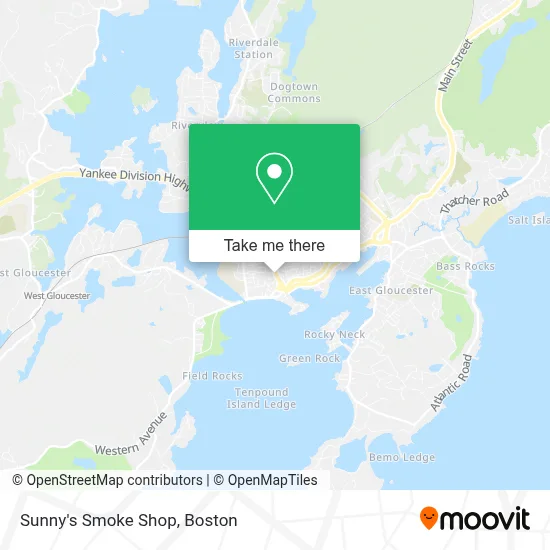
See Sunny's Smoke Shop, Gloucester, on the map
Public Transit to Sunny's Smoke Shop in Gloucester
Wondering how to get to Sunny's Smoke Shop in Gloucester? Moovit helps you find the best way to get to Sunny's Smoke Shop with step-by-step directions from the nearest public transit station.
Moovit provides free maps and live directions to help you navigate through your city. View schedules, routes, timetables, and find out how long does it take to get to Sunny's Smoke Shop in real time.
Looking for the nearest stop or station to Sunny's Smoke Shop? Check out this list of stops closest to your destination: Western Ave & Centennial Ave; Mcpherson Park; Commuter Rail Station - Gloucester; Gloucester High School; Main St & Pleasant St; Gloucester.
Bus: BEVERLY COMMUTER, CITY OF BEVERLY SHUTTLE, GLOUCESTER - WEST GLOUCESTER - ESSEX, GLOUCESTER CROSSING/BLACKBURN EXPRESS, GLOUCESTER CROSSING/BUSINESS EXPRESS, NEWBURYPORT LINE SHUTTLE, NEWBURYPORT LINE SHUTTLE, ROCKPORT LINE SHUTTLE, ROCKPORT LINE SHUTTLE, ROCKPORT LINE SHUTTLE, MAGNOLIA, GLOUCESTER - ROCKPORT VIA EASTERN AVE.Train: NEWBURYPORT/ROCKPORT.
Want to see if there’s another route that gets you there at an earlier time? Moovit helps you find alternative routes or times. Get directions from and directions to Sunny's Smoke Shop easily from the Moovit App or Website.
We make riding to Sunny's Smoke Shop easy, which is why over 1.7 million users, including users in Gloucester, trust Moovit as the best app for public transit. You don’t need to download an individual bus app or train app, Moovit is your all-in-one transit app that helps you find the best bus time or train time available.
For information on prices of train and bus, costs and ride fares to Sunny's Smoke Shop, please check the Moovit app.
Use the app to navigate to popular places including to the airport, hospital, stadium, grocery store, mall, coffee shop, school, college, and university.
Sunny's Smoke Shop Address: 42 Washington St street in Gloucester
- Rhea Pizzeria,
- US Bank,
- I Andiamo Italian Eatery & Pizza,
- Good for the Sole Walking,
- Sylvania Lighting Services-Ma,
- Joe Popcorn's Slush,
- USPS Collection Box - Blue Box,
- Tidal Consulting,
- Cape Ann Technologies, Inc.,
- Good Shepherd Pet Care,
- Oak To Ember,
- Lucido's Barber Shop,
- Lifebridge Salem,
- smart Family Trusts,
- The Cape Ann Chamber of Commerce,
- The Sullivan Firm,
- I&J Cleaning Services,
- Weinstein-Zanger Matthew Phys,
- Angels Francine's Com,
- Amvets Post 32 Gloucester, Ma
Places Near Sunny's Smoke Shop (Gloucester)
- Isabella Stewart Gardner Museum, Boston,
- Cheers, Boston,
- House Of Blues, Boston,
- Boston Convention & Exhibition Center, Boston,
- North End, Boston,
- Castle Island, Boston,
- Seaport District, Boston,
- Wang Theater, Boston,
- Td Garden, Boston,
- Quincy Market, Boston,
- Mgm Music Hall, Boston,
- Boston Medical Center, Boston,
- Faneuil Hall, Boston,
- Wilbur Theatre, Boston,
- Boston Children's Hospital, Boston,
- Museum Of Science, Boston,
- Boston Common, Boston,
- Massachusetts General Hospital, Boston,
- Leader Bank Pavilion (Leader Bank Pavillion), Boston,
- Prudential Center, Boston
How to get to popular places in Boston with public transit
Get around Gloucester by public transit!
Traveling around Gloucester has never been so easy. See step by step directions as you travel to any attraction, street or major public transit station. View bus and train schedules, arrival times, service alerts and detailed routes on a map, so you know exactly how to get to anywhere in Gloucester.
When traveling to any destination around Gloucester use Moovit's Live Directions with Get Off Notifications to know exactly where and how far to walk, how long to wait for your line, and how many stops are left. Moovit will alert you when it's time to get off — no need to constantly re-check whether yours is the next stop.
Wondering how to use public transit in Gloucester or how to pay for public transit in Gloucester? Moovit public transit app can help you navigate your way with public transit easily, and at minimum cost. It includes public transit fees, ticket prices, and costs. Looking for a map of Gloucester public transit lines? Moovit public transit app shows all public transit maps in Gloucester with all Bus, Train, Subway and Ferry routes and stops on an interactive map.
Boston has 4 transit type(s), including: Bus, Train, Subway and Ferry, operated by several transit agencies, including MBTA, Southeastern Regional Transit Authority, MetroWest Regional Transit Authority, Rhode Island Public Transit Authority, WRTA, Lowell Regional Transit Authority, Merrimack Valley Transit, Montachusett Regional Transit Authority, Cape Cod Regional Transit Authority, Brockton Area Transit Authority, Martha's Vineyard Transit Authority, the WAVE - Nantucket Regional Transit Authority, GATRA, Cape Ann Transportation Authority and Massport