Directions to Sunoco Gas Station (Boston) with public transportation
The following transit lines have routes that pass near Sunoco Gas Station
 Bus: G1.
How to get to Sunoco Gas Station by bus?
Click on the bus route to see step by step directions with maps, line arrival times and updated time schedules.
From Dcu Center, Worcester
112 minFrom South High Community School, Worcester
206 minFrom Walmart Supercenter, Worcester
168 minFrom Foxwoods, Worcester
139 minFrom Registry Of Motor Vehicles (Rmv) Branch Office, Worcester
113 minFrom Palladium, Worcester
115 minFrom Worcester, MA, Worcester
109 minFrom Polar Park, Worcester
111 min
Bus stop near Sunoco Gas Station in Boston
- Allen / Harbour, 3 min walk,VIEW
Bus lines to Sunoco Gas Station in Boston
- G1, Union Station,VIEW
What are the closest stations to Sunoco Gas Station?
The closest stations to Sunoco Gas Station are:
- Allen / Harbour is 173 yards away, 3 min walk.
Which bus line stops near Sunoco Gas Station?
G1 (Five Town Plaza Via Bicentennial)
What’s the nearest bus station to Sunoco Gas Station in Boston?
The nearest bus station to Sunoco Gas Station in Boston is Allen / Harbour. It’s a 3 min walk away.
What time is the first bus to Sunoco Gas Station in Boston?
The G1 is the first bus that goes to Sunoco Gas Station in Boston. It stops nearby at 5:35 AM.
What time is the last bus to Sunoco Gas Station in Boston?
The G1 is the last bus that goes to Sunoco Gas Station in Boston. It stops nearby at 9:42 PM.
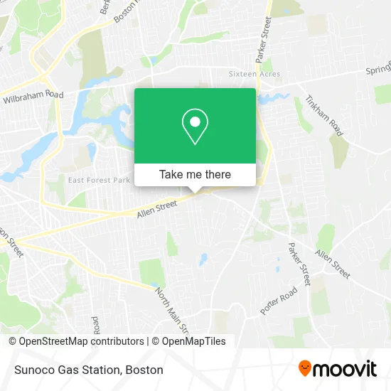
See Sunoco Gas Station, Boston, on the map
Public Transit to Sunoco Gas Station in Boston
Wondering how to get to Sunoco Gas Station in Boston? Moovit helps you find the best way to get to Sunoco Gas Station with step-by-step directions from the nearest public transit station.
Moovit provides free maps and live directions to help you navigate through your city. View schedules, routes, timetables, and find out how long does it take to get to Sunoco Gas Station in real time.
Looking for the nearest stop or station to Sunoco Gas Station? Check out this list of stops closest to your destination: Allen / Harbour.
Bus: G1.
Want to see if there’s another route that gets you there at an earlier time? Moovit helps you find alternative routes or times. Get directions from and directions to Sunoco Gas Station easily from the Moovit App or Website.
We make riding to Sunoco Gas Station easy, which is why over 1.7 million users, including users in Boston, trust Moovit as the best app for public transit. You don’t need to download an individual bus app or train app, Moovit is your all-in-one transit app that helps you find the best bus time or train time available.
For information on prices of bus, costs and ride fares to Sunoco Gas Station, please check the Moovit app.
Use the app to navigate to popular places including to the airport, hospital, stadium, grocery store, mall, coffee shop, school, college, and university.
Sunoco Gas Station Address: 1390 Allen St street in Boston
- Rockitcoin,
- Kaylas Hair and Beauty,
- Comb Company,
- Berkshire Bank,
- Newman Locksmith & Key,
- City of Springfield K 5,
- Tower Property Management,
- Arthur T. Talmadge School,
- Christ Presbyterian Church,
- Bicentennial Plaza,
- Talmadge Elementary School,
- Greater Springfield Midwifery,
- Anne&Joseph Mem. Cons. Area,
- Skin by Natalie,
- Anne Pratt PHD, Licensed Psychologist,
- Dr. Brackman's Antireflux Page,
- Bicentennial Hwy. (1),
- Jake's Small Engine Repair,
- The Lawn Sprinkler Company,
- Bob Schmidt Lawn Care
Places Near Sunoco Gas Station (Boston)
- Faneuil Hall, Boston,
- Prudential Center, Boston,
- Quincy Market, Boston,
- Seaport District, Boston,
- Isabella Stewart Gardner Museum, Boston,
- Castle Island, Boston,
- Mgm Music Hall, Boston,
- Boston Common, Boston,
- Massachusetts General Hospital, Boston,
- Wang Theater, Boston,
- Leader Bank Pavilion (Leader Bank Pavillion), Boston,
- Boston Convention & Exhibition Center, Boston,
- Cheers, Boston,
- Boston Medical Center, Boston,
- Td Garden, Boston,
- Wilbur Theatre, Boston,
- North End, Boston,
- Boston Children's Hospital, Boston,
- Museum Of Science, Boston,
- House Of Blues, Boston
How to get to popular places in Boston with public transit
Get around Boston by public transit!
Traveling around Boston has never been so easy. See step by step directions as you travel to any attraction, street or major public transit station. View bus and train schedules, arrival times, service alerts and detailed routes on a map, so you know exactly how to get to anywhere in Boston.
When traveling to any destination around Boston use Moovit's Live Directions with Get Off Notifications to know exactly where and how far to walk, how long to wait for your line, and how many stops are left. Moovit will alert you when it's time to get off — no need to constantly re-check whether yours is the next stop.
Wondering how to use public transit in Boston or how to pay for public transit in Boston? Moovit public transit app can help you navigate your way with public transit easily, and at minimum cost. It includes public transit fees, ticket prices, and costs. Looking for a map of Boston public transit lines? Moovit public transit app shows all public transit maps in Boston with all Bus, Train, Subway and Ferry routes and stops on an interactive map.
Boston has 4 transit type(s), including: Bus, Train, Subway and Ferry, operated by several transit agencies, including MBTA, Southeastern Regional Transit Authority, MetroWest Regional Transit Authority, Rhode Island Public Transit Authority, WRTA, Lowell Regional Transit Authority, Merrimack Valley Transit, Montachusett Regional Transit Authority, Cape Cod Regional Transit Authority, Brockton Area Transit Authority, Martha's Vineyard Transit Authority, the WAVE - Nantucket Regional Transit Authority, GATRA, Cape Ann Transportation Authority and Massport