Directions to Super Cargo (Boston) with public transportation
The following transit lines have routes that pass near Super Cargo
 Bus: 104, 121, 66, SL3, 120.
- Train: NEWBURYPORT/ROCKPORT.
- Subway: BLUE LINE.
- Ferry: EAST BOSTON FERRY, EAST.
How to get to Super Cargo by bus?
Click on the bus route to see step by step directions with maps, line arrival times and updated time schedules.
From Spaulding Rehabilitation Center, Boston
90 minFrom Porter Square, Cambridge
100 minFrom Copley MBTA Station, Boston
46 minFrom Sonia, Boston
92 minFrom Hampton Inn & Suites Boston Crosstown Ctr, Boston
58 minFrom New Balance, Boston
90 minFrom Cyclorama, Boston
53 minFrom Jamaica Pond, Boston
81 minFrom Warren St, Boston
75 minFrom South End, Boston
41 min
How to get to Super Cargo by train?
Click on the train route to see step by step directions with maps, line arrival times and updated time schedules.
How to get to Super Cargo by subway?
Click on the subway route to see step by step directions with maps, line arrival times and updated time schedules.
From Spaulding Rehabilitation Center, Boston
79 minFrom Porter Square, Cambridge
41 minFrom Copley MBTA Station, Boston
30 minFrom Sonia, Boston
75 minFrom Hampton Inn & Suites Boston Crosstown Ctr, Boston
46 minFrom South End, Boston
27 minFrom New Balance, Boston
79 minFrom Cyclorama, Boston
34 minFrom Jamaica Pond, Boston
51 minFrom Warren St, Boston
63 min
Bus stops near Super Cargo in Boston
Subway station near Super Cargo in Boston
- Maverick, 4 min walk,VIEW
Ferry station near Super Cargo in Boston
- Lewis Mall Wharf, 9 min walk,VIEW
Bus lines to Super Cargo in Boston
What are the closest stations to Super Cargo?
The closest stations to Super Cargo are:
- Bennington St @ Prescott St is 191 yards away, 3 min walk.
- Lexington St @ Shelby St is 258 yards away, 4 min walk.
- Maverick is 271 yards away, 4 min walk.
- Bennington St @ Chelsea St is 326 yards away, 5 min walk.
- Lewis Mall Wharf is 674 yards away, 9 min walk.
Which bus lines stop near Super Cargo?
These bus lines stop near Super Cargo: 104, 121, 66, SL3.
Which train line stops near Super Cargo?
NEWBURYPORT/ROCKPORT (#27 | Rockport)
Which subway line stops near Super Cargo?
BLUE LINE (Wonderland)
What’s the nearest subway station to Super Cargo in Boston?
The nearest subway station to Super Cargo in Boston is Maverick. It’s a 4 min walk away.
What’s the nearest bus station to Super Cargo in Boston?
The nearest bus station to Super Cargo in Boston is Bennington St @ Prescott St. It’s a 3 min walk away.
What’s the nearest ferry station to Super Cargo in Boston?
The nearest ferry station to Super Cargo in Boston is Lewis Mall Wharf. It’s a 9 min walk away.
What time is the first subway to Super Cargo in Boston?
The BLUE LINE is the first subway that goes to Super Cargo in Boston. It stops nearby at 5:08 AM.
What time is the last subway to Super Cargo in Boston?
The BLUE LINE is the last subway that goes to Super Cargo in Boston. It stops nearby at 2:03 AM.
What time is the first bus to Super Cargo in Boston?
The 120 is the first bus that goes to Super Cargo in Boston. It stops nearby at 5:32 AM.
What time is the last bus to Super Cargo in Boston?
The 120 is the last bus that goes to Super Cargo in Boston. It stops nearby at 1:24 AM.
What time is the first ferry to Super Cargo in Boston?
The EAST is the first ferry that goes to Super Cargo in Boston. It stops nearby at 5:55 AM.
What time is the last ferry to Super Cargo in Boston?
The EAST BOSTON FERRY is the last ferry that goes to Super Cargo in Boston. It stops nearby at 7:55 PM.
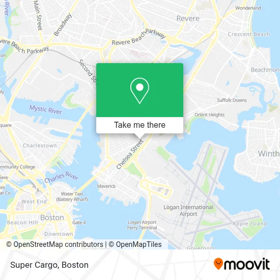
See Super Cargo, Boston, on the map
Public Transit to Super Cargo in Boston
Wondering how to get to Super Cargo in Boston? Moovit helps you find the best way to get to Super Cargo with step-by-step directions from the nearest public transit station.
Moovit provides free maps and live directions to help you navigate through your city. View schedules, routes, timetables, and find out how long does it take to get to Super Cargo in real time.
Looking for the nearest stop or station to Super Cargo? Check out this list of stops closest to your destination: Bennington St @ Prescott St; Lexington St @ Shelby St; Maverick; Bennington St @ Chelsea St; Lewis Mall Wharf.
Bus: 104, 121, 66, SL3, 120, 112.Train: NEWBURYPORT/ROCKPORT.Subway: BLUE LINE.Ferry: EAST BOSTON FERRY, EAST.
Want to see if there’s another route that gets you there at an earlier time? Moovit helps you find alternative routes or times. Get directions from and directions to Super Cargo easily from the Moovit App or Website.
We make riding to Super Cargo easy, which is why over 1.7 million users, including users in Boston, trust Moovit as the best app for public transit. You don’t need to download an individual bus app or train app, Moovit is your all-in-one transit app that helps you find the best bus time or train time available.
For information on prices of subway, bus and train, costs and ride fares to Super Cargo, please check the Moovit app.
Use the app to navigate to popular places including to the airport, hospital, stadium, grocery store, mall, coffee shop, school, college, and university.
Super Cargo Address: 376 Chelsea St street in Boston
- El Palmar Restaurant (El Palma Restaurant),
- Jeveli's (Jeveli's Restaurant East Boston, MA),
- Tienda Taqueria (Tignda and Taqueria Guadalajara),
- Boston Public Library - East Boston Branch,
- Superior Luggage (Luggage Repair),
- Shelby St. hq,
- Eagle Hill,
- Oliveira's East Boston,
- Boston Latin DJS,
- Joe Scoolabasta the Seagull Inn,
- Economy Lot Logan Airport,
- Rino's Place,
- Boston Logan Intl Airport,
- Wood Island Station,
- Sacred Heart Parish (Sacred Heart Italian Church),
- Westfarms Mall,
- Entrance I-90 E,
- East Boston,
- Logan Airport North Gate,
- Logan Express
Places Near Super Cargo (Boston)
- Boston Medical Center, Boston,
- Prudential Center, Boston,
- Boston Convention & Exhibition Center, Boston,
- Wilbur Theatre, Boston,
- Seaport District, Boston,
- Leader Bank Pavilion (Leader Bank Pavillion), Boston,
- Cheers, Boston,
- Boston Common, Boston,
- House Of Blues, Boston,
- Boston Children's Hospital, Boston,
- Massachusetts General Hospital, Boston,
- Mgm Music Hall, Boston,
- Museum Of Science, Boston,
- Wang Theater, Boston,
- Castle Island, Boston,
- Td Garden, Boston,
- Quincy Market, Boston,
- Faneuil Hall, Boston,
- Isabella Stewart Gardner Museum, Boston,
- North End, Boston
How to get to popular places in Boston with public transit
Get around Boston by public transit!
Traveling around Boston has never been so easy. See step by step directions as you travel to any attraction, street or major public transit station. View bus and train schedules, arrival times, service alerts and detailed routes on a map, so you know exactly how to get to anywhere in Boston.
When traveling to any destination around Boston use Moovit's Live Directions with Get Off Notifications to know exactly where and how far to walk, how long to wait for your line, and how many stops are left. Moovit will alert you when it's time to get off — no need to constantly re-check whether yours is the next stop.
Wondering how to use public transit in Boston or how to pay for public transit in Boston? Moovit public transit app can help you navigate your way with public transit easily, and at minimum cost. It includes public transit fees, ticket prices, and costs. Looking for a map of Boston public transit lines? Moovit public transit app shows all public transit maps in Boston with all Bus, Train, Subway and Ferry routes and stops on an interactive map.
Boston has 4 transit type(s), including: Bus, Train, Subway and Ferry, operated by several transit agencies, including MBTA, Southeastern Regional Transit Authority, MetroWest Regional Transit Authority, Rhode Island Public Transit Authority, WRTA, Lowell Regional Transit Authority, Merrimack Valley Transit, Montachusett Regional Transit Authority, Cape Cod Regional Transit Authority, Brockton Area Transit Authority, Martha's Vineyard Transit Authority, the WAVE - Nantucket Regional Transit Authority, GATRA, Cape Ann Transportation Authority and Massport