How to get to Super Stop & Shop by bus?
Click on the bus route to see step by step directions with maps, line arrival times and updated time schedules.
From Wollaston Beach, Quincy
99 minFrom Staybridge Suites Boston-Quincy, Quincy
82 minFrom Granite Links Golf Club at Quarry Hills, Quincy
104 minFrom crown Colony Shuttle, Quincy
73 minFrom Hingham, MA, Hingham
92 minFrom Milton, MA, Milton
98 minFrom Randolph, MA, Randolph
58 minFrom Milton Academy, Milton
93 minFrom Beth Israel Deaconess Hospital-Milton, Milton
86 min
How to get to Super Stop & Shop by train?
Click on the train route to see step by step directions with maps, line arrival times and updated time schedules.
How to get to Super Stop & Shop by subway?
Click on the subway route to see step by step directions with maps, line arrival times and updated time schedules.
Train stations near Super Stop & Shop in Braintree Town
Subway station near Super Stop & Shop in Braintree Town
- Braintree, 29 min walk,VIEW
What are the closest stations to Super Stop & Shop?
The closest stations to Super Stop & Shop are:
- Braintree is 2248 yards away, 27 min walk.
- Weymouth Landing/East Braintree is 4847 yards away, 58 min walk.
Which bus lines stop near Super Stop & Shop?
These bus lines stop near Super Stop & Shop: 230, 236.
Which train line stops near Super Stop & Shop?
FALL RIVER/NEW BEDFORD (#2016 | South Station)
Which subway line stops near Super Stop & Shop?
RED LINE (Ashmont/Braintree)
What’s the nearest subway station to Super Stop & Shop in Braintree Town?
The nearest subway station to Super Stop & Shop in Braintree Town is Braintree. It’s a 29 min walk away.
What’s the nearest train station to Super Stop & Shop in Braintree Town?
The nearest train station to Super Stop & Shop in Braintree Town is Braintree. It’s a 27 min walk away.
What time is the first subway to Super Stop & Shop in Braintree Town?
The RED LINE is the first subway that goes to Super Stop & Shop in Braintree Town. It stops nearby at 5:09 AM.
What time is the last subway to Super Stop & Shop in Braintree Town?
The RED LINE is the last subway that goes to Super Stop & Shop in Braintree Town. It stops nearby at 2:00 AM.
What time is the first train to Super Stop & Shop in Braintree Town?
The FALL RIVER/NEW BEDFORD is the first train that goes to Super Stop & Shop in Braintree Town. It stops nearby at 5:27 AM.
What time is the last train to Super Stop & Shop in Braintree Town?
The KINGSTON is the last train that goes to Super Stop & Shop in Braintree Town. It stops nearby at 12:25 AM.
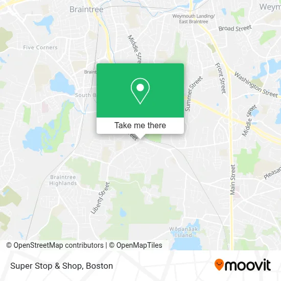
See Super Stop & Shop, Braintree Town, on the map
Public Transit to Super Stop & Shop in Braintree Town
Wondering how to get to Super Stop & Shop in Braintree Town? Moovit helps you find the best way to get to Super Stop & Shop with step-by-step directions from the nearest public transit station.
Moovit provides free maps and live directions to help you navigate through your city. View schedules, routes, timetables, and find out how long does it take to get to Super Stop & Shop in real time.
Looking for the nearest stop or station to Super Stop & Shop? Check out this list of stops closest to your destination: Braintree; Weymouth Landing/East Braintree.
Bus: 230, 236.Train: FALL RIVER/NEW BEDFORD, CAPEFLYER, KINGSTON, GREENBUSH.Subway: RED LINE.
Want to see if there’s another route that gets you there at an earlier time? Moovit helps you find alternative routes or times. Get directions from and directions to Super Stop & Shop easily from the Moovit App or Website.
We make riding to Super Stop & Shop easy, which is why over 1.7 million users, including users in Braintree Town, trust Moovit as the best app for public transit. You don’t need to download an individual bus app or train app, Moovit is your all-in-one transit app that helps you find the best bus time or train time available.
For information on prices of bus, subway and train, costs and ride fares to Super Stop & Shop, please check the Moovit app.
Use the app to navigate to popular places including to the airport, hospital, stadium, grocery store, mall, coffee shop, school, college, and university.
Super Stop & Shop Address: 316 Grove Street street in Braintree Town
- Crunch Fitness (Crunch Gym),
- JBS Holistic Nutrition,
- Massachusetts State Lottery Headquarters,
- VCA South Shore (Weymouth) Animal Hospital,
- Melville Candy Company (Melville Old Time Candy & PDTS),
- ATM,
- Dance with Energy at the Weymouth Club ,
- Horizon Plaza,
- Chateau,
- Personal Computer Resources,
- The Chateau,
- Boston Towing,
- Marshfield BP Towing,
- 1 2 3 Tow Service,
- Repairable Car Company,
- Cheap Towing Slim Jim,
- Cindy S Towing,
- Roadone,
- A Towing,
- Emergency Towing
Places Near Super Stop & Shop (Braintree Town)
- Quincy Market, Boston,
- Boston Convention & Exhibition Center, Boston,
- Wilbur Theatre, Boston,
- Cheers, Boston,
- Leader Bank Pavilion (Leader Bank Pavillion), Boston,
- Boston Children's Hospital, Boston,
- Museum Of Science, Boston,
- Boston Common, Boston,
- North End, Boston,
- Prudential Center, Boston,
- Td Garden, Boston,
- Boston Medical Center, Boston,
- Isabella Stewart Gardner Museum, Boston,
- Castle Island, Boston,
- House Of Blues, Boston,
- Faneuil Hall, Boston,
- Seaport District, Boston,
- Wang Theater, Boston,
- Mgm Music Hall, Boston,
- Massachusetts General Hospital, Boston
How to get to popular places in Boston with public transit
Get around Braintree Town by public transit!
Traveling around Braintree Town has never been so easy. See step by step directions as you travel to any attraction, street or major public transit station. View bus and train schedules, arrival times, service alerts and detailed routes on a map, so you know exactly how to get to anywhere in Braintree Town.
When traveling to any destination around Braintree Town use Moovit's Live Directions with Get Off Notifications to know exactly where and how far to walk, how long to wait for your line, and how many stops are left. Moovit will alert you when it's time to get off — no need to constantly re-check whether yours is the next stop.
Wondering how to use public transit in Braintree Town or how to pay for public transit in Braintree Town? Moovit public transit app can help you navigate your way with public transit easily, and at minimum cost. It includes public transit fees, ticket prices, and costs. Looking for a map of Braintree Town public transit lines? Moovit public transit app shows all public transit maps in Braintree Town with all Bus, Train, Subway and Ferry routes and stops on an interactive map.
Boston has 4 transit type(s), including: Bus, Train, Subway and Ferry, operated by several transit agencies, including MBTA, Southeastern Regional Transit Authority, MetroWest Regional Transit Authority, Rhode Island Public Transit Authority, WRTA, Lowell Regional Transit Authority, Merrimack Valley Transit, Montachusett Regional Transit Authority, Cape Cod Regional Transit Authority, Brockton Area Transit Authority, Martha's Vineyard Transit Authority, the WAVE - Nantucket Regional Transit Authority, GATRA, Cape Ann Transportation Authority and Massport