How to get to Superior Clean Pro by bus?
Click on the bus route to see step by step directions with maps, line arrival times and updated time schedules.
From Windermere, Edmonton
93 minFrom Nait, Edmonton
58 minFrom Sandman Signature Edmonton Downtown Hotel, Edmonton
30 minFrom Grant MacEwan University, Edmonton
65 minFrom Borden Park Road Northwest, Edmonton
73 minFrom Digitex Inc, Edmonton
70 minFrom T&T Supermarket, Edmonton
74 minFrom Blessed Hands Massage, Edmonton
65 minFrom Norquest College, Edmonton
31 minFrom Edmonton's K-days, Edmonton
34 min
Bus stops near Superior Clean Pro in Edmonton
Bus lines to Superior Clean Pro in Edmonton
What are the closest stations to Superior Clean Pro?
The closest stations to Superior Clean Pro are:
- 163 Street & 95 Avenue is 299 meters away, 5 min walk.
- 160 Street & 95 Avenue is 444 meters away, 7 min walk.
- 163 Street & 99 Avenue is 511 meters away, 7 min walk.
Which bus lines stop near Superior Clean Pro?
These bus lines stop near Superior Clean Pro: 007, 052, 915.
What’s the nearest bus station to Superior Clean Pro in Edmonton?
The nearest bus station to Superior Clean Pro in Edmonton is 163 Street & 95 Avenue. It’s a 5 min walk away.
What time is the first bus to Superior Clean Pro in Edmonton?
The 915 is the first bus that goes to Superior Clean Pro in Edmonton. It stops nearby at 5:58 AM.
What time is the last bus to Superior Clean Pro in Edmonton?
The 007 is the last bus that goes to Superior Clean Pro in Edmonton. It stops nearby at 12:32 AM.
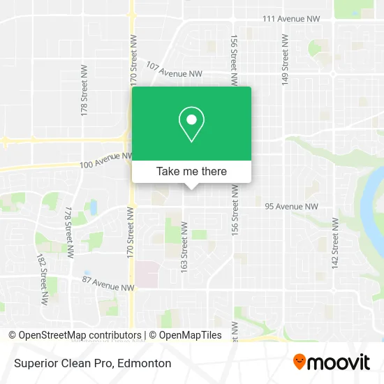
See Superior Clean Pro, Edmonton, on the map
Public Transit to Superior Clean Pro in Edmonton
Wondering how to get to Superior Clean Pro in Edmonton? Moovit helps you find the best way to get to Superior Clean Pro with step-by-step directions from the nearest public transit station.
Moovit provides free maps and live directions to help you navigate through your city. View schedules, routes, timetables, and find out how long does it take to get to Superior Clean Pro in real time.
Looking for the nearest stop or station to Superior Clean Pro? Check out this list of stops closest to your destination: 163 Street & 95 Avenue; 160 Street & 95 Avenue; 163 Street & 99 Avenue.
Bus: 007, 052, 915, 924, 671, 678, 676.
Want to see if there’s another route that gets you there at an earlier time? Moovit helps you find alternative routes or times. Get directions from and directions to Superior Clean Pro easily from the Moovit App or Website.
We make riding to Superior Clean Pro easy, which is why over 1.5 million users, including users in Edmonton, trust Moovit as the best app for public transit. You don’t need to download an individual bus app or train app, Moovit is your all-in-one transit app that helps you find the best bus time or train time available.
For information on prices of bus, costs and ride fares to Superior Clean Pro, please check the Moovit app.
Use the app to navigate to popular places including to the airport, hospital, stadium, grocery store, mall, coffee shop, school, college, and university.
Superior Clean Pro Address: 9621 162 St NW Edmonton, AB T5P 3K7 street in Edmonton
- Striker,
- Nutri-Metics by Julie Kulchysky,
- Jason's Gardening,
- M & M Food Market,
- KC's,
- Michael's Hair Group Inc,
- Eddie the Barber and Hairsalon,
- Jolly Jack's Daycare,
- Off Leash Dog Parks,
- John Labots Graphic Design,
- Asmara Garage Doors,
- Kiddie Day Home,
- Mr Recycle,
- Awakened Souls,
- Mayo Manor Apartments,
- Energized Electric,
- St Thomas More Junior High,
- Premiere Pest Patrol,
- McGinn Apartments,
- Greater Edmonton Mobile Veterinary Services
Places Near Superior Clean Pro (Edmonton)
- University of Alberta, Edmonton,
- West Edmonton Mall, Edmonton,
- Edmonton Valley Zoo, Edmonton,
- Canada Place Service Canada Centre, Edmonton,
- Alberta Legislature Building, Edmonton,
- Edmonton EXPO Centre, Edmonton,
- Edmonton VIA Rail Station, Edmonton,
- Fort Edmonton Park, Edmonton,
- Northgate Centre, Edmonton,
- Rogers Place, Edmonton,
- Grey Nuns Community Hospital, Edmonton,
- Borden Park, Edmonton,
- Edmonton Commonwealth Stadium, Edmonton,
- MacEwan University, Edmonton,
- Royal Alexandra Hospital, Edmonton,
- Kingsway Mall, Edmonton,
- Londonderry Mall, Edmonton,
- Cross Cancer Institute, Edmonton,
- Kaye Edmonton Clinic, Edmonton,
- Whyte Avenue, Edmonton
How to get to popular places in Edmonton with public transit
Get around Edmonton by public transit!
Traveling around Edmonton has never been so easy. See step by step directions as you travel to any attraction, street or major public transit station. View bus and train schedules, arrival times, service alerts and detailed routes on a map, so you know exactly how to get to anywhere in Edmonton.
When traveling to any destination around Edmonton use Moovit's Live Directions with Get Off Notifications to know exactly where and how far to walk, how long to wait for your line, and how many stops are left. Moovit will alert you when it's time to get off — no need to constantly re-check whether yours is the next stop.
Wondering how to use public transit in Edmonton or how to pay for public transit in Edmonton? Moovit public transit app can help you navigate your way with public transit easily, and at minimum cost. It includes public transit fees, ticket prices, and costs. Looking for a map of Edmonton public transit lines? Moovit public transit app shows all public transit maps in Edmonton with all Bus and Light Rail routes and stops on an interactive map.
Edmonton has 2 transit type(s), including: Bus and Light Rail, operated by several transit agencies, including ETS LRT, ETS, Strathcona County Transit, St. Albert Transit, Spruce Grove Transit, Fort Saskatchewan Transit, Beaumont Transit and Leduc Transit