How to get to Sushis Thrift by bus?
Click on the bus route to see step by step directions with maps, line arrival times and updated time schedules.
From Palladium, Worcester
141 minFrom Foxwoods, Worcester
165 minFrom Registry Of Motor Vehicles (Rmv) Branch Office, Worcester
140 minFrom Polar Park, Worcester
137 minFrom South High Community School, Worcester
233 minFrom Worcester, MA, Worcester
136 minFrom Dcu Center, Worcester
138 minFrom Gardner, MA, Gardner
281 min
Bus stops near Sushis Thrift in Boston
Bus lines to Sushis Thrift in Boston
What are the closest stations to Sushis Thrift?
The closest stations to Sushis Thrift are:
- Main / Mechanic is 82 yards away, 2 min walk.
- Stop And Shop - Westfield is 316 yards away, 4 min walk.
- Olver Transit Pavilion is 652 yards away, 8 min walk.
Which bus lines stop near Sushis Thrift?
These bus lines stop near Sushis Thrift: B23, R10.
What’s the nearest bus station to Sushis Thrift in Boston?
The nearest bus station to Sushis Thrift in Boston is Main / Mechanic. It’s a 2 min walk away.
What time is the first bus to Sushis Thrift in Boston?
The R10 is the first bus that goes to Sushis Thrift in Boston. It stops nearby at 5:27 AM.
What time is the last bus to Sushis Thrift in Boston?
The R10 is the last bus that goes to Sushis Thrift in Boston. It stops nearby at 10:53 PM.
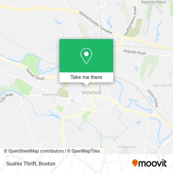
See Sushis Thrift, Boston, on the map
Public Transit to Sushis Thrift in Boston
Wondering how to get to Sushis Thrift in Boston? Moovit helps you find the best way to get to Sushis Thrift with step-by-step directions from the nearest public transit station.
Moovit provides free maps and live directions to help you navigate through your city. View schedules, routes, timetables, and find out how long does it take to get to Sushis Thrift in real time.
Looking for the nearest stop or station to Sushis Thrift? Check out this list of stops closest to your destination: Main / Mechanic; Stop And Shop - Westfield; Olver Transit Pavilion.
Bus: B23, R10, G47.
Want to see if there’s another route that gets you there at an earlier time? Moovit helps you find alternative routes or times. Get directions from and directions to Sushis Thrift easily from the Moovit App or Website.
We make riding to Sushis Thrift easy, which is why over 1.7 million users, including users in Boston, trust Moovit as the best app for public transit. You don’t need to download an individual bus app or train app, Moovit is your all-in-one transit app that helps you find the best bus time or train time available.
For information on prices of bus, costs and ride fares to Sushis Thrift, please check the Moovit app.
Use the app to navigate to popular places including to the airport, hospital, stadium, grocery store, mall, coffee shop, school, college, and university.
Sushis Thrift Address: 56 Washington St street in Boston
- Canine Learning Center,
- Moose Club,
- Coinbridge Bitcoin ATM - 41 Franklin Street, Westfield, Ma,
- Westfield Farmers' Market,
- Friends-the Columbia Greenway,
- Massachusetts State Normal Training School,
- Libertyx Bitcoin ATM,
- Molt's Discount Liquors,
- Feng Ye,
- Courthouse Square,
- Roosters Chicken and W,
- Your Neighborhood Laundromat,
- Performance Music,
- YWCA,
- Berkshire Insurance Group,
- Medicine Shop Brew Pub,
- Chrissy G's Bakery,
- Anuvraha Grocery Store,
- Unitrade,
- PKS Associates Deputy Collector
Places Near Sushis Thrift (Boston)
- Museum Of Science, Boston,
- Massachusetts General Hospital, Boston,
- Td Garden, Boston,
- Cheers, Boston,
- House Of Blues, Boston,
- Leader Bank Pavilion (Leader Bank Pavillion), Boston,
- Isabella Stewart Gardner Museum, Boston,
- Boston Children's Hospital, Boston,
- North End, Boston,
- Wilbur Theatre, Boston,
- Seaport District, Boston,
- Boston Medical Center, Boston,
- Boston Common, Boston,
- Wang Theater, Boston,
- Castle Island, Boston,
- Mgm Music Hall, Boston,
- Boston Convention & Exhibition Center, Boston,
- Prudential Center, Boston,
- Faneuil Hall, Boston,
- Quincy Market, Boston
How to get to popular places in Boston with public transit
Get around Boston by public transit!
Traveling around Boston has never been so easy. See step by step directions as you travel to any attraction, street or major public transit station. View bus and train schedules, arrival times, service alerts and detailed routes on a map, so you know exactly how to get to anywhere in Boston.
When traveling to any destination around Boston use Moovit's Live Directions with Get Off Notifications to know exactly where and how far to walk, how long to wait for your line, and how many stops are left. Moovit will alert you when it's time to get off — no need to constantly re-check whether yours is the next stop.
Wondering how to use public transit in Boston or how to pay for public transit in Boston? Moovit public transit app can help you navigate your way with public transit easily, and at minimum cost. It includes public transit fees, ticket prices, and costs. Looking for a map of Boston public transit lines? Moovit public transit app shows all public transit maps in Boston with all Bus, Train, Subway and Ferry routes and stops on an interactive map.
Boston has 4 transit type(s), including: Bus, Train, Subway and Ferry, operated by several transit agencies, including MBTA, Southeastern Regional Transit Authority, MetroWest Regional Transit Authority, Rhode Island Public Transit Authority, WRTA, Lowell Regional Transit Authority, Merrimack Valley Transit, Montachusett Regional Transit Authority, Cape Cod Regional Transit Authority, Brockton Area Transit Authority, Martha's Vineyard Transit Authority, the WAVE - Nantucket Regional Transit Authority, GATRA, Cape Ann Transportation Authority and Massport